Saturday 27 November 2010

Winter arrives

Just one week ago it felt as if autumn was coming to an end - now it's official; winter is here!


Three days of heavy snow showers and low temperatures have transformed the browns and russets to dazzling white.  The north and north east of Scotland have so far seen the heaviest falls (which is not in itself unusual) but it is pretty early for such heavy snowfall here.


Getting around has become something of a challenge on tiny rural roads, this is the lane outside our house


The whole land is sparkling under more than 45 centimetres of snow which just keeps on coming in great sweeping showers


                                            The whole scene is very Christmas-like, but a month early!


                                                 If you want to go anywhere, first excavate your car.....

Friday 26 November 2010

The hill of timid birds

I was staying at the very comfortable Forest Way independent hostel near Inverlael.  Iain, the owner, is a hillwalker himself and has designed the hostel to suit the needs of other hillwalkers; it's really well thought out and very comfortable.

An advantage of the location is that I was able to climb hills right from the front door.  I chose a Corbett, Beinn Enaiglair (hill of timid birds) which would give a good short route.  The hill just looks like a grassy lump when seen from the road at Braemore junction, but has plenty of interest on it's eastern flanks which are hidden from the road.


After an initially very steep start, a superbly built stalker's path runs right around the hill.  These old paths are a joy to walk, taking elegant lines on the hill and gaining height almost effortlessly.  There was a jarring contrast with an ugly vehicle track which has been crudely bulldozed into the face of the hill above the road by Braemore estate.

This eastern side of the hill doesn't get much sun in the winter and I was glad to climb into bright sunshine higher up.  The view to the east is dominated by the Munro of Beinn Dearg (Red hill).  The massive drystone wall which is such a feature on this hill can be seen running up into the snowline on the left hand skyline.  This wall was built as a "destitution wall", one of a number of roads and walls built to give men work in return for food during the famine of the 1840's


From the 889 metre summit of Beinn Enaiglair, the views are extensive and very fine.  To the south the Fannaichs range stand out on the horizon


To the west, there's a view over Loch a'Bhraoin to the tangle of mountains and ridges in the Fisherfield forest


While to the north west, An Teallach catches the eye.  Strangely, this hill had far less snow than most


In an eastern corrie of the "hill of timid birds" I found this superbly camouflaged grouse doing it's best to remain unnoticed and neatly illustrating the hill name!

Thursday 25 November 2010

Into the shadows on Loch Broom

It seemed likely that the south shore of Loch Broom would give more sheltered conditions than I'd experienced along the north side, but this would involve an open crossing of 8 kilometres.  I felt that conditions were OK to make this crossing, and that it would be better to make it before the flood tide started and opposed the wind, which would make things more difficult.


An hour and a half of steady paddling in choppy conditions and I was looking back at Ben More Coigach from the shelter of Annat Bay.  The cloud had lifted from the summit ridge, which looks completely different from this angle.  Although I was now getting good shelter, I was to be in the shade for the rest of the day and it was chilly!


Beinn Ghobhlach (Forked Hill) is a small but prominent hill on the Scoraig peninsula which separates Loch Broom and Little loch Broom; it looks very fine from Ullapool.  Beinn Ghobhlach is also a hill particularly suited to being climbed by paddling to the base.  The hill itself and the long ridge below the western end were blocking the low angle sunlight.  One pleasant surprise was a close view of a Sea Eagle on the cliffs, such grand birds.

I crossed the narrow mouth of inner Loch Broom to Ruba Cadail (Sleep Point!) as the sun was setting.  The sunset was firing the clouds above Beinn Ghobhlach with lovely purple colours and I landed to take some of images on the SLR camera.  Only when I got home did I realise that the memory card hadn't been in the camera......


So the only photograph I have of a beautiful sunset is this one from my compact camera.  The afterglow lasted a long while, but the temperature was rapidly dropping as I arrived back at Ardmair. 

Wednesday 24 November 2010

Light and shade in Loch Broom


I'd decided on a paddle in outer Loch Broom near Ullapool with a hillwalk the following day.  The forecast was for cold but relatively settled conditions prior to a wintry spell of weather.  I hoped to get some shelter from the predicted northeasterly wind by paddling along the north shore of the outer loch from Ardmair Bay to Achiltibuie.

Ardmair Bay is a perfect lauch site; a curving shingle beach with car parking right above it and a campsite in the summer.  It's sheltered by Isle Martin and has the impressive backdrop of Ben More Coigach (big hill of Coigach).  Arriving at about sunrise, 0800 at this time of year, I wasted no time in getting moving as it was cold in the shade.


The low winter sun was illuminating Isle Martin beautifully whilst Ben More Coigach was enveloped in a sea of cloud which washed over the ridge.  It seems to be a feature of this hill that it forms these washes of cloud.  Normally they form from the southwest (left edge on this picture) and dissipate to the east but today the reverse was happening.

The vibrant colours are a total contrast with the greens of summer - this variety is one of the wonderful things about the changing seasons in Britain.


There aren't too many places in Scotland where mountain cliffs drop straight into the sea, but Ben More Coigach is one such.  Close in, the mountain drops very steeply to the water and landing places are very limited.  The cliffs are formed mainly of sandstone which was glowing in the low sunlight.

It's heavily featured and eroded rock and has some interesting shapes.  There seemed to be a Norse warrior staring out from the left edge of this outcrop!


The forecast northeasterly wind was actually blowing from the south east and increased rapidly to F4-5.  This made for uncomfortable and wet paddling along the cliffs and shore on the north side of the loch.  I was glad to pull into the shelter of Horse Sound and land on the sandy beach at Achininver.

The skyline had become a monochrome sweep of mountain and cloud.  The prominent domed hill in the centre of this photograph is Sail Mhor (Big Heel) which I'd climbed a couple of weeks previously.

Time for a cup of tea while I decided what to do next; once back around the point and into the wind it would be a slog back to Ardmair.

Sunday 21 November 2010

The end of autumn?

     It feels as if autumn is coming to an end here in the north east of Scotland.


                           The weather has been very mixed, with the first gales some weeks ago bringing rain and hail.


The leaves added a blaze of colour to the landscape before a particularly strong gale thrashed most of them off the trees


The higher hills have now had a covering of snow for nearly two weeks; this is Corryhabbie hill from Carn Daimh (Stag Cairn) in Speyside.


The trees look bare now, and the lower ground is wet.  The tatties are "howked" and the barley stubble is waiting to be ploughed in to restart the cycle, only the neeps (turnips) are still in the ground.  It really feels like the beginning of winter.

Saturday 20 November 2010

A short way along Loch Long

Once the ice had cleared away, I decided to finish my day by paddling up Loch Long (Ship Loch - a name of Norse origin).


The entrance to the loch at Dornie is spanned by the A87 main road to Kyle of Lochalsh and Skye.  My original launch point is just out of shot on the left hand side - a useful slipway with some public toilets nearby (part of the village hall) which are immaculately kept.


Loch Long is a narrow fjiord-like sea loch reaching some 8 kilometres inland to Killilan (a version of Cill Fhaolain - Cell of Fillan. St Fillan was a Columban missionary who travelled widely in Scotland and has several places named after him).

In parts the loch is less than 200 metres wide, and twists about so that it seems to be coming to an end.  It's easy to imagine Longships or Birlinns being rowed up this loch.


This wind blasted Larch tree is growing on an exposed rocky point near the final turn in the loch.


The view which opens up is unexpected and very scenic.  The loch becomes wider and shallower near the head and is backed by two hills, Ben Killilan on the left and Sguman Coinntich (Mossy peak) on the right.

The head of this loch was also covered by ice, which was heading out towards the narrower parts on the ebbing tide.  I could go no further and paddled back before I got caught up in the ice again.

Friday 19 November 2010

Icons and ice

The night which followed our evening paddle was very cold, clear and still.  I launched the following morning at Dornie where the sea lochs of  Alsh, Duich and Long meet.


Dornie is the site of Eilean Donan castle, an iconic image of Scotland and probably one of the most photographed castles in Britain.  This photograph shows the seaward side of the castle.  Named after a monk, St Donan, who established a monastic cell on the island in 580 AD, there has been a fortification here since the early 13th century.  At a time when sea lochs were the natural highways the position was perfect both for defence from Viking raiders and later as a power base for the Lordship of the Isles - then a quite separate entity from Scotland.

The castle went through many changes and grew gradually in size until the 18th century when it had a place in the Jacobite rising of 1719.  It was garrisoned by 46 Spanish troops (Spain was sympathetic to the Jacobite movement) who had landed gunpowder and were awaiting cannon and shot from Spain.  The English government learned of the occupation of the castle and sent three frigates, HMS Flamborough, Worcester and Enterprise to deal with the situation.  The warships bombarded the castle for three days, making limited impact since the walls were in places over 3 metres thick.  Finally, sailors from HMS Enterprise were landed, overwhelmed the garrison and blew up the castle with the store of powder.

The castle remained a ruin until 1911 when it was purchased by Colonel John Macrae-Gilstrap who employed a Clerk of Works, Farquar Macrae and together they spent 20 years restoring Eilean Donan according to original plans.  It was completed in 1932, opened to the public in 1955 and handed to a trust in 1983.  Today it's a hugely successful tourist attraction and has been used in several films.


At the head of Loch Duich is another iconic view, the Five Sisters of Kintail, one of the classic ridge walks in Scotland.  Owned by the National Trust for Scotland, there are three Munros and two other summits on the ridge.  A subsidiary eastern summit is named Sgurr nan Spainteach (peak of the Spaniards) originating from a battle, again in 1719, when a small Spansh force was defeated at the base of the hill by Hanoverian troops.


Further up the loch I came upon ice.  Unusual for Scotland, and especially early in the year.  The ice was around a centimetre thick and probably formed near the head of Loch Duich were the water is less salty.


The ice covered the loch for several square kilometres and was really difficult and unnerving to paddle.  I was having to crash the paddle through, which felt unstable, and turning the boat was very hard.  Fortunately it was moving out on the ebb tide and I was able to get free.


Despite the wintry appearance of the ice, there are still pockets of autumn colour on this sheltered coast.  This stand of Larches and Pines were reflecting beautifully in the still water.

Thursday 18 November 2010

Slow-burn sunset over Skye


As we paddled slowly back toward Kyle, the sun was setting in a bronze blaze to the southwest.


Cloud banks to the west of Skye made this a slow, smouldering affair.


The colours filled the sky after the sun set; as so often the best colour comes long after the sun has dipped below the horizon.  The Cuillin hills seemed razor sharp in the cold, clear air.


And the colour burned on, turning to a final flourish before beginning a long fade from gold to pink.


We sat, entranced.  It's said that you don't watch a west coast sunset, you participate in it.  Certainly that was true of this evening.  Our paddle back to Skye seemed effortless, as if we'd absorbed something of the slow-burn sunset.  We arrived at the slipway well after dark with memories to last a very long time. 

Wednesday 17 November 2010

Kyle to Plockton

The islands on the way to Plockton are a good place to see wildlife, particularly Otters.  Today didn't disappoint; I had good sightings of at least four including one bringing a crab ashore to eat.  Unfortunately I didn't get any good photographs. 


The pretty village of Plockton is situated in a bay sheltered from the prevailing southwesterly weather.  It has National Trust for Scotland "Conservation" status and in the recent past has been the setting for a TV series about a rural policeman (Hamish MacBeth).  The village High School is particularly well known for it's Traditional Music academy which has produced some fine musicians and has an impressive array of guest tutors.  This Sunday morning it was very quiet; many of the houses around the two small harbours seem to be second homes. 


Leaving Plockton on the return leg, the view to the north is dominated by the Applecross hills across Loch Carron.  From inside one of the many islands, the Corbetts of Sgurr a' Chaorachain (peak of the little sheep) and Beinn Bhan (white hill) grab the attention.  The light wind had now dropped to almost nothing and the sun was shining - great paddling weather!


During the day I met with Murdo and Raymond.  These are lucky guys - this is one of their local paddles.  We headed slowly back towards Kyle, accompanied by curious Common Seals.  It had been a really good day, but the early evening was to prove the highlight.

Tuesday 16 November 2010

Under the bridge to Skye

I set off on a chilly but quiet morning from Kyle of Lochalsh to paddle north to Plockton, then return to Kyle.  The whole coast between the two is dotted with islands and skerries noted for wildlife and owned by the National Trust for Scotland.


At Neap tides and with almost no wind Kyle Akin (Hakon's Narrows - a hint to the Norse influence here) was quiet.  At Springs and with some wind, it's a very different and challenging stretch of water.  Ahead, the Skye bridge spans the Kyle.  This bridge, opened in 1995, replaced the Calmac ferry and reduced queues, but was very controversial because of the punitive tolls.  The eventual removal of tolls on this and all bridges in Scotland was due largely to ordinary people making a principled and obdurate stand.

You can still travel as in the words of the famous song, "over the sea to Skye" by using the Glenelg Ferry which runs from April to October.  It's by far the most pleasant way to reach Skye, and thoroughly recommended.


Under the bridge on the Lochalsh side stands the Eilean Ban lighthouse.  Built in 1857 by Thomas Stevenson, it's no longer lit but is still a daymark.  It's now pretty much overshadowed by the bridge.  The prominent hill in the background is Dun Caan on the island of Raasay.


From most angles the bridge is a fairly unremarkable concrete span, but from directly below it has a undoubted slender grace.  I now left the traffic and bustle to paddle north along the coast.

Thursday 11 November 2010

An elevated view from the Big Heel

As I was staying at the hostel named after this hill, climbing Sail Mhor (Big Heel) seemed very appropriate.


Getting out just as it was getting light, a short walk along the road starts the day, then the best route climbs alongside the beautiful Ardessie falls.  The early sun was catching the top of Sail Mhor, but this side of the hill was in cold shade.

Higher up the angle eases into a hanging river valley, then there's a steady ascent on short heather and stony ground to the summit of the hill.  Sail Mhor is a Corbett and though at 767 metres lower than many of the hills nearby, is a superb viewpoint


To the west I looked down on Gruinard Bay and my paddle of the previous day. I'd set out from a beach in the left hand side of the bay and paddled clockwise. Gruinard Island is prominent in this view.


To the north, the view extends over Little Loch Broom, Beinn Ghobhlach and the entrance of Loch Broom up to the Assynt Coigach hills.


Beyond Little Loch Broom and Cailleach Head are the Summer Isles - a fantastic sea kayaking location.


Turning around, the view is just as good! The outliers of An Teallach are on the left and beyond are some of the hills of the Fisherfield Forest. 

I was well wrapped up, but even so it was pretty cold exposed to the wind on the summit.  After around 15 minutes of taking in the view I headed back down the hill, going first to the smaller "top" in this picture.  The whole walk took a little over five hours, perfect for a short day.

Wednesday 10 November 2010

Gruinard Island

Gruinard Island is a lozenge shaped sandstone island 2.5km by 1 km and lies on the east side of Gruinard Bay around 1km from the shore.  Once wooded, it was used as sheep pasture from the 18th century.  The island hasn't been permanently inhabited since the 1920's.

In 1941, during the Second World War, government scientists decided that this "useless" island would be ideal for testing a biological weapon.  It was suspected that the Germans were testing weapons containing virulent diseases, so the British scientists decided to act. They penned sixty sheep on the island and bombed them with Anthrax spores. Unsurprisingly, the sheep died (experiment successful?) and were buried in a cave on the island. 

The difficulties began almost straight away.  Firstly, there was no vaccine for Anthrax at the time, and a poor understanding of the propagation and viability of the spores.  Anthrax has the unfortunate qualities of being both a deadly and a very resilient bacillus. Then a sheep carcass floated out of the cave and infected livestock on the mainland.  That was quickly "hushed up".  It became obvious that the spores in the soil were not dying, and the Government bought the island in 1947 from the Eilean Darach estate for £500 and put up the "Keep Out" signs.  As information gradually leaked out post-war, Gruinard was tagged in the popular imagination as "Anthrax Island".

In 1986, amid increasing environmental concern, the UK government's Chemical Defence Establishment conducted new sampling and discovered that there were still relatively high levels of spores in the soil on the island.  A combination of environmental concern and fear of infection/litigation forced action.  The entire surface area of the island was soaked in formaldehyde and sea water to disinfect it, then sheep and rabbits were reintroduced to test the effectiveness of the clean up.

In 1990 the island was declared free of Anthrax and sold back to Eilean Darach estate for the original purchase price - together with a 150 year indemnity.  Some scientists however, claim that  the spores will continue to be brought to the surface by vegetation for hundreds of years......

The one good thing to have come out of the whole experiment was that it did help toward an effective vaccine for Anthrax in both livestock and humans.

(The information above has been paraphrased from Hamish Haswell-Smith's indispensible guide "The Scottish Islands")


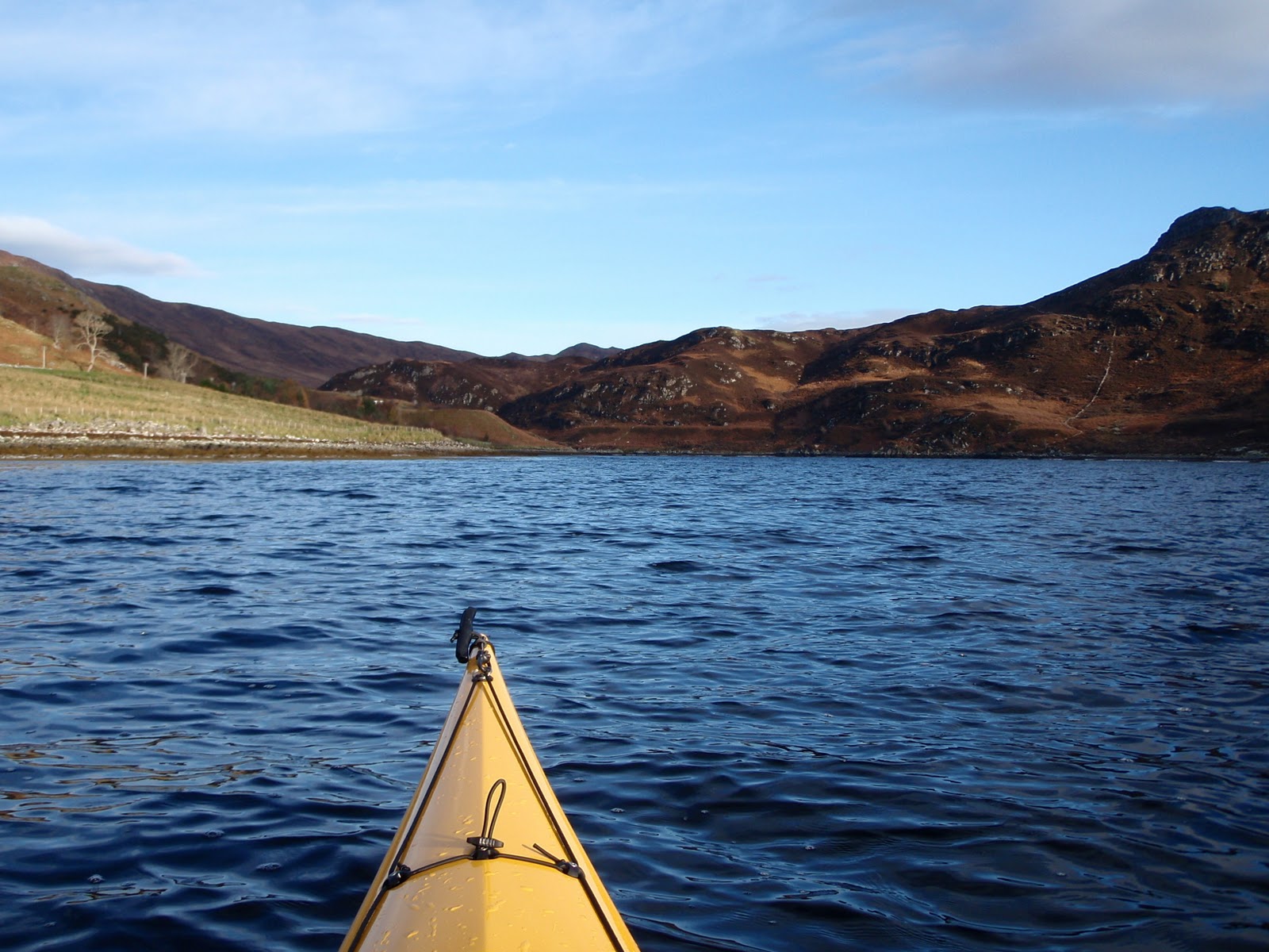
Although I feel that it is safe to visit the island - at least on the shore - one can't help having just a little apprehension.  After paddling the 4km across from Mellon Udrigle I landed on the west coast of the island near this arch, which at higher states of the tide could be paddled.

The north west coast of Gruinard Island is an unexpected rock-hopping delight with pinnacles, channels and boulders to explore.


Heading around the north end and down to the south east tip, the spit of Sron a' Mhoil reaches out toward Gruinard House and provides a convenient landing place.


This ruined shepherd's hut seems to be the only building on the island.  Beyond is the 106m high point, An Eilid (the Hind).

It would be good to think that such things will never be happen again, but who knows?  The attitude from far away government which sees this part of a northern land as "useless" is a continuing factor.

Perhaps the last word on the whole affair should be left to Gruinard Island itself.  In the north west corner, a tiny bay contains an eloquent response in stone to the scientists who infected it.


                                       The land always endures, always has the last word!


A thin and chilly wind was blowing, and it was time to leave the island, though I'm glad I visited..  I paddled back to Gruinard into a wintry looking sunset.  I'd managed around 32km during the day without hurrying, and the wild calls of Divers welcomed me back to the beach.