Showing posts with label harbours. Show all posts

Tuesday, 20 September 2022

Pinned on Pabay

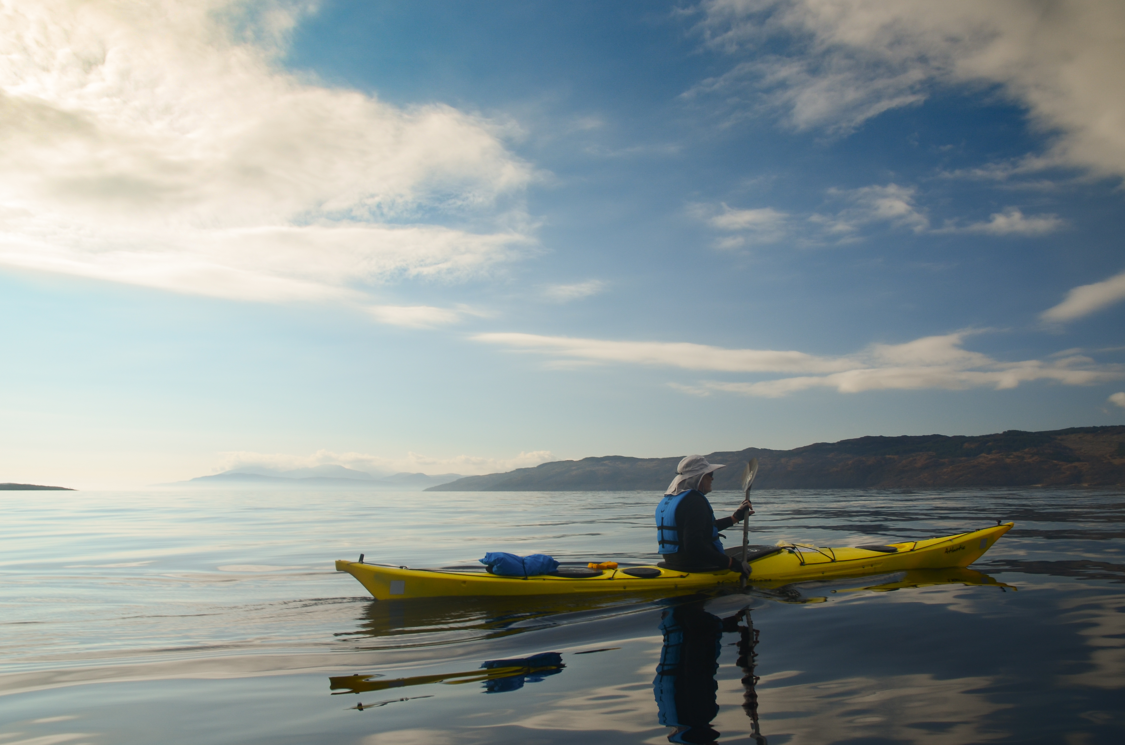
The morning weather was as lovely as the evening had been, clear and calm.  The view to the Cuillin of Skye was our constant companion on this trip and one of the highlights with changing light and angles subtly altering the colour and form.  We've all got great memories of climbs on that great arc of ridge - exhilarating and sometimes downright frightening!
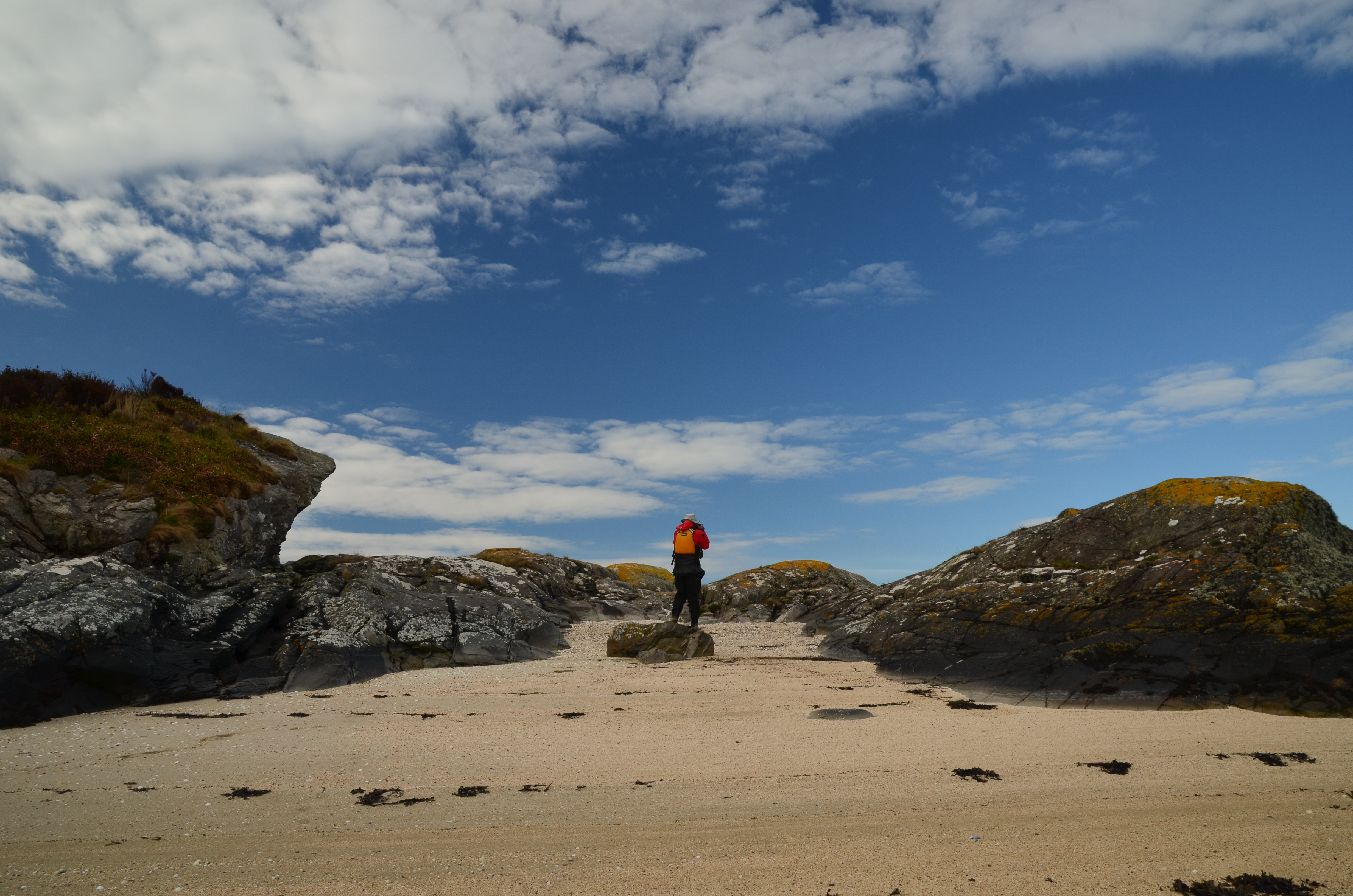


We had a leisurely breakfast and got on the water - within a few minutes we were back ashore on a tiny island with a "now you see it, now you don't" sandy beach which disappears at higher states of the tide.  We'd wanted to stop here because it's rather a fine viewpoint; the first image in this post was taken from the beach.
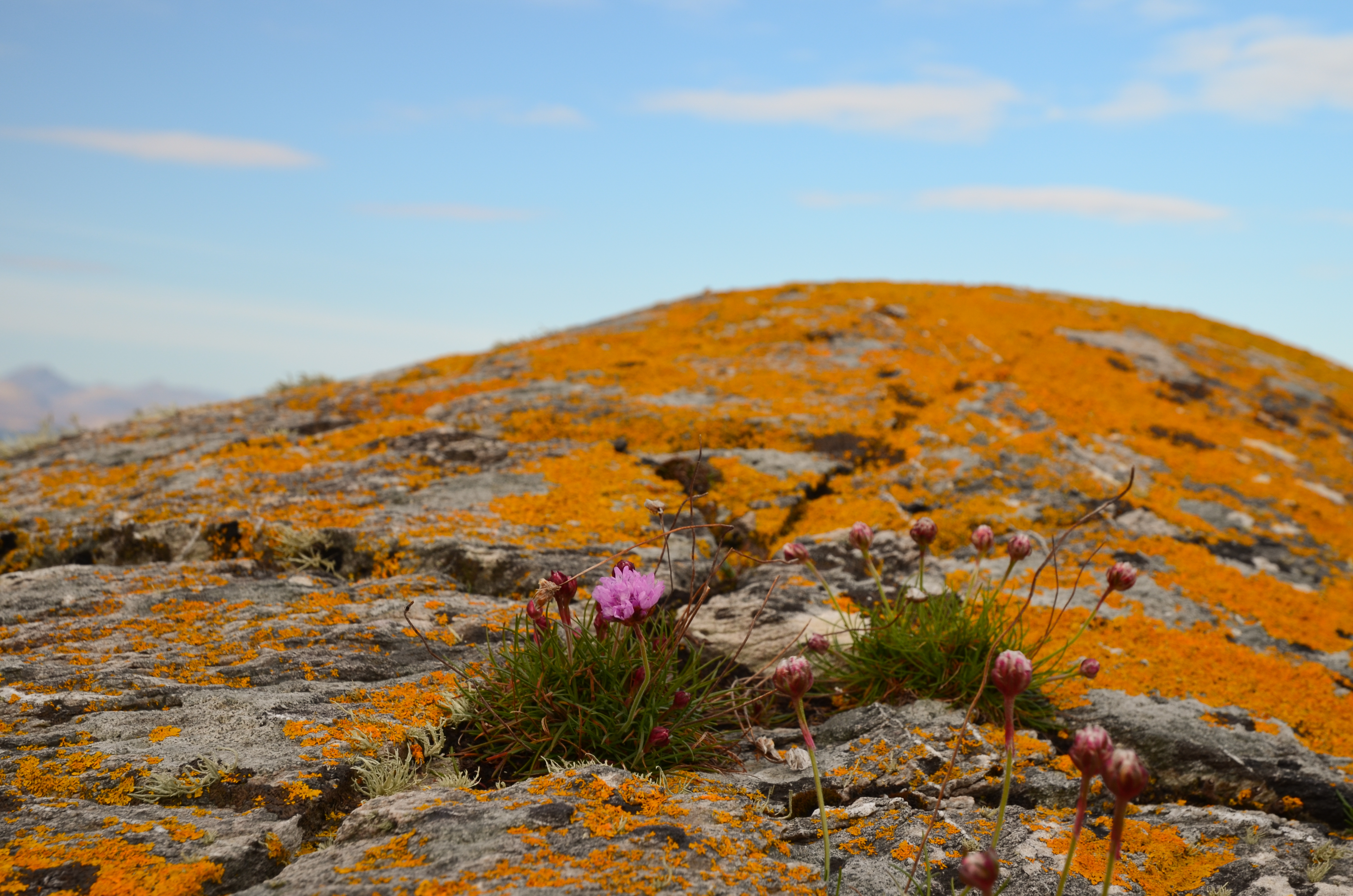


The view near to hand wasn't bad either - vivid orange lichens glowing in the morning sunshine, set off by a few Thrift flowers.


Orange seemed to be the theme of the morning; we returned briefly to Kyleakin to collect some things and whilst preparing to get back underway we noticed a bright orange vessel passing under the Skye bridge.


She's the "Mikal With", a 67 metre long palletised cargo vessel.  On most marine vessel websites she has a blue hull and a different owner than recently.  She's either owned or on charter to MOWI, a Norwegian aquaculture company.


We set out again from Kyleakin and aimed for the island of Pabay, which we intended to use as a stepping stone on our way to an intended camp on Scalpay.  The breeze had been slowly building and once clear of Kyle Akin it became quite strong from straight off the Skye coast (our port quarter).

We put our sails up to take advantage of the push and were absolutely blasted across towards Pabay.  I found this a really great sailing run, but was certainly not prepared to stop paddling in order to take photos!  Our average speed on this blast was 9.4km/h, or nearly twice cruising speed.....


Although a fast passage, it had been an energetic one - it is paddle sailing rather than just sailing!  We were all ready for a lunch stop by this point.


Approaching Pabay the wind seemed to ease  a little and we dropped our sails to paddle into the tiny harbour area.  Donny had motored along to Broadford in his F-RIB and made a direct crossing from there to Pabay; he had a pretty wet ride!
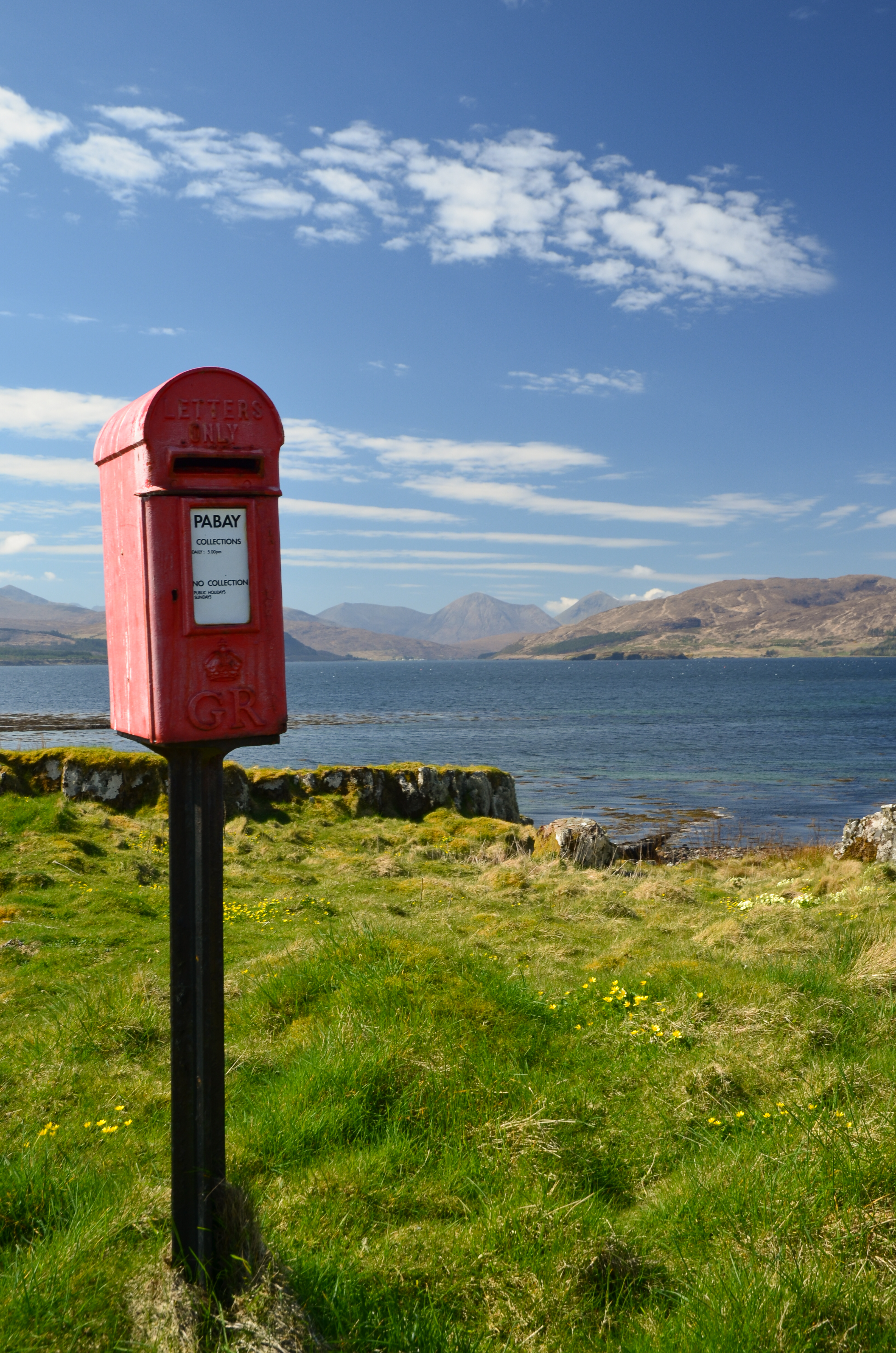


One of the iconic sights on Pabay (Norse: Priest Island) is this post box.  It seems incongruous since there are only a couple of houses on the island but is here because the island issues it's own postage stamps for mail which is transferred into the Royal Mail system in Skye (from where it needs Royal Mail stamps).


Sheltered from the breeze (which was becoming stronger) we lazed in warm sunshine, surrounded by clumps of Primroses.  The pale yellow of the flowers set against the blue of sky and sea was gorgeous.


Above where we lunched a pair of Bonxies (Great Skuas) watched us warily.  These impressive piratical predators had picked a nest site with a great view over the low lying island.


One of the features of Pabay is its geology which is shales intersected by dykes of harder rocks.  The whole island is almost flat and nearly doubles in size as the tide falls from high to low water, leaving the geometric patterns of dykes.

Another feature is that, despite being flat the island has virtually no wild camping spots accessible from the water.  The rock layers from a barrier and the softer rock gives good growing conditions for brambles and tangled low undergrowth.

This gave us a problem; we were pretty much pinned on Pabay.  The wind had continued to rise and in the Sound between Pabay and Scalpay was approaching a Force 6.  None of us was keen on trying the paddle across unless we really had to, but despite trying along the sheltered parts of Pabay by kayak we could find nowhere to camp.  We returned to the harbour to have a re-think.  Douglas and I walked up to the "big house" which is undergoing renovation by a new owner of the island.  We explained our situation and asked if we might camp near the harbour.  The Access provision in the Land Reform (Scotland) Act is wide ranging but does not cover access near to houses or infrastructure.  The owner was most kind in allowing us to camp for the night and it was really appreciated by us.


We pitched our tents in areas which wouldn't affect access to and from the harbour itself and found a spot out of the wind to cook dinner - preceded by fresh soup.  The day had been recovered but our plans would need to be altered.  The forecast was for the wind to drop almost completely by morning, so we decided on a paddle to the Applecross shore via the Crowlin Islands.


As the sun set, the wind came around a couple of points and seemed to drop by several degrees in temperature - it was pretty cold within minutes.  Dinner done, we retired to the tents (which we'd pinned very securely to Pabay) for an early night.
 

Thursday, 7 April 2022

Fyne, just fine....

The morning sun on the tent woke me early at our camp on the shore of Loch Fyne.  Up and about, I made breakfast and enjoyed the sunshine on what was clearly going to be a fine Fyne day.


We left our tents up until the last minute as there was quite a bit of condensation from the cool night air, but by 0900 we were packed and ready to carry three kayaks and one F-RIB down the pebble beach to the water.


And what a morning!  Our plan was to head over to Tarbert for second breakfast and we made the 6km crossing of Loch Fyne in idyllic conditions.


To the south the Arran hills were cloud-capped - in fact they had cloud cover throughout the four days we were in the area, even when everywhere else was in bright sunshine.


We stayed on the north side of East Loch Tarbert so that we wouldn't be in the way of the ferry which sails on a very regular route to Portavadie from here.  On this beautiful morning all of the Isle of Cumbrae's passengers seemed to be sat outside to enjoy the weather and we got a cheery wave from some smaller passengers.


Tarbert is in a very strategic position and has a long history.  The name is shared with several other places and indicates a place where boats could be dragged across a narrow isthmus between to bodies of water - from the Old Norse/Gaelic "Tairbert" or draw-boat.

This Tarbert has a narrow neck of land less than 2km wide separating East and West Lochs Tarbert; being able to portage a boat here avoids the long and potentially hazardous passage around the Mull of Kintyre.  The strategic value of the tairbert was demonstrated spectacularly in 1093 when King Magnus "Barelegs" was ceded all the land on the western seaboard of Scotland which could be circumnavigated in a longship.  He sat in his longship as it was dragged from one Loch tarbert to another and so claimed the entire Kintyre peninsula!

The castle was first constructed in the 13th century, subsequently strengthened by Robert Bruce, was captured by James IV from the Lords of the Isles and last changed hands in the 17th century before falling into disuse.


Tarbert is a busy port used by fishing vessels and leisure craft as well as two ferry services.  We looked at landing near the harbour head but the receding tide had left some evil looking mud, so settled for a slip near the yacht club which also has a signboard about the Argyll Sea kayak Trail; this being a prominent stop on the trail.  You can buy shellfish direct from the processor at the top of the ferry slip, so all in all a good place to pause!

We couldn't see where Donny had landed in his F-RIB, he seemed to have disappeared.  The mystery was solved when he strolled around the harbour to meet us having blagged a berth on the best pontoon in the marina - for free - for a couple of hours stopover!

We wandered into town (don't expect a metropolis!) and settled on the excellent Cafe Ca'Dora for second breakfast.  We were just in time before breakfast serving turned to lunch serving and enjoyed an outstanding "Full Scottish" accompanied by great coffee - Cafe Ca'Dora is rated as 12/10 as a sea kayaking food destination by us!


We returned to the slipway and whilst repacking our boats took a closer look at this graceful craft beached at the top.  She's the "Freydis", a 40ft/12 metre replica Viking longship built by volunteers in Tarbert to take part in the annual Loch Fyne Viking festival.  Named after Freydis, daughter of Erik the Red and sister of Leif Erikson, who has various claims to fame in the Norse sagas as an explorer, not all of them savoury!

Sadly, Freydis has seen "better days"; some of her planks are sprung and she'd need some TLC to be seaworthy again, but what a fine Fyne vessel!


 Freydis' dragon prow is particularly impressive, carved from a single piece of wood and adorned with metal "scales" and a fearsome tongue....now, I wonder what a scaled-down version of a dragon prow would look like on a sea kayak?!

Monday, 14 September 2020

Stacks of colour at Rubha Reidh

The point and lighthouse at Rubha Reidh marked the extent of our outward journey on this superlative summer day.  We turned and headed back around the point, pausing to investigate the tiny jetty at Port an Amaill which was used to supply the light with paraffin and stores for many years - the narrow, twisting road from Melvaig to Rubha Reidh was only completed in 1962.


Seen from the west the stacks are even more impressive than our initial view from the east as they stand out from the cliffs.  It's a great place to explore with a sea kayak and one can paddle in and around the narrow channels at the base of each stack - so we did!


A last run between tow of the larger stacks in perfect conditions brought us back out to the eastern side....


...and back out into the riot of colour in the bay of Camas Mor.  I'd rate this pace, in these conditions, as one of the best places I've ever explored by kayak - just superb.


Image by Allan McCourt

We took turns to pose in our boats for photographs, seemingly suspended on brilliant aquamarine water which would grace a tropical island.


After spending time just absorbing the intensity of the colours we headed in to a small beach we'd spotted on our outward leg.  If Camas Mor is difficult of access on foot, then this beach takes it to another level.  At spring tide high water it will pretty much disappear and is guarded by rocks and reefs, but if you make it here, and it's possible to land, we recommend that you do so.....


 ....we promise you won't be disappointed!  An utterly superb beach, surrounded by dramatic rock architecture and lapped by a sea of stunningly intense colour; it's a great place.

Wednesday, 15 July 2020

Heading out for a fish supper


While the full lockdown and then the 5-mile travel guidance has been in place sea kayaking has been off the agenda.  But, as the restrictions ease, there's opportunity to get out on the water again.  Lorna, Allan and I met on a sunny afternoon at our usual launch spot at Sandend for a short excursion.


Heading west from Sandend brings great paddling straight away with a series of channels and leads behind rock stacks.  On most days the narrower gaps are inadvisable due to swell surging through, but a combination of low swell and proximity to high water offered the opportunity to paddle all of them.  this particular gap is just shoulder width at its narrowest - but went easily.


It's a great little area to weave through, and full of interest.....


...as well as wildlife.  The last time we were able to kayak here the seabirds were just beginning to scope out the cliffs.  The breeding season is now nearly over, chicks like this Kittiwake (Rissa tridactyla) are well grown and on the way to fledging.  The Moray Firth is rich in seabird colonies and those on this stretch of coast are remarkably relaxed about passing kayakers - provided one moves slowly and quietly there's no agitation at all from the birds.


We continued west and crossed the county boundary from Aberdeenshire into Morayshire before pulling in at our outward destination of Cullen.  A sandy beach in the outer harbour makes for an easy and convenient landing.  we had a particular reason for making Cullen the target of our evening - Allan made a phone call and we walked up to the town's main street.....


...to collect an order of fish and chips from the excellent Linda's Fish & Chips, which we took back down to eat on benches overlooking the harbour; dining out doesn't get much better than this!  Suitably refuelled, we then set out back towards Sandend, but part way back found that we weren't the only ones with eyes on a fish supper.....


Six or seven of the Bottlenose Dolphins for which the Moray Firth is famous treated us to a fairly close pass with much jumping and tail slapping as they hunted their own fish for supper - it's such a treat to share space with these creatures, and seeing them on this first outing back seemed extra special.


What little breeze there was died completely as we approached Sandend making for a tranquil, relaxed end to our evening paddle.  After so long off the water, it was good to be back!

Saturday, 28 December 2019

A short day's sea kayaking


Unusually, the winter solstice fell on 22nd December this year rather than 21st.  The forecast was for a cold and sunny day so Allan and I planned a short paddle on the Moray Firth coast.  We met up at Sandend having driven up on quite icy roads; the temperature was barely above freezing when we got onto the water.  Our relaxed planning for the day extended to not having decided which direction to paddle until we actually got into the boats!  We settled on a round trip west to Cullen, a favourite paddle and one full of interest.


The forecast had been accurate with regards to the weather, and also with regard to the swell, which was over a metre with a 10 second periodicity.  These longer period swells are long distance travellers and they carry enormous power.  The Moray Firth is rarely completely calm, and even with no wind and a deceptively flat sea state the swell deserves respect.  Almost straight away we experienced the energy and noise of surging swell thundering across the jagged rocks near Sandend


We managed to get into some of the wider channels which thread behind stacks and cliffs just west of Sandend, but not comfortably.  It all looks serene in this image but the swell was magnified in these confined spaces.......


...in this narrow gap we estimated a 3 metre rise and fall - and felt disinclined to investigate more closely!


Clear of the channels we were able to enjoy the kayaking with bright sunshine on our backs; welcome if not bringing much warmth.


At Sunnyside beach the breakers were "smoking" as they rolled onto the shore.  This beach looks to be an idyllic place to take a break but landings here are rarely straightforward.  There are reefs and boulders studding the gently shelving approach and the surf has a tendency to break quite late.  Even on the calmest of summer days this beach can spring a surprise!


It took us a little less than two hours to make our way around to Cullen where we pulled in to the harbour to take luncheon.  The iconic railway viaduct is a feature of the town but no longer carries a railway.


The outer harbour has a small sandy beach which is an ideal stop.  Benches on the harbour wall face the afternoon sun and there are public toilets close by.  Another very attractive feature of this harbour is the proximity of an excellent fish and chip shop!  We'd brought our own lunches on this day - featuring mince pies of course, given the proximity to Christmas.  After a leisurely lunch it was time to head back to Sandend.  An advantage of doing a winter trip heading west first then east is that we wouldn't have the sun in our eyes for much of the trip - with one significant exception.


Heading back along the eastern side of Cullen Bay we were treated to a nice view of a group of Long Tailed Ducks (Clnagula hylemalis).  these sea ducks appear in small numbers to winter on the coasts of eastern Scotland and north east England and always seem to be very elegant.


Although we saw no other leisure boaters during our short trip, we weren't the only ones out on the water.  This creeler was working a line of creels close inshore near the Logie Head which is near to the boundary between Morayshire and Aberdeenshire.


We enjoyed a steady paddle back to Sandend, arriving at mid afternoon.  This tiny harbour is really difficult to locate in mid-winter when it's a sunny day - the sun streams directly into one's eyes and makes for locating the correct line of approach surprisingly hard work.  We landed in deep shade with the temperature still hovering around freezing, so we wasted no time in unpacking our boats and loading them onto the cars before heading around the corner into bright sunshine for a warming cup of tea above the beach.


The swell hadn't diminished at all and was being enjoyed by numerous surfers, like us they were getting the best of this winter solstice.  Short it may have been, but we'd enjoyed our paddle on this shortest of days.  From now until mid June 2020 the light will increase day on day - now there's something to celebrate!