Showing posts with label geology. Show all posts

Tuesday, 20 September 2022

Pinned on Pabay

The morning weather was as lovely as the evening had been, clear and calm.  The view to the Cuillin of Skye was our constant companion on this trip and one of the highlights with changing light and angles subtly altering the colour and form.  We've all got great memories of climbs on that great arc of ridge - exhilarating and sometimes downright frightening!
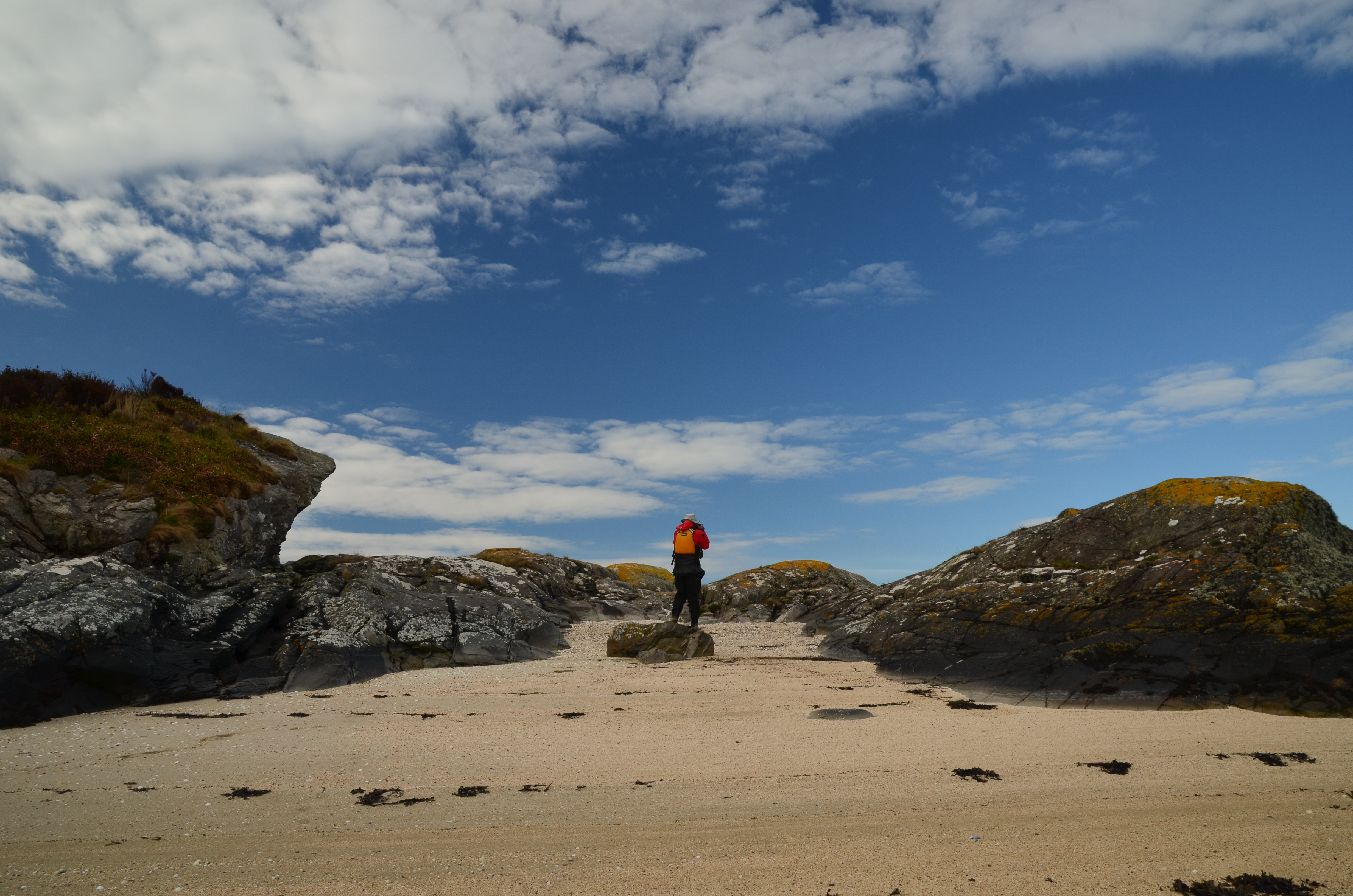


We had a leisurely breakfast and got on the water - within a few minutes we were back ashore on a tiny island with a "now you see it, now you don't" sandy beach which disappears at higher states of the tide.  We'd wanted to stop here because it's rather a fine viewpoint; the first image in this post was taken from the beach.
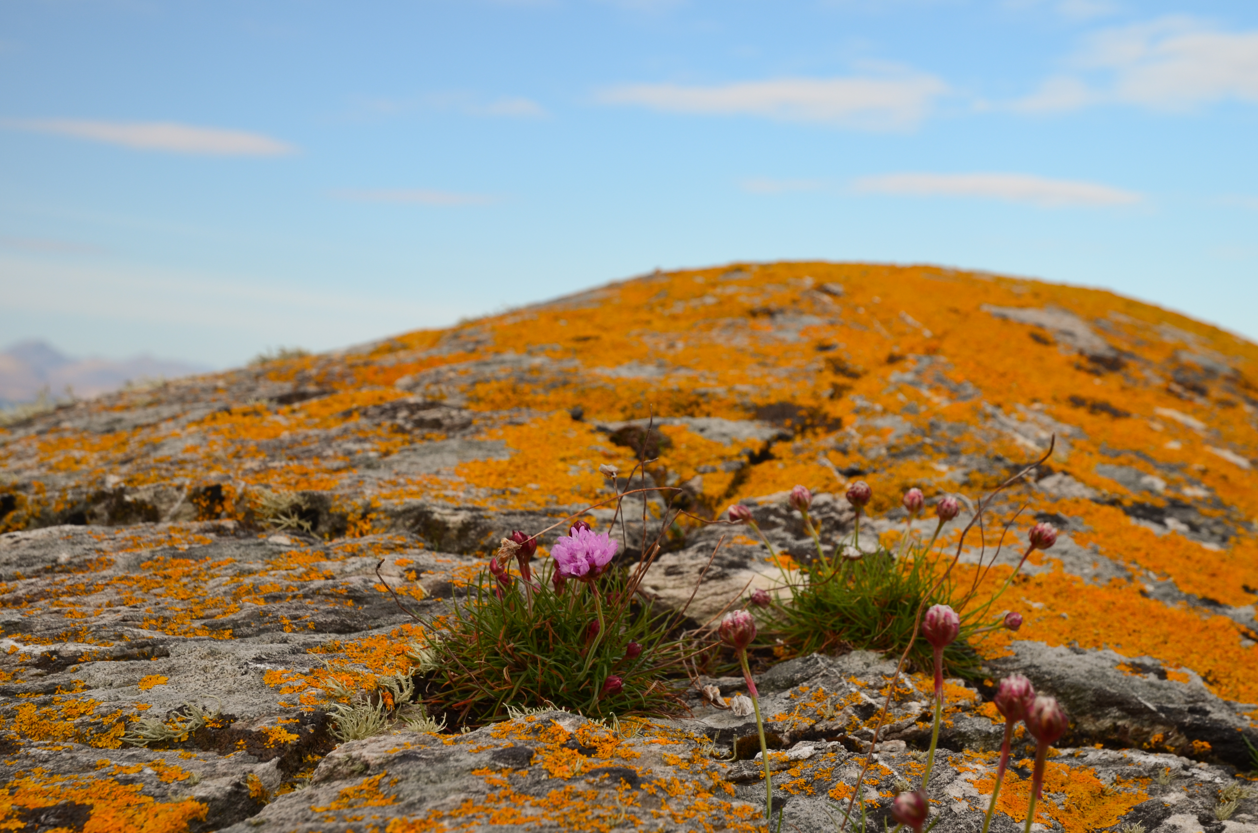


The view near to hand wasn't bad either - vivid orange lichens glowing in the morning sunshine, set off by a few Thrift flowers.


Orange seemed to be the theme of the morning; we returned briefly to Kyleakin to collect some things and whilst preparing to get back underway we noticed a bright orange vessel passing under the Skye bridge.


She's the "Mikal With", a 67 metre long palletised cargo vessel.  On most marine vessel websites she has a blue hull and a different owner than recently.  She's either owned or on charter to MOWI, a Norwegian aquaculture company.


We set out again from Kyleakin and aimed for the island of Pabay, which we intended to use as a stepping stone on our way to an intended camp on Scalpay.  The breeze had been slowly building and once clear of Kyle Akin it became quite strong from straight off the Skye coast (our port quarter).

We put our sails up to take advantage of the push and were absolutely blasted across towards Pabay.  I found this a really great sailing run, but was certainly not prepared to stop paddling in order to take photos!  Our average speed on this blast was 9.4km/h, or nearly twice cruising speed.....


Although a fast passage, it had been an energetic one - it is paddle sailing rather than just sailing!  We were all ready for a lunch stop by this point.


Approaching Pabay the wind seemed to ease  a little and we dropped our sails to paddle into the tiny harbour area.  Donny had motored along to Broadford in his F-RIB and made a direct crossing from there to Pabay; he had a pretty wet ride!
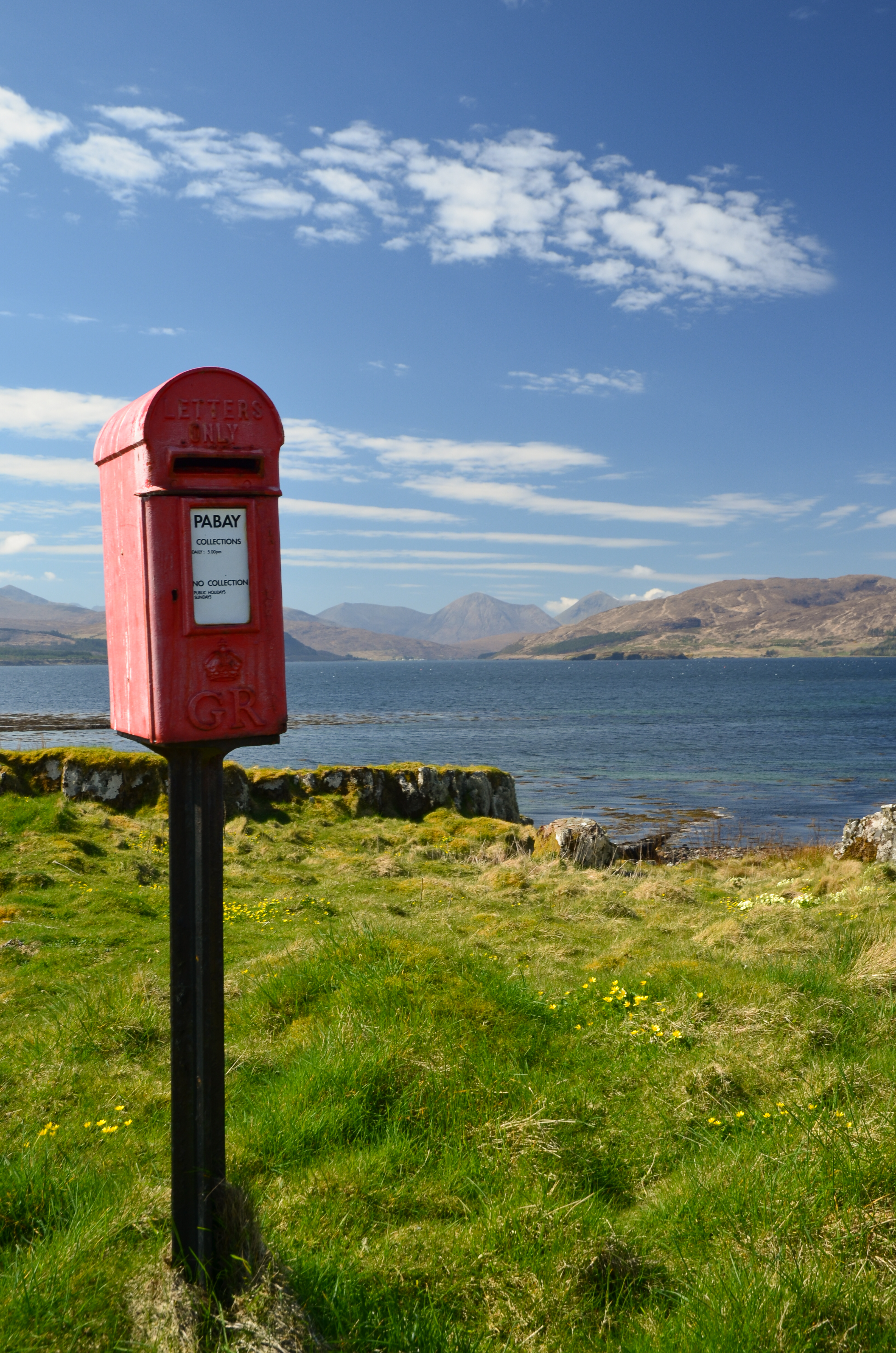


One of the iconic sights on Pabay (Norse: Priest Island) is this post box.  It seems incongruous since there are only a couple of houses on the island but is here because the island issues it's own postage stamps for mail which is transferred into the Royal Mail system in Skye (from where it needs Royal Mail stamps).


Sheltered from the breeze (which was becoming stronger) we lazed in warm sunshine, surrounded by clumps of Primroses.  The pale yellow of the flowers set against the blue of sky and sea was gorgeous.


Above where we lunched a pair of Bonxies (Great Skuas) watched us warily.  These impressive piratical predators had picked a nest site with a great view over the low lying island.


One of the features of Pabay is its geology which is shales intersected by dykes of harder rocks.  The whole island is almost flat and nearly doubles in size as the tide falls from high to low water, leaving the geometric patterns of dykes.

Another feature is that, despite being flat the island has virtually no wild camping spots accessible from the water.  The rock layers from a barrier and the softer rock gives good growing conditions for brambles and tangled low undergrowth.

This gave us a problem; we were pretty much pinned on Pabay.  The wind had continued to rise and in the Sound between Pabay and Scalpay was approaching a Force 6.  None of us was keen on trying the paddle across unless we really had to, but despite trying along the sheltered parts of Pabay by kayak we could find nowhere to camp.  We returned to the harbour to have a re-think.  Douglas and I walked up to the "big house" which is undergoing renovation by a new owner of the island.  We explained our situation and asked if we might camp near the harbour.  The Access provision in the Land Reform (Scotland) Act is wide ranging but does not cover access near to houses or infrastructure.  The owner was most kind in allowing us to camp for the night and it was really appreciated by us.


We pitched our tents in areas which wouldn't affect access to and from the harbour itself and found a spot out of the wind to cook dinner - preceded by fresh soup.  The day had been recovered but our plans would need to be altered.  The forecast was for the wind to drop almost completely by morning, so we decided on a paddle to the Applecross shore via the Crowlin Islands.


As the sun set, the wind came around a couple of points and seemed to drop by several degrees in temperature - it was pretty cold within minutes.  Dinner done, we retired to the tents (which we'd pinned very securely to Pabay) for an early night.
 

Tuesday, 1 September 2020

Smooth headland, smooth going

We left Camas Mor with some reluctance, it's a lovely spot and one that's usually difficult to land on.  Ahead of us the sea shaded from aquamarine to indigo and every shade of aqua blue in between.  The cliffs are high here and we began to pick out the stacks near to our destination.


A glimpse of another strip of pale golden sand caught our attention - and if Camas Mor is difficult of access then this beach takes it to another level.  Backed by rugged, loose cliffs it would be a tricky scramble down and back.  The scale of the place is put in perspective by the group of walkers on the skyline near the lowest cliffs......


We were now paddling in emerald green water - an indication of some depth over a sandy seabed.  The sandstone stacks rose up in front of us, intricate and challenging.


When we came to shallower water the sea colour changed again - bright turquoise alternating with a deep green where patches of laminaria weed grow from the seabed......


...while behind us the emerald green was stunning - flashes of light darting across the seabed as the bright sunshine was refracted off the ripples on the surface.


As if this couldn't get any better, the colour of the water intensified close to the stacks, which added their own warm red shade to provide contrast.


Against an intensely blue summer sky, the contrast of the sandstone's red was startling.


 Suddenly, we were past the stacks and the height of the land fell quickly to Rubh Reidh (the smooth headland).  Rubh Reidh is named for the appearance of the sloping slabs.  These are of a different type of sandstone, termed autoclastic (made of itself) and are understood to have been sediments broken and tilted 30 degrees to the northwest, possibly by earthquakes.


Across the headland, Rubh Reidh lighthouse stands tall and distinct, visible from many miles up and down this northern coast.  Built by David Alan Stevenson between 1908 and 1912, the tower stands 25 metres tall (37 metres above the sea) and shows four white flashes every fifteen seconds.  I've travelled this coast in large vessels and the intricate chain of lights is perfect, each distinct and in just the right place - one of the great engineering and navigational feats.

To be here, at the Smooth Headland, in smooth conditions was a real treat.  I've walked to the light and tried three previous times by sea kayak to turn this point; each time conditions were too big for me.  the tide sweeps around at 3 knots, it's absolutely exposed and despite it's lack of height is described in yachtsman's pilot books and the sea kayak guide to the north west as "the most dramatic and challenging of the Wester Ross headlands".  We felt pretty lucky!

Friday, 11 October 2019

Summer sojourn on the Moray Firth - among the red towers


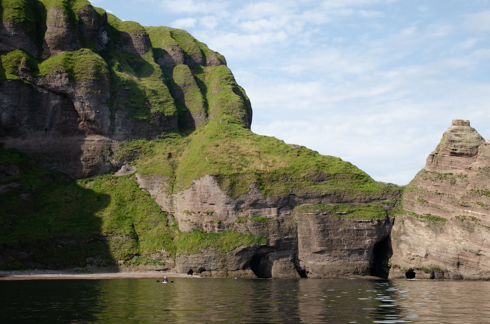
The conglomerate rock arch we passed through is a portal to a very special stretch of coastline.  A wall of red rock capped with verdant green and carved into spires, battlements and stacks, it's like nowhere else on the Moray Firth.  This area between Strahangles Point and Pennan Head never fails to amaze.


The scale only becomes apparent as you paddle close inshore.  These cliffs are over 120m/400ft high and fall sheer to a glacis of the most brilliant green grass overlaying fallen pieces of the cliffs.


There are gaps between stacks of fantastical shape, haunted by seabirds.  Each time we've paddled here we've felt ourselves to be in a privileged place......


....in a landscape that could have been taken straight from a Tolkien book.


On a day of windless calm with the sea a mirror of the cliffs, we paddled into the shade of the north facing cliffs in silence, lost in our own appreciation of this place of soaring red towers.


Our kayaks were dwarfed by the scale of the rock architecture.  Sure, there are bigger cliffs and higher stacks but few places I've paddled have quite the same atmosphere as this double cirque of stone.


We'd entered the place through one arch, and we would leave by another arch, a long cave-arch passable above half tide and in calm conditions.  The entrance is guarded by submerged rocks and needs care. 


The arch leads out to a line of cliffs which anywhere else wold be a highlight of a paddling route.  Here; thoughts almost immediately turn to paddling back through the red towers.

Wednesday, 2 October 2019

Summer sojourn on the Moray Firth - Findochty to Sandend

In the last week of August a spell of warm and potentially settled weather was forecast. High pressure dominated the weather across the British Isles but there was some doubt as to where the centre would be - and that could mean windy conditions would encroach from the west. Allan, Lorna and I were keen for a multi-day sea kayak trip somewhere and discussed several different locations. In the end we decided that hte best chance of good weather over a period of three or four days was actually quite close to home on the Moray Firth. Wild camping is possible on this coast but it would mean a long linear trip; we opted to use a fixed base at a camp site in a central position.

Our friend Douglas was due to join us but couldn't make it due to an unavoidable engagement but we were delighted that Raymond could join us for two of the three days paddling.


We met up in Findochty on a very warm morning, there was almost no wind and not a cloud in the sky.  Even though the Moray Firth coast gets some of the best weather in Scotland, you never take days like these as a given!  We ran a shuttle ahead to Sandend where we would camp so that we'd just have day kit in the boats and were soon ready to set out.


We left the harbour and turned east.  The coast immediately becomes engaging, the rock architecture dramatic.  The seabirds which nest in their multitudes all along this stretch had mostly completed their breeding cycles, just a few pairs had well-grown chicks still in the nest.....the evidence of their summer occupation was plain to see on the guano-stained rock though.


Looking back to Findochty the most prominent building is the Church of Scotland church, a white painted building on an elevated site overlooking the harbour.  Completed in 1863, it served Findochty when the town was a thriving and busy fishing port.  Until a bell was installed in 1877 worshippers were called to kirk by a foghorn! 

The church would have been a landmark for the fishing fleet, at that time mostly rowed vessels and a magnet for fishermen on Sundays when all the boats would be in port.  We were approaching one of our favourite places - a landmark in its own right and a magnet for any sea kayaker or photographer visiting this area...


The graceful arch of the Bow Fiddle is a highlight of any trip here, and we always paddle it if conditions allow.  As for many folk, Raymond's reaction on turning a corner to look straight through was one of amazement.  As he'd not paddled it previously we hung back to allow him to experience passing under the graceful blade of rock above a smooth slab - it's a fantastic place to be in a kayak!


We all followed Raymond in "stringing the bow" out into open water.  The Bow Fiddle is so named due to its resemblance to the tip of the bow used to play a fiddle.  Nearby is another special place with an evocative name - the "Whale's Mou" (mouth), a huge sea cave with a natural window in one side and a narrow exit at the landward side.  Naturally, we explored that too!


We continued across Cullen Bay in conditions which had now gone from warm to hot, landed for a leg-stretch east of Cullen and then continued around to the Logie Head, a fissured prow of pale grey rock popular with climbers.  The Logie Head marks a change in rock type from the reddish Cullen Quartzite (which is metamorphised sandstone) to Greywacke.  Nearby is another change, the boundary between Morayshire to the west and Aberdeenshire to the east.


East again we landed for a coffee at the beautiful Sunnyside Beach.  Today it was very benign but landing here can be surprisingly difficult.  t higher states of tide the sandy curve of the beach looks very inviting but there are sharp reefs to negotiate, like the one in the foreground in this image, and the surf picks up alarmingly close to the shore.  No such problems today, we landed easily and joined other beach-goers on what was one of the best afternoons of the whole summer.


One of the great features of this part of the Aberdeenshire coast is Findlater Castle which today was lit superbly by the high afternoon sun.  You have to admire the vision of the person who said "I kow, we'll build it right there"!


Just beyond Findlater we met a group of paddle-boarders on a trip out from Sandend.  A cave-arch here is a hidden feature with superb lighting in sunny conditions, the water crystal clear and lit turquoise.


We were now on the last section of our day's paddle.  We think that the section of coast from Findochty to Sandend is the equal of anything in Scotland for variety and features (but we're a bit biased as it's pretty local for us!).  There were still some highlights left to enjoy though....starting with a turn in to a narrow geo.  There are several similar entrances, but once you know the correct way in......


....you enter a series of narrow channels behind masses of rock.  This is paddling right amongst and behind cliffs; one channel is barely shoulder width and is pasable only in perfct conditions.  Most of the others like this one will "go" in most conditions.  It's a great finale to a great stretch of coast for sea kayaking.


All too soon we landed in the tiny harbour at Sandend.  The camp site we'd be using is actually right behind to bech here, but first we drove back to Findochty to recover two cars left there.  The temperature at 5pm was 28 degrees Celsius, one of the warmest days of the year.  Summer sea kayaking doesn't get much better!

Tuesday, 30 April 2019

A celebration on "Mica Beach"


By the time we'd paddled about half way down Loch Shiel and the mountains had begun to recede on either side, the wind had dropped to a very light breeze.  It was still an assistance though and we would eventually cover the length of the loch at an average 7km/h despite taking plenty of time to dawdle and enjoy the situation.


Second luncheon was on the horizon and we pulled over to the west side of the loch to land at a beach we've passed previously but not landed on.  Stark when we saw it in winter conditions, it seemed a lot more welcoming with fresh green spring leaves opening and birdsong echoing across the hillside.


The glacial nature of the landscape is obvious in the ice-polished rock on the shore.  The geology in this area is quite complex, this looks to be a metamorphic rock type.  Among the pebbles on the beach we found some pieces of mica which were incredibly bright - almost mirror-like in their shine.  We'll know this place as Mica Beach on future trips.


The view back up Loch Shiel was very fine, bright blue water framed by steep hillsides clothed in green and backed by a mountain skyline.


Closer to hand, the spring flowers were in evidence on a grassy bank above the beach, the beautiful flowers of Wood Anenome (Anenome nemorsa) studded the undergrowth; a welcome sight.


Another welcome sight was a small libation of Caol Ila malt whisky, dispensed from Douglas' flask - for we had something to celebrate.....


.....the first day on the water for Douglas' new P & H Cetus MV kayak.  As we were marking h=the vent on fresh water, we would of course have to hold another launch ceremony when "Sula" first felt salt water!

Sunday, 5 August 2018

Fried on Eigg

After enjoying lunch and checking out the facilities at Galmisdale Mike and I returned to our boats and paddled a couple of hundred metres round to the bay which is recommended for yachts to anchor and for informal camping. 


I knew from a previous visit that the ground behind the bay is also used for grazing sheep and cattle - and sure enough some of the cattle were cooling themselves in the water when we arrived on the beach.While we felt that they'd have seen it all before and would be unlikely to bother us, we felt t wise to leave everything in our boats rather than pitching the tents straight away in case one of the younger beasts got curious....

Having used a trolley to half pull and half carry each boat up the soft sand, we got changed into shorts and light shirts for a bit of a walk.  We each had an ultralight rucsac in our boats and packed these with water, some snacks, a long sleeved top and sun cream....good to go.


Heading up the track back towards Galmisdale, we found where the sheep normally on the machair had gone......everything on Eigg is dual purpose where possible!  These ewes had the right idea, at just gone 1pm the heat was pretty full-on, and they still had thick fleeces.


At Galmisdale there's a sign board detailing waymarked walks, with each walk having a colour code.  The coloured waymarks are a bit sketchy to find - if, like us, you want the quickest route to climb An Sgurr, take a track up through some pretty woodland, then follow a rough track across open pasture to reach a gate near this house.  The route then goes left beyond the house and then immediately right - not that obvious but once on the hill path, very straightforward.

This must be one of the most photographed views of An Sgurr, it has a nice composition with the house giving some foreground - and is also a good place to pause on the first of the steep slopes!


There really isn't much doubt which way the wind blows here.  This tree, unexpectedly it's a Beech, was older than its size suggests, cropped and sculpted by the wind.


The climb towards An Sgurr is steady and uncomplicated, just a couple of rocky steps on the crossing of a moor which laps the base of the prow - which gets steadily more impressive as you approach.

The Sgurr is the southern termination of a pitchstone ridge which runs along the spine of Eigg.  Formed during the birth of a huge volcano complex which included creation of the island of Rum, it is effectively a mirror image of the landscape of 58 million years ago.

Pitchstone is formed from viscous lava flows and is tougher than the usual basaltic lavas.  The story of the Sgurr ridge is this:

As the Rum volcano complex erupted, a layered basalt lava flow landscape emerged, covering the ground to the level of the present day ridge.  Over time (about 6 million years), a valley was eroded out of the basalt lavas, and when the pitchstone lava was erupted it filled this valley to the brim. Because pitchstone is so much harder than basalt it resisted erosion as the basalt around it was worn away, so what you see today is an inverted valley, like a jelly-mould image.  There's a good explanation of the process in this paper by the JNCC.


As we crested the slope at the base of the great prow, the view opened to Rum, the source of all the lava. From an elevated viewpoint the vague shape of the Rum Main Ring Fault can be seen in the hills.  Our route contoured along the north flank of An Sgurr to climb though a fault line and emerge onto a shallow col.....


....where the view to the south is suddenly revealed.  The long finger of Ardnamurchan is in the foreground with the west coasts of Islay beyond, fading into a heat haze.


The route now switches to the south side of the An Sgurr ridge and follows a narrow path with a little bit of exposure and stunning views.  Below our feet was the coast we'd paddled that morning, out to sea lies Muck, our original target for the day.  Beyond Muck, faintly discernable in the haze we could see the outline of land - and puzzled for a few minutes about where this might be until Mike correctly identified Coll and Tiree - islands I've yet to visit.

It was clear that the wind had dropped considerably, and that we'd probably have been able to get to and from Muck safely - but what we'd missed in visiting Muck was being amply compensated by this brilliant hillwalk.


Cresting the ridge, we got a view down to Galmisdale and the route we'd walked to get up.  We could clearly see the narrow finger of turf where we would camp, just below the dark coloured skerry in this image.


To the north, the previous night's camp at Bay of Laig was visible at the same time, and the view leapt across the Sound of Rum, now an intense blue.


The final few metres to the summit track across the surface of the pitchstone, showing some of the columnar shapes formed as it cooled.  Right now, it felt like the lava was still warm from the volcano - the heat was terrific and was being reflected up from the rock in pulsing waves of dry, hot air.


On reaching the summit, we flopped down and spent a good half an hour just taking in the views and the situation.  At 393 metres/1289 feet An Sgurr is quite a small hill, but it has a view matched by few other hills in Scotland.  The combination of islands, mountains and lochs forming a true 360 degree panorama are simply stunning.

We left the summit reluctantly - it would have been easy to while away hours up here but we were being absolutely scorched by the sun and had limited water with us.  Truly, we were being fried on Eigg, and would be "sunny side up" for days afterward.

We went fast and direct on the descent - for we had a powerful incentive.....