Showing posts with label Eddrachillis Bay. Show all posts
Monday, 21 May 2018
Four seasons in a forenoon
I slept well in my tent, pitched behind Glendhu bothy. We woke to frozen ground and a dusting of snow which was coming and going in light showers - quite a difference to the warmth of the previous afternoon!
It's often said that in Scotland you can experience four seasons in a day - and we were about to have just such a day.
Snow was falling steadily on the hills above Glendhu. Our bothy companions took a look outside and voted unanimously for a late start to see if it would clear.
After breakfast we got packed up, said goodbye to the lads and got on the water in improving conditions. The wind died completely and the cloud began to break and lift up the crags surounding the head of the loch. An easy paced paddle took us down to Kylesku in a little over an hour.
Our plan had now evolved a little due to forecast strong winds the following day. We'd thought of shuttling a car ahead to Scourie and paddling from Kylesku north, using the camp site at Scourie, but the forecast northerlies would have made this a hard slog. Instead, we decided to drop our camping gear and excess kit at the vehicles in Kylesku, then to explore Loch a' Chairn Bhain, returning to Kylesku to finish.
On the shore opposite the fishing jetty lie the remains of the two-car ferry "Maid of Kylesku". She served the Kylesku crossing from the 1950's until 1967 when she was replaced by the "Queen of Kylesku" in 1967, which in turn was replaced by the "Maid of Glencoul". When the Kylesku bridge replaced the ferry service in 1984, the "Maid of Glencoul" was redeployed as a relief vessel at the Corran ferry in Lochaber.
"Maid of Kylesku" was simply beached when she reached the end of her service life in 1967 and it's testament to the strength of her construction that she's essentially still in one piece over fifty years later - although she has certainly seen better days.
Having unloaded most of our kit back into the vehicles at Kylesku, wetook advantage of the strong ebb stream too pass under the Kylesku Bridge at quite a lick. Rain began to fall steadily as we set out, and soon after we went under the bridge there was a dramatic change in conditions as a squall barrelled in from the north bringing a vicious mix of rain and hail on a suddenly strong wind.
As quickly as it had come in the squall passed through and disappeared over the summit ridges of Quinag, trailing veils of rain as it did so. The wind dropped, out came the sun and it suddenly felt warm - another of Scotland's weather tricks.
By the time we reached the seaward end of Loch a' Chairn Bhain (loch of the white cairn) we were paddling under blue skies and bright sunshine once more. I remembered a small pebble beach at the back of a tiny bay where we stopped for luncheon; there are surprisingly few landing places on the north shore of this wide loch.
The colours here were really fine, that alluring mix of white sand under turquoise water, a real treat. Allan and Lorna were both suffering from heavy colds and decided to go just a little further before turning back.......
.....but first we explored the tiny Loch Shark, a lovely shallow loch enclosed by pine and spruce woods - most unusual for this part of the coast. As Allan and Lorna began the return leg towards Kylesku, headed north to paddle around the island of Calbha Beag (little calf).
Almost as soon as I turned north the wind began to increase; in the channel between Calbha Mor and Calbha Beag it became a real effort to make progress and I reached the top of the island with some relief.
The north coast of this small island is rugged and steep; the wind had quickly built a swell in the wide open Eddrachilis Bay which was acting against the ebb tide to produce quite sporting conditions - lots of spray, noise and movement. I was then treated to a fast, surfing run down the west coast of the island taking advantage of the wind-over-tide wave trains....there aren't any photos of this section!
From the still frost of the early morning, to snow, dead calm, hail and rain, bright sunshine and now a barrelling wind; we'd had four seasons in a forenoon never mind a day! Truly, in Scotland we don't have a climate, we just have weather.......
I spoke to Allan on the VHF radio to let him and Lorna know I was back inside Loch a' Chairn Bhain. A pleasant paddle took me back towards Kylesku, where the bridge is suddenly revealed when a point which seems to block the loch off is rounded. This is still one of my favourite bridges, there's a simple grace to it and seen from the ridges of Quinag the curve of the deck seems to fit the landscape really well for a modern structure.
We packed up at Kylesku and consdiered options. The forecast for the following day was poor and Allan and Lorna decided to head to Scourie to camp before taking a leisurely trip home. I decided to head home to take the opportunity of seeing visiting family, and started on the journey back across country.
Before I did though, I stopped on the road at a layby with a view up the length of Loch Glencoul - a view familiar to many geology students and one that has few equals from a main road.
Heading over the watershed to the eastern side of Scotland, the higher hills were still plastered white - this is Ben Wyvis, a sprawling giant of a hill visible from a wide area.
A short trip, but a good one in a favourite part of the country; hopefully I'll be back there soon.
Friday, 27 September 2013
Reflections
As forecast, the morning turned overcast as I paddled back towards the mouth of Loch a' Chairn Bhain. Whilst exploring in a bay which I'd passed the previous day, I found this sheltered beach. Time for second breakfast........
The shore was composed of beautiful banded gneiss pebbles with occasional quartz and red sandstone ones; a fair representation of the local geology.
Immediately behind the top of the shore lay this lochan, a perfectly still reflecting pool fringed with lillies and rushes. Salt and fresh water are just a few meters apart here, but seem totally separate as there's no obvious outflow from the lochan to the sea.
With the seaward view in one direction and the lochan in the other, this would have made a lovely spot to spend some time except for one small thing - well actually millions of small things! The midges waited until I'd got my stove going before making a ferocious attack. I was sufficiently "motivated" to take my cup of tea and balance it on the foredeck of the boat whilst backing off the shore to leave the biting hordes behind. I sat in the bay and enjoyed a midge-free second breakfast.....
The still and overcast conditions, whilst ideal for midges, also made for great reflections as I headed back towards Kylesku.
Scree fans reflected in the still water made for interesting patterns......
...including this delta-wing shape.
The sun was beginning to burn away the cloud as I neared the Kylesku Bridge, which itself was making a nice symmetrical reflection.
I arrived back at the old ferry slip at Kylesku just as the sun burned away the last shreds of cloud from Quinag - the mountain which had been my constant companion on this short journey. Just less than 100 km in the three days, but I could add my own reflections of a superb few days to those on the waters of the loch.
Wednesday, 25 September 2013
Northlight
One of the features of the far north of Scotland which is shared with the Northern Isles and the Hebrides is a remarkable quality of clear, sharp light. This quality is difficult to describe adequately, but it can dominate everything in effects from astonishing clarity to a light which seems almost to penetrate solid objects and light them from within.
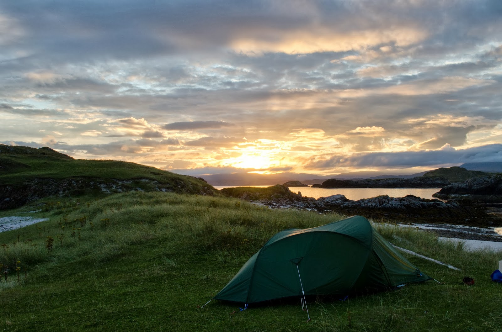
The view from my camp site had some of this effect.....
The evening shade was pure and clear and seemed to amplify the warm glow struck from the flanks of Quinag by the dipping sun. My tent (in the lower right of this image) had a great view, but the real grandstand effect could be had by climbing a small hill.
It was, quite simply, stunning and I sat long into the evening just absorbing the slow change of light.
A glance from the tent first thing in the morning after a cool night puntuated by the sighing of seals and the gentle talk of deer hinds grazing nearby revealed cloud streaming off the flanks of another of Assynt's distinctive mountains, Canisp.
There was the promise of a fair day to come in the early sunshine, though the forecast was for a cloudy morning followed by a brighter afternoon prior to a spell of windy weather.
I took breakfast after packing up the tent, a sequence which proved beneficial. As the rising sun passed behind a cloud bank, a barely discernible noise started...... it was the sound of tens of thousands of midges reacting to the lower light levels and shouting "Get him!!" Truly, bright sunshine and a breeze are the kayakers friend!
I still had to pack the boat, so one of these proved once again to be worth its weight in gold......
After finishing breakfast from inside my midge-armour I got on the water as the northern light played another dazzling trick. Searing sunlight streamed through the thin cloud and fired it with white light, creating a lace-like effect.
It was just 7.30 am and the day had already given so much.
The evening shade was pure and clear and seemed to amplify the warm glow struck from the flanks of Quinag by the dipping sun. My tent (in the lower right of this image) had a great view, but the real grandstand effect could be had by climbing a small hill.
It was, quite simply, stunning and I sat long into the evening just absorbing the slow change of light.
A glance from the tent first thing in the morning after a cool night puntuated by the sighing of seals and the gentle talk of deer hinds grazing nearby revealed cloud streaming off the flanks of another of Assynt's distinctive mountains, Canisp.
There was the promise of a fair day to come in the early sunshine, though the forecast was for a cloudy morning followed by a brighter afternoon prior to a spell of windy weather.
I took breakfast after packing up the tent, a sequence which proved beneficial. As the rising sun passed behind a cloud bank, a barely discernible noise started...... it was the sound of tens of thousands of midges reacting to the lower light levels and shouting "Get him!!" Truly, bright sunshine and a breeze are the kayakers friend!
I still had to pack the boat, so one of these proved once again to be worth its weight in gold......
After finishing breakfast from inside my midge-armour I got on the water as the northern light played another dazzling trick. Searing sunlight streamed through the thin cloud and fired it with white light, creating a lace-like effect.
It was just 7.30 am and the day had already given so much.
Saturday, 21 September 2013
Culkein Drumbeg, the compact maze
After leaving Loch Ardbhair I turned west, heading towards Culkein Drumbeg. Yet another aspect of Quinag began to open up, this is the end of Sail Ghorm (the blue heel) which is the northernmost part of the mountain.
The area around Culkein Drumbeg is a confusing maze of small islands and channels which change almost hourly according to the state of the tide. At high water it's possible to paddle around most of the islands whilst at low water it becomes challenging to find a way through the maze. I had about half tide conditions and so had a bit of both here.
Along the shore there are small headlands......
.......under which caves can be explored. The low entrance to this one opened into.....
...a green pool and inner grotto. The sound of waves could be heard though there was almost no water movement on the side through which I entered; I thought that there might be another entrance to this particular cave.
Narrow clefts and channels between the islands frame views of distant mountains.
And there is the odd enticing white sand beach too. A full day could easily be spent paddling around this compact area while staying within two kilometers of the jetty at Culkein Drumbeg, it's just so full of variety and interest. The best way to do this would be to time a startfrom the jetty at about half flood tide, to get the maximum options for exploration.
Looking back, the views to the northeast were superb, the ash grey quartzite hills of Ben Stack, Foinaven and Arkle crowding the skyline.
Wednesday, 18 September 2013
A two thousand year old view - the Broch of Loch Ardbhair
After leaving Loch Shark I crossed back over the mouth of Loch a' Chairn Bhain and along the coast, where the map indicates a channel between the mainland and Eilean Rairaidh. ou really have to believe in the map, because the channel seems hardly to exist, but it's there!
Beyond the island, the mouth of Loch Ardbhair seems to be blocked by a rocky arm, but this channel is also there and leads via an "S" shaped entrance into a shallow loch about 1.5km long and 600 metres wide. Right at the head of this loch, the map has marked on it "Broch". Well, this was certainly worth exploring further....
On a small tidal island, the remains of a circular structure can clearly be made out. There seems some debate as to whether this structure was a true Broch, or some other kind of building, referred to by the generic term "roundhouse". Brochs appear all over the north of Scotland and particularly in the Northern Isles, and mostly take the form of a tapered round tower type construction with massive walls with well fitting stones, galleried inside and with more than one floor. They mostly date from 600BC to AD100, a quite considerable period of development.
This "Broch" (also referred to as "An Dun" - the fort) has a single skin drystone wall 8 meters in diameter and up to 3 meters thick at its base. The quality of construction isn't that good in comparison with some Brochs, but it seems meant to have beeen a defensive or protective structure of some sort.
A drystone dyke, noted by the surveyors as a "causeway now partly displaced" runs down the hill and into the water, emerging at the base of the outer wall. Whilst I don't have the level of insight that specialists in ancient structures have, I couldn't see this a primarily a causeway. When looking at ancient structures or ruins I try to put myself in the place of the folk who built and used it. While this could have had use as a means of access, it's quite narrow and would have been precarious; perhaps it had another use as a means of keeping back some water at the head of the loch on the falling tide, maybe as a fish trap or holding area?
The site of this structure probably hasn't changed that much since the Broch builders constructed and used it nearly two thousand years ago; this would still have been a shallow, Curlew-haunted arm of the sea, hidden from view to those who didn't know it was here.........
....and this view to Quinag from the narrow entrance way can hardly have changed at all in two millenia. This continuity of place occupied my thoughts as I left the tiny island and headed back out of Loch Ardbhair to the sea.
Subscribe to:
Posts (Atom)