Showing posts with label Firth of Clyde. Show all posts

Monday, 11 April 2022

An evening to savour

The Loch Fyne Light Show started with a distinct softening and warming of the light quality.  We picked up cameras to watch as the sun sank through a cloudbank over the Kintyre shore.


Donny walked to a vantage point on a nearby rock rib to take some video - you can see Donny's film about our trip on his YouTube Channel here.


I joined Donny to get a view with no rocks in the foreground and was rewarded with this lovely path of sunlight beaming across Loch Fyne.


I spent a good twenty minutes just taking it all in; the last two years have seen few trips due to Covid restrictions and work pressures....it was so good just to "be" in the outdoors again, in the moment with a lovely sunset.


The sun dipped below the Kintyre hills and the sky put on a final flourish of gorgeous light....just superb.


As Donny and I wandered back over to join Raymond and Allan at our camp site the light show faded to a pastel finish, but there was one last and beautiful element to come.


After sunset the pale, ethereal light was as gorgeous as the sunset had been, though in a completely different way.  My photographic skills don't do the light quality any justice whatsoever, the softness and opacity of a calm evening.  It's this changing "Solas" (light) which really makes a day.


The temperature dropped after sunset and we got our fire, built well below the Spring high water line, lit and away.


Contained by a few big logs, it soon built a very satisfactory heat with remarkably little refuelling required due to the lack of wind.  We sat around and enjoyed after-dinner treats and the odd dram - life seemed particularly agreeable on this Fyne evening!

Saturday, 9 April 2022

A Fyne afternoon for a swim

Replete and refreshed from our second breakfast in Tarbert, we headed south down the Kintyre shore before crossing back to the Argyll shore of Loch Fyne.  Conditions remained absolutely perfect with calm water and warm sunshine - we had to keep reminding ourselves it was still March!


Close by the Argyll shore we landed on the tiny island of Sgat Mor (the name is possibly Big Skate after the fish).  We were delighted to find this tiny shell sand beach on which to take a leg-stretch.  We didn't stay long as the island is home to a colony of Great Black Backed gulls who voiced their displeasure very forcefully.

Sgat Mor has a small navigation light in a tower on the highest point, and for good reason.  It seems to have been a regular shipwreck site and even with the light has seen groundings, the latest in 1994.

Our plan for the day was to reach our intended camp site early in the afternoon so that we could take some time to just enjoy the great weather, rather than cranking out distance.  Soon after leaving Sgat Mor we arrived at a spot we'd scoped on the way past the previous day.  Donny was already there and had enjoyed a doze in the sunshine; you'll be able to see this trip in video on his Youtube site.


We soon had the tents up on a patch of turf above the beach, which was backed with colourful early Gorse and alive with birdsong.  A couple of hours were spent just relaxing, collecting firewood and airing out kit.  As is the way of things, the time slipped by really pleasantly doing, essentially, not a lot.  This is an important part of these journeys for me, when all that's necessary is to keep fed, warm and comfortable all life's other hassles and stresses can be put on hold as doing pretty much nothing takes up all my time.


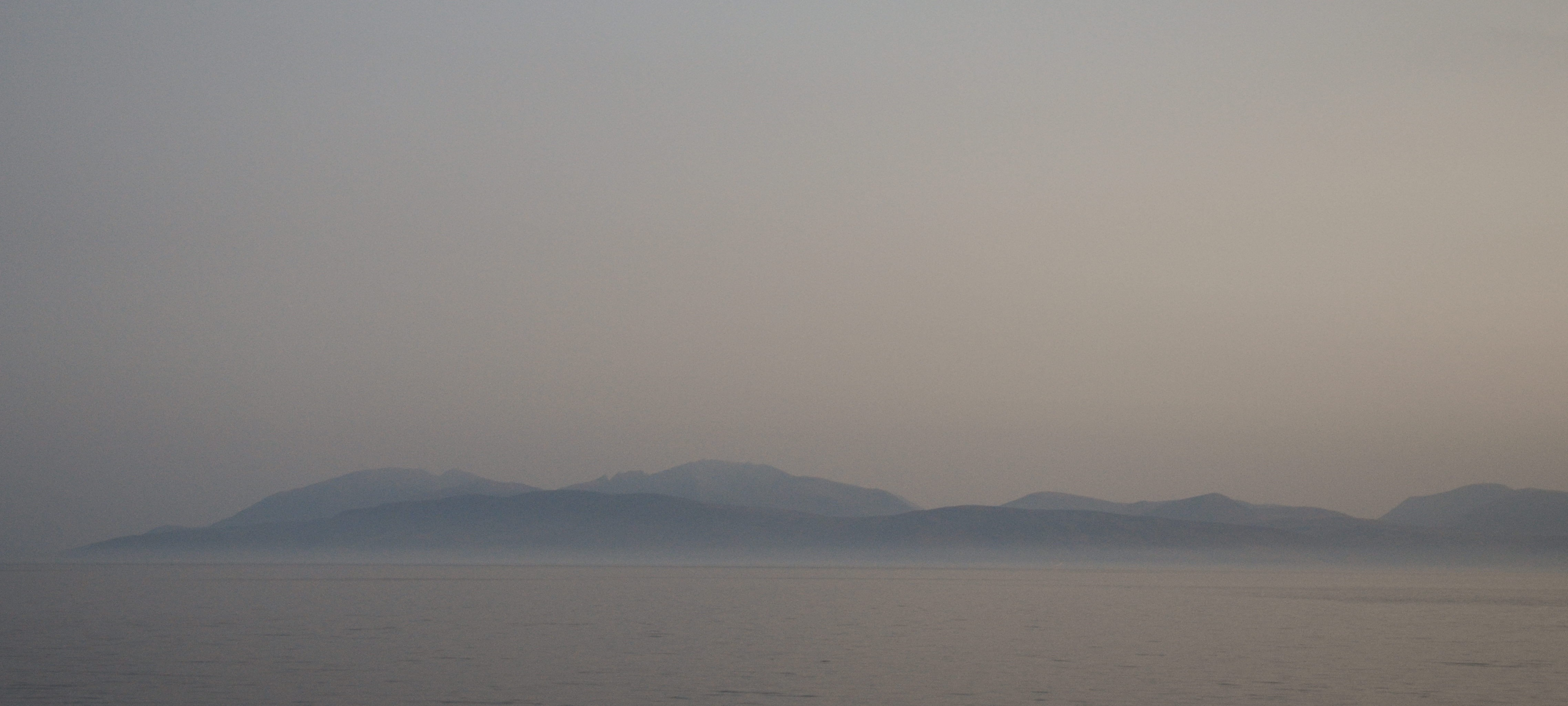
Our camp looked straight across to the hills of Arran which were in a blue haze.  Strips of sea mist around the north of the island made it appear to be floating above the sea rather than rising from it.


As the afternoon wore on the warmth increased and the light took on a lovely quality.  We were all rather warm in just t-shirts and light trousers and so a swim was debated.....


Donny, Allan and I took the plunge and can report that the water was on the bracing side of refreshing, but that once immersed it was a brilliant experience.  We emerged invigorated and dried off in the warm sunshine.  Only once have I swum in the sea earlier than 25th March and that was in similar conditions in the Sound of Arisaig - in February of 2013!


 After getting dressed and cooking a dinner of  home made Spaghetti Bolognaise courtesy of Raymond, we built the fire using some larger logs to contain and reflect the heat.  The early evening light was promising something special, so we finished all our camp chores and prepared for the light-show.

Friday, 23 September 2016

Clyde cruising on the return from Arran


The final day of our trip from Campbeltown to Brodick took us around the north of Arran past the impressive boulders at Fallen Rocks and around to the east coast of the island.


Near to the car park at Sannox which is the start of a walk to the Fallen Rocks was what looked like a commercial campsite.... except that it isn't.


It would be hard to imagine a  bigger contrast between these folks idea of what "wild camping" is and our own.  Set for several days, big tents, barbeques, everything including the kitchen sink.  We paddled on....


The cloud and drizzle of the morning cleared with superb dramatic effect at exactly the moment we rounded the corner and entered Sannox Bay -  all that was missing was a drumroll followed by a musical "Ta Da!" as one of the best views anywhere in Scotland was revealed.  The sweeping ridges of these granite hills really are superb.


This is a favourite stopping place of ours, often after a crossing from the Ayrshire coast via the island of Bute; it was most definitely time for second breakfast!  As we enjoyed coffee we watched the wind rising steadily to something more than a fresh breeze, and our decision to re-cross to Arran from Inchmarnock the previous evening proved to be a good one; the wind quickly reached F5.  Any crossing in these conditions would have been a real slog; in fact we may not have been able to get away from the exposed shore of Inchmarnock.


This part of the coast is well known for sudden squalls coming down from the hills and although we started out using our sails we quickly dropped them as the gusts were threatening to damage the rigs with heavy boats.  Even without sailing we made quick time down the coast to Corrie.....


....with its amusing "sheep" harbour bollards.  Three face south and one (the "black sheep" of the flock) faces north.


Another hour or so of steady paddling brought us into Brodick Bay and journey's end - well almost.


From a very uncertain forecast we'd enjoyed a great three night trip in a variety of conditions - all made possible by the use of ferries.  We'd paddled 94 kilometres over two full days and two half days and camped for three nights - in a pretty wide variety of conditions.


Having landed on the shore in Brodick we loaded our boats back onto the trolleys and headed along the promenade to buy our tickets and join the queue waiting to embark on the "Isle of Arran" for the return to Ardrossan and our car which was in the long-term secure carpark at the ferry terminal - the same ferry we'd sailed out to Campbeltown on four days previously.  We could then sit back in the cafeteria onboard and enjoy a lunch of Piri-piri chicken with fresh salad as we cruised back across the Clyde - definitely a good end to our journey!

Thursday, 20 August 2015

Give them an Inch.....


We landed on the west coast of Inchmarnock about 30 minutes before sunset and wasted no time in getting our tents up and camp established.  There are easier places to land and camp at the north and south ends of the island but we hoped that the spot we chose would be exposed to any breeze which would keep the midges away.

Inchmarnock means Marnoc's Island and is named for the Celtic monk Saint Marnoc (the name also cropping up in other place-names of the south-west of Scotland such as Kilmarnock).  At the north end of the island, a stone "cist" (burial container) was excavated to reveal a female skeleton buried with a jet bead necklace and a dagger.  The remains were carbon dated to 3500 BC, and the Bronze Age lady re-interred behind a pane of glass.


Across the Sound of Bute, the Arran hills were lit with a warm glow from the low evening sunshine.  It really was quite idyllic, and as a bonus the expected midge attack was thwarted by a "sundowner" breeze which started up as we finished putting up our tents.


The sun was setting in a blaze of golden light over the Kintyre peninsula by the time we'd finished making camp.  We decided to cook our evening meal on the pebble beach where we could light a fire below the tideline so that all traces would be erased at the next spring tide.

When it comes to moving boats at wild camp sites there seems to be two types of sea kayaker - those who move their boats right up to the tents, and those who only move their boats above the expected high water mark.  We definitely fall into the second category - we carried our boats onto a level patch of pebbles above the high water line - and not an Inch further!


 Douglas and Mike had used this camping spot some weeks previously and Mike was concerned that they may have used up most of the available driftwood - but it turned out that they hadn't tried nearly hard enough as there was plenty of wood along the shore.  Within ten minutes we had a good pile and with the help of a Wilcox Ignition Aid (TM) we soon had a satisfying blaze going.

Local stories claim that Bute's 19th century drunks were dropped off on Inchmarnock to be cured by "isolation and deprivation".  We felt no inclination to emulate these unfortunate folk and enjoyed a frothing sports recovery drink as we cooked our evening meal..... 

After eating we sat back and just enjoyed being in this place - so near to a big city and yet really quite remote.  The only sounds were the gentle crackling of our fire and the water on the pebbles of the beach; there was no man-made noise and very few lights visible on the surrounding coasts.


 The afterglow of the sunset was a long and drawn-out affair, an hour after the sun had dipped below the Kintyre hills there was still a band of intensely coloured light on the horizon.  The air was warm and the heat from our fire meant that we only needed jackets as it got dark.


Give us an Inch and we'll take a mile!

Wednesday, 19 August 2015

A summer evening on the Firth of Clyde


After a long work-enforced break from paddling and walking I was very keen to get back out on the water, and if possible to do a short overnight trip.  A good forecast for two consecutive days in the Clyde area (a rarity in the poor summer of 2015) and the availibilty of Douglas and Mike settled the deal, location and start time sorted by two texts and a brief phone call.  We met at Largs Marina on a gloriously warm afternoon and loaded our boats for a two day trip among the Clyde islands.

Douglas kindly helped me set up my new FEKS Trade Wind 80 sail before we set off, though it didn't look too promising for a test given the windless calm!  We paddled out from the public slipway and past the "Pencil Monument" which commemorates the 1263 Battle of Largs during which a Scots army under King Alexander II beat off a Norwegian force under King Hakon of Norway.


It was so warm that we'd set out in shorts and T-shirts, stowing our padde kit inside the boats, but even lightly dressed it was a warm afternoon.  The initial few kilometres south through Fairlie Roads between the mainland and Great Cumbrae is an industrial scene with the Hunterston ore terminal, Hunterston nuclear power station and two gigantic wind turbines dominating the view.


 In contrast to the modern industry on the shore, we passed this beautifully maintained sailing craft whith her varnished hull and graceful rig.


 After an hour so we detected a faint breeze and hoisted our own sails for a short while.  Although we'd only been on the water for an hour, a stop for afternoon tea below the 16th century Little Cumbrae Castle seemed very much in order.  A keep with royal connections, Little Cumbrae castle was in the possession of the High Steward of Scotland and is very similar to Portencross Castle over on the Ayrshire mainland.


 As we passed around Gull Point at the southern end of Little Cumbrae we got our first view of the distinctive outline of the Arran skyline some 15 kilometres across the Firth of Clyde.  We also saw two groups of Porpoises in this area, their sharp exhalations clearly audible on the calm air.


 The west coast of Little Cumbrae is a long series of lava flows.  These are best viewed from the south end of Bute where three distinct flows can easily be picked out.  A Peregrine Falcon zipped along the cliff edge before landing on the skyline and as we paddled out a little farther we were treated to a series of close passes by squadrons of Manx Shearwaters.

This rugged and quite remote coast with its wildlife is, amazingly, just 45 kilometres from the centre of Scotland's biggest city - but a world away.


As we'd not set out from Largs until mid-afternoon we would be paddling into the summer evening before reaching our intended camp site.  The sun wouldn't set until late and it was a lovely evening to be on the water, we had no sense of hurry or a schedule to keep; we just enjoyed being out here.


 We made a brief stop at a tiny pebble beach near Garroch Head on the south tip of the island of Bute to stretch our legs and to put on paddling clothes.  It wasn't that the temperature had dropped much, more that we knew we'd be landing next just as the midges were getting most active and thought that covering our legs would be best- it pays to plan ahead!


A crossing of a little over 10 kilometres of paddling lay between us and our camp site as we paddled away from the coast and out onto a mirror calm Sound of Bute.  It was truly great to be out on the water again......

Monday, 21 July 2014

Big air and deep water at Ailsa Craig

Having looked around the lighthouse and the quarry infrastructure, Douglas and I decided to make the most of our day on Ailsa Craig by climbing to the summit of the island.

The start of the path isn't easy to find but Douglas has been up previously and knew exactly where to look behind one of the buildings to find it.  The path is faint and in summer goes through chest high bracken on the lower slopes.  It also climbs at quite an angle, varying from steep through very steep to vertiginous and requires the occasional use of hands. 


After an initial steep pull the angle briefly relents on a shelf of rock.  Ahead is the Castle, a square peel tower built with local stone and dressed on the corners with blocks of sandstone.  The Castle was almost certainly built by the Hamiltons but no record remains of why it was built or how long it was occupied.  It is said to have links with the monks of Crossraguel Abbey and was also briefly held by Catholic forces on behalf of King Philip II of Spain.


Above the Castle the ascent resumes its steep angle.  A small well, more a tiny spring really, sits above the building and may have influenced the siting of the building.  The steep slopes of Ailsa Craig continue underwater as well as above, straight into the deep water of the Firth of Clyde. 


We paused on a level platform just below the final rocky climb to the summit to watch as FPV Minna cruised by below.  At 42 metres long she's not a big vessel and looked even smaller from up here.


One final pull up and we were on the 338 metre/1109 ft summit of Ailsa Craig.  The small summit area is surrounded by ground which drops away to the sea below, the faint noise of thousands of seabirds and the clouds of white specks we knew to be Gannets with two metre wingspans gave a sense of scale; we were truly in "big air". 

And the views!  From the Ayrshire coast round to County Antrim in Northern Ireland to Kintyre, Arran and the mountains of Argyll there is a wonderful 360 degree view with a foreground of blue sea.  Arran looked close and yet is 25 kilometres away.  We picked out Pladda and Benna Head, highlights of our recent journey around the island.

There was almost no breeze on the summit and the afternoon was warm.  We spent some time absorbing the views and then prepared for the descent, the knee-jarring to come would be as tough as the climb - though Douglas' bionic knees can now cope with a remarkable amount!


We were glad of the dry underfoot conditions on our way down.  The angle is such that for most of the way any slip would have serious consequences; in muddy conditions I would think twice about climbing the hill.  Gradually the lighthouse came into view along with our kayaks drawn up on the storm beach.  It's interesting to contrast this image with one taken by Douglas from a similar point in 2012; the curving shingle spit and a huge pile of rock have been completely erased by storms in the intervening period - a really striking change. 

We were hot and tired on the way down and looked forward to completing the "hat trick" at Ailsa Craig by kayaking, hillwalking and swimming.....


On the lower heathery slopes we saw several beautiful Magpie moths (Abraxa grossulariata).  They feed on the leaves of shrubs, so on Ailsa Craig they must favour the only small trees available, Elders (known as Bour trees and so scarce are trees here that they're marked on the map).  Lovely as this small wildlife spectacle was, our wildlife encounters were shortly to get a whole lot more widescreen....


Meantime though there was the pure pleasure of a swim in the cool waters of the Firth of Clyde.  Instantly refreshing and invigorating, our swim was enlivened by the presence of a couple of nearby Grey Seals who were curious about these pale-coloured visitors to their world and stayed around to check us out, quite a privilege

Sunday, 20 July 2014

Light and heavy stones at Ailsa Craig


As we finished our second breakfast MFV Glorious re-embarked her passengers and headed off for a tour around Ailsa Craig.  We intended to do the same circumnavigation, but Douglas suggested we do it later in the day when the light would be better on the south-west facing cliffs.  Meanwhile, we had plenty of time to explore.


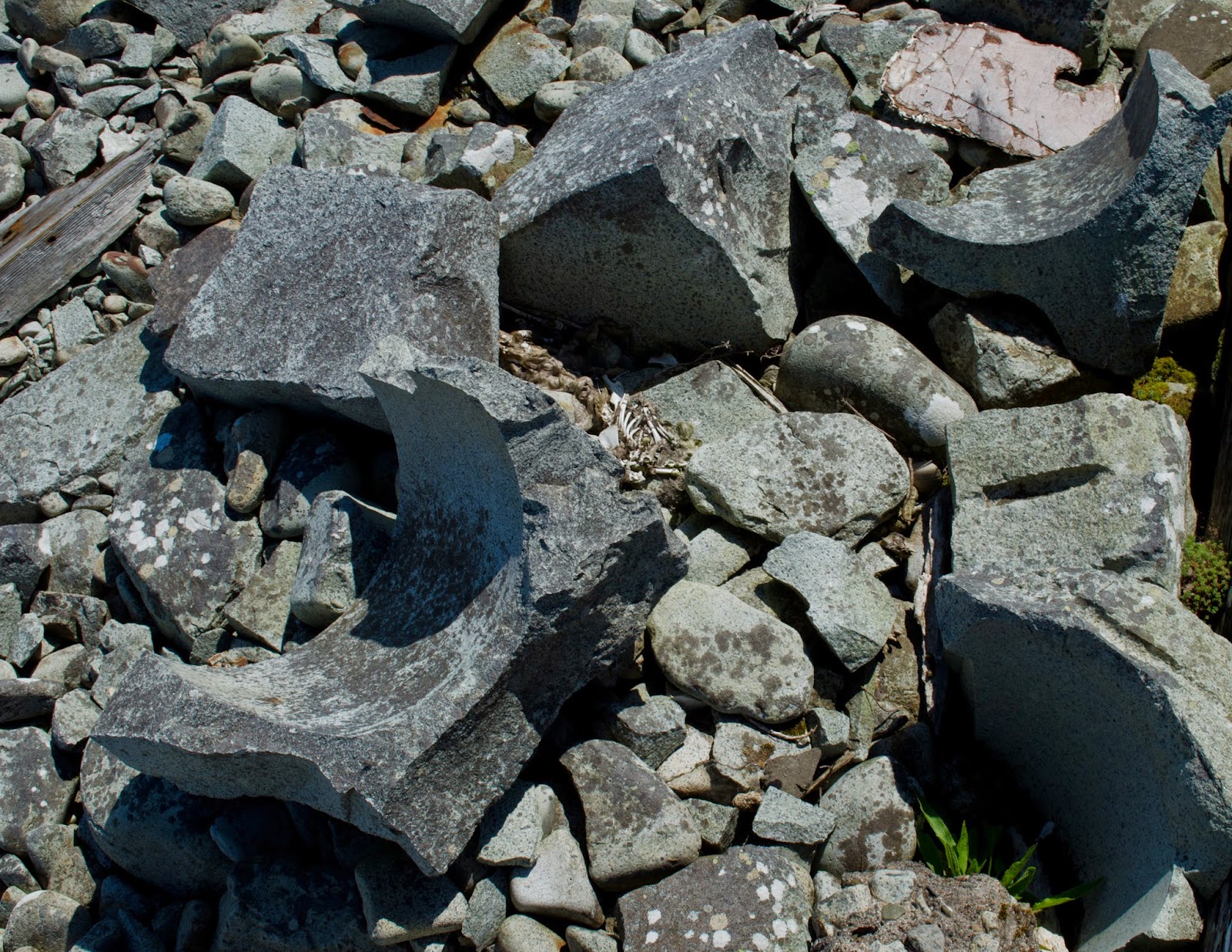
A feature of the area around the quarry and boulder beach near the lighthouse buildings and pier are the shaped offcuts of granite lying around.  They are the clue to Ailsa Craig's world-renowned status as the origin for most of the world's Curling stones.

Curling has a long tradition in Scotland and the Netherlands, and when taken abroad by emigrant Scots became a major sport in Canada.   Known as "the roaring game" from the noise of the stones rumbling down the ice "sheet", it is still a popular pastime with indoor rinks and also (like in my home village of Alford) outdoor rinks used in winter.

The granite stones have to be of a prescribed weight between 38 to 44 lbs (17 and 20kg) and with a maximum circumference of 36 inches (910 mm).  The two principal sources of stones ar Ailsa Craig and Trefor quarry in Wales.  The preferred stone is made from a particular type of microgranite known as Blue Hone from just one area on the island, its characteristic fine grain and hardness resist water absorption and makes long-lasting and true running stones.  Quarrying ceased for a time between 2002 and 2013 because of the bird reserve status of Ailsa Craig, but in 2013 Kays of Scotland, who have exclusive quarrying rights graned by the island's owner the Marquess of Ailsa, quarried 2000 tons of rock - enough to fill anticpated orders until 2020. 


Adjacent to the lighthouse building is the narrow guage tramway which ran from the quarry to the pier to transport the quarried rock.  Remarkably, the points on the tramway still function.


We like lighthouses a lot - and Ailsa Craig is a fine example of a Stevenson light built for the Northern Lighthouse Commissioners.  The buildings and surrounding area are in separate ownership to the rest of the island, there was a plan to turn the keeper's cottages and storerooms into holiday accommodation but nothing seems to have come of it.  Some of the buildings are open and are showing the signs of neglect and exposure to the elements.


The best view of the lighthouse is from a little distance away.  Completed in 1886 under the supervision of Thomas and David Stevenson, the light is 18 metres above sea level, flashes white once every 4 seconds and is visible for 17 nautical miles.  Prior to the installation of wireless telephone equipment in 1935, the keepers relied upon pigeons to carry messages ashore to a loft at Girvan on the Ayrshire coast.  Ailsa Craig was automated in 1990 and converted from gas to solar-electric power in 2001.

We had seen such a lot during our short exploration around the landing area - it was time to get a bit of a higher view!