Monday 30 September 2019

Creag Dhubh - a little cracker

The route from home which I use most to access the sea kayaking and hillwalking on Scotland's west coast goes up towards the source of the River Don, crosses the shoulder of the Cairngorm massif to the broad valley of the Spey at Grantown, then runs south to Newtonmore before cutting through to Spean Bridge on the A86 road. This route gives fantastic and varied scenery - the great mountains of the Cairngorms, Creag Meagaidh, the Grey Corries and Ben Nevis, two of Scotland's finest rivers, long fresh water lochs and finally to the sea lochs of the west coast. Amongst all the grandeur of the big mountains, there's one small but very distinctive hill above the A86 which has long been on my list to climb.

A short way  south west of Newtonmore there is a small parking area opposite the picturesque Lochain Uvie, which is the only parking opportunity for quite a long stretch of road.  There's a gate into the wood at the parking area itself used by climbers accessing the crags above - a better point to start out for the summit can be found by walking 400m south west along the road to a gate opposite the gatehouse for Creagdhubh Lodge.


A green track curves up through a lovely stretch of natural birch wood to emerge onto a heathery shoulder west of the crags.  On the day I did this walk a pair of Peregrine Falcons were shrieking their displeasure at a group of climbers who were inspecting the crags for possible routes.  In the end there was too much water seeping down for them to climb - probably just as well given the Peregrines clearly had young in the nest somewhere above.  There's actually a full-blown waterfall on this crag which is in freefall for much of its height; in a drier winter it might give good winter climbing.

From this shoulder the summit of Creag Dhubh (Black Crag) can just be made out as the highest step of a rugged ridge.  There are a couple of options to gain the ridge - either cut directly across above the wood to skirt the end of the crag or take a wider sweep on an old track to gain the ridge above a grassy (and quite wet) hollow.  The direct route went through chest-high bracken and looked likely to be really hard work so I elected for the more circuitous route on the track.


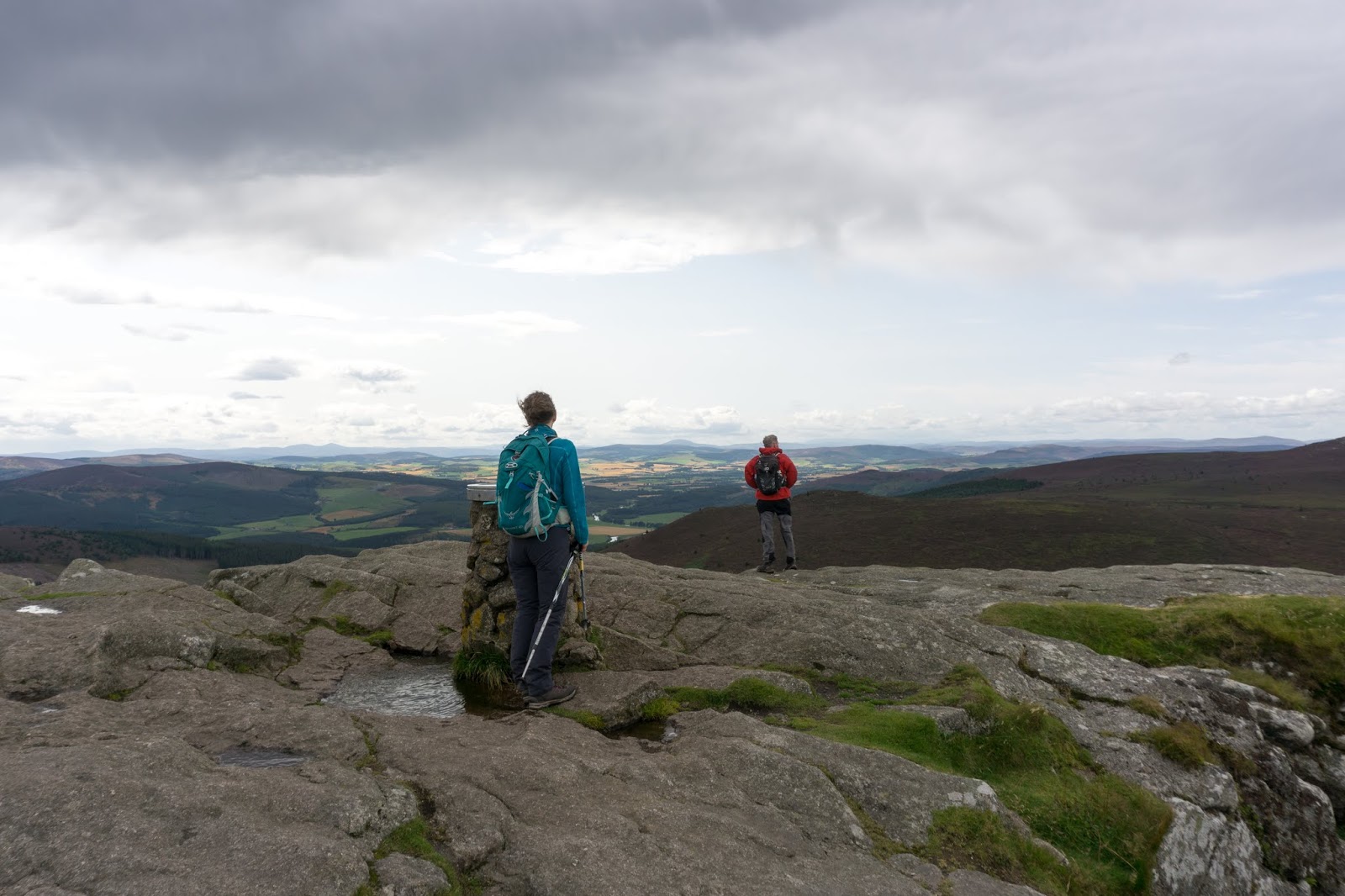
As soon as the ridge proper is reached a tiny scratch of a path can be found right on the crest and its best to stick to the path for both the views and to work through some steep ground ahead.  For a comparatively small hill Creag Dhubh offers superlative views, it has a central position and is reasonably well isolated from surrounding high ground giving a sense of space and long horizons.  To the south and west the eye is drawn along he upper reaches of the Spey valley to the hills of the central highlands.


Looking further again the hills of the Ben Alder, Rannoch and Mamore ranges can all be made out - a view all the way to Scotland's western ramparts.


Nearer at hand the ridge continues up a steep and loose section where a little care is needed, then drops slightly before the final summit cone.  One of the reasons this hill is so distinctive is that it's a rocky, rugged and craggy individual amongst more rounded and grassy domes.


The summit views are really fine.  North and east the Spey is joined by the waters of the Truim and the River Calder as it gains power to push through to the Moray Firth.  The town of Newtonmore is laid out below and the horizon is dominated by the distant Cairngorm giants.


To the north west there's a great view over Glen Banchor to the Monadhliath, a huge expanse of remote plateau.  Glen Banchor's hills and glens are an area I've not explored - I intend to rectify that!


A substantial built cairn marks the summit of Creag Dhubh.  At 756m/2480ft this is not a high hill, indeed it is 6 metres or 20 feet shy of reaching Corbett status.  Like most "Grahams" though, it is a very fine hill and a real miniature mountain.  The distinctive nature of the hill gives it unique character, which possibly explains the origin of the battle cry of Clan Macpherson who have their roots in this area of Badenoch - "Creag Dhubh!"  One chief of this clan went on the run after the shambles of the 1745 rebellion and hid from government forces for nine years.  There are several legends about his hiding place - or places - including one cave on the face of Creag Dhubh known as "Cluny's Cave".  Macpherson eventually slipped the net and made his way to France to join the exiled Charles Edward Stuart.  He never returned to Badenoch or Scotland and died in 1764 in France.


For the descent route one can continue north east to Biallaid on the outskirts of Newtonmore but this would require either two cars or a 5 kilometre walk along the fast and twisting A86 road. I chose to return via my outward route, but took the more direct line skirting the edge of the crags to the road at the parking area.  This route is steep and rough and would take a bit of determination if used for the ascent!  The view from the ridge down to Lochain Uvie is impressive; so steep is this ground that it seems right below one's feet.

Creag Dhubh is a cracking little hill and one I'd definitely recommend.  I had originally thought of climbing it as a "leg-stretcher" on the way to or from somewhere else, but deserves much more respect than that and I'm glad I made it the objective of the day.  My images don't actually show how rugged the hill is, but the image below by "Gaffr" and posted here with his kind permission, captures the atmosphere and nature of the hill really well


8 HPIM6874 (640x481).jpg
Image by Gaffr


Low down in the wood I met with this group of goats - smelt before seen!  They seemed unperturbed by my wandering towards them and merely moved aside before going back to their browsing.  I've seen the occasional one on the A86 hereabouts too, something to bear in mind when speeding along!

Saturday 14 September 2019

Top to top to Tap

I'm lucky to have Bennachie as a neighbour. One of the most prominent hills in the north east of Scotland, a glimpse of the distinctive outline of the Mither Tap (Mother Top) means "home" to generations of Aberdeenshire folk.  Bennachie inspires a real fondness in people and there's even a dedicated band of volunteers known as the Bailies of Bennachie who look after the hill and its environs.  I climb it regularly by a variety of routes, but there was one which I hadn't done.


Lorna, Allan and I met up on a bright late summer day to do one of the longest routes on Bennachie, a traverse from one end to the other of what's essentially a long ridge with a number of "tops".  They live closer to the hill than me and have a clear view of it from their house - a very desirable feature in any property I feel!

We pre-positioned a car at the end of our intended walk and drove back west to the top of a feature known as the "Lord's Throat", a wooded valley carrying a minor road.  A rough track leads to a sand quarry and after a bit of scratching about we climbed above the quarry and onto the open hill above.  a view opens up straight away to the furthest tops of Bennachie above the valley of the River Don.


The heathers were all in full bloom, the colours stunning.  This is the larger flowered Bell Heather (Erica cinerea).....


...and this is the more ubiquitous Ling heather (Calluna vulgaris).  As we walked our boots raised clouds of honey-scented pollen and one of the dominant sounds was that of the bees collecting pollen - we saw several species on this part of the hill.


This is a corner of the hill I hadn't previously walked and I was intrigued by a line of very old and long-disused shooting butts arranged in a line upslope.  Drystone built, the may have been turfed on top when in use and each had an offset entrance for the "gun".  Interestingly, almost every one harboured a Rowan tree.  Rowan (Sorbus aucuparia) seeds germinate in an interesting way; if you plant them they just won't grow.  The seeds are contained in a bright red berry which are irresistible to many species of birds.  the berry and seed must first pass through the gut of a bird in order to germinate; and of course will benefit from having a blob of guano fertiliser to boost its chances.  The berries are irresistible to some humans too - they make a superb jelly to accompany meats and cheeses!

Rowans are one of the most common trees in Scotland, and are the tree which reaches higher altitudes than any other species here - up to 870m/2850ft in a few places.  There's a rich folklore surrounding the tree; it's associated with protection and was commonly planted at the gable end of a house to afford protection from witchcraft in particular.  Rowans rarely live longer than 150 years so it's possible to guess the dates of some ruins by the Rowans near to them.  Here, in a lovely piece of symmetry, the works of man provide protection for the Rowan - the seeds dropped by a bird have fallen into the grouse butts and the seedlings have grown within the circular embrace of the wall, protected from weather and from browsing animals until well established.


From near the summit of the first "top", Black Hill, there's a wide view over the Aberdeenshire countryside.  Due to its relative isolation from surrounding high ground such good views are a feature of the whole of Bennachie.


From Black Hill the ridge proper swings into an east-west orientation and as we continued west the views just kept coming.  We took a slight detour to the "top" of Hermit Seat (who was the hermit I wonder and what was his story?) and past Hummel Craig.  A Hummel is a stag with no antlers and Craig is a derivation of Crag.   From the next "top" of Watch Craig we looked over the valley of the River Don to Pitfichie Hill and Cairn William.  Allan and Lorna were just able to see their house from this point!


Once up on the higher ground the paths on Bennachie are really good going and distance just reels away.  In quicker time than we'd anticipated we found ourselves on the rocky tor of Oxen Craig. At a modest 528m/1736ft this is the highest point of Bennachie but probably visited by only a small percentage of the folk who climb "Bennachie".  Behind us rain showers were strafing the land further west...it seemed we'd probably get wet before the day was done.


A view indicator plaque identifies some of the hills and key features to be seen from Oxen Craig, including some at considerable distance.  The view ranges from the city of Aberdeen in the east, round to the hills of Angus in the south, to the Cairngorm giants almost 70 kilometres away and round north to Peterhead and the Buchan coast - an enormous sweep of the northeast of Scotland.


We sat out a shower below Oxen Craig and once it had passed headed slightly off the main line of the ridge to another "top", Craig Shannoch.


From Craig Shannoch there's a good view across to the main attraction of any walk on Bennachie - the Mither Tap.  In fact the Mither Tap is Bennachie for most folk; the name of the whole hill is a derivation of Beinn a' Chioch (hill of the breast) and it's the Mither tap which is the most visible, most prominent feature.  Across a huge swathe of Aberdeenshire you can look for it - the eye instinctively drawn to a familiar outline.  Bennachie, always Bennachie - it's what inspires such affection for the hill.  The Tap is a granite plug from the heart of a long ago eroded volcano and has considerable steep drops on three sides.  I'd guess that only about one in a hundred people who climb the Mither tap go on to walk to the "real" summit of Oxen Craig - such is the draw of the Tap.


We climbed to the summit, almost able to lean on a tearing westerly wind.  We'd traversed top to top to reach the Tap, a fitting end to the high ground of Bennachie.


This place has a long history of use.  Being so prominent prompted the building a hillfort here.  Constructed during the Iron age and possibly occupied as early as 1000BC, it seems to have been developed for a long period and may have been the site of the battle of Mons Graupius (which gave its name to the Grampian region and mountain range) where the Picts were heavily defeated by a Roman army.  The aerial pictures on the Canmore site show the extent of the ruins.


The curving entrance to the upper fort is particularly well preserved - here you can really walk through ancient history.


The descent from the Mither Tap to the Bennachie Centre is knee-jarring, steep and in places rough.  Although the shortest route in terms of time and distance I've always thought this the least attractive way to climb the Mither tap.  There are a number of ways to reach the Tap, as shown on this downloadable map, or you could always do our longer route of around 10kms!  We'd enjoyed a superb day doing this route; it's one all three of us will repeat.

Thursday 5 September 2019

Late Summer in a jar

Over the weekend we noticed that the Blackbirds and Starlings were starting to work over the Rowan (Sorbus aucuparia) trees in the garden.  As the clusters of red berries ripen it becomes a bit of a race for us to gather a basket before they all get eaten!  The berries seem irresistable to all kinds of birds and the Rowan has an interesting adaptation in that the berries need to pass through the gut of a bird before the seeds they contain will germinate.

We cooked the berries with an equal weight of cooking apples until the mixture became a thin orange porridge, then strained the lot through a cloth overnight to extract a couple of litres of rose-pink fluid.  This liquid is then boiled up in a 60:40 proportion with sugar until setting point is reached. The whole process is shown here, and the result looks like late summer in a jar!


Rowan and Apple jelly goes superbly well with meats and cheeses and is the secret ingredient in our venison casseroles.  It needs to mature for a few weeks and will keep for a year, slowly darkening in colour.

It had been a bit of a surprise to see the birds begin eating the berries in the first couple of days of September - we felt it was earlier than usual.  We still had a jar of jelly left from 2018's crop which was dated 15 September, and looking further back over the blog to 2016 and 2012's entries it certainly seems that the "normal" date we've made this preserve has been in the second half of September.