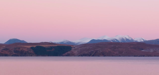
As we left the Black Islands we paddled into the breeze and so dropped our sails. After an energetic couple of kilometres of paddling we came into a lagoon with the most wonderful colour of water as the sun lit the white sand below our boats. Really - could a day get any better than this?!
Mountain and Sea Scotland
Hillwalking and Sea Kayaking in Scotland
Tuesday, 31 May 2022
Over the sea from Skye
As we left the Black Islands we paddled into the breeze and so dropped our sails. After an energetic couple of kilometres of paddling we came into a lagoon with the most wonderful colour of water as the sun lit the white sand below our boats. Really - could a day get any better than this?!
Wednesday, 25 May 2022
Bridging the gap
We set off on a lovely Spring morning, heading SE from Ordgarff along the track which is signed as "Old Military Road". This simple statement has a deal of history behind it because this is a section of road built between 1748 and 1757 as part of a massive roadbuilding and infrastructure project following the 18th century Jacobite rebellions.
That said, the first of the bridges isn't typical of the "Wade Bridge", being a graceful, slender arch over the Allt Damh - seemingly defying gravity!
Just under 2km further along the track is Delavine Bridge. This is much more representative of the bridge construction on the 18th century military roads. Delavine was one of three bridges repaired and stabilised over three years from 1997 to 2000 to keep these scheduled monuments intact. A plaque on Delavine bridge records the work, placed on the outer parapet where it is particularly difficult to read without standing in the burn itself! It is typical of the larger bridges of the period in construction and in being 4 metres wide.
The familiar term is "Wade roads" and "Wade Bridges" in reference to General George Wade, a military Commander in North Britain from 1724 to 1740. Wade is actually the only person named in the British National Anthem - one of the more clunky verses which isn't used today reads:
The "Wade" road here is part of a 100 mile (160km) route from Coupar Angus to Fort George near Inverness via Braemar, Corgarff and Grantown on Spey. The whole route was built in nine years between 1748 and 1757, starting just two years after the final Jacobite defeat at Culloden Moor. For context, the 26 mile/42km Aberdeen Western Peripheral route took five years to complete in the 21st century!
By the time construction of this road was started Wade had long since left the Highlands and in fact died in the same year work on this route started. His successor, Major William Caulfeild (note the spelling, not "Caulfield") was appointed Inspector for Roads in Scotland in 1732. While nowhere near as well known as Wade, Caulfeild oversaw far more of the network: Wade was responsible for 250 miles (400km) of road, forty bridges and two forts; Caulfeild for 900 miles (1400km) of road and over six hundred bridges - an astonishing series of works.
A little over a kilometre further on the road crosses the third bridge of the section, this one spanning the Burn of Tornahaish. Here also the bridge required restoration works and all three bridges on the section are now leased from the landowner, Candacraig Estate, by the Gordon Trust on a 99 year lease. Smaller than Delavine and without a parapet, the span and height above what is a very small burn gives an indication of the volume the Burn of Tornahaish is capable of in spate.
The track climbs up from Burn of Tornahaish to join the A939 road, or more properly become the A939 road. From here the Military Road goes to Gairnshiel then on over the hill to Crathie on Deeside. We walked uphill for a short way before leaving the road on a track cutting back uphill, having bridged the gap of several kilometres between our previous walks. Here we had a choice of routes to reach Bellabeg. One route would take us over to link with a lower level walk we've done before while the other would climb up onto the high ground to cross the summit of Scraulac - a route done several times previously.
Cutting off the road just outside Bellabeg, a track descends around a wooded hill to the last of the historic bridges of our walk. Poldullie Bridge was constructed in 1715 by Sir John Forbes of Inverernan and crosses the River Don. A remarkably graceful single span bridge, the elegant form is best seen from above as in the images on the Canmore site. Sir John Forbes made a fatal choice in throwing in his lot with the Jacobites at the 1715 rebellion and was captured following the battle of Sherrifmuir. He died in Carlisle prison the day before the date of his execution. It was this rebellion which prompted much of the roadbuilding effort in Scotland in order to "pacify" the Highlands. Movie buffs might recognise Poldullie Bridge as it featured in the 2019 film "Mary Queen of Scots".
Friday, 13 May 2022
Jottnar Grim Hard Shell Jacket - Long Term Review
The hood is helmet compatible but adjustable to cinch it down. It moves with the head faultlessly and has a very well designed stiffened and mouldable laminated peak. This image was taken on a ski tour in very cold conditions when it really showed how protective a hood can be.
Monday, 18 April 2022
From swimming to snowmen
After the warmth of late march, early April saw temperatures drop dramatically in north eastern Scotland as pressure systems realigned and allowed a bitterly cold northerly airstream to establish for a run of two weeks.
In our local shop I overheard a Mum remarking that on a Sunday afternoon her toddlers had been in the paddling pool in the garden, and by Thursday morning they were building a snowman in the same garden!
The hillwalking has been good though, clear northerly air gave great views like this one from near Coilochbhar Hill showing Pressendye and some of the other Donside hills.
Wednesday, 13 April 2022
The end of a fine Fyne journey
I woke to birdsong and warm sunshine at our camp near Ardlamont Point. We ate breakfast while enjoying the sights and sounds of the place.
Donny left earlier in his F-RIB than we did in our kayaks, he wanted to get back to the launch point at Kames at a relatively high tide which would considerably reduce the carrying distance with his boat, kit and outboard engine. It had been great to do another trip with Donny; his film of the journey is here.
After a leisurely breakfast while waiting for the dew to dry off our tents we packed up too and got underway. We erased all trace of the previous night's fire, which was lit below the Spring high water line. There was remarkably little plastic washed up here; it's possible somebody has carried out a beach clean. We scoured the length of the beach and removed the few bits of plastic bottles and a fish-farm feed bag to take away with us. This beach makes a fine camp site, it's one we'll return to in the future.
The paddle back to Kames was remarkable for the very warm and still conditions we experienced. We sweated profusely even at a slow pace of travel - in March! We returned to our launch site late morning and packed up - it was the end of a fine Fyne journey.
Our journey to Inchmarnock and around lower loch Fyne had been comparatively short in distance - we travelled 64km over two half days and two full days, but had been packed with good things, the most important of which was getting out on a multi-day trip again with good friends and in a great location. The weather had played a big part in the trip and had encouraged us to arrive at camping spots in the mid afternoon rather than cranking out distance; it was a routine which worked very well.
Ordnance Survey 1:50K Landranger maps 62 (North Kintyre and Tarbert) and 63 (Firth of Clyde) cover the area in which we paddled. We launched from the concrete slipway at Blair's Ferry where there is parking for several cars across the road from the slip. The slip itself was built during the Second World War for operating landing craft in preparation for the D-Day landings. The car parking is on concrete slabs which were the vehicle muster and turning area and the imprint of the I Corps insignia can still be made out, pressed into the concrete ramp.
There are no significant tidal streams to be concerned about on this trip, but Ardlamont Point and Inchmarnock can be difficult places to paddle in strong wind, being exposed to most wind directions. Ardlamont Point in particular can be a challenge.
Monday, 11 April 2022
An evening to savour
The Loch Fyne Light Show started with a distinct softening and warming of the light quality. We picked up cameras to watch as the sun sank through a cloudbank over the Kintyre shore.
Donny walked to a vantage point on a nearby rock rib to take some video - you can see Donny's film about our trip on his YouTube Channel here.
I joined Donny to get a view with no rocks in the foreground and was rewarded with this lovely path of sunlight beaming across Loch Fyne.
I spent a good twenty minutes just taking it all in; the last two years have seen few trips due to Covid restrictions and work pressures....it was so good just to "be" in the outdoors again, in the moment with a lovely sunset.
The sun dipped below the Kintyre hills and the sky put on a final flourish of gorgeous light....just superb.
As Donny and I wandered back over to join Raymond and Allan at our camp site the light show faded to a pastel finish, but there was one last and beautiful element to come.
After sunset the pale, ethereal light was as gorgeous as the sunset had been, though in a completely different way. My photographic skills don't do the light quality any justice whatsoever, the softness and opacity of a calm evening. It's this changing "Solas" (light) which really makes a day.
The temperature dropped after sunset and we got our fire, built well below the Spring high water line, lit and away.
Contained by a few big logs, it soon built a very satisfactory heat with remarkably little refuelling required due to the lack of wind. We sat around and enjoyed after-dinner treats and the odd dram - life seemed particularly agreeable on this Fyne evening!
Saturday, 9 April 2022
A Fyne afternoon for a swim
Replete and refreshed from our second breakfast in Tarbert, we headed south down the Kintyre shore before crossing back to the Argyll shore of Loch Fyne. Conditions remained absolutely perfect with calm water and warm sunshine - we had to keep reminding ourselves it was still March!
Close by the Argyll shore we landed on the tiny island of Sgat Mor (the name is possibly Big Skate after the fish). We were delighted to find this tiny shell sand beach on which to take a leg-stretch. We didn't stay long as the island is home to a colony of Great Black Backed gulls who voiced their displeasure very forcefully.
Sgat Mor has a small navigation light in a tower on the highest point, and for good reason. It seems to have been a regular shipwreck site and even with the light has seen groundings, the latest in 1994.
Our plan for the day was to reach our intended camp site early in the afternoon so that we could take some time to just enjoy the great weather, rather than cranking out distance. Soon after leaving Sgat Mor we arrived at a spot we'd scoped on the way past the previous day. Donny was already there and had enjoyed a doze in the sunshine; you'll be able to see this trip in video on his Youtube site.
We soon had the tents up on a patch of turf above the beach, which was backed with colourful early Gorse and alive with birdsong. A couple of hours were spent just relaxing, collecting firewood and airing out kit. As is the way of things, the time slipped by really pleasantly doing, essentially, not a lot. This is an important part of these journeys for me, when all that's necessary is to keep fed, warm and comfortable all life's other hassles and stresses can be put on hold as doing pretty much nothing takes up all my time.
Our camp looked straight across to the hills of Arran which were in a blue haze. Strips of sea mist around the north of the island made it appear to be floating above the sea rather than rising from it.
As the afternoon wore on the warmth increased and the light took on a lovely quality. We were all rather warm in just t-shirts and light trousers and so a swim was debated.....
Donny, Allan and I took the plunge and can report that the water was on the bracing side of refreshing, but that once immersed it was a brilliant experience. We emerged invigorated and dried off in the warm sunshine. Only once have I swum in the sea earlier than 25th March and that was in similar conditions in the Sound of Arisaig - in February of 2013!
After getting dressed and cooking a dinner of home made Spaghetti Bolognaise courtesy of Raymond, we built the fire using some larger logs to contain and reflect the heat. The early evening light was promising something special, so we finished all our camp chores and prepared for the light-show.
Thursday, 7 April 2022
Fyne, just fine....
The morning sun on the tent woke me early at our camp on the shore of Loch Fyne. Up and about, I made breakfast and enjoyed the sunshine on what was clearly going to be a fine Fyne day.
We left our tents up until the last minute as there was quite a bit of condensation from the cool night air, but by 0900 we were packed and ready to carry three kayaks and one F-RIB down the pebble beach to the water.
And what a morning! Our plan was to head over to Tarbert for second breakfast and we made the 6km crossing of Loch Fyne in idyllic conditions.
To the south the Arran hills were cloud-capped - in fact they had cloud cover throughout the four days we were in the area, even when everywhere else was in bright sunshine.
We stayed on the north side of East Loch Tarbert so that we wouldn't be in the way of the ferry which sails on a very regular route to Portavadie from here. On this beautiful morning all of the Isle of Cumbrae's passengers seemed to be sat outside to enjoy the weather and we got a cheery wave from some smaller passengers.
Tarbert is in a very strategic position and has a long history. The name is shared with several other places and indicates a place where boats could be dragged across a narrow isthmus between to bodies of water - from the Old Norse/Gaelic "Tairbert" or draw-boat.
This Tarbert has a narrow neck of land less than 2km wide separating East and West Lochs Tarbert; being able to portage a boat here avoids the long and potentially hazardous passage around the Mull of Kintyre. The strategic value of the tairbert was demonstrated spectacularly in 1093 when King Magnus "Barelegs" was ceded all the land on the western seaboard of Scotland which could be circumnavigated in a longship. He sat in his longship as it was dragged from one Loch tarbert to another and so claimed the entire Kintyre peninsula!
The castle was first constructed in the 13th century, subsequently strengthened by Robert Bruce, was captured by James IV from the Lords of the Isles and last changed hands in the 17th century before falling into disuse.
Tarbert is a busy port used by fishing vessels and leisure craft as well as two ferry services. We looked at landing near the harbour head but the receding tide had left some evil looking mud, so settled for a slip near the yacht club which also has a signboard about the Argyll Sea kayak Trail; this being a prominent stop on the trail. You can buy shellfish direct from the processor at the top of the ferry slip, so all in all a good place to pause!
We couldn't see where Donny had landed in his F-RIB, he seemed to have disappeared. The mystery was solved when he strolled around the harbour to meet us having blagged a berth on the best pontoon in the marina - for free - for a couple of hours stopover!
We wandered into town (don't expect a metropolis!) and settled on the excellent Cafe Ca'Dora for second breakfast. We were just in time before breakfast serving turned to lunch serving and enjoyed an outstanding "Full Scottish" accompanied by great coffee - Cafe Ca'Dora is rated as 12/10 as a sea kayaking food destination by us!
We returned to the slipway and whilst repacking our boats took a closer look at this graceful craft beached at the top. She's the "Freydis", a 40ft/12 metre replica Viking longship built by volunteers in Tarbert to take part in the annual Loch Fyne Viking festival. Named after Freydis, daughter of Erik the Red and sister of Leif Erikson, who has various claims to fame in the Norse sagas as an explorer, not all of them savoury!
Sadly, Freydis has seen "better days"; some of her planks are sprung and she'd need some TLC to be seaworthy again, but what a fine Fyne vessel!
Freydis' dragon prow is particularly impressive, carved from a single piece of wood and adorned with metal "scales" and a fearsome tongue....now, I wonder what a scaled-down version of a dragon prow would look like on a sea kayak?!