Tuesday 31 May 2016

The view from Pressendye

A catch-up post of a walk up Pressendye in early May, a hill in Aberdeenshire overlooking the Howe of Cromar with wide views to the mountains south of the River Dee.

Pressendye can be climbed from several different starting points; I've usually started from Milltown of Towie on the River Don to the north, but today decided to try from the south (there's also a handy route which goes from the village of Tarland).  I started from the B9119 road at the start of the access to the Petts farm, where there's space to park a couple of cars clear of the farm road.


Heading up the road to the farm the views start to open out, Lochnagar is some 30km distant but seemed much closer in a northerly airstream with very clear air.


Above the farm the continuation track climbed through a pleasant wood of Scots Pine, taking a switchback course to reach a forest track.  Following this track west and then north the top of the forest is reached and.....


...the heathery top of Pressendye comes into view.  Although it looks a straightforward route from this point, there are several tracks and paths which converge here - not all of them end up anywhere near Pressendye....


It's a short and easy climb up to the 619m/2030ft summit which has a large and partly tumbled shelter cairn.  Inserted in the rocks of the cairn is a visitor's logbook in a plastic box, on this fine Spring day I wasn't surprised that there had been other folk here earlier in the day.  Pressendye (Gaelic "Preas an Daigh" - copse of the fire) is a "Graham" and so is on many folk's lists - but just as a great viewpoint it more than repays the short climb - the whole walk can be done in under three hours.


The siting of a trig point here suggests that there should be a good view and that's certainly true. The nearest large hill is the Corbett of Morvern (big mountain) a few kilometres to the west.  Further west the big Cairngorm hills were being periodically obscured by sweeping snow showers, the effect of sun, shadow and sudden colour was quite kaleidoscopic.


To vary the descent I walked over to Pittenderich, a lower summit which also sports a big cairn, this one even has planks built in to serve as bench seats!


From Pittenderich a short descent on a muddy path emerges at the forest track a little to the east of the point where it decends towards the Petts.  Hading downhill there's a grandstand view over Tarland and the Howe of Cromar to the Dee valley and across to Mount Keen, the most easterly Munro.

If you climb Pressendye by this route it's worth also visiting the nearby Culsh Earth House, a 2000 year old souterrain which is close to the B9119 road - parking is on the roadside and remember to take a headtorch.......

If climbing Pressendye from the northern (Donside) direction, you may pass one of the more bizarre sights in the Scottish hills, the outline of a huge Playboy Bunny symbol mown into the heather of a corrie!

Wednesday 25 May 2016

A long brawl in Loch Sween


 From our stop on Danna we headed across to the mouth of Loch Sween, reluctantly leaving an exploration of the MacCormaig Islands for another time.  A breeze helped us on our way but we knew that the northerly direction would be against us as we paddled up the length of Loch Sween.


 And indeed it was, a persistent headwind against which we tried to tack, but eventually we had to drop the sails and just accept the paddle into wind.  Out tacking leg did take us to the eastern shore of the loch though, where the rather impressive ruin......


 ...of Castle Sween occupies a small outcrop on the shore.  Possibly one of the oldest stone built castles in Scotland, Castle Sween is believed to date from around 1100 and was built by the eponymous Suibhne,  head of the half-Norse clan of the MacSweens - the Norse equivalent name is Sweinson. 


 The castle was enlarged in around 1262 to add a range and tower, and in its long existence  has seen its share of the "long brawl" of Scottish history, having been held by the MacSweens, the MacDonald Lords of the Isles, the MacNeills (another half-Norse clan) and the Campbells.

Sadly, these days it is almost entirely besieged by a large caravan park; it was actually quite difficult to frame photographs which didn't include the caravans.


 Having paddled past the castle we headed back to the western side of Loch Sween to try and find a little less headwind for our own "long brawl" up the loch.  The gorse had recently come into full bloom and matched the "Kokatat Mango Yellow" of Douglas' drysuit quite nicely!  In the sunshine and a calm patch of shore the scent of coconut filled the air, the distinctive smell of gorse flowers however unlikely  a tropical scent seems in Scotland...


In the narrow channel behind Taynish Island the tide was running strongly, fished by this Otter which seemed oblivious to the passing of our boats.


 On the shore is a rather nice circular crenellated building which seems to have once been a waiting room for boat passengers for nearby Taynish House; a small but well made pier is just adjacent.


 as we neared the end of our journey there was a nice coincidence; we met a couple in an open boat with whom we'd spoken as we prepared to set out from Carsaig Bay at the very start of our trip four days previously.  They had very kindly kept an eye on both cars we'd left - a gesture we really appreciated. 


 A little ahead of Mike and Douglas, I was able to very slowly get within camera range of this Great Northern Diver (Gavia immer).  Mostly a winter visitor to Scottish waters, a few non-breeding individuals remain on northern coasts, and it was a real thrill to see one of these shy and retiring birds close to, and in breeding plumage.


Although we'd had a long day per mare and per terram since starting out some eight hours previously from Cruib Lodge, it was with some reluctance we paddled into Tayvallich to end a simply exceptional four days around Jura.  The weather had allowed us to enjoy to the full the delights of the island's west coast and into Loch Tarbert - we felt truly lucky. 

After recovering the shuttle car from Carsaig Bay we packed up and headed home; another trip was at an end....but we hope to be back to Jura before too long!

Tuesday 24 May 2016

A brew and a banjo


As we cleared Tarbert Bay we picked up a tiny breeze and hoisted our sails to get some assistance across the Sound of Jura.......


...but it soon died and we paddled on in a flat calm in hazy but very warm conditions.  To the south, the Kintyre peninsula and the outline of Cara were just visible, reminding of us of a great October trip around Gigha and Cara

We expected to be set to the south as we crossed the sound of Jura and so headed north along the Jura coast before striking out across the sound.  The tidal flow is stronger towards the east (mainland) side of the channel and we felt the push as we passed arraig and Daimh (Stag rock).  The Knapdale coast hereabouts is a series of low "fingers" projecting south and it's quite difficult to distinguish one "finger" from another.  Soon though we turned to land......


...in a sandy bay on the tidal "island" of Danna.  We all felt that this little bay was something of an anticlimax after the superb beaches of Jura......


...but as the sun came out and we got our second breakfast underway, the feeling was a bit more positive......


...it's amazing what a "brew" of tea and a bacon & egg "banjo" can achieve!


When we set out from Danna we looked back over the Sound of Jura to the island which had granted us to us an outstanding few days of sea kayaking in magnificent surroundings - it will not be too long until we return.

 A plan to visit the MacCormaig Islands was reluctantly abandoned given that time was marching on and we all had long journeys home once we finished the paddling.  Turning north, we began the last leg of our journey.

Saturday 21 May 2016

Per mare per terram - across an island


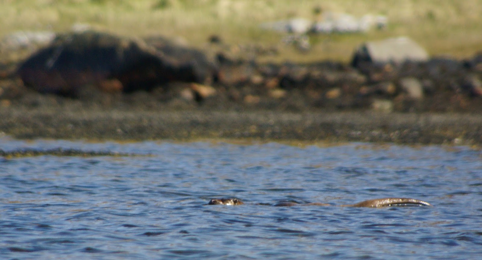
 We slept well at Cruib Lodge, waking at at 0500.  After packing our boats and tidying the bothy ready for the next visitors we were pleased to be on the water as planned by 0600.  Unusually for us, first breakfast was postponed in order to get to the head of Loch Tarbert at high water.  The last morning of our Jura adventure began with a searingly bright sunrise......


 ...and a lovely quality of early morning light.  There was no sign of life on the yacht anchored in the bay, the only sounds were the dip of our paddles and the distinct calls of shorebirds creating a slight echo from the hills surrounding the middle part of the loch.


 The channel connecting the middle section of West Loch Tabert with the hidden inner section is called the Cumhann Beag (Little Narrow) and that just about sums up this unlikely passage.  The entrance is very difficult to see and the passage itself is more like a canal than a channel.  Tidal streams can run at up to 8 knots (16 km/h) on Spring tides, one of the main reasons we'd started so early was to get the last of the flood through here.

The stream was still pushing though as we paddled the narrows; remarkably in this age of digital charts and maps when everything would seem to be well explored, the first survey of the Cumhann Beag was only undertaken in 2006 and even that may not be comprehensive.  The inner loch was historically used as a concealing base for longships and their Scottish equivalent, the Birlinns of sea raiders.  It's more peaceful today but remains a challenging anchorage for adventurous yachtsmen.


 This tree growing from the west side of the channel clearly shows that it's not always calm in this part of the world!


 We reached the head of inner Loch Tarbert right on the time of high water, although the tide actually rose for some 40 minutes after this.  We were pleased to have avoided having to carry the boats over the mud which is revealed at lower states of the tide - this day was going to be energetic enough without an additional "plowter" through sticky mud!

The most important priority was to get tea and coffee brewed, after which our belated first breakfast was taken.  Then we rigged our boats for the next stage of the journey and changed out of drysuits into walking gear.

Between Loch Tarbert and Tarbert Bay, the island of Jura is less than 2km wide.  The name "Tarbert" is found in several places around the west of Scotland and derives from a Norse phrase meaning "draw boat"; a Tarbert being a place where a longship could be hauled overland from one body of water to another.  In at least one place, pulling a boat over a Tarbert was used to gain control over a large area of the mainland following an agreement that a Norse king could claim ownership of anything he could take his longship around!

This amphibious ability would have been most useful to seafarers in case of stormy weather, or as a flanking manoeuvre.  The Norse warbands were true "marine" fighters, using their shallow draught and manoeuvrable ships to access far inland, an amphibious ability which led them from their Scandinavian bases as far as North America, across the Arctic, down the Atlantic and Mediterranean coasts of Europe, to the Middle East and even far into Asia via river systems.  The motto "per mare per terram" (by sea and by land) is that of the UK's elite Royal Marines, and sums up this amphibious fighting capability.

 In addition to sea raiding, the Tarbert was used to transport a range of goods and even bodies bound for burial on Iona as it avoided the fast tidal streams of the Corryvreckan and the Sound of Islay which flank Jura to north and south.

We aimed to emulate the Viking example (minus the raping, burning and pillage or course!....) by putting our boats onto the trollies for the 2km pull.  Douglas has been testing an Easy Haul Portage Strap made by Kayak Carrier Systems this year, and it works really well on a long portage such as this.  I tried out an arrangement using the short tow-line attached to the deck of my boat (which is one of those things which can be used in all sorts of ways) attached to a spare portage strap.  Once I'd adjusted for legth I found this worked very well, but is obviously less adjustable than the KCS shoulder strap.


The track across the Jura Tarbert is notoriously rough. The track is bumpy, stony and rises to around 30 metres above sea level before heading down to the east side of the island.  It's a noted destroyer of sea kayak trollies, but I'm pleased to report that our KCS Expedition trollies once again proved their worth; the addition of the rear extension prevented any movement of the trolley beneath the boat and all three made the crossing without a hitch - a truly tough piece of kit.


After crossing the high point of the crossing the track descends to cross the island's only road and enters the narrow strip of good agricultural ground on the east coast.  The underlying rock here is a schist which breaks down into much more fertile soils than the volcanic rocks elsewhere on the island.  It's land which has been farmed and lived on for thousands of years.  This slender 2.5m high standing stone is aligned N-S and is at the end of a low ridge near the remains of a later chapel and burial ground, indicating an ancient, continuing use.

Soon after, we arrived at Tarbert Bay on the east coast of Jura, and although the portage itself had been strenuous, it had presented little difficulty.  The final 10 metres to the sands of Tarbert Bay were another matter altogether though.....

Barring the way to the water was a wide swathe of rotting seaweed which was a calf-deep slime and absolutely stank - quite the worst example I've experienced for years.  We changed into drysuits and paddling boots before attempting this obstacle.  The stench was such that it attacked in a multisensory way and I found myself having to resist the urge to retch as we crossed it six times to move our three boats - fairly minging!  As soon as we reached the water we washed our drysuits and equipment clean of the vile residue.


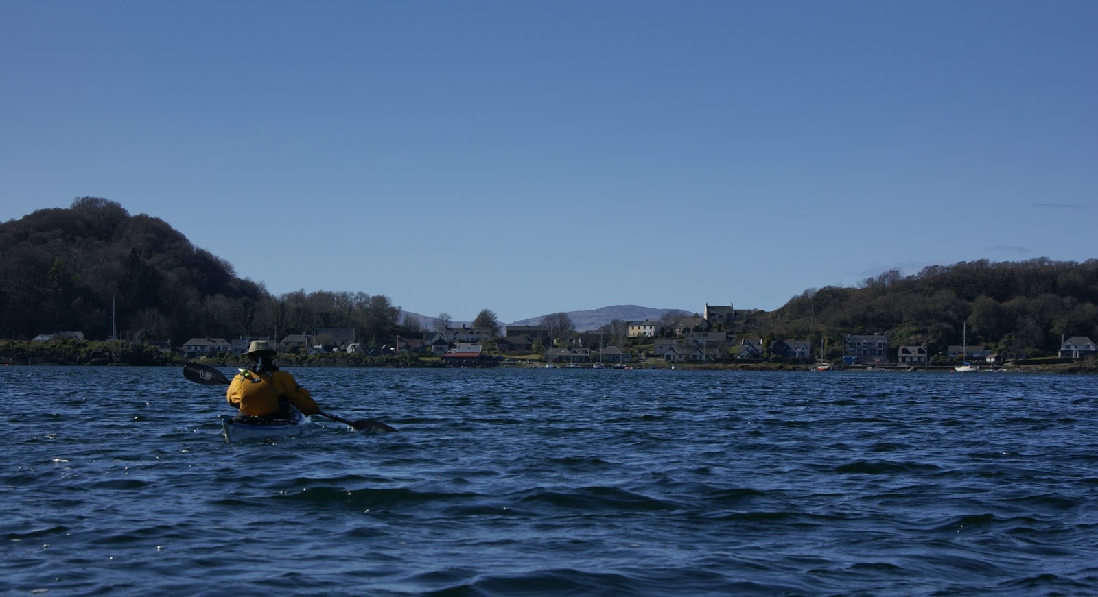
At last cleaned off, we set out from Tarbert Bay into the Sound of Jura "per mare" for the final leg of our adventure...

Thursday 19 May 2016

Al fresco dining for three at Cruib Lodge


 After leaving the "Zen garden" raised beach we continued through the narrows and into the middle part of Jura's West Loch Tarbert.  It was now early evening and we were keen to get to our planned overnight stop.  A light breeze helped us, we were able to use our sails in addition to steady paddling for much of the way.

Loch Tarbert has three sections; a wide outer section open to the prevailing swell and weather passing between the islands of Colosay and Islay, a sheltered middle section and a smaller inner loch accessed vai the most unlikely of channels.  We were heading for a bothy in the middle section which remains hidden on approach........


 ...until a final corner is turned and the neatly kept bothy appears at the head of a small bay.  Our planned arrival time coincided with high water which meant that we had only to lift the boats from the water with no carrying involved.  This convenience did have a consequence though....we needed to be at the very head of the inner loch right on high water the following morning to avoid a long carry over mud.  As HW would be at 0641 we needed to be underway by 0600, but that was tomorrow's issue - for now we could enjoy being in this superb location and in warm evening sunshine.


 Cruib Lodge bothy is owned by Ruantallain estate who retain half of the building (open outwith the deerstalking season and locked for estate use in the stalking season) with half of the building  maintained as an MBA bothy open at all times.

It takes a deal of faith and trust for estate managers and owners to permit use of buildings as open bothies - and a good deal of work and cooperation to keep the buildings in good shape.  The trust, reputation and experience which the MBA has built up over 50 years is critical in maintaining the unique bothy tradition - and it's why I'm a member.  Membership gives no "rights" to bothies or any particular privilege other than contributing to something which is a national treasure.

The estate end of Cruib Lodge appears to have originally been a deer larder.  The hooks for hanging carcasses are still in place on large overhead beams and the large apertures now glazed with sash windows would have contained not glass but slatted wooden covers to allow airflow whilst the carcasses were hung and butchered.  The amount and size of the windows in this end of the bothy make it perhaps one of the lightest and airiest of all bothy rooms; Mike and I chose to put our sleeping things in this end, while Douglas chose the other room which would be warmer as we lit a fire in the grate with the wood we'd gathered earlier in the day.


 Above the fireplace is a well-stocked library, and it's the mark of a remote and well kept bothy that the books haven't been used as firelighters.  The peats placed around the fireplace were cut by Douglas' friend Tony who had visited some weeks previously and had left an entry in the bothy visitor's book.  After enjoying a great fire through the evening, we were able to add a good deal of dry logs to leave for the next occupants.


 A yacht which had passed whilst we were exploring the raised beach in the outer loch was anchored in the bay and other than that there was no sign of any other human activity - it's a truly remote and wild spot.  After sorting out our kit and changing into evening attire (not vastly smarter than our paddling attire!) we cooked our dinner.......


 .....which was served, accompanied by frothing sports recovery drinks and a post-prandial dram of Jura Superstition distilled just 15km from where we were dining, at a table on the terrace with marvellous views......


 .....over the bay and of a sunset lighting up the clouds in ever changing shades.


After dinner we got our fire going and sat chatting about this and other trips into the long Hebridean evening.  A glance outside showed a hazy full moon rising; a reminder that the following day would be Spring tides and that we needed to get an early start.

Alarm clocks set for 0500, we retired early and slept well after another great day on the west of Jura.

Wednesday 18 May 2016

The Zen beach of West Loch Tarbert


As we paddled into West Loch Tarbert, the sea loch which almost bisects Jura we got a helpful push from a breeze at our backs.  Across on the north side of the loch we could see a huge raised beach system, and we were heading for an even more remarkable example.

The beaches and terraces above the present-day shoreline are a legacy of the last ice age. As the ice sheet melted the immense weight pressing down on the land was released and the land began to rise in a process known as "isostatic rebound".  The north of the UK is still undergoing this process and there's an opposite sinking effect in the south east of the British Isles.  Isostatic changes are quite independent of the major (eustatic) changes in sea level - it's the land itself which is changing level. The resultant landforms such as raised beaches, dry stacks, arches and raised beaches can be be found in many places around the Scottish coast and on many of the islands.


But this beach in West Loch Tarbert is perhaps the most remarkable I've ever visited.  A 750 metre crescent of pebbles rising 15 metres above the current sea level, the scale is quite difficult to convey without a very wide angle camera lens.  


The very top of the beach has a narrow strip of vegetation, mainly heather with some grasses.


Behind the beach is a lochan held back by the pebble ridge; it has no visible outflow and the nearby burn of Abhainn Liundale also disappears into the pebbles- the water reaching the sea by filtering down the beach.  In this image there's a pale line across the pebbles which is one of the tracery of deer tracks heading to and fro.....


...clearly visible if this Google Earth image is enlarged.


The whole beach looks as if it has been recently raked over, the pebbles are uniform and the surface smooth.  On the slope above the lochan there are a number of strange circular or oval patches of heather, arranged as if the whole beach were a vast Zen garden - and that's the feeling I had whilst wandering around.

Douglas captured the sense of the place during a previous visit in this image from above the beach and this one using a wide angle lens - in my opinion two of the most striking images from his very large portfolio.


From a distance the beaches look ash grey, while close up the water washed pebbles seem to have little variation - they are left just as they were at the last high tide several thousand years ago - a remarkable relic.


But down on the present-day high water mark a hidden beauty is revealed....


as the little waves rushing over the pebbles recede....


...to reveal a subtle palette of greens purples and browns, a reflection of the landscape from which the pebbles have been drawn.

I left this beach with a feeling of having been in a unique and special place, perhaps all the more a privilege due to the difficulty of getting to it.  With an atmosphere all it's own, the "Zen beach" of West Loch Tarbert is a truly amazing place.