Showing posts with label Caves. Show all posts

Wednesday, 5 January 2022

Short day, short view

Life, work and other things meant that this blog was a little neglected during 2021.  That's not to say that I didn't manage to get out and about though, and there will be some catch-up posts coming in the next few weeks.

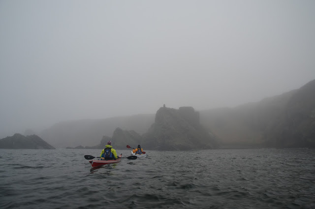
Just a couple of days prior to the winter solstice and there isn't much daylight here in Aberdeenshire, realistically six hours is what we get.  When Allan and Lorna and I left our homes in inland Aberdeenshire we were in bright sunshine with temperatures well below zero Celsius.....just 45 minutes drive north to the Moray Firth coast and things were a lot different; very misty conditions and the temperature a couple of degrees above freezing.  With just a light wind and a low swell we decided to set out from Cullen, paddle east to Sandend and return to Cullen.  It's an area we know very well but we took no chances with the visibility and set up a GPS in case things closed in further.


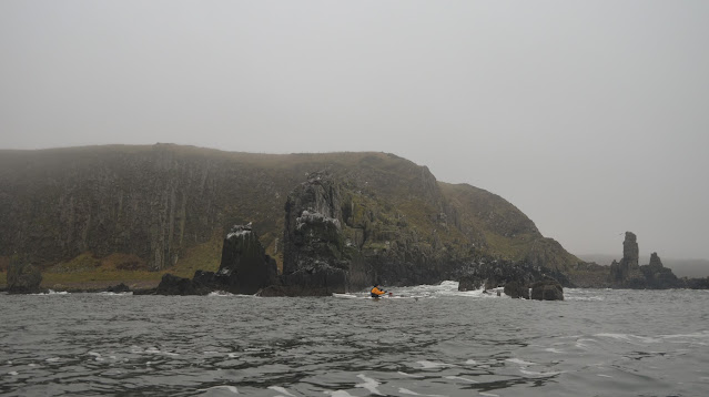
The misty conditions certainly made for an atmospheric journey through the rock stacks which are such a feature of this coast, everything seemed out of scale as towers and rocks loomed out of the mist.  We mentally ticked off known landmarks as we went and had soon warmed up from the chilly start.


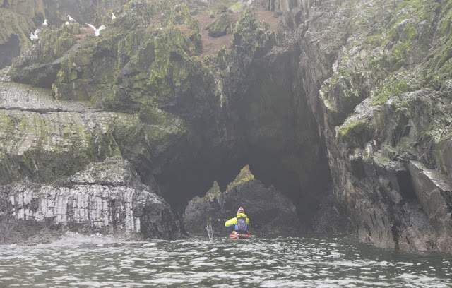
The swell was low but long-period and as is typical on this coast had "sets" of two or three much larger swells at regular intervals.  Near to top of the tide this cave-arch doesn't have much headroom, so good timing is a must!


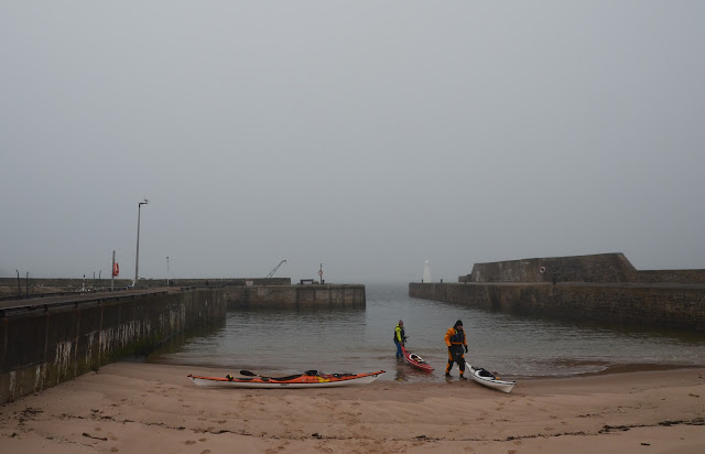
 We took lunch in the tiny harbour at Sandend before heading back around to Cullen.  The mist had started to lift a little and the swell eased to give a leisurely return leg.


An unremarkable paddle of just 13km maybe, but as usual this coast gave plenty of interest, and it was a bonus to be able to get out in our kayaks right on the cusp of the shortest day of the year.

Friday, 11 October 2019

Summer sojourn on the Moray Firth - among the red towers


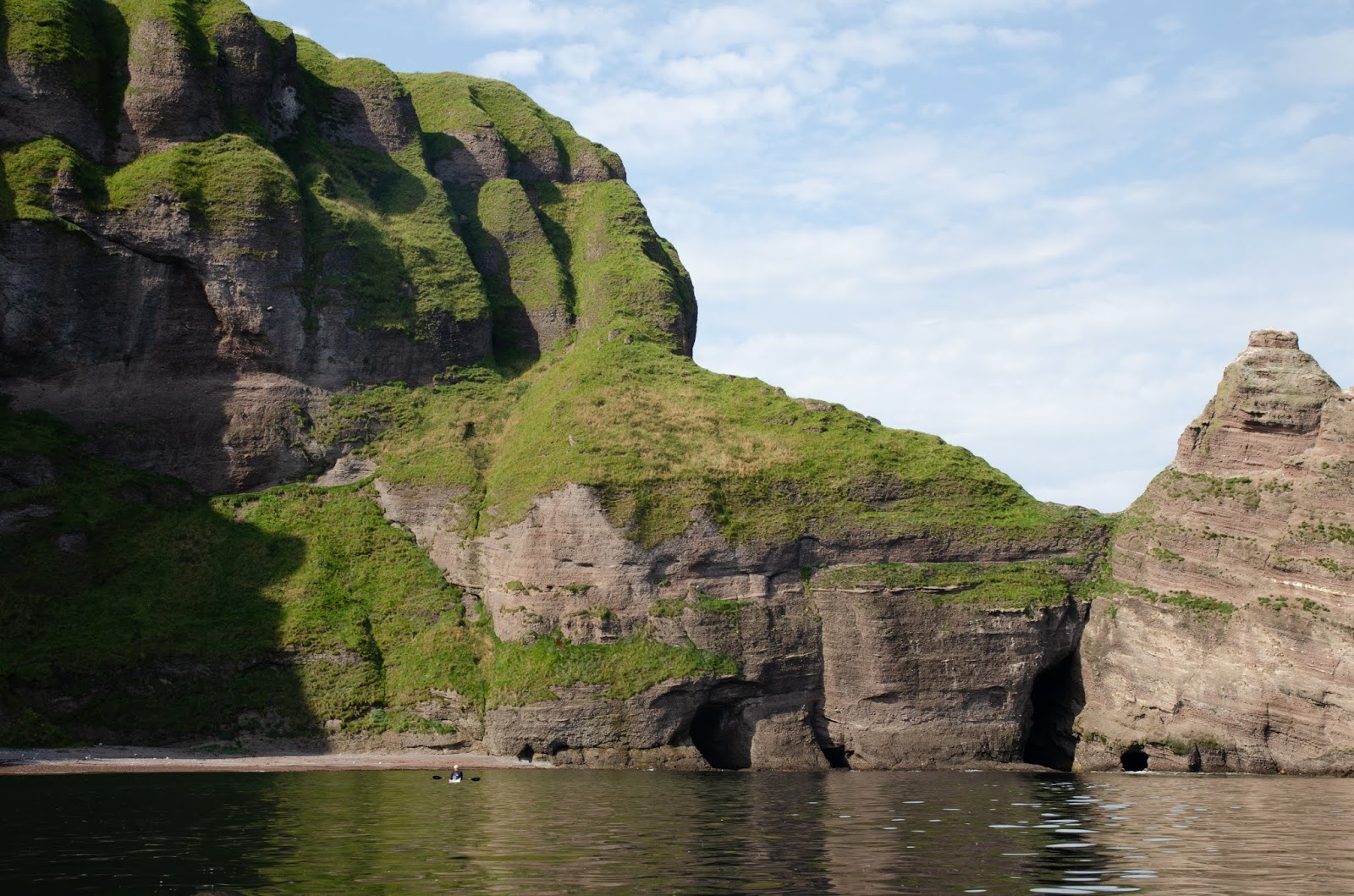
The conglomerate rock arch we passed through is a portal to a very special stretch of coastline.  A wall of red rock capped with verdant green and carved into spires, battlements and stacks, it's like nowhere else on the Moray Firth.  This area between Strahangles Point and Pennan Head never fails to amaze.


The scale only becomes apparent as you paddle close inshore.  These cliffs are over 120m/400ft high and fall sheer to a glacis of the most brilliant green grass overlaying fallen pieces of the cliffs.


There are gaps between stacks of fantastical shape, haunted by seabirds.  Each time we've paddled here we've felt ourselves to be in a privileged place......


....in a landscape that could have been taken straight from a Tolkien book.


On a day of windless calm with the sea a mirror of the cliffs, we paddled into the shade of the north facing cliffs in silence, lost in our own appreciation of this place of soaring red towers.


Our kayaks were dwarfed by the scale of the rock architecture.  Sure, there are bigger cliffs and higher stacks but few places I've paddled have quite the same atmosphere as this double cirque of stone.


We'd entered the place through one arch, and we would leave by another arch, a long cave-arch passable above half tide and in calm conditions.  The entrance is guarded by submerged rocks and needs care. 


The arch leads out to a line of cliffs which anywhere else wold be a highlight of a paddling route.  Here; thoughts almost immediately turn to paddling back through the red towers.

Thursday, 10 October 2019

Summer sojourn on the Moray Firth - underneath the arches

The third day of our trip on the Moray Firth dawned bright and sunny again. Raymond had hillwalking plans for this day and so it would be Allan, Lorna and I paddling. We'd discussed various route options for the day over dinner the previous evening - perhaps setting out again from Whitehills to make a continuous journey, or heading farther east to Aberdeenshire's North Sea coast.  It didn't take much debate before we decided on a trip which would take in some of the best rock architecture on this coast.


It takes longer than you'd think to drive the 30-odd miles from Sandend to Pennan, then take a twisting, hilly road to the pebble beach below the village of New Aberdour.  It's notobvious on this image but this beach is quite steep-to and often has dumping surf which makes launching and landing tricky.  If this is the case, a burn running into the sea is a good guide to some rock channels which can break up some of the swell.  No swell problems on this morning though!  A bit of a cloud sheet had drawn overhead, but it was still warm and there was clear blue sky to the west indicating sunnier conditions on the way


Rather than run a lengthy shuttle which would have been awkward with three kayaks and two vehicles we'd decided to paddle west from New Aberdour to the village of Pennan and return by the same route, perhaps visiting Troup Head if there was time.  Doing an out-and-back isn't always the best option, but given the scenery we knew was on this stretch, paddling it twice would be just perfect.  The rock architecture starts almost straight away, a square-cut arch forming a bridge leading out from a small headland.


This arch is bigger than it appears - we wondered how many people might have casually strolled out to the headland without knowing that this was beneath their feet!


Having passed through the first arch, there's immediately another one, taller and narrower. This would be great paddling in itself, but is just the warm-up for what follows.


Crossing a small rock bay, we headed through a couple of channels between different types of rock - this coast has some really complex geology which is in part the reason it's so interesting.


Ahead of us was the impressive Strahangles Point.  Much less well known than Troup Head farther to the west, it's actually higher than Troup - if not as massive.  The cave-arch at the base of the point goes through one of the spurs of the point, and can be very tricky in less benign conditions.


Having paddled through the cave into the shaded geo beyond, I landed on a pebble beach to see if there were any interesting pieces among the driftwood.  I was surprised to see a young Grey Seal pull up into the shallows right beside me.  It showed no fear, just curiosity and seemed to want to know exactly what I was up to.


When I walked up the beach at the back of the geo, the young seal swam back to investigate Lorna's boat a little closer, following her every move.  The water in the geo was shallow and we could see the seal twisting underneath the kayak.  Although not behaving at all nervously it could have panicked at any time - not really a good thing in this confined place.  Lorna moved out into more open water and the seal followed, allowing me to launch without spooking it.  A lovely close encounter, and it wouldn't be our last of the day.


Beyond Strahangles Point there's another change in the geology to a conglomerate rock with flood-washed pebbles in a red matrix.  Quite a soft rock type, it erodes to form some great features; this narrow arch is the gateway to a place of wonders.....

Wednesday, 25 April 2018

Springtime on the Moray coast

Spring has arrived in the north of Scotland. After a long and more "normal" winter, the weather is warming as the days lengthen, though there will no doubt be the customary colder spells punctuating the progress towards summer. On two consecutive weekends we headed up to the Moray Firth coast......


Firstly on a day of brilliant warm sunshine, the first properly warm day of the year.  The dark soils of the coastal fields were "smoking" as they absorbed the sun's warmth, giving off their moisture into cool morning air. 

The soundtrack to our walk between Portgordon and Spey Bay was cascading torrents of song from numerous Skylarks. We were treated to really close encounters as the birds took off from close by and climbed into the air, trailing their gorgeous song behind them - "larks ascending" indeed.


On the return leg we kept close to the long pebble beach which forms much of this stretch of coast.  The millions of tons of pebbles are regularly re-arranged by storms and there's usually dumping surf along the whole length of the beach as the waves run up to the steep berm.  This morning things were relatively calm, particularly at a lower state of tide.  Out to sea, great banks of haar drifted in and out, formed by the mix of warming air over a cold sea.


The following weekend we returned to the Moray coast, this time I took a kayak - and since a lively but steady easterly breeze was forecast, a Flat Earth sail.  Heading out from Lossiemouth, the first leg took me out to Halliman Skerries, a reef which is submerged above half tide, marked by a lattice tower.  The sea conditions out in the shallow waters around the skerry were decidedly bouncy with some wind over tide too - there are no photographs from that section!

Turning downwind, I enjoyed a fast run along the shore, maintaining a steady 10 km/h with some faster bursts in a decent breeze.


In no time at all I was approaching Covesea lighthouse, sadly no longer in use as a working light.  On the shore nearby are some of the concrete blocks placed during World War 2 to prevent amphibious invasion on the beaches here.


I made my own amphibious landing some way along the shore in an angle of the beach protected from the swell by a rocky spit.  It was a beautiful day and I was able to sit and relax in the warm sunshine with a flask of tea and some lunch.


There were plenty of folk out enjoying the beach and the spring weather.  The air was crystal clear and the colours seemed to be very vibrant.


Continuing west, I landed again near to the two-legged stack which is a prominent feature on this part of the shore.  I was surprised to see that most of the pebbles have been scoured from the beach around the stack, perhaps moved in the winter storms.


A last look back along the shore to Covesea lighthouse before turning into Clashach cove - a sparkling blue sea fringed with brilliant white surf - the North Sea is often dismissed as grey.......


The creeler "Calypso" has been up on the rocks here since 30th April 2017 when she lost power while lifting pots close to shore - fortunately her owner was able to get off safely.  I was mildly surprised that she hasn't yet been washed off the rocky shelf or completely broken up by big waves.


In Clashach Cove just west of Hopeman there are a number of superb caves cut into the honey coloured sandstone, well worth exploring.  Today, though this image appears calm, there was a fair swell running in and out and I didn't venture into any of them.  All too soon I was turning into the sandy beach inside the harbour to end a great few hours on the water.


It had been really good to have some warm sunshine - and it really feels that Spring has arrived.  Lambs are everywhere and on the 21st April we heard the first Willow Warbler as the summer visitors begin arriving.  We enjoyed an ice cream from the harbour shop to round off a day by the seaside in traditional style....Spring may be here, but as the Hopeman weather forecasting station reminded us - we don't really have a "climate" in Scotland, we have "weather"!
Monday, 2 April 2018

A speleological, ornithological, meteorological kind of day (part 1)


Opportunities to paddle the North Sea coast of Aberdeenshire have been fleeting for the last few months as the winter has seen a pattern of easterly and northerly airstreams which create big swells on this east facing coast.  A few days of westerly wind had allowed the swell to drop, offering Allan and I the chance to paddle up the coast from Catterline towards Stonehaven.


Heading north in bright sunshine we soon came to the first of many interesting rock formations - the Garran, which has an arch right through into a bay beyond.


Paddling back out against a stiff breeze funneling in was hard work!


The coast here is a conglomerate rock with rounded pebbles and boulders set in a reddish matrix, a legacy of when this part of Scotland was an arid landscape washed by periodic and devastating floods.  In some places the different flood events can be clearly seen in the cliffs.  The rock is reasonably soft and forms caves, some very large and surprisingly long.......


...and some narrow slots which penetrate the cliffs, often with the boom and roar of surf somewhere in the gloom at the back - there are cave monsters here!


The highest stretch of cliffs are managed by the RSPB as Fowlsheugh reserve, known for the staggering numbers of breeding seabirds.  The birds are just arriving back from a year at sea, beginning to pair up and squabbling over nesting sites.  There's lots of coming and going and plenty of noise.  Once the birds have begun to lay their eggs we keep well out from the cliffs to avoid disturbance and reduce the opportunities for predators to snatch an unguarded egg or chick.


Not all the birds are back yet, but already the cacophony, noise and movement assault the senses.  Out on the water great rafts of Razorbills, Fulmars and Kittiwakes congregate, while their partners on the cliffs squabble over nest sites - the round holes where boulders have fallen out are particularly favoured.  Fowlsheugh is the largest mainland seabird colony in the north east of Scotland, these 60 metre high cliffs form the breeding ground for upwards of 130,000 pairs of birds - mainly Razorbills and Kittiwakes but there are also large numbers of Guillemots and Fulmars and small numbers of Puffins.


At the northern end of the main cliff face there's yet another speleological opportunity, and if this particular one doesn't take your fancy......


....there's plenty more just around the corner!  This slanting cave opens up into a long chamber at right angles within the cliff.


One cave we didn't visit is this one tucked at the back of a long geo.  It has a fine waterfall positioned right over the highest point of the arched mouth and a beach of red pebbles within.  It's a favoured spot for Atlantic Grey Seals to haul out undisturbed and we could see around a hundred animals on the beach, many of them the pups born in November.  Their somewhat otherwordly wailing calls were echoing out of the cave along the walls of the geo; in it's own way this is as good a wildlife spectacle as the seabirds - only not so many folk are lucky enough to have the the opportunity of seeing and hearing it.


Another headland with another cave - this one is actually a tunnel right through the headland.......


...emerging into a bay on the other side of the headland.  The exit appears blocked by rocky walls, but a sharp right turn in a narrow channel leads to open water.  As with all the caves on this coast, safe paddling is limited by the swell.  I've paddled here many times in conditions which didn't even permit going near the entrances.  Although most don't have inward sloping roofs, swell is still greatly amplified in all of them.


One of the options for a lunch stop had been one of the beaches at Tremuda Bay, but it seemed we were far from the only sea kayakers to be enjoying the fine conditions!  A group from Stonehaven Canoe Club were doing a trip and also conducting a beach clean-up.  They'd done a great job of it too, there was no plastic rubbish at all on the two beaches we landed at.

With hardly room to land another boat on the rocky beach, we decided to push on to another lunch spot a little way up the coast.....

Monday, 1 January 2018

First footing on the Moray Firth


 The first day of a new year, and the first day's sea kayaking of the year!  Donald, Anne, Allan and I met up at Findochty to paddle a favourite section of the Moray Firth coast on a bright but distinctly chilly January morning.  Having run a shuttle down the route we headed out from the frosty shade of the harbour and into bright sunshine.


 Away to the north across the Moray Firth the mountains of Caithness stood out well, plastered in snow.  Although the images in this post seem to show a flat calm sea, it was anything but for most of the day.  A powerful long-period groundswell from the northeast kept up constant interest, to say nothing of constant noise and bursting spray.  We threaded between rock stacks and channels to arrive at the iconic feature of this part of the coast....


 ....the Bow Fiddle Rock, which we hoped to "first foot".  The rocky inlets just to the Portknockie side were full of swell and clapotis, but it seemed quiet enough in the channel under the graceful arch.


 Deceptive though, as the swell was certainly running.  Anne is right in the centre of the arch in this image - just her paddle visible in the trough between two larger swells.


 Just as Allan was about to paddle through, a set of really large swells arrived and burst through the arch.  At this point we couldn't see him at all.......


 ...but cannily he'd waited until the noise and action subsided before sweeping through on the backwash - this was great sea kayaking!


 I hadn't expected to be able to paddle through the nearby large cave-tunnel known as the "Whale's Mou" (mouth) but in the event it was very benign, seemingly at right angles to the swell.  An hour or so either side of high water it's possible to paddle through and into a bay on the other side, then back out into Cullen Bay again.


 The bay is a sun trap even in the depths of winter!  We'd hoped to land on one of the pebble beaches here but all had been steepened by recent storms and had swell running into them, so we decided to head for Cullen harbour....


...and enjoyed a leisurely paddle across the bay with a breeze and the sun on our backs.  Luncheon was taken in a sunny corner of the harbour and featured slices of Christmas cake - thanks Anne! :o)

I took no photos from Cullen to Sandend as the swell got quite engaging close in to the Logie Head and along the rocky coast near to Findlater Castle.  Donald and I managed to pass through a small cave-tunnel, but there wasn't much headroom in the bouncy conditions....


 We had to squint into the low winter sun to find the correct line of approach into the tiny harbour at Sandend; but the sun hadn't risen high enough to reach most of the cottages or the harbour itself, and the temperature as we landed was barely above freezing.  What a great day we'd enjoyed on our "first foot" paddle - it's set a high standard for 2018!


This is a favourite paddle and arguably some of the best sea kayaking anywhere, with sandy beaches, picturesque harbours, stacks, arches, caves and a castle too.  It's around 14 kilomteres from Findochty to Sandend - we took a little less than four hours - but you can easily fill a whole day on this route in calm conditions when the features can be fully explored.  For the best experience, choose a day with minimal swell; a couple of hours either side of high water gives the best rockhopping opportunities.  There's little in the way of tidal effect on this section, but the whole coast is exposed to the north and east.