Showing posts with label mimetoliths. Show all posts

Wednesday, 3 May 2017

Nothing to see here.....

There's no question that the west coast of Scotland possesses world class sea kayaking locations - and it's been said that the east coast of the country "would be great if the west coast wasn't there".  Faint praise indeed...... 

Here's a look one of our local paddles, a Moray Firth outing from Gardenstown heading east to Rosehearty.


A feature of the Moray Firth and indeed much of the east coast is that there are plenty of small harbours from which to launch.  Gardenstown (also known as Gamrie) is one such, and close by is Crovie - so tightly packed against the cliffs that there isn't space for road access.  Some of the harbours are administered by Trusts - if you use them at the start or end of a trip there's usually an honesty box and it's worth contributing to help with the upkeep.


Most of the houses in these former fishing villages stand gable end to the sea and have small windows fitted with shutters to protect them from the violence of gales.  Big windows and the desire for sea views are modern phenomena!


The main feature on this trip is Troup Head, Scotland's only mainland gannetry.  The Gannets are evident long before the headland is reached, brilliant black and white shapes wheeling above on two-metre wingspans.


The gannetry itself is an assault of sound, sight and smell.  On this visit the birds hadn't begun to lay eggs - later in the season it's best to keep well out to avoid disturbance.


Not just Gannets here....there are Kittiwakes, Razorbills, Guillemots, Puffins, Shags and Cormorants in their hundreds of thousands.  The east coast has truly vast numbers of seabirds and this is one of the better places to experience them from a kayak - whirling masses filling the sky.  Top tip: wear a hat and be careful when you look skyward!


There are beaches of golden sand and beaches of wonderfully coloured pebbles - hours can be spent searching for particularly nice examples. 


The cliffs along much of this stretch of the Moray Firth drop sheer into the sea - and some have unusual rock architecture such as this mimetolith known as the Lion's Head.
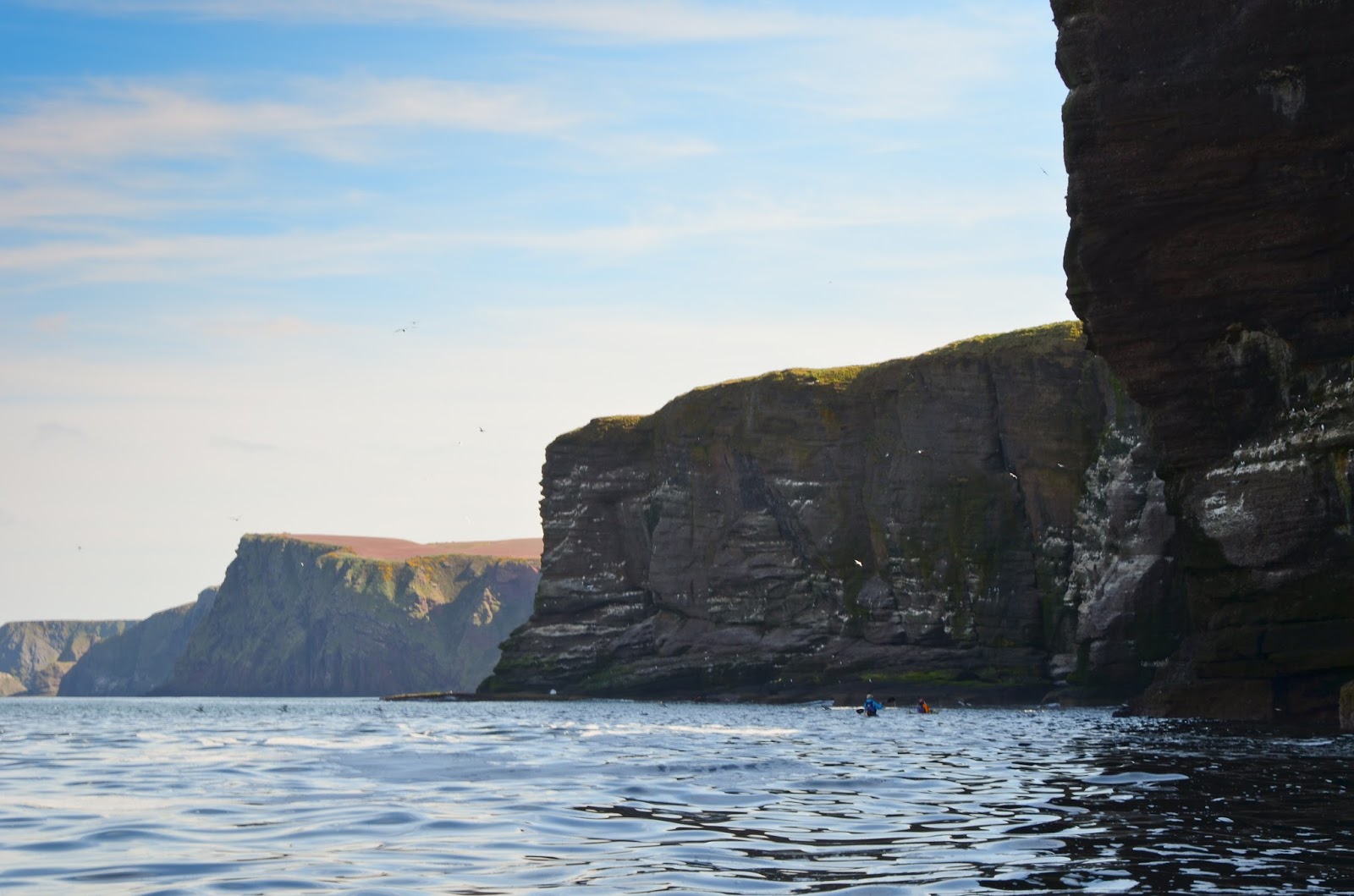


Each corner turned brings a fresh view, headland after headland marching into the distance along a wild coast.  There's a sense of scale and a definite exposure to the North Sea here, choose settled weather to get the best from this trip.


The verticality is punctuated with pretty villages such as Pennan.  There's a good pub here if it's all getting a bit much.....


The geology is fascinating; you'll travel along a wide variety of rock types.  At times the colour can be turned up to the maximum in Spring and Summer; the contrast of vivid red sandstone, brilliant yellow gorse and deep green water near Pennan is stunning - and on warm days the coconut scent of the gorse drifts down to the water.


The Moray Firth is one of the best places in Scotland to see Bottlenose Dolphins; a well known pod hunts regularly right along the coasts of the Firth.  These are the most northerly population of Bottlenose dolphins, the largest individuals of the species and some of the best studied - it's always a thrill to catch sight of the distinctive dorsal fins close by.


It's quite possible to be paddling along a wild shore with Gannets overhead, dolphins close on one side of the kayak and Puffins on the other side!


Another rock type and another change of scenery; sheer cliffs towering above deep bays.....


....stacks, towers, arches and caves linked by narrow channels......


...along with the odd secluded bay, totally inaccessible except by water......

All this, and the chances are high that you'll meet more dolphins than other sea kayakers.  Really, you wouldn't like it....nothing to see here folks!   :o)

Monday, 9 May 2016

Catching the tidal travelator in the Sound of Islay


 We enjoyed a most comfortable camp on the Islay shore and woke to another glorious Spring morning.  There was plenty of time for a leisurely start as the north-going tidal stream didn't start until 1048 so we spent the morning engaged in those most satisfactory of activities - drinking coffee, faffing and fettling the packing of our boats


A northerly breeze was getting up by mid morning and so we decided to get on the water a short time before the tide turned.  A breeze acting against the north-going tidal stream had the potential to create some lively conditions in the narrowest part of the Sound of Islay, so it made sense to pass through before the fastest of the tidal stream became established.  It looked like the sailing ship "Stavros Niarchos" had used the last of the south-going stream to make her transit south back into the Sound of Jura.

After enjoying an exhilarating sail across from Islay to the Jura shore in a solid F4 wind, we reconvened on the shore before setting off northwards.


 The first indication of the wind against tide conditions was a defined line of choppy water marking an eddy line where the main flow was beginning to pour north.  I took no photos for the next couple of kilometres as it got really quite lively.  We kept close together and the worst of the chop was over relatively quickly.


 We kept glancing over our shoulders as we expected the MV Hebridean Isles to overhaul us somewhere in the narrows, and right on time she motored past to berth at Port Askaig prior to making an onward crossing to Colonsay.


 Islay is blessed with a number of fine navigational marks by which seafarers can determine their position along the coast.  Conveniently they are mostly painted white and have suitably prominent lettering to aid identification.  The first of these we passed was Caol Ila, and further north Bunnahabhain


 We made good an average speed of 10km/h on our way back through the Sound of Islay, and this was against a stiff breeze for most of the way.  Catching the tidal travelator is definitely the way to go in these parts!  Once clear of the narrows we turned back up the west coast of Jura to retrace part of the previous day's route towards Loch Tarbert.  When the coastline is this good paddling the same section on consecutive days was certainly no hardship.....

...and we saw things we'd not noticed on the previous day.......


 ...including this splendid mimetolith which bears a striking resemblance to Queen Victoria.......


.....and, resplendent in green, a rock which had a slight resemblance to a pixie..... (and no, we hadn't visited either distillery on the way past!)

Thursday, 28 April 2016

The wild and lonely coast of north west Jura


 We slept well in Glengarrisdale bothy, rising early to a sparkling Spring morning. After breakfast we cleaned out the bothy and laid the firewood ready for the next occupants before saying our goodbyes to Tom and Frances.  Our Iindispensable Kayak Expedition Accessory bags were carried down to the boats - lighter by some food, firewood and a couple of containers of sports recovery drinks each.


 We set out onto a flat calm sea under a cloudless sky of intense blue - the colours of the land fairly zinging in the clear air.


 The northwest of Jura is a wild and lonely coast. Whether on foot or on the water one needs to be self-reliant as well as self-propelled as no paths penetrate the area for a full 25 kilometres of coastline, moor and hill.  Often beset by heavy swell and bad weather, we felt privileged to be able to experience this special place in such benign conditions.


A short distance out from Glengarrisdale we passed the first of several mimetoliths encountered on this side of the island - promptly christened "Iguana Rock" !


 Fifteen kilometres distant, the island of Colonsay lay low on the western horizon.  Our plans had included the possibility of crossing to Colonsay to explore a little of its east coast.  At the fireside planning session the previous evening we'd voted unanimously that both Jura and Colonsay deserved longer exploration than the weather window of around four days we had available - and therefore that we'd stay on the Jura coast and save Colonsay for a future venture rather than paddling out to "tick" the crossing - it was an easy decision to make.


 Headland after headland of wild coastline lay ahead of us awaiting exploration.  The underlying rock of Jura is mainly metamorphic quartzite; in fact it's the largest area of this rock north of the Highland Boundary Fault and shows up on the coast in beaches of bone white pebbles.  A characteristic of quartzite is that it produces poor, peaty soils and rough terrain pretty unsuitable for agriculture.  Only on the east side of the island is the quartzite varied by a narrow strip of schist which breaks down to much more fertile and abundant soil and that's where almost all the population (and the distillery) are.  The prevalence of metamorphic quartzite is part of the reason why there are some 6000 Red Deer and only 200 people on Jura, the eighth largest of the Scottish islands but one of the most sparsely populated.


 Along with there are numerous wild goats and we saw small groups right along the shore and above on seemingly inaccessible cliffs - animals completely at home in their environment.


We paddled at a very relaxed pace, taking time to absorb the view and the situation.  The first of a series of raised beaches came into view, the level of the shore at the end of the last Ice Age.  Since then the land has been rebounding from the release of the ice sheet in a process known as isostatic rebound, we could trace the former high water mark along lengthy sections of the coast.  What a place this was to sea kayak!

Friday, 20 November 2015

Solway sojourn - a stone symbol and a smashing session


 We made good progress out of the River Dee and back out to Kircudbright Bay with the ebb tide behind us.  The morning's wind had died away and it was pleasantly warm on the water - especially so for mid-October.  Ahead lay Little Ross Island where we'd camped above the shore in line with the lighthouse the previous night.


 We called the Dundrennan Range safety boat, the "Gallovidian", to report our intentions on VHF and again got a very positive and pleasant response. Douglas had obtained the range schedule a couple of days prior to our trip and we knew that the range was active with military vehicles firing out to sea to the east of Little Ross.  During the morning and again in the afternoon we heard a variety of light and medium gunfire and what sounded to be a particularly impressive automatic heavy calibre weapon.

A pebble beach on the mainland side of The Sound gave us an opportunity to stop and stretch our legs as the the next section of our journey would be a couple of hours straight paddling.  It was now well into the afternoon and by no means certain that we'd reach our intended camp site before sunset.


We passed back along the outstanding line of cliff scenery between  Slack Heugh and Brighouse Bay with a gentle push from the wind.  To our disappointment we couldn't spend as long as we'd have liked on this section due to the time and the ebbing tide, of which we were acutely conscious - low water on the Solway can result in some very lengthy distances from the water to the top of the beach.

We certainly didn't rush along though - that's not our style unless absolutely necessary.  Keeping close inshore we enjoyed both the scenery and the very warm conditions, we paddled in short sleeved shirts and salopettes and even in this light kit we felt somewhat hot.

There were new angles that we'd not noticed on our outward journey too.....


...this mimetolith bears more than a passing resemblance to the Lion Rampant, heraldic symbol of Scotland - even the yellow background is present!

The noise of artillery fire from Dundrennan Range had faded away as we turned out of The Sound and into the shelter of the cliffs but as we cleared Brighouse Bay we looked over our shoulders......


 ...and wondered just what exactly they were firing back there!


 We indulged in a little more exploration of the caves and clefts on our way to Kirkandrews Bay, were we'd stopped at Castle Haven Dun on our outward journey.  We had noticed a good selection of dry driftwood and a broken pallet washed up above the tide line and set these aside to collect on the way back. 

We landed on soft sand in a narrow inlet, recovered our stash of wood and made use of a "Driftwood Reduction Kit" consisting of:

                                                  Area of flat rock x 1
                                                  Large boulder x 1
                                                  Folding pruning saw with good quality blade x 1 


The technique is relatively unsophisticated but quite effective.  Place the pallet on the flat rock and apply the boulder repeatedly from a working height.  Take the other driftwood pieces and reduce in like manner or by cutting into manageable pieces with the saw.  Place the resulting firewood into a couple of Indespensible Kayak Expedition Accessory bags and stow inside or secure on top of the boats.  Job done!

We were only ashore about 15 minutes, but even in that short time the tide had receded quite a distance.  It was time to head for our campsite by the quickest route......


........back out through the skerries into what was turning out to be a truly beautiful evening.