Thursday 29 August 2013

What's in a name? - Craignagour Hill and Scraulac


I walked west from Mona Gowan across a shallow bealach (col) to the next top on the ridge. This hill continued the goaty theme, it's name being Cairnagour Hill, a version of Cairn na Gobhar (cairn of the goats).  At one time presumably there was a herd of goats on these hills, but they're long gone.  The view here is looking back to Mona Gowan with Morven in the distance.


The ridge culminates a further kilometer or so to the west on a top called Scraulac.  No goat association here and I puzzled over the unusual name until I got to the summit.  The rock here is different to the other hills, a blocky quartzite which is quite unusual locally.  The Gaelic speaking people tended to name hills quite prosaically, and I think that Scraulac may be a version of Sgritheall-ach (scree place).  Just my guess of course - Gaelic mountain nomenclature is sometimes a hotly disputed subject!


My descent followed the line of an estate boundary, marked in fine Victorian style by granite blocks incised with a "C" on one face and an "I" on the other.  These are likely to represent Candacraig estate to the eastern side of the boundary and Inchrory estate to the west.

Candacraig House is these days owned by the comedian and former shipyard worker Billy Connolly while the estate remains in the possession of a Mr F. Wallace.  Inchrory is a huge estate, some 41,000 acres of mainly rough moorland and is owned by a secretive Malaysian businessman.  The shooting parties I saw out on the hill were on Inchrory ground, which was good as my descent was down Candacraig ground - I had no desire to spoil their day (and hopefully they wouldn't have spoiled mine either!)


There's a fine view of Mona Gowan on the descent; from most other angles it's not really a very prominent hill.


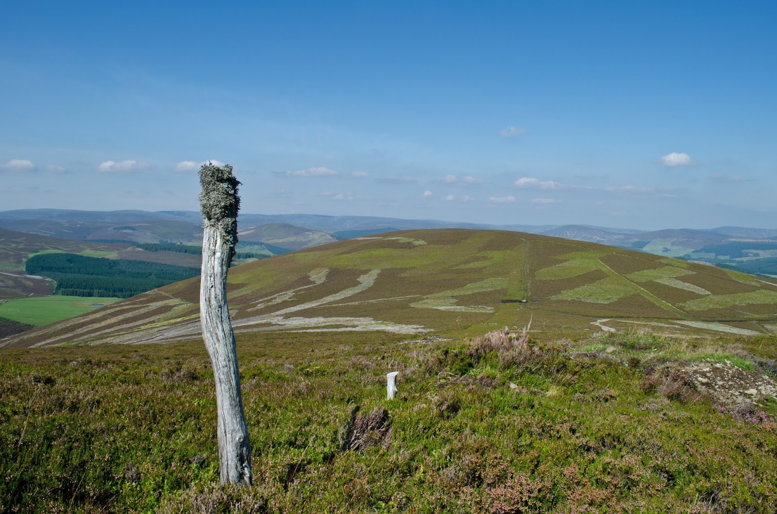
The day was very warm as I headed back to the forest edge, my track out can be seen on the right of this picture.


In the patches of muirburn were loads of Cowberry plants (Vaccinium vitis-idaea), the glossy berries shining in the sun. Also known as lingonberry, it's a plant of high heaths and is much used in Scandinavian cuisine.


The final couple of kilometers of my walk were on the road, but as fine a road as you could wish to walk, trees on one side and a burn (stream) on the other.

The round of Mona Gowan, Craignagour Hill and Scraulac is a great half day out in a quieter part of the country for hillwalking - really recommended.

Wednesday 28 August 2013

Mona Gowan - a view fit for a Queen (or a goat)


On a warm late summer day I decided on short round on some of the local hills.  Just 15 minutes drive from home and I set off from Culfork near the village of Strathdon on a forest track.  Some forestry tracks can be dark and shaded, but this one had vibrant colour among the trees and heather.


The colourful scenery continued as the track emerged from the forestry and began to climb across the open moorland above.  This view is looking north to Strathdon and Glen Nochty.


Looking back as the track began to zigzag up a steep section, the patches of "muirburn" were very obvious.  This is a managed grouse moor and patches are burned in early Spring to promote regeneration of young heather shoots which the Grouse feed on.  Regrowth of heather takes several years and the striped appearance of open heather moorland is a feature of the eastern Highlands.  The Grouse have clearly had a good breeding year; I saw lots of birds and also (this being August and the beginning of the Grouse season), several shooting parties.


Grouse shooting is an important part of the economy locally and "guns" travel from all over the world to shoot.  I do wish they'd learn to pick up after themselves though, the tracks and open hill are littered with cartridges.


After just an hour and a half's steady climb on a good track I reached the 749m/2457ft summit of Mona Gowan.  This hill is a "Graham" - a Scottish hill between 2000 and 2500ft; of which there are 224.  The name is a corrupted spelling of the Gaelic Monadh Gobhar - "Goat Moor".  The big cairn of stones was originally erected in 1887 for Queen Victoria's Jubilee.

The view from the summit is very expansive.  Mona Gowan is the eastern end and high point of a broad east-west ridge, and apart from nearby Morven it stands apart from any other high ground.  There's a huge feeling of space here, the rolling heather moors stretching in all directions to the Cairngorm giants in the south and west and to the Ladder and Cromdale hills in the north east - a patchwork of purple heather and bright green fields and forests.  Any Queen or indeed goat would be pleased enough with this view!


Despite all the colour, it was this hazy view towards Lochnagar which caught my eye.  I love these long views of successive ridgelines receding to the horizon.  Space, warm sun and enough of a breeze to keep away the insects kept me on the summit to eat lunch and enjoy the place.

Monday 26 August 2013

A Late summer evening


 Late summer seems often to be a time of muted, heavy colours.  But walking around this evening there are still some vibrant shades too.  The showy, meter high flower spikes of Rosebay Willowherb (Chamerion angustifolium) are nearing the end of their flowering period.  The capsules which form as the flowers drop will open to disperse seeds carried on downy plumes.  Also known as "fireweed", it's a successful plant considered a weed by gardeners, and as each plant can self-pollinate and produce up to 80,000 seeds it's difficult to eradicate once established.  The bees like it though, flowering patches fairly hum with activity.


Wild raspberries are at their best in July and August.  The fruits really stand out against the dark leaves and make a sweet snack from the hedgerows :o)


On the farmland the pace is beginning to quicken.  A grass field newly cut for silage is almost shockingly fresh green against the gold of rapidly ripening barley.  Soon the big machines will be cutting the barley too.

On a warm and windless summer evening we ate outside and sat long into the dusk watching the light fade and the first stars appear, the evening birds joined by pipistrelle bats - the perfect summer evening in fact.  The following morning has  brought thick mist which is slow to burn off in the sun and there's a slight autumnal feel to the air.

It's still late summer, but there's no doubt that the wheel of the seasons is beginning to turn...

Sunday 18 August 2013

A state of grace


Lorna, Allan and I paddled out of Cullen Bay in the most beautifully calm conditions, the evening light reflecting on glassy calm water.

I don't believe I've ever experienced such a peaceful evening on the Moray Firth coast. There was a complete absence of swell or surf noise and even the seabirds were quieter and more relaxed as we passed.  Paddle strokes seemed effortless as the distance slipped by on our return to Sandend. In such conditions one can enter a kind of state of grace; the journey, the sea and the sky merging to give a great feeling of peace and well-being.


Approaching the turn into Sandend Bay, the sky in the west was amazing.  Gauze thin high cloud was picked out by crepuscular rays as the sun dipped below cloud banks, just beautiful.

As a final treat, we saw a pod of the Moray Firth dolphins crossing the bay parallel to us as we headed back into the harbour.  What a truly lovely evening........

Saturday 17 August 2013

Going out for dinner - an outside table for three please!


After passing through the tunnel we continued past the gaunt ruin of Findlater Castle on our way to Logie Head, the bold blade of rock marking the eastern end of Cullen Bay.


There are rockhopping possibilities here too in such calm weather and we threaded the channels at the very base of the head..........


....before paddling along the shore of Cullen Bay past small rock stacks, enjoying the warm sun on our faces..........


 ...............to arrive at our dinner destination, Cullen.  The town is best known for "Cullen Skink", a smoked haddock, potato and onion chowder.  Haddock would be on our menu too, but in a slightly more calorific form :o)


The classic British Fish n' Chips, served in paper and eaten al fresco - what could be better?!  We bought our dinner from "Linda's Fish & Chips" just above the harbour and ate them whilst sat on the harbour wall, our "table" had great views along the bay.

Suitably fed and watered, we got ourselves sorted for the paddle back to Sandend.  The wind had now died to a breath, but despite this we were pleased to note a complete absence of midges - the little blighters are fortunately much less prevalent on the east coast.

Our evening out had given us superb close-in paddling amongst the rock architecture, channels and caves; a historic castle, some lovely views of the birds along the coast, but there were two more special treats saved for our retun leg....

Friday 16 August 2013

Going out for dinner - the road less travelled


On a warm and tranquil late afternoon, Lorna, Allan and I met at Sandend on the Moray Firth coast to go out for dinner.


We took the road less travelled......


 Down narrow ways.......


......and even narrower ways......


.....through a tunnel which none of us had found previously on this complex stretch of coastline.  The early evening sun lit the water and created a path of green light.

Tuesday 13 August 2013

A honey scented walk up Mount Blair


Mount Blair is a small hill at the south end of Glen Shee and is on the border between Perthshire and Angus.  It's classified as a "Graham", a Scottish hill between 2000 and 2500 feet in height.  I've often noticed it when driving the A93 road between Braemar and the south as although not a big hill it has a prominent location and is crowned with a telecommunications mast.

As I was driving this way and had an hour or so to spare, I thought it would make a nice short climb.


The ascent leaves the B9150 right on the Perthshire/Angus boundary and pretty much goes straight uphill over grassy ground grazed by sheep and cattle.  Thistles are coming into flower, the vivid flower heads bright against a cloudy sky.


Heather is also in full bloom and the air was filled with a glorious heather-honey smell.  The gentle ridges to the east made for some nice angles


The upper slopes of the hills here are carpeted in the paler Ling heather (Calluna vulgaris), and in places a bit lower down this is mixed with the darker Bell heather (Erica cinerea).


A dust of pollen coats both boots and trousers as you walk through the heather, the sound of bees is ever present.  Higher up the hill a chilly breeze was blowing, but the heather scent was still strong.


At the summit the large telecommunications mast is a bit of an intrusion but can be ignored except for the noise of the wind in the rigging holding it together.  A view indicator was installed here but is now in a bit of disrepair, although inside the  circular windbreak  a plaque commemorating several prominent local landowners is still in place.  The large cairn is possibly prehistoric and is reputed to hold a more recent suicide's grave.


 Mount Blair sits right at another boundary, that between highland and lowland ground.  To the north the view is absolutely highland with the green trough of Glen Shee winding up to the bigger hills of the southern Cairngorms.  Close by are the Angus Glens, long parallel valleys cutting into the Mounth hills between the Cairngorms and the North Sea coast.


To the south the view is much more lowland in nature with the  mix of farmland, moorland and forest which makes Perthshire such a varied county.

 I varied my descent to take in a heathery ridge to the east and add a couple of kilometers to the walk.  Perhaps appropriately, I put up a couple of young Red Grouse on my way down to the road.  This was the "Glorious Twelfth" - 12th August being the start of the Grouse shooting season in Scotland.

The whole walk took less than two hours - as a hill to climb for some exercise on a journey either south or north it's a great choice and a super viewpoint too. 

Sunday 11 August 2013

A short walk to Johnshaven Fish Festival


This weekend saw the annual Johnshaven Fish Festival taking place.  It's a lively affair with all kinds of fish and shellfish available to eat and to buy as well as lots of other local specialities. We set off to walk to Johnshaven from Gourdon, five kilometers north along the coastal path which follows the line of a former railway trackbed.


As well as good food and drink, there was entertainment ranging from a pipe band to a rock band.  The weather was dry - always a bonus for an outdoor event in Scotland!  The harbour area of the village was very busy.

We'll visit Johnshaven again soon when the NEOS arts festival is taking place; there are numerous artists and studios in this pretty village.


We bought a pair of Arbroath Smokies fresh from the smoker, a delicious smell of fish and woodsmoke drifting across the harbour ensured that this famous stall was kept very busy! A smokie is a haddock smoked by traditional methods, using oak chips here, and the fish has now attained protected regional food status, meaning that only haddock smoked by these traditional methods within a five mile radius of Arbroath can be truly called "Arbroath Smokies".  Once eaten, never forgotten - a Smokie is a delicious and healthy food.


I blogged about the building of this fine boat previously when she was in the early stages of construction.  After a few setbacks (the building beside which she was being constructed burned down - the rebuild job can be seen in the second picture of this post) she is nearing completion as a Creeler.


Her likely employment will be in working creels for Lobsters.  The nearby business was selling Lobsters straight from the boiler - we couldn't resist buying one for dinner....  After eating lunch bought from a harbourside stall we walked back to Gourdon with the mingled smells of Arbroath Smokie and fresh Lobster wafting from the bags we carried!


All ready for preparation.  A Lobster so very fresh needs nothing fancy, we simply opened it and......


....served it with fresh salad, lemon, wholemeal bread and butter and accompanied by a glass of chilled Prosecco.  Just delicious!  Having access to such good, local and fresh produce from mountain, farm and sea is one of the joys of living here. 

If ever a 10 kilometer walk was amply rewarded, then it was this one!


Saturday 10 August 2013

An umbrella of rock


Continuing west from Portknockie, the next harbour along the coast is Findochty.  A small beach immediately to the east of the village seemed to be a good place to stop for lunch but the weed on the strandline was plagued with sandflies.  I decided to head back a bit to a bouldery beach I'd spotted near Tronach Head.


As I approached the beach there was a sudden commotion among the seabirds.  I was sure that this wasn't a reaction to my presence and looked upwards, just as the unmistakeable arrowhead shape of a Peregrine Falcon carved through the air along the cliffs and landed on an outcrop.  This was a juvenile bird, quite darkly coloured and a bit clumsy but still enough of a threat to panic the seabirds. It's really good to see these birds doing well.


After a leisurely stop for lunch I headed east back along the coast.  There are numerous caves along this stretch, some perhaps destined to become arches like the Bow Fiddle in time.


From the southeast there were dark clouds looming and on the horizon I could see heavy rain falling.  As luck would have it I was close to the cave I'd wanted to examine more closely; this would make a good shelter!


I've often looked into this cave, which is about 50 meters long, but the conditions have never been good enough for me to enter; either a swell has been running or there hasn't been enough water.  Today everything was favourable and I paddled into the entrance, watched by several nesting Shags and Kittiwakes.  The air was cooler inside and the all pervading sharp smell of seabird guano was quite strong, but I was out of the rain which had begun falling heavily outside.


 There's even a slit window set into the wall part way along, so I could check on the progress of the rain shower....


The tide was pretty much near to a Spring high water and at the back of the cave the exit led to a small pool with just enough space to turn around.  This back door is much smaller than the front entrance and must be a fearsome place when big swells pass down the funneling walls and roof of the cave.

My umbrella of rock had kept me completely dry through a really heavy downpour and as it headed out to sea, I did the same.


Stopping for a leg stretch on the sand at the western end of Cullen beach, the cloudscape was quite impressive and picked out nice shades in the water.  A short paddle back to Cullen harbour ended the trip.

As described, this is a 13 kilometer round trip from Cullen.  Allow three to four hours to explore the many caves and stacks.  There isn't too much to be concerned about with tides, the flow can be paddled against even at Springs.  The main limitation here is swell; anything more than a half meter swell will create uncomfortable clapotis along most of the coast.

There is easy launching and adjacent parking at Cullen harbour plus public toilets.  There is also an independent hostel right on the harbour which would make a great base for visiting paddlers to explore the Moray Firth coast with super trips both east and west from Cullen.