Thursday 30 May 2013

Around Eilean Shona - but only just!


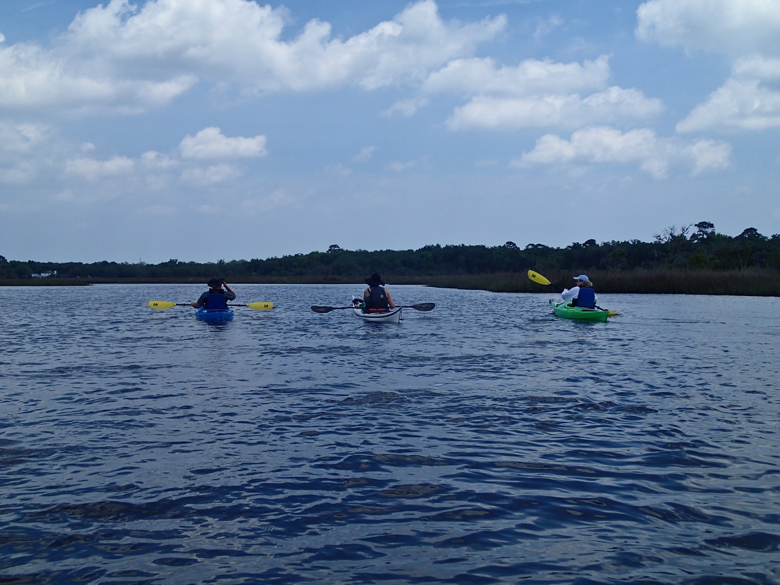
 Moving on from "Shoe Bay", Douglas and I made our way along the South Channel, staying close to the south coast of Eilean Shona.  This is a great area for watching wildlife from a kayak.....


You are pretty much guaranteed close views of seals, the curious younger animals will follow very closely and can be seen through the clear water as they swim under the boats on inspection passes.  We also saw several Otters and an Eagle in quick succession during this part of the journey.


There is plenty of historical interest here too, our route took us past Eilean Tioram (the dry island) with the atmospheric ruin of Castle Tioram seeming to grow organically from its rocky form.  A tidal island with a rocky outcrop and two accessible small beaches must have been a prime site for operating Birlinns (a light Highland version of the Viking longships) and would have been a natual choice for building a fortification.  The present castle is mediaeval, dating from the 13th or 14th century, but it is fairly certain that there was a fortified site on Eilean Tioram long before that.


Douglas and I didn't linger though; we were hopeful of managing to pass through the North Channel before it dried out on the falling tide.   Already we were approaching half tide and though it was neaps, we knew it would be a close run thing.  An spell of hard paddling into a sneaky breeze got us to the tip of Shona Beag from where we could see that there was water most of the way to the ford.  At low water, over a kilometer of sticky mud is exposed either side of the ford - no good for a portage!

We were in luck....  The channel was indeed "closed to shipping" but we had water all the way to the ford and needed to portage only over the ford itself and a couple of meters of mussel shell seabed.  If you  paddle around Eilean Shona, tidal planning will always be a factor.  When I last paddled this channel with Simon and Liz, we planned the passage to drift down gently on the flood tide, enjoying flat calm conditions and autumnal colours.  More recently, Douglas and I were prevented from gaining ground in the channel by a very strong headwind, and had to turn around.


Back on the water at the other side of the ford, we enjoyed a gun-barrel view down the channel to the Sgurr of Eigg.  The time pressure was now off; we could relax and slow the pace.  The North Channel has rocky slopes on either shore and is a really atmospheric place to paddle.


There was very little wind to affect us this time and all too soon we reached the twisting channel leading to the open sea.  From seaward, it seems unlikely that Shona is even an island, the channel entrance is hidden and the rocky heights of the island look to be a continuation of the coast itself.


We paddle north a little way to reach a favourite luncheon spot.  There was a chilly breeze blowing, but nothing like as cold as when we'd lunched here  previously - after I'd taken an unplanned swim!

We took second luncheon of soup accompanied with cheese and houmous wraps, and partook of a small serving of Golden Steadying Liquid to ward off the chill of the breeze.

From here, we paddled south down the cliff-lined west coast of Eilean Shona to complete our circumnavigation. 


On the way back to Ardtoe we heard warnings of gales "imminent".  Once again we'd managed to snatch a superb day on the water in a narrow window of weater - which seemed to have been the way of things in winter 2012-13.

We both had "interesting" journeys home.  Some of the worst snow in northern Scotland is normally in March, and this year was no exception.  Douglas' route took him over the exposed Rannoch Moor in a blizzard.  My route home crosses the spine of Scotland and I listened to the radio in the car as one potential route home after another was closed due to snow.  I had a very difficult time between Grantown on Spey and Tomintoul as the snow whirled down in huge flakes driven by a strong easterly wind, obscuring the road completely at times.  Other drivers did double-takes as I passed with a sea kayak on the roof of the car! 

Safely home and in front of a blazing log fire, I could reflect on a great short journey and the culmination of a marvellous shared winter of exploration on Scotland's west coast.

Douglas will also tell the story of this trip - starting here with a truly pyrotechnic sunset......

Wednesday 29 May 2013

A soft sand shuffle in "Shoe Bay"


North of Ardtoe, Douglas and I enjoyed some relaxed rockhopping amongst the channels and outcrops of the coastline until we arrived at Eilean Shona.  This steep sided and craggy island fits into the coastline like a ball and socket, separated from Moidart by narrow tidal channels.  


Our target was "Shoe Bay", but you won't find this name on any conventional map!  If you paddle this stretch, look for a flash of white sand below a rocky outcrop. The bay actually has three entrances at half tide or above.


Clear water above a pure white sand makes for wonderful colour in the water even in overcast conditions.  We paddled steadily in to the tiny beach.........


....where the unofficial name becomes instantly obvious.  The fine white sand is incredibly soft even when it has been exposed by an ebb tide.  One's feet sink in to ankle depth or above - a really strange sensation!  Many, many shoes must have been lost on this gorgeous beach...


Douglas and I made our way up the beach to a grassy knoll above, our deep footprints etched in the sand. We celebrated our arrival on Eilean Shona with a first luncheon of coffee, fruit and a small dram of "The Singleton".  The views were amazing, and all the more enjoyable because, during the previous two months, we'd travelled together along all the visible coastline and islands.
"Shoe Bay" is a hard place to leave, and not just because of the soft sand.  It would have been a pleasure to spend several hours here, but our plan was to circumnavigate Eilean Shona, and we were already behind the tidal schedule - it was time to move on.

Sunday 26 May 2013

All calm in Kentra Bay


 Back in March I met up with Douglas at Glenuig - just a short time after our superb trip around the Small Isles.  This time our intention was to paddle the coast south of Loch Ailort starting at Ardtoe.  It's an area we are both familiar with but as ever there are sections we've not explored.  There was also the chance to link up the trips we'd done over the winter from Ardnamurchan to Arisaig and the Small Isles.

One of the places neither of us had visited is Kentra Bay, a broad and shallow bay which dries completely at low water.  The bay takes its name from the settlement on the shore and is an anglicisation of "Ceann Traigh" (head of the beach) - indicating the sandy expanse at low water.


As we paddled through the narrow entrance into Kentra Bay we were treated to a close view of an Otter fishing in the tide.  This was the first of several Otters we saw during the day, they do seem to be numerous in this area. 

This jetty is at Kentra on the east side of the bay.  It would make a good launch spot except that there is nowhere convenient to park a vehicle, and a notice requests that the jetty be left clear as it is use for local fishing craft.  The stonework was very solid looking and obviously built by craftsmen.  The road from Acharacle to Ardtoe can be seen just above the jetty.  This is a narrow and twisty singletrack with a very steep hill just above Ardtoe.  It also comes with a fearsome warning for summer visitors! There is parking with a 50p per day honesty box at Ardtoe.


 The birch trees on the shore had an early Spring blush of purple on them - these trees carry a purple wash right through the winter.  The water was absolutely flat calm and we felt quite warm in our drysuits.


Winter was far from over though.  The snow on the Rum Cuillin was fresh (it hadn't been there the previous week).  The dark peak to the left of the snowy hills is the distinctive Sgurr of Eigg; both it and the Rum Cuillin felt like old friends after our journey in the Small Isles. The small rocky island is Sgeir Eididh just off Ardtoe.

We were both really glad we'd taken the detour to explore Kentra Bay.  Provided there is sufficient water, it certainly repays a little exploration.  The calm water seemed to suit the ambience of this hidden gem.

Now we turned north, back past Ardtoe towards our next destination, Eilean Shona.

Thursday 23 May 2013

P & H Delphin 155 - a brief impression


During our kayak trip on the Fort George River I was lucky enough to get the chance to paddle the P & H Delphin 155 for a few hours.  My friend Douglas has written a very comprehensive and considered review of the Delphin based on a year of paddling the boat - my brief notes here are merely an impression formed over a few hours on flat water with some tidal stream.

The image above shows the high degree of rocker on the Delphin hull.  This undoubtedly contributes to the boats manoeuvrability.  The appearance of the Delphin has polarised views amongst UK sea kayakers with some seeing it as the way ahead for design, some seeing it as a niche boat for surf and tidal race play, and some finding it ugly and awkward looking.  My view prior to paddling the boat fell into the second group - I thought it was an unusual design aimed squarely at the emerging "park and play" group of kayakers wanting to surf and to play in rough water in tidal races


The cockpit is very comfortable, the seat and backrest being sourced from P & H's parent company (Pyranha's) Connect 30 whitewater set-up.  The cockpit is nice and long making for easy entry and exit.  The backrest is adjusted by ratchets on each side of the cockpit; this was easy to adjust and stayed put.  The thigh grips are also adjustable but this would need to be done before getting on the water.  Footpegs are the familiar P & H twist-lock adjustment, once set these were firm and felt as if they could take some force.  Compared with my own boat (a Tiderace Xcite) the fit seemed to be a little "looser" - in particular the thigh grips didn't give the same feeling of being dialled in to the boat when in hard turning mode.  This could be partially explained by the fact that I didn't customise the fit of the Delphin too much during my short paddle.

This image shows the most distinctive feature of the Delphin on the water - the fact that in normal use the bow is well clear of the water.  Under the forward end of the hull lies a unique hull-form with relatively hard chines and a mid-line V being separated by double concaves.  These features fade out gradually into a flat hull in the mid section before forming into soft chines toward the stern.  All this is obviously designed to help control while surfing whilst being forgiving enough to get back off a wave without too much drama.  The distribution of volume definitely favours the forward end of the boat to help rough water handling.  The hull shape under the bow produces an unusual gurgling from under the boat whilst turning tightly on flat water.

Which brings me to manoeuvrability.  Put simply, this is the most responsive, tightest turning sea kayak I have ever paddled!  The rate at which this boat can turn is more analogous to a river boat than a sea kayak.  A raise of the knee and a slight edge produced a 90 degree turn whilst at cruising speed; a dynamic sweep results in a 180 degree turn with little effort.  Edging felt secure; I managed to put the cockpit rim under water whilst experimenting with braced turns and the boat still felt solid on its edge.  I spent some time using the tightly spaced supports of a road bridge as slalom gates in a tidal stream of approximately 3 knots - the Delphin was an absolute hoot and could be threaded through gaps I wouldn't attempt with many sea kayaks.

When stopping paddling to take photographs, the Delphin habitually veered one way or the other, yet whilst paddling it tracks straight and true.  The skeg is the P & H Mark II skeg which felt light and positive, though I didn't need to use it on my paddle.


There are three hatches (no conventional day hatch).  The rear oval hatch cover was very difficult to get back on once removed - no doubt this will ease with use.  Both the main compartments would hold a good level of kit - but here's the question: would loading this boat compromise the in-water dynamics?  I imagine that a good deal of care would be required if loading the Delphin for a multi-day trip, but the space is certainly available.  The small deck hatch forward of the cockpit is a useful size (I'm a big fan of these small hatches), but isn't completely watertight if submerged - the main compartments were watertight despite the boat being overturned numerous times during wet practice.


                                                                                                                   Image:  Heather Ferris


The Delphin is a really stable boat.  Balance is neutral and the back deck is both the widest point of the boat and also relatively low which aids rolling and made us look good doing balance exercises !  It would make a great boat to instruct from, being very manoeuvrable and forgiving. 

So, do I still think that the Delphin is a niche boat?

Well, I didn't get a chance to surf the boat, but everything I have heard leads me to believe that it is a superb surfing and rough water boat.  It is much more than that though.  It would make a great boat for a novice and would not be quickly outgrown.  It can cruise, could be used for overnight trips, but perhaps for me the most exciting  use for a Delphin would be for rockhopping.

The way this boat can be manoeuvred, edged and turned on the spot, coupled with the tough Corelite construction makes the Delphin potentially the most effective rockhopping weapon available.

My preconceptions have been absolutely changed - the Delphin is a very, very good boat and an exciting as well as an interesting design.  OK, the looks aren't as "elegant" as some boats, but  if you can get past the uncoventional appearance, go for a paddle in one and prepare to have your preconceptions challenged!

Tuesday 21 May 2013

Warm water and white sand - Florida's Fort George River


We paddled steadily onward down the Fort George River, which is unusual in having State Parks on both banks. 


The water is shallow and warm, the river is a dynamic environment of shifting sandbars edged with saltmarsh habitats.


This was a fun trip!  Those who hadn't paddled previously were able to relax and enjoy our journey in sheltered water.  Iain had a huge grin all day - even after an unplanned swim whilst enthusiastically practising turns.......  :o)


We paddled under the bridge which carries the A1A  road.  The tidal stream was running nicely under the bridge and gave a bit of easy moving water to play in.


Once past the bridge we turned north along the course of the river, which is protected from the Atlantic Ocean by a long sand spit.  Near the end we pulled up onto the white sand for a break.  This far out along the sand we shared it only with gulls, waders and Pelicans.


We had a great time swimming in the warm water and playing balance games in the boats.  Two of our group, neither of whom had sat in a kayak previously, managed to do 360 degree shuffles on the back deck, and to stand up in the boats -  great stuff!


 Joe demonstrated sculling for support, with a Florida twist - no spraydeck.....   Supporting the flooding boat was a most impressive effort


A happy group of British paddlers on a warm Florida beach  :o)


Our journey back to the boat launch at the Ribault Club was speeded by a breeze at our backs and a bit of tidal assistance.  

We'd like to thank Joe and Hennessy for a really enjoyable day.  If you're visiting north Florida, we can thoroughly recommend a trip with First Coast Outfitters!


Sunday 19 May 2013

Florida paddling on the Fort George River


 On a gloriously warm morning I met up with eight work colleagues and we set off to the St Johns River ferry.  This was a fairly early sailing and at first we thought we were the only passengers....


But as sailing time approached the vehicle deck filled up with people out to enjoy a sunny weekend in all sorts of transport.  We were headed to Fort George Island State Park, just to the north of Jacksonville's St Johns River to meet up with Joe from First Coast Outfitters


The meeting point was at a boat launch adjacent to the very impressive colonial style Ribault Club, a playground for the wealthy citizens of Jacksonville in the 1920's. 


 A useful small beach with a parking area gives access to a section of the Fort George River.  We met up with our fellow paddlers and with Joe and Hennessy, our guides for the trip, for a safety brief and stretching session....


Before getting fitted comfortably into our boats.


Off to the side of the boat launch, a muddy bank was home to large numbers of Fiddler Crabs (Uca spp), the males have one claw much larger than the other which they use to signal to females by elaborate waving and acoustic drumming displays.  These fascinating creatures can also regenerate missing limbs!


Sun cream applied and boats sorted, we got set to launch....


And headed out on sparkling water to the Fort George River

Thursday 16 May 2013

Saltmarsh paddling at Dutton Island Preserve, Florida


During a visit to north Florida, I got an opportunity to sign up for a paddling trip with First Coast Outfitters of Jacksonville Beach.   I joined a local family for the trip, meeting up at Dutton Island Preserve on a beautiful sunny afternoon.


Following a safety brief from our guide, Rachel, we headed off out into the open water of the Intracoastal Waterway .........


before turning off into a series of channels which wind among the saltmarsh environment.  The water was shallow and warm, and bird calls the predominant sound.


As we rounded the end of Dutton Island a shrill calling alerted us to a pair of Ospreys at their nest.  We moved along to avoid disturbing the birds, a really rare species in Scotland but very numerous here in Florida.


At the furthest point of our paddle we passed through a tunnel under the access road to the island - I think this may well have been our youngest team member Owen's favourite part of the journey!


After paddling through some narrow and shallow channels containing oyster beds (which needed to be carefully avoided), we entered a wider channel which had been dredged to provide an access route when development of this pristine environment was being actively pursued.  Fortunately, a community campaign resulted in the area being made a nature preserve, accessible to all.


Rachel has a wealth of knowledge about the history and wildlife of Dutton Island, and she added enormously to the experience by pointing out things we would otherwise have missed.  This Great Egret was very unconcerned by our presence, but other species we saw were more retiring.


As we approached the end of the paddle, and back on the Intracoastal Waterway, we were treated to an appearance by three dolphins feeding close to us.  It was a really great finale to a great day; and what a change to be paddling in T-shirt and shorts rather than a drysuit! 

Wednesday 15 May 2013

Super Troup-er


Back in March, a neap tide combined with relatively calm conditions - a good combination to paddle around Troup Head, one of the large headlands on the Aberdeenshire coast.   I started some kilometres to the east, at a small bay near New Aberdour.   If launching here, it's worth knowing that the steeply shelving pebble beach produces dumpy surf in anything but flat calm conditions.  At the west end of the bay, narrow channels amongst a rocky reef provide a bit of a barrier to the swell.  I managed to get away from the pebble beach, briefly considering a "seal launch" down the steep angle before common sense prevailed!


This stretch of coast is well known for seabirds and for superb rock architecture.  The cliff scenery starts straight after setting out - in fact the section of coast between New Aberdour and Pennan is perhaps the best of the trip in this respect.  The day was hazy and overcast; not great for photography but perfect for getting in close to the arches, stacks and caves.


Even on a calm day this coast is exposed to swell from several directions.  Geos cut back into the cliffs, gaps open invitingly and caves just beg to be explored - but a constant eye needs to be kept for larger sets of waves, which are disconcertingly irregular.


My paddle was timed to start out in the last of the west-going ebb, so that the tidal stream would be just picking up on the east-going flood as I rounded the main headlands.  There is a good harbour in which to take a break at Pennan, a pretty village which was once a fishing port but is now more of a tourist attraction having been made famous in the movie "Local Hero".


Immediately after leaving Pennan the cliffs change from eroded sandstones to harder igneous rocks, and get markedly higher.  The nearest headland here is Lion's Head, Troup Head itself is the furthest.  The dark cliffs between the two are riddled with large, low caves.


The cliffs provide great interest, and choosing a calm day allows a close passage below.  From spring to late summer there are tens of thousands of seabirds nesting on cliff ledges and in the turf above.


Even at the very start of the breeding season, the air is filled with wheeling Gannets; Troup Head is one of very few places where Gannets nest on mainland cliffs, rather than on offshore islands and stacks.


Beyond Troup Head, the cliffs gradually diminish in height, but the interest continues with sharkfin stacks separated from the cliffs by narrow channels.  Atlantic Grey Seals are ever-present on this section, escorting the paddler along their "patch".


All too soon, the rocky coast opens into Gamrie Bay and the tiny village of Crovie is passed.  There is a small pebble beach here, but the houses are hard against the shore with their gables to the sea and it would be difficult to get boats up the steep hill to the road-end. Crovie is now best known as a village of artists, and has several studios among the strip of houses.  A couple of kilometers to the east is the larger village and harbour of Gardenstown (sometimes known by its former name of Gamrie).  There is a good harbour with a slip in which to land (there's also an honesty box for donations by harbour users).  It's worth knowing that the road down into the village is extremely tight - we unfortunately managed to scratch our new car here....

This superb paddle is only about 12 kilometers, but packs a huge amount into a short stretch of coast.  Choose a calm day and it will be a superb experience!