Showing posts with label Pictish sites. Show all posts

Sunday, 3 May 2020

One good thing - 2nd and 3rd May 2020

One good thing about the weekends is the opportunity to take longer walks without the time constraint of working from home. These longer routes have averaged around 15km and are usually circular, although one of the walks this weekend was linear.


Setting out from home I revisited the route which runs from Alford to Rhynie over the Correen Hills.  Once used as a cattle droving route, it was also used as a path between kirks.  The parishes of Forbes on the Tullynessle side of the hills and Kearn to the north shared a minister and services alternated between the kirks, so on Sundays this route would have been busy with one or other congregation making a return journey over the hill.  This route remains a right of way between Alford and Rhynie and is relatively easy to follow.

From Terpersie a track climbs gently up on a broad spur to a long-disused quarry.  The soundtrack was all moorland birds, the constant backing stream of Skylark song, the sudden "squelch" call of a Snipe zig-zagging away from close by, the chuckle of Red Grouse, the wild call of  Curlews in display flight, and - as expected this weekend the familiar pirate call of a Cuckoo, the first of the year.


The view back down to Tullynessle opens up as height is gained, moorland and forest bounded by rich farmland. 


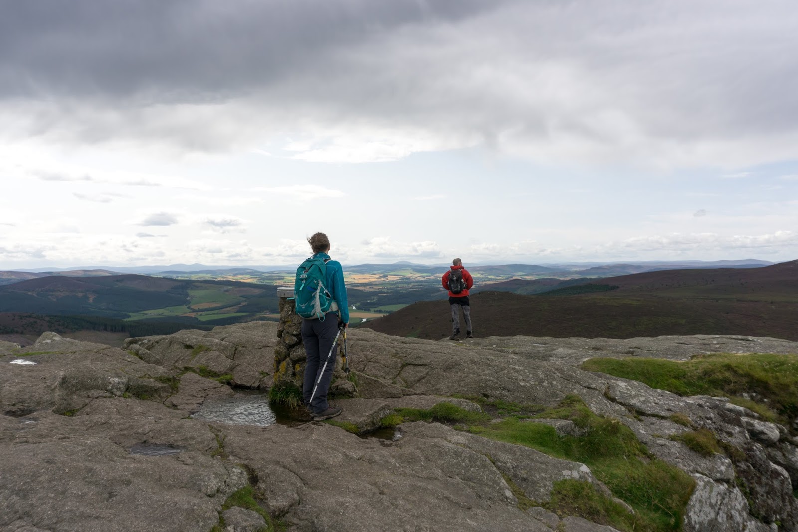
The highest point of the walk is at a shallow bealach (col) near Badingair Hill from where a wide view opens up to the north with Tap O'Noth crowned by its massive hillfort prominent.  The previous time i walked this route I turned east (right in this image) near the solar array to finish at the village of Clatt.  Today I wanted to follow the traditional route to Rhynie - which goes along the strip along the side solar panels towards Tap O'Noth.


Close up the renewable energy plant is quite impressive.  I had a fascinating chat with a mole-catcher who was checking his traps around the base of the solar panels.  He's one of the last people to specialise in mole catching locally and I learned lots in a short conversation.  The moles here are clearly very numerous judging from the amount of molehills and are presenting a problem not just around the infrastructure but in the livestock fields nearby.


The three turbines at Carnmore are 81 metres tall and each of the blades is 25 metres long, rotating at a nominal 26rpm, each has an output of 850Kw which is claimed to be capable of powering 600 homes.  The whooshing of the blade tips was noticeable but not as intrusive as some.


Nearby is the remains of Cairnmore hillfort - a Pictish site dated to around 500AD.  Not as immediately spectacular as the forts on the summits of Tap O'Noth or Bennachie, it is nevertheless thought to have been a site of high status in the Pictish era and has a wide outlook over the surrounding country and a direct line of sight to Tap O'Noth.

Tap O'Noth was built many hundreds of years before Cairnmore but it's possible that both were in use at the same time for a period.  At this time of year it's likely that huge fires would have burned near both sites at the celebration of Beltane, which has roots very early in history.


An information board gives a good impression of what the site may have looked like based on a series of archaeological digs.

The route from Cairnmore follows a farm road downhill to a quiet country road leading to the village of Rhynie.  If time allows there's an outstanding collection of Pictish symbol stones at the kirk in the village.

This route was a little over 15km and takes around 4 hours including stops. I feel that the finish in Rhynie is a better one than the finish in Clatt. It's another added to my exploration of walks straight from home, and has lots of good things to recommend it.

Saturday, 14 September 2019

Top to top to Tap

I'm lucky to have Bennachie as a neighbour. One of the most prominent hills in the north east of Scotland, a glimpse of the distinctive outline of the Mither Tap (Mother Top) means "home" to generations of Aberdeenshire folk.  Bennachie inspires a real fondness in people and there's even a dedicated band of volunteers known as the Bailies of Bennachie who look after the hill and its environs.  I climb it regularly by a variety of routes, but there was one which I hadn't done.


Lorna, Allan and I met up on a bright late summer day to do one of the longest routes on Bennachie, a traverse from one end to the other of what's essentially a long ridge with a number of "tops".  They live closer to the hill than me and have a clear view of it from their house - a very desirable feature in any property I feel!

We pre-positioned a car at the end of our intended walk and drove back west to the top of a feature known as the "Lord's Throat", a wooded valley carrying a minor road.  A rough track leads to a sand quarry and after a bit of scratching about we climbed above the quarry and onto the open hill above.  a view opens up straight away to the furthest tops of Bennachie above the valley of the River Don.


The heathers were all in full bloom, the colours stunning.  This is the larger flowered Bell Heather (Erica cinerea).....


...and this is the more ubiquitous Ling heather (Calluna vulgaris).  As we walked our boots raised clouds of honey-scented pollen and one of the dominant sounds was that of the bees collecting pollen - we saw several species on this part of the hill.


This is a corner of the hill I hadn't previously walked and I was intrigued by a line of very old and long-disused shooting butts arranged in a line upslope.  Drystone built, the may have been turfed on top when in use and each had an offset entrance for the "gun".  Interestingly, almost every one harboured a Rowan tree.  Rowan (Sorbus aucuparia) seeds germinate in an interesting way; if you plant them they just won't grow.  The seeds are contained in a bright red berry which are irresistible to many species of birds.  the berry and seed must first pass through the gut of a bird in order to germinate; and of course will benefit from having a blob of guano fertiliser to boost its chances.  The berries are irresistible to some humans too - they make a superb jelly to accompany meats and cheeses!

Rowans are one of the most common trees in Scotland, and are the tree which reaches higher altitudes than any other species here - up to 870m/2850ft in a few places.  There's a rich folklore surrounding the tree; it's associated with protection and was commonly planted at the gable end of a house to afford protection from witchcraft in particular.  Rowans rarely live longer than 150 years so it's possible to guess the dates of some ruins by the Rowans near to them.  Here, in a lovely piece of symmetry, the works of man provide protection for the Rowan - the seeds dropped by a bird have fallen into the grouse butts and the seedlings have grown within the circular embrace of the wall, protected from weather and from browsing animals until well established.


From near the summit of the first "top", Black Hill, there's a wide view over the Aberdeenshire countryside.  Due to its relative isolation from surrounding high ground such good views are a feature of the whole of Bennachie.


From Black Hill the ridge proper swings into an east-west orientation and as we continued west the views just kept coming.  We took a slight detour to the "top" of Hermit Seat (who was the hermit I wonder and what was his story?) and past Hummel Craig.  A Hummel is a stag with no antlers and Craig is a derivation of Crag.   From the next "top" of Watch Craig we looked over the valley of the River Don to Pitfichie Hill and Cairn William.  Allan and Lorna were just able to see their house from this point!


Once up on the higher ground the paths on Bennachie are really good going and distance just reels away.  In quicker time than we'd anticipated we found ourselves on the rocky tor of Oxen Craig. At a modest 528m/1736ft this is the highest point of Bennachie but probably visited by only a small percentage of the folk who climb "Bennachie".  Behind us rain showers were strafing the land further west...it seemed we'd probably get wet before the day was done.


A view indicator plaque identifies some of the hills and key features to be seen from Oxen Craig, including some at considerable distance.  The view ranges from the city of Aberdeen in the east, round to the hills of Angus in the south, to the Cairngorm giants almost 70 kilometres away and round north to Peterhead and the Buchan coast - an enormous sweep of the northeast of Scotland.


We sat out a shower below Oxen Craig and once it had passed headed slightly off the main line of the ridge to another "top", Craig Shannoch.


From Craig Shannoch there's a good view across to the main attraction of any walk on Bennachie - the Mither Tap.  In fact the Mither Tap is Bennachie for most folk; the name of the whole hill is a derivation of Beinn a' Chioch (hill of the breast) and it's the Mither tap which is the most visible, most prominent feature.  Across a huge swathe of Aberdeenshire you can look for it - the eye instinctively drawn to a familiar outline.  Bennachie, always Bennachie - it's what inspires such affection for the hill.  The Tap is a granite plug from the heart of a long ago eroded volcano and has considerable steep drops on three sides.  I'd guess that only about one in a hundred people who climb the Mither tap go on to walk to the "real" summit of Oxen Craig - such is the draw of the Tap.


We climbed to the summit, almost able to lean on a tearing westerly wind.  We'd traversed top to top to reach the Tap, a fitting end to the high ground of Bennachie.


This place has a long history of use.  Being so prominent prompted the building a hillfort here.  Constructed during the Iron age and possibly occupied as early as 1000BC, it seems to have been developed for a long period and may have been the site of the battle of Mons Graupius (which gave its name to the Grampian region and mountain range) where the Picts were heavily defeated by a Roman army.  The aerial pictures on the Canmore site show the extent of the ruins.


The curving entrance to the upper fort is particularly well preserved - here you can really walk through ancient history.


The descent from the Mither Tap to the Bennachie Centre is knee-jarring, steep and in places rough.  Although the shortest route in terms of time and distance I've always thought this the least attractive way to climb the Mither tap.  There are a number of ways to reach the Tap, as shown on this downloadable map, or you could always do our longer route of around 10kms!  We'd enjoyed a superb day doing this route; it's one all three of us will repeat.

Sunday, 29 January 2017

Aberlemno Pictish stones

Between Brechin and Forfar in the north east of Scotland is the small village of Aberlemno. Once on the main road through the area, the village is now quiet but is the setting for some remarkable Pictish sculptured stones.

Parking is available at the village hall, adjacent to three of the stones which stand at the roadside.  One is an unshaped and highly eroded sandstone boulder which bears faint traces of a curving symbol.  Nearby is a much more imposing stone.


The cross slab known as "Aberlemno 3" is the latest of the roadside group and probably dates to around the 8th century AD.  These later stones are termed "Class 2" to denote their finer, more detailed carving.  Standing 2.8 metres high and a metre wide, it simply towers above the road.  The face of the stone bears a cross, two angels and animal figures.....


...while the reverse has more typically Pictish carvings.  The Crescent and V-rod, and the double disc and Z-rod are recurring themes of Pictish art - and while there are many theories their meaning remains elusive.

Below the symbols is a hunting scene with mounted hunters, deer and hounds, trumpeters and a man with a spear and shield.  The lowest section carries biblical images including a lion.

This mix of Christian and Pictish symbolism is common on later Pictish stones, there seems to have been a flourishing of art in the time following the conversion of the Picts to Christianity.


A little way down the road is the oldest of this group of stones, dating from around 500AD and of the "Class 1" group of early, more simply carved stones. A leaning, unshaped boulder, it's carved with a mix of symbols including a serpent, double disc and Z-rod and another recurring theme, the mirror and comb.  The rear of this stone bears prehistoric cup-and-ring marks and it's believed that it may be a standing stone re-used by the Picts - it had probably stood in the landscape for many centuries before the Picts carved their own symbols on it.

If Aberlemno had only these three stones by the roadside, it would be very well worth visiting - but nearby there's another stone which is of huge importance.


Aberlemno Church sits below the road in a sheltered spot.  The churchyard has a number of interesting gravestones, but there really is no doubt why most visitors search out this place.


The cross-slab in front of the kirk is one of the most impressive of all Pictish stones.  Believed to date from the late 8th to 9th centuries AD, it is a huge monolith of Old Red Sandstone.  Even after the passage of over 11 centuries, the carving is stunningly beautiful and intricate.  The workmanship involved in making this carving from a single boulder really does dispel any notion that the Picts were a primitive or uncultured people. That they left absolutely nothing in the way of written records through the 800 or so years that they were were the major power in the north of Scotland is, in a sense, irrelevant; the legacy they left in stone has endured.

The vertical arms of the cross bear three different knotwork designs, the horizontal arms have keywork designs.  Either side of the cross are intertwined animals and mythical beasts.  At some point a hole has been bored through the stone - it's thought that this was done in order to move or to re-position it in some way.

This stone is 2 metres high, 1.3 metres wide and about 30cm thick and is one of the finest of all surviving Pictish stones.  It's known to archaeologists as "Aberlemno 2" but more commonly as the "Dunnichen Stone".  For, despite the magnificence of the west-facing cross it is the other face which elevates the Dunnichen Stone in importance.


The eastern side, facing the kirk, is carved with the only battle narrative to be found in the Pictish stone record. The sculpture on this face can't match the intricacy of the cross, it's the story it tells which makes this sandstone slab especially important.

The Picts held most of northern Scotland and the Northern Isles, and had done for several centuries since the Romans withdrew - their lands marched with the Britons of Alt Clut (which later became known as the kingdom of Strathclyde) and with Dalriada - separated from both by the high ground of Druim Alban, the spine of the country.

In the 7th century they came under pressure from relative newcomers to the British Isles; the Angles of Northumbria.  A huge power struggle in what would become England between the Northumbrians and Mercians had been won, and now the Northumbrians looked north.  After invading the lands south of the Highland boundary, they ventured still further north and inflicted a defeat on a Pictish army in 672, capturing large areas of Pictish territory.

The Picts reorganised, and under their king Brude reasserted themselves.  The Northumbrian King Ecgrith, marched north again in 685- against the advice of his council and of his trusted advisor St Cuthbert.  The Pictish army allowed the Northumbrians to advance beyond the Forth and the Tay, to a site close to a body of water where they turned and attacked.

The Dunnichen stone is believed to tell the story of this battle.  Some historians dispute the interpretation, pointing out that the stone was carved a hundred years after the battle.  Dunnichen was, however, a truly pivotal point in history and the most significant battle the Picts had fought since a Pictish army was destroyed by the Agricola's legions in AD84 at Mons Graupius - it seems entirely plausible that this stone should commemorate such an important event.

A replica of the east face of the Dunnichen Stone has been placed in the Aberlemno Village Hall car park - in a photograph it's easier to make out the detail on this.


A surprising amount is known about the battle of Dunnichen; not from the Picts themselves but from contemporary chroniclers, most of them Northumbrian Angles including the monk-scholar Bede.

The fighting took place at around three o'clock in the afternoon of Saturday 20th May 685.  The Northumbrians called the place "Nechtansmere" (Nechtan's Lake - Nechtan is a common Pictish name), others knew it as Dunnichen (Dun Nechtain - Nechtan's fort) and the Britons called it Linn Garan (Heron's Pool).  Intriguingly, if the theory that the Pictish language was a P-Celtic (related to Welsh rather than Gaelic) is correct, "Linn Garan" is what the Picts themselves may have called the place.

The result was utterly decisive - the Northumbrian Angles weren't just defeated, they were destroyed.  Ecgfrith and all his bodyguard were killed having fought to the last man; almost the entire Northumbrian army was killed during or after the battle.

The narrative on the stone starts at the top with Picthish symbols - the notched rectangle, Z-rod and triple disc.  Below, the story is told in three "registers" somewhat like a cartoon strip.

The Picts appear on the left hand side of each register and are shown fighting both on foot and on horseback.  They wear no helmets and have long straight hair - perhaps this appearance might hint at the meaning behind the combs and mirrors in Pictish symbology?  They carry distinctive curved shields with prominent bosses and are shown using swords and spears.  The more one looks at the  figures, the more detail seems to come forward.

Pictish horses look to be small and nimble ponies with long tails - the Picts ride without saddles or stirrups and use a saddle cloth on their horses.

In contrast, the Northumbrians wear helmets with long noseguards and ride heavier, thickset horses with broad necks and cropped tails.  They are all shown on horseback - at least initially.

The sculptor clearly knew about battles and tactics - the Pictish infantry in the middle register are shown in battle formation; the leading rank armed with shield and sword to withstand the shock of a charge and stab out from behind the shield.  The middle rank have spears which would have projected beyond the front rank in a hedge of spearpoints while the rear rank stands with spear upright, ready to step forward.

Working down the registers, the story of the battle emerges.  In the top row an Northumbrian is seen fleeing the field on a Pictish horse, his sword and his round shield cast aside - perhaps representing a headlong rout.

In the middle register a Northumbrian cavalry spearman attacks the ranks of Pictish infantry who stand in their battle formation to meet the charge.

In the bottom register, mounted warriors face each other, both spear-armed.  The Northumbrian figure readies himself to throw a spear while the Pictish figure raises his shield to parry the blow.  At bottom right is a dead Northumbrian, his shield lies beside him and a raven pecks at his throat.  As a battle tale - it's a clear representation of a Pictish victory.  Contemporary accounts say that Dunnichen was mainly a clash of foot-soldiers with limited cavalry, so perhaps the mounted figures on the stone represent Brude and Ecgfrith themselves.

Dunnichen proved a truly pivotal point in the story of the Picts.  Brude's victorious army stormed southwards across the Tay, killing or enslaving any Angles who they came across and recapturing their former lands. The Angles were driven back to the shores of the Forth and never again ventured north in any significant way.  In fact, it would be close to 500 years before the north of what had by that time become Scotland was invaded in force by the people who had become the English - when Edward I ("Longshanks") devastated the country.

Ecgfrith's body was identified and borne in honour from the battlefield by Pictish warriors.  In a remarkable and unprecedented act, Brude had his fallen foe interred on the holy island of St Columba, Iona.  No Anglian (English) king had been buried there previously and it was a powerful statement by the victorious Brude.  He was seen to act with honour to a fellow king, and also to be able to dictate the final resting place of his enemy.

Brude consolidated his hold on the Pictish lands, recovering Orkney and ruling all the Pictish kingdoms as one "Pictland".  He died peacefully in 693 - and was himself taken to Iona.  He was buried by Abbot Adomnan in a simple wooden coffin in the earth of the monastic graveyard which already held the bones of Ecgfrith; two mighty warlords reunited in death.

There is so much to the Pictish stones, to the story of this remarkable and fascinating people.  Aberlemno and its symbol stones, more than most, offer a glimpse of them.

Wednesday, 16 November 2016

Inveravon church and Pictish stones


Off the busy A95 road along Speyside, a small sign points the way to Inveravon Church and Pictish stones  Tucked out of sight well below the present line of the road and above the River Spey itself, the church is in a peaceful spot.  The name "Inveravon" (mouth of the Avon) hints at the proximity of the confluence of two of Scotland's best known rivers, the Avon and the Spey.  The present church is the latest in a series of buildings on the site, which was closer to the old course of the Spey and so on a more prominent spot.  There was possibly a chapel here built by St Drostan in the seventh century, at the height of Pictish power.

The first church proper was built in 1108 and probably incorporated some nearby Pictish stones into its fabric.  A new church with a turf roof was built in 1568, which was re-roofed with slate in 1633.  In 1806 the present church was built in a simple but elegant style and at least one Pictish stone was discovered.


The interior of the church continues the theme of elegant simplicity with a light and airy atmosphere and remains in use as a place of worship.  Early Christian churches were often built on sites of pagan or communal significance and Inveravon seems to have been one of them. 


The kirkyard contains grave markers of great age and a mausoleum for the Grants of Ballindalloch, the local lairds but interesting as these are, the greater interest is to be found in the porch of the church.  Pictish symbol stones found at the site were placed against the wall of the church but have now been protected in the porch, beautifully lit to show them to their best.


There are four impressive carved stones, numbered according to their sequence of discovery.  Inveravon 1 is a slab of blue slate 1.7 metres by 0.9 metres bearing a large but (by Pictish standards) crude carving of an eagle.  Above the eagle is a shape interpreted as a mirror case, and below the eagle and now faintly discernable are a mirror and comb - two of the recurring items found on Pictish stones.


Inveravon 3 is, at first glance, the least interesting, but it is just a fragment of the original as the stone was broken to form building material for the church.  Carved onto the stone is the head portion of a fantastic beast, again a common Pictish symbol and variously interpreted as a dolphin, an elephant or simply a mythological beast.


Inveravon 4 was discovered buried near the church in 1964 and is heavily weathered.  Standing a metre tall and half a metre across, the stone is carved with the same beast motif as Inveravon 3, together with other "standard" Pictish symbols, the crescent and V-Rod.


Perhaps the most impressive of the stones is Inveravon 2 which was unearthed in the 19th century. The carving remains sharp, suggesting it was incorporated into the building of one of the earlier churches.  An array of typical symbols can be made out, the triple-disc, mirror and comb, plus the crescent and V-Rod.

It's remarkable that a people who dominated the north and east of Scotland for many centuries left so little which we can interpret with any certainty.  For me, the fact that we can't understand what these beautiful and impressive stones mean - or what they signified to the Picts - makes them even more special.

In a previous post I wrote that I hoped to explore more Pictish sites, and this is one of the better ones - if you're travelling along Speyside, a turn off the A95 and into the past is heartily recommended.

Sunday, 31 January 2016

Rhynie Symbol Stones

Below the slopes of Tap o' Noth and its summit hillfort lies the village of Rhynie.  A quiet and unassuming place, archaeologists believe that at one time Rhynie was a major centre of Pictish power.  A glance at the map shows the amount of standing stones and stone circles in the surrounding area, most of which pre-date the Picts, but in 2011 a dig near to the spot where the "Rhynie Man" was found revealed the traces of a substantial fortified settlement.  Some of the artefacts recovered were of Roman origin and alongside other research has led to the suggestion that Rhynie was a royal Pictish site.

The Picts have proved elusive for historians; the word most often used when referring to them is "enigmatic".  Believed to have been both ethnically and linguistically a Celtic people, they controlled much of the north and east of what is now Scotland for at least 600 years.  Despite this prominence, comparatively little is known about them. They left no chronicles or written records and much of what is known of them comes from Roman, Gaelic and Norse sources; peoples they were in conflict with.  The Pictish language remains only in echoes down the centuries, in personal names such as Kenneth and Alpin, and in identifiably Pictish place name roots such as "Pit" or "Peth" (as in Pitmedden and Perth), "Aber" (as in Aberdeen) and "Lhan" (as in Lhanbryde).

The most tangible remains aside from fortified sites such as Tap o' Noth and Burghead are undoubtedly the several hundred Symbol Stones discovered across what was once Pictland.  Carved with great skill and artistry, most feature a range of uniquely Pictish motifs, often abstract or animistic and sometimes with representations of domestic objects. "Enigmatic" to the modern mind, the fact that the symbols occur on stones across the whole of Pictland from Shetland to the Forth implies that they would have been understood by all Picts.  A great resource for discovering more about the stones themselves and the Picts as a people is Historic Scotland's "Pictish Stones" website.

Rhynie has a good collection of symbol stones (aside from the Rhynie Man which, incongrously, is located in Aberdeen city council's HQ).  There are three stones in a shelter near to the present day churchyard, with a fourth in a nearby field.  


The light wasn't so good for photography when I visited on a grey November afternoon. This, the  largest stone, is 1.3 metres tall and carved with a "beast" possibly representing a seal or an otter combined with two typically Pictish abstract symbols- the double disc and Z-rod and a mirror and comb.


An information board nearby has clear representations of the carvings; the one in my photograph is at the lower left.

The fact that the meanings behind the symbols are uncertain adds to the experience of visiting the stones; I find Pictish sites fascinating and hope to explore more in the coming months.

Thursday, 28 January 2016

Tap o' Noth hillfort


 The initial and enduring impression as one enters the Tap o'Noth hill fort is the sheer scale of the site.  The walls enclose an area approximately 100 by 30 metres,  making the site around the size of a football pitch.  The aerial view on "Canmore", the digital archive of the Royal Commission on the Ancient and Historic Sites of Scotland can be used as our guide around this impressive place.


 Although tumbled, enough remains of the walls to gain an insight into what a mighty fortress this would have been, the tumbled remains of the walls are 6 metres wide and 3 meres high  The organisation of labour to build and to occupy Tap o'Noth must indicate an advanced people with a structured society and the means to both construct sites like this and sustain themselves at the same time.  Archaeological finds here include an axe head dated around 2000BC-800BC and a piece of bronze horse harness dating to around the 1st-3rd century AD.  This would indicate that the site was probably in use from the Bronze Age and continued through to the Iron Age Picts, perhaps starting out as a small fort before being greatly expanded.  The word "Noth" is thought to have a Pictish origin and possibly has the meaning of "looking" or "seeing" - very appropriate given the wide ranging views from the summit.


 The fort site has a stone lined cistern well, clearly visible on the aerial view as a dark depression near the southern end of the enclosure.


 Parts of the wall have been vitrified by intense and prolonged heat, these vitrified sections are mostly concentrated at the north western end wall.


Debate continues amongst experts as to what vitrification represents, destruction or a deliberate strengthening of the walls.  There's some more about vitrified hillforts here, and as I visit more vitrified forts it seems to me to be logical that this represents a deliberate construction technique rather than a destructive one.


But the fort itself is just the crowning glory.  Lower down (pretty much at the divide between the grass and heather in this image) there was another stone rampart running right around the hill.  Remains of over 100 house platforms have been recorded in this area, with a definite clustering on the northern and northeastern slopes, sheltered from the prevailing wind and weather by the hill and the fort.


The line of the lower rampart can be seen in this image.  The whole site is a staggering 21 hectares in area; this is no mere defensive bolt-hole or even a status symbol built by an individual - it looks and feels more like a major centre of power; which is what it is believed to have been.


From the northern slopes of the hill a series of terraces exists in places, and occasionally the possible outline of a building.  From here the fort wall looks very impressive - how much more so must it have looked when in use?


The effort involved in the building of such walls must have been enormous.  It would be a mistake to think that these Iron Age people were in most senses of the word "primitive".  Named "Picti" (painted people - probably deriving from the habit of tattooing) when the Romans encountered them in the late 200's AD the Picts were already a force to be reckoned with.  A sophisticated and organised society who farmed, kept livestock, indulged in art and sculpture and were fearsome warriors, they dominated northern and eastern Scotland until around 900 AD when the Picts were defeated and absorbed by their Gaelic Scots neighbours.


As I stood in a raw wind at the wall of Tap o' Noth,  my  thoughts of the warriors who would once have peopled this place were interrupted by a flat roar......


....the signature noise of a modern warrior class - the crew of a Tornado fighter-bomber streaking past in a hard turn.