Showing posts with label Loch Nevis. Show all posts

Monday, 13 May 2024

Happy returns in Morar

The first few months of 2024 have seen some really poor weather conditions in Scotland.  In the north-east of the country it was the wettest winter for many years and April was the coldest since 1905!  When the forecast for the first few days of May showed warm and settled conditions on the west coast, Douglas and I made plans for a few days sea kayak camping.

We met at Mallaig mid-morning on a glorious day.  A glance at the map shows how well positioned Mallaig is to access superb sea kayaking routes.  Our plan would be very flexible and would largely be dictated by a forecast of variable winds from a generally easterly direction.  Before packing our boats we took second breakfast of croissants and pains au chocolate with coffee from the excellent Mallaig Bakehouse and also bought a large focaccia bread to accompany dinner.


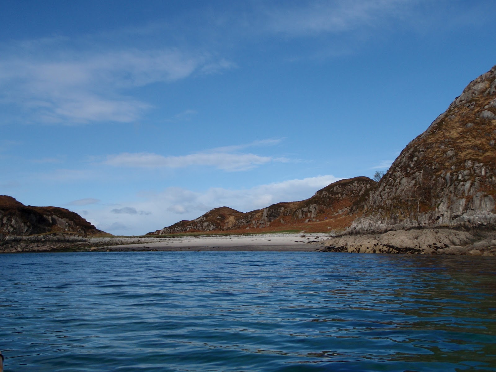
 We were on the water and away shortly after noon and enjoyed a leisurely few hours paddle towards our first planned camp.  As we'd both had long-ish drives to reach Mallaig we had no intention of pushing hard to make distance, it just wasn't that sort of a day.  A light breeze from astern helped push us gently along as we paddle-sailed a shoreline alive with the sounds of Willow Warblers and echoing to the calls of Cuckoos.


Arriving at a camp we've used before is a bit like meeting an old friend; one looks for the subtle changes and reminisces about good times.  We were pleased to see not much had changed here and that the bracken hadn't started reaching up, making for a better range of pitches.  We got our tents up, enjoyed a coffee and then went for a walk.  Douglas and I both enjoy the off-water parts of a sea kayak trip as much as the paddling, exploring and just being in a place adds so much to the experience.


We climbed above the shore and through woods of birch and oak to a stretch of higher ground which had clear signs that this now deserted shore was once worked by a community.  "Run Rig" furrow marks were everywhere, testament to back-breaking work over generations to make something of the poor, acid soils by fertilising with seaweed and dung.


Croft houses, some little more than a gable or a "rickle o'stanes" dot the ground near the shore.  It's likely that the occupants had been moved from better agricultural ground inland to theses far edges to make way for sheep in the years of the Clearances.  The houses had a superb situation, but a view won't feed your family and this was subsistence living at the extreme with starvation an ever-present threat.


Near the ruins of a more substantial house was this tractor which is slowly being consumed by rust and the boggy ground.  We could make out that the engine was a Standard make, but little else - it would be fascinating to learn something of its story.

Just around here we were treated to one of the experiences which really make a trip.  Overhead we heard the distinctive "kyow-kyow" call of a White Tailed Eagle.  looking up we saw not one but two birds flying purposefully overhead.  But things got even better; a third, absolutely huge eagle (an adult female we think) launched from a nearby crag and engaged the two overflying birds.  Twisting in mid-air and presenting its talons seemed to intimidate the two birds which flew quickly off.  Then the third bird was harried relentlessly by a pair of Ravens which mobbed it all the way back to the crag - it was a great wildlife spectacle!


It was only four or so hours into our trip but already it felt that we'd been amply rewarded for making the effort to get out!  Returning to our camp we gathered driftwood and some fallen birch branches for a fire and started to think about getting dinner prepared....

Thursday, 24 May 2012

Rock art, Loch Nevis

Whilst collecting firewood during a recent trip near the head of Loch Nevis, Dave and I came across an outcrop of rock on the shore which had bee smoothed by wave action. I went back early the following morning to see if I could capture some of the graceful patterns.


I'm not sure of the rock type, it's mainly a grey crystalline rock which has been polished by wave action like a huge pebble.  The whole outcrop had folded strata of paler and darker rocks running through it.  These strata were often just a few millimetres thick and formed swooping patterns where they'd been exposed.


Formed, I'm guessing, by heat, folded by immense pressure then sculpted by water.  Random elements, but the result was truly striking and graceful.

Monday, 16 April 2012

A blessing in the Loch of Heaven


Continuing along the north shore of Loch Nevis (the name is possibly derived from the Gaelic for "heaven") I landed on the shore at Inverie Bay. I'd planned to land near high water to avoid a long portage with the boat as the tide recedes some distance in the shallow bay, though I'd brought a trolley just in case.

Inverie is the most remote mainland village in Scotland and is accessible only by sea or on foot over one of the mountain passes in one of the roughest areas of the country.  The land around the village is now owned by the community and managed by the Knoydart Foundation.  The foundation was set up to effect the community purchase of the estate made possible by the Scottish Government Land Reform Act.  It's been a great success story and is a fine example of why land ownership in Scotland matters so very much.

We stayed at the Foundation Bunkhouse, which is both comfortable and well equipped.  I was met by the warden, Anna, and shown around.  Dave and I had stayed here just after the bunkhouse opened and the progress has been considerable.


On my way into the bay, I passed this strange sculpture which is semi-immersed at high water.  It seems to be a figure and made of a single piece of wood.

After a meal and a couple of beers in The Old Forge (Britain's most remote mainland pub), we walked back  in heavy rain, counting our blessings that we weren't returning to wet tents.

We were even more glad we weren't camping when we woke to snow showers!


Dave, Karen, Diane and Andy still had three days of their backpacking trip to go, but for me this would be the last day.  I paddled across the bay towards the entrance of the loch, only realising how much snow had fallen overnight when I could see through to the bigger hills.


Once the snow eased the sun warmed things a little and I passed close to the hulk of the "Serene", a Mallaig registered trawler which now sits in a corner of the bay minus her superstructure.


At Rubha Raonuill (Ranald's Point), a statue of the Madonna (marked as a monument on the map) seems to offer a blessing to those entering the Loch of Heaven.


Certainly the bay and beach she stands above are a small piece of earthly paradise.

All is not completely heavenly in Loch Nevis though; there are a couple of quite large fish farms along the south shore.  There are deep divisions in the Highlands between those who see the salmon farms as a source of employment in a harsh economic location and those who point out that the industry is far more polluting than it should ever be.  Loch Nevis was the first recorded site in Scotland where Infectious Salmon Anaemia was recorded in the 1990's.


Once out of the shelter of the loch I was exposed to the north wind and the resulting swell coming down the Sound of Sleat.  I had a bouncy and entertaining ride back in a beam, then quartering sea.

Entering Mallaig, the bustle and activity of a working port were a contrast to the previous couple of days.  My drive home was also entertaining; several roads were blocked by heavy snowfall as winter made a temporary return to the Highlands.  It had been a good little trip, and good to share part of my friends adventure.

Saturday, 14 April 2012

Exploring the sights of Loch Nevis


The overnight rain ceased at 7am sharp and the morning looked promising.  We planned to meet up again at Inverie in the evening, Dave, Karen, Andy and Diane would walk over the hill pass of Mam Meadail whilst I paddled along Loch Nevis.


The view back to the upper loch shows Ben Aden (hill of the face) to the left and the ridge leading to the summit of Sgurr na Ciche (peak of the breast) in the centre.  Sourlies lies at the head of a bay just to the right of this ridge.


All along the south shore of upper Loch Nevis are signs of former occupation, as here at Ardnamurach (perhaps height of the shellfish).  There was a small community here with a larger house and some smaller dwellings.


This ruined cottage was nearer the shore.  The ground here is now very wet but there are signs of former drainage channels and walls.


Some dwellings are grander than others!  This impressive building at the entrance to Tarbet Bay seemed to be unoccupied and in need of a little TLC.  What a place though....

On the way up the loch, through the mist and drizzle, I'd glimpsed a whale on the shore of the loch.  No, seriously.....


A whale!  Moby is a 30 metre, 60 tonne seagoing vessel comparable to a Sperm Whale in size and is the creation of Tom McLean, adventurer and owner of Ardintigh Outdoor Centre.

As I was taking a photo, Tom called from a window to invite me ashore for a cup of tea.  I spent a pleasant half hour chatting.  Tom rowed solo across the Atlantic in the 1960's.  Twice.  What a character!


Across the loch at Port Longaig (port of the longship place), a tiny inlet shows signs of a much older type of vessel.

The right hand side of the inlet was meticulously cleared of rocks to provide a "noust" or beaching place for either a longship or the lighter Highland version, a Birlinn.  A spike of rock had been driven into the earth above the noust to secure the vessel.  I wondered about the people who used this place; were they clansmen of one of the families along the west coast or effectively pirates?

Either way, they'd chosen a spot concealed from most angles and sheltered from the prevailing weather.  Their boat noust has survived many centuries after them.

Saturday, 7 April 2012

A loch with a lid on


On the first of a three day outing on Loch Nevis , I left Mallaig in cloudy, drizzly weather.  The boat was heavy with my own kit plus some resupplies for friends who were in the middle of a six night backpacking trip linking bothies in Knoydart and Morar.

For the first couple of hours visibility was poor; it was like paddling in a Tupperware box with the lid on.


Farther into Loch Nevis, the hills press in and the loch narrows at Kylesknoydart.  I'd planned carefully to arrive here before the ebb tide started with up to 3 knots of tidal stream.  The cloudbase had lifted somewhat and the drizzle had eased, making for more pleasant conditions. I had time to land on the shingle spit to collect firewood.  There was plenty and I paddled on with a very large bag of wood on the foredeck.


I soon arrived at the rendezvous, Sourlies bothy.  My friends had arrived shortly before and there were also other folk arriving.  I pitched my tent to ease space indoors and we unloaded the wood and supplies consisting of fresh milk, vegetables, and of course a couple of bottles of wine :o)

Dave and I scoured the shoreline and gathered another large bag of firewood; we'd not be cold in this bothy!

We shared a most convivial evening in the best tradition of bothying.  It was raining when I retired to the tent and continued to rain heavily right through the night as the "lid" once again descended on Loch Nevis.