Showing posts with label Furth of Scotland. Show all posts

Sunday, 18 December 2016

Pale shapes beyond the Pale

Whilst working in the north west of England, a Saturday afternoon with the promise of dry and bright winter weather tempted me to look for walking locations.  As the area was unfamiliar, nearby Delamere Forest looked a good place to start.  The bright sunshine and clear air at the coast were replaced by dense mist as I drove to Delamere, obscuring the sun but lending great atmosphere.

As expected, most of the trails were busy with families enjoying the dry conditions and escaping the madness of pre-Christmas retail pressure, and with dog walkers and cyclists.  It's good to see the forest so well-used, although there wasn't much of a sense of solitude.

Having walked the longest of the trails around the forest and its glacial relic lake, I decided to extend my walk to take in another trail which led up and over Old Pale, which as the name suggests was once fortified, as was nearby Eddisbury Hill.  Old Pale forms the highest point of the northern part of a long sandstone ridge above the Cheshire plain.

Seven counties are visible from the 176m/577ft summit, marked by a sandstone monolith surrounded by stones representing the seven counties.  On this misty day, not even one county was visible though!  A cloud sea just below the summit extended to the horizon in most directions, but offered an atmospheric descent....


Shifting mist brought trees in and out of focus; pale shapes looming from the grey and then disappearing again.....


A slight sinking of the cloud sea allowed the shapes of winter trees to stand out in sharp silhouette, all the more marked as I'd been in mist for several hours.


As the sun dipped towards the skyline the lowering rays made for a very atmospheric winter scene- a small effort to make time for a walk had been amply rewarded.

Friday, 8 April 2016

The Roseland Peninsula - St Just to St Mawes


Continuing my walk exploring the Roseland peninsula, I arrived in the village of Portscatho in a particularly heavy rain shower.  As I headed inland from the village the rain passed and a burst of sunlight brought out the colours of land, sea and sky to great effect.  My plan was to cross the peninsula using country lanes and farm tracks in order to walk back to St Mawes - the ferry timetable dictated that my pace would need to be fairly brisk....


But having arrived at St Just in Roseland, I made time to slow down and visit the parish church. Situated on a tidal creek in a very sheltered spot, the church is at the base of a steep bank, and the churchyard is one of the most remarkable anywhere.  Part cemetery, part semi-tropical garden, it's an incredibly beautiful, unique and when I visited, peaceful spot.  the church is however, one of the most photographed in Cornwall and must get very busy in the summer.

There was plenty of evidence of the early spring here - the view down to the church tower was framed by the flowers of a large Magnolia - in almost full flower before the end of March.


The church of St Just in Roseland dates from the 13th century and is built on the site of a Celtic chapel and was served by Celtic clergy from nearby Lanzeague for the first 400 years before being taken into the Saxon, bishop led, church.  Cornwall and the French region of Brittany have a shared Celtic heritage which is fiercely preserved with distinct language and customs.  A 19th century vicar planted many of the exotic trees and plants which today make this a very special and unique place.  Along the path edges there are many granite blocks inscribed with biblical verses, at this time of year surrounded by masses of Primroses.


Having lingered at the church I pressed on down the western edge of the Roseland peninsula.  A path goes through farmland just above the shore here but after a spell of wet weather it was incredibly muddy and I ended up abandoning the path to walk and clamber along the rocky shoreline itself - which proved a bit more strenuous but a lot less messy!  I arrived at St Mawes in good time, and in a burst of warm sunshine.  As I'd walked close to 25 km and had a half hour to spare before the last ferry, I felt that some refreshment would be in order, and so......


....repaired to a suitable purveyor of refreshments and sat in the sun to enjoy.....


...a frothing Sports Recovery Drink......


The ferry "Duchess of Cornwall" arrived right on time and soon I was crossing back to Falmouth, reflecting on a great day's walking.  If the Place ferry is running, this is a walk well worth the effort - starting at either Falmouth and using two ferries, or at St Mawes using just the Place ferry.  Shorter loops can be walked too, based on either St Mawes or Place.

My thanks to Sam, skipper of the "Duchess of Cornwall" for going out of his way to drop me at Place on a day when the small ferry wasn't running.

Tuesday, 5 April 2016

The Roseland peninsula - a Place apart


Whilst working in Cornwall I've managed to do some coastal walking based around the town of Falmouth.  One stretch of coast I'd particularly wanted to explore was the Roseland peninsula, but not having use of a car this involves two ferries.  A couple of attempts to reach the area were unsuccessful due to winter ferry timetable restrictions or windy weather preventing the smaller ferry running.

On a bright and breezy day the plan came together.  I caught the ferry from Falmouth to the pretty village of St Mawes, and although the smaller onward ferry wasn't running, the skipper of the "Duchess of Falmouth" kindly dropped me at the landing point on the Roseland - a place called Place.  From near Place, theere's a lovely view back to the neat white houses of St Mawes.


The coastal path passes behind Place House, through a churchyard containing a mediaeval stone coffin......


...before crossing farmland to the shoreline with a view to the lighthouse at St Anthony's Head.  Built in 1835, this light marks the eastern entrance to the large natural harbour of Falmouth - Carrick Roads.  It was originally lit by Argand lamps, then by pressurised vapour (the former paraffin store is near to the path) before being converted to electricity in 1954.  The light flashes white once every 15 seconds, is visible for 22 miles, and contains a red sector to warn shipping of the Manacles rocks.  As there are no longer any lightkeepers, part of the building can be rented as holiday accommodation.


Also protecting the entrance to Carrick Roads, which is one of the largest natural harbours in the world, are the remains of these gun emplacements - a view indicator sited where the guns would once have been.


The coast path from St Anthony's Head to Portscatho is a pure delight; a path winding along the cliffs above a wild and in most places inaccessible shoreline.  The weather on my walk alternated between bright sunshine and intense, lancing showers of hail and rain - it suited the scene perfectly.


 Conditions have been so mild in Cornwall through the winter of 2015-16 that it's hardly been a winter at all.  Daffodils flowered in late January, and on the last weekend of March the Primroses were well in bloom.  Quite a contrast to home in Aberdeenshire some 700 miles north!


Towan Beach was sheltered from the wind and pleasantly warm inbetween the showers; a couple of hardy souls were even taking a swim.  It was tempting to linger, but I had the ferry timetable firmly in my mind - I needed to be back at St Mawes to catch the last ferry to Falmouth, departing late afternoon, so reluctantly pressed on.

Monday, 17 March 2014

The remarkable plant communities of a Florida saltmarsh

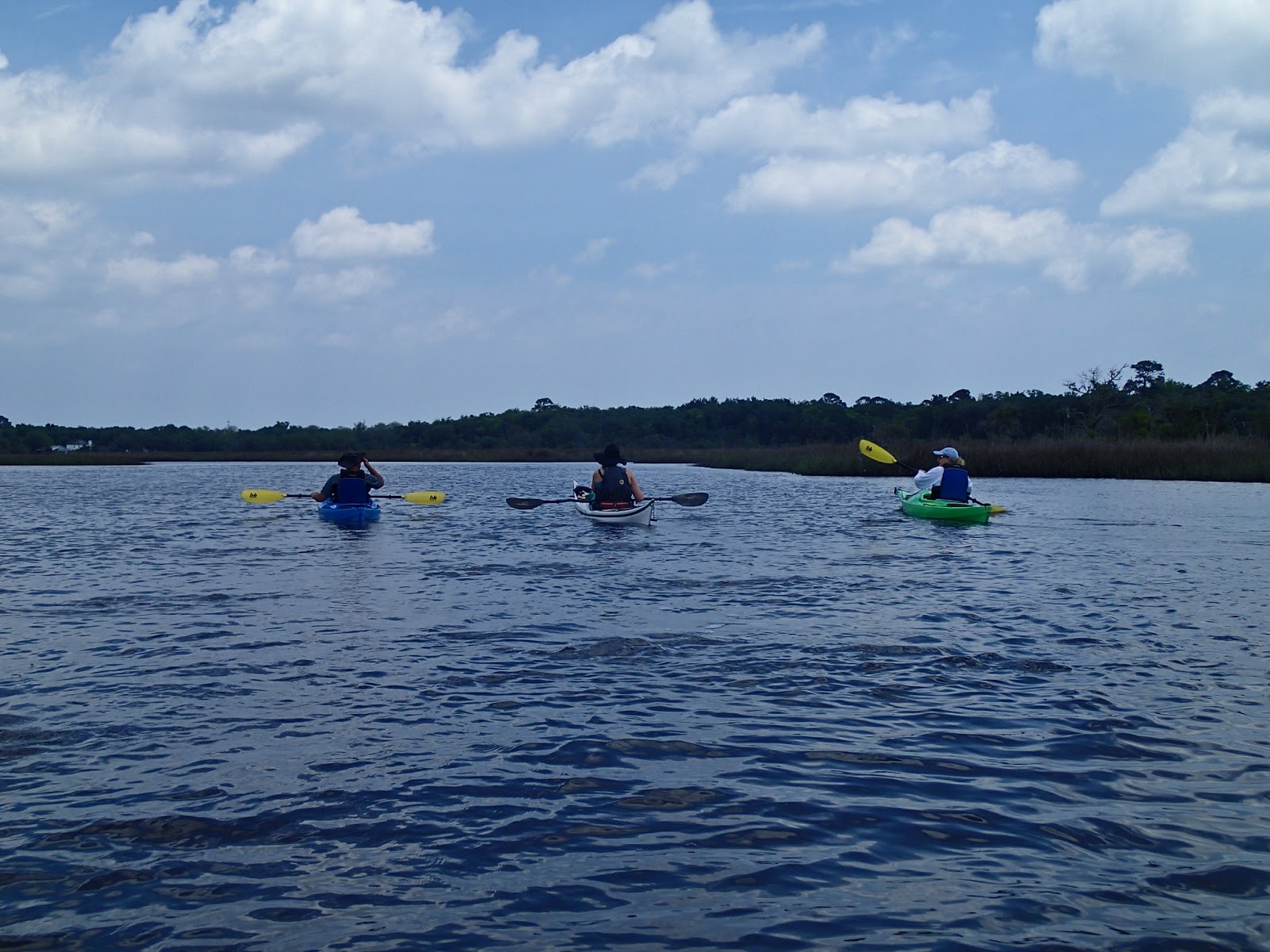
Our journey through the saltmarsh channels around Dutton Island was full of interest, but perhaps the most fascinating aspect was the remarkable plants which inhabit this ecosystem.


Seb resting with the stern of his kayak in the Spartina grass (Spartina alterniflora).  The dense stands of this grass appear, at first glance, unremarkable......


 Our guide Matt is highly knowledgeable and has a real passion for this environment.  He explained that the Spartina Grass is a "keystone" species, one which actively alters its environment.  The development of a saltmarsh is dependent upon seeds of the grass floating to a place where it can take root.  It spreads asexually by rhizome systems and, over thousands of years, builds up a dense matrix of vegetable matter which in turn allows sediments and mud to build up, eventually forming areas of drying ground.

Any species in a coastal marsh has to be incredibly tough, tolerant to salt, wind and extremes of both moisture and temperature.  This colonising species allows the growth of other less tolerant plants and, eventually, dry land which can support stands of trees.  The trees provide nesting sites for many of the birds in the marsh as well as opportunities for land animals.

Below the water, the shelter and diminished flow allows the deposition of mud, perfect for the rich invertebrate life of the marsh and for Oysters.  The oyster beds filter the rich water and also provide a barrier to damaging storm surges.

All this from an unremarkable looking grass!


Along the edges of one of the man-made channels adjacent to the marsh the raising of the spoil banks has provided a leg-up for a surprising variety of trees, including Junipers adjacent to small Palms.


The trunk of a long-dead pine made a striking shape, and was drilled with holes drilled by a woodpecker, the standing dead wood still a valuable part of the whole ecosystem


Back out along the Intracoastal Waterway, we stopped on a tiny beach for a short break.  A fallen tree here gave us a close-up view of another remarkable plant which festoons trees, particularly Live Oaks all across north Florida - Spanish Moss (Tillandsia usneoides).

It isn't Spanish in origin, nor is it a moss.  Resembling "old man's beard" lichen found in norther boreal forests, it isn't a lichen either.  This fascinating flowering plant is an epiphytic species - it takes all its nutrients and moisture from the air and from rainfall. Related to Bromeliads, the plant forms hanging pendants up to 6 metres long and does particularly well in the high humidity of Florida.  It doesn't harm the host tree, merely using it as a frame on which to grow, though sometimes the weight of Spanish Moss pendants can break off branches from trees.

The saltmarsh of Florida is a superb environment, and home to some truly remarkable plant species.  I'm very grateful to Matt for sharing his deep passion for and knowledge of this special place.

Tuesday, 21 May 2013

Warm water and white sand - Florida's Fort George River


We paddled steadily onward down the Fort George River, which is unusual in having State Parks on both banks. 


The water is shallow and warm, the river is a dynamic environment of shifting sandbars edged with saltmarsh habitats.


This was a fun trip!  Those who hadn't paddled previously were able to relax and enjoy our journey in sheltered water.  Iain had a huge grin all day - even after an unplanned swim whilst enthusiastically practising turns.......  :o)


We paddled under the bridge which carries the A1A  road.  The tidal stream was running nicely under the bridge and gave a bit of easy moving water to play in.


Once past the bridge we turned north along the course of the river, which is protected from the Atlantic Ocean by a long sand spit.  Near the end we pulled up onto the white sand for a break.  This far out along the sand we shared it only with gulls, waders and Pelicans.


We had a great time swimming in the warm water and playing balance games in the boats.  Two of our group, neither of whom had sat in a kayak previously, managed to do 360 degree shuffles on the back deck, and to stand up in the boats -  great stuff!


 Joe demonstrated sculling for support, with a Florida twist - no spraydeck.....   Supporting the flooding boat was a most impressive effort


A happy group of British paddlers on a warm Florida beach  :o)


Our journey back to the boat launch at the Ribault Club was speeded by a breeze at our backs and a bit of tidal assistance.  

We'd like to thank Joe and Hennessy for a really enjoyable day.  If you're visiting north Florida, we can thoroughly recommend a trip with First Coast Outfitters!


Sunday, 19 May 2013

Florida paddling on the Fort George River


 On a gloriously warm morning I met up with eight work colleagues and we set off to the St Johns River ferry.  This was a fairly early sailing and at first we thought we were the only passengers....


But as sailing time approached the vehicle deck filled up with people out to enjoy a sunny weekend in all sorts of transport.  We were headed to Fort George Island State Park, just to the north of Jacksonville's St Johns River to meet up with Joe from First Coast Outfitters


The meeting point was at a boat launch adjacent to the very impressive colonial style Ribault Club, a playground for the wealthy citizens of Jacksonville in the 1920's. 


 A useful small beach with a parking area gives access to a section of the Fort George River.  We met up with our fellow paddlers and with Joe and Hennessy, our guides for the trip, for a safety brief and stretching session....


Before getting fitted comfortably into our boats.


Off to the side of the boat launch, a muddy bank was home to large numbers of Fiddler Crabs (Uca spp), the males have one claw much larger than the other which they use to signal to females by elaborate waving and acoustic drumming displays.  These fascinating creatures can also regenerate missing limbs!


Sun cream applied and boats sorted, we got set to launch....


And headed out on sparkling water to the Fort George River

Thursday, 16 May 2013

Saltmarsh paddling at Dutton Island Preserve, Florida


During a visit to north Florida, I got an opportunity to sign up for a paddling trip with First Coast Outfitters of Jacksonville Beach.   I joined a local family for the trip, meeting up at Dutton Island Preserve on a beautiful sunny afternoon.


Following a safety brief from our guide, Rachel, we headed off out into the open water of the Intracoastal Waterway .........


before turning off into a series of channels which wind among the saltmarsh environment.  The water was shallow and warm, and bird calls the predominant sound.


As we rounded the end of Dutton Island a shrill calling alerted us to a pair of Ospreys at their nest.  We moved along to avoid disturbing the birds, a really rare species in Scotland but very numerous here in Florida.


At the furthest point of our paddle we passed through a tunnel under the access road to the island - I think this may well have been our youngest team member Owen's favourite part of the journey!


After paddling through some narrow and shallow channels containing oyster beds (which needed to be carefully avoided), we entered a wider channel which had been dredged to provide an access route when development of this pristine environment was being actively pursued.  Fortunately, a community campaign resulted in the area being made a nature preserve, accessible to all.


Rachel has a wealth of knowledge about the history and wildlife of Dutton Island, and she added enormously to the experience by pointing out things we would otherwise have missed.  This Great Egret was very unconcerned by our presence, but other species we saw were more retiring.


As we approached the end of the paddle, and back on the Intracoastal Waterway, we were treated to an appearance by three dolphins feeding close to us.  It was a really great finale to a great day; and what a change to be paddling in T-shirt and shorts rather than a drysuit! 

Monday, 11 April 2011

A colourful day on the Dorset cliffs

Whilst I've been at work, I've had a few opportunities to explore the Dorset coast on half day walks.  It's a surprisingly wild coast in parts and very varied.  In superb Spring weather yesterday, the walk along the stretch from Bowleaze to the White Nothe was truly beautiful.  The air was alive with birdsong, and I had my first view this year of a Common Sandpiper - the migrants are arriving in force.

The view to the east was truly exceptional


The chalk cliffs of this part of the coast were dazzlingly white and contrasting superbly with a calm and very blue sea.  This is the view from the headland of White Nothe looking over Bat's Head and Lulworth to the distant Purbeck Hills.  The top of the detached arch of Durdle Door is just visible immediately beyond Bat's Head, which itself has a small arch


Looking down from the cliffs, the water was clear enough to see every detail of the reefs.  I sat in the sun, enjoying the warmth and thinking what a great day it would be for sea kayaking.  As if by magic....


First a double kayak passed, the air so still that I could clearly make out the voices and paddle splashes way below


And then four brightly coloured singles passed, all heading west toward Ringstead..  I lost sight of the lucky paddlers as they passed Ringstead, maybe heading to Weymouth.  They (and I) were treated to a great day, a real hint of the summer to come.

I fairly caught the sun, my face was glowing during the eveening - one more colour to add to the day!