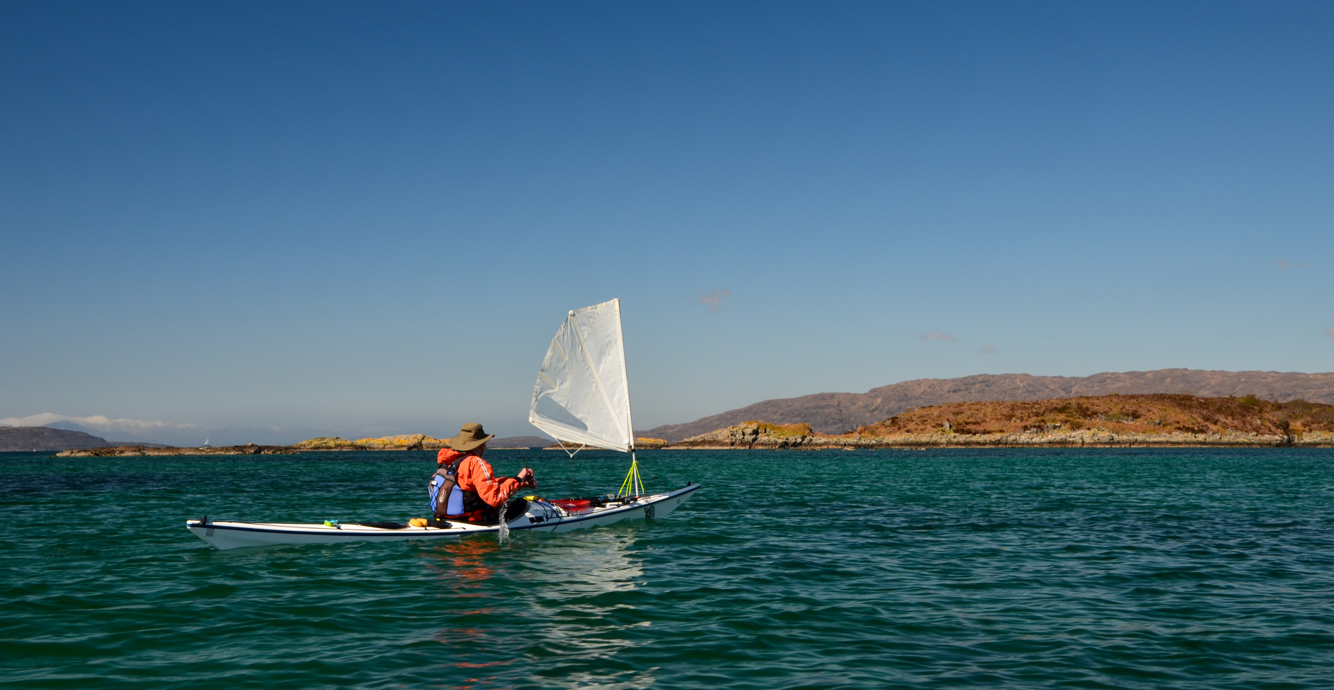
Showing posts with label Skye. Show all posts

Tuesday, 20 September 2022

Pinned on Pabay

The morning weather was as lovely as the evening had been, clear and calm.  The view to the Cuillin of Skye was our constant companion on this trip and one of the highlights with changing light and angles subtly altering the colour and form.  We've all got great memories of climbs on that great arc of ridge - exhilarating and sometimes downright frightening!
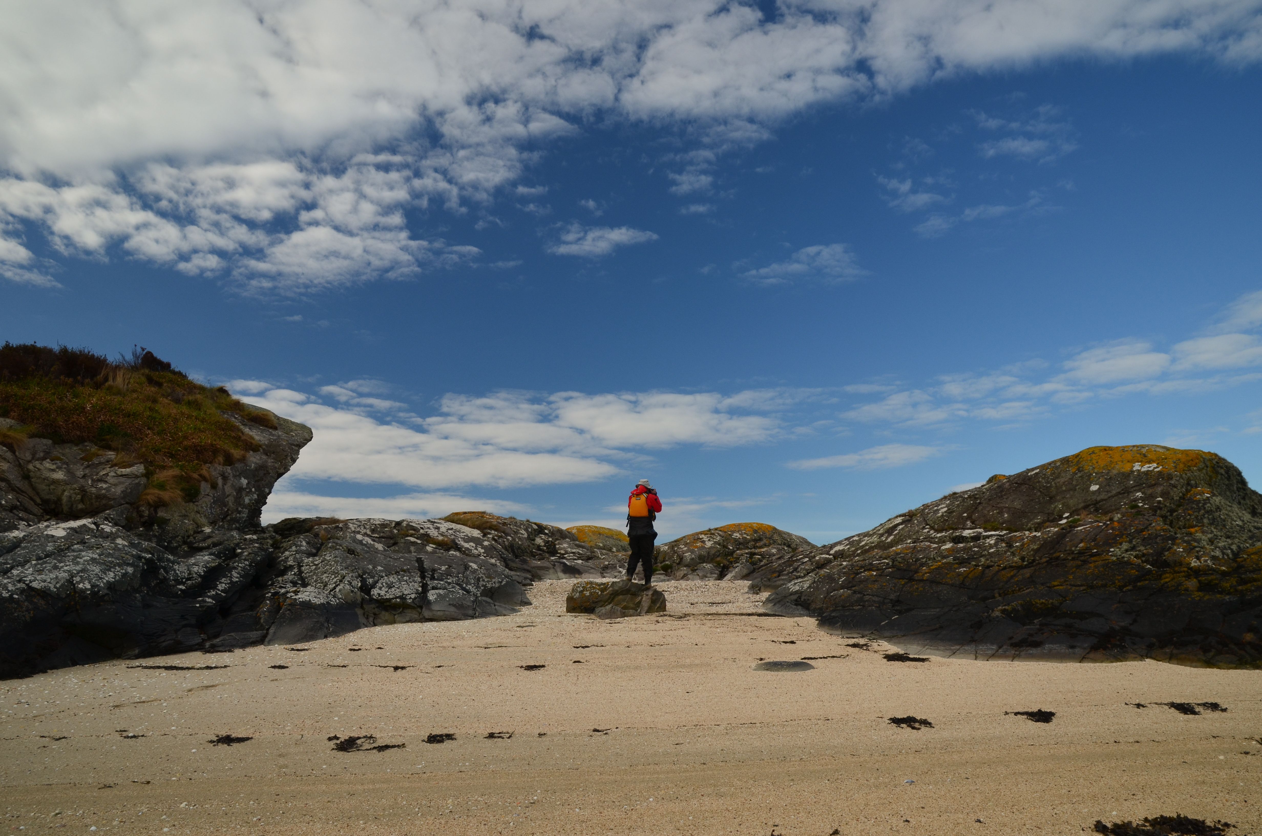


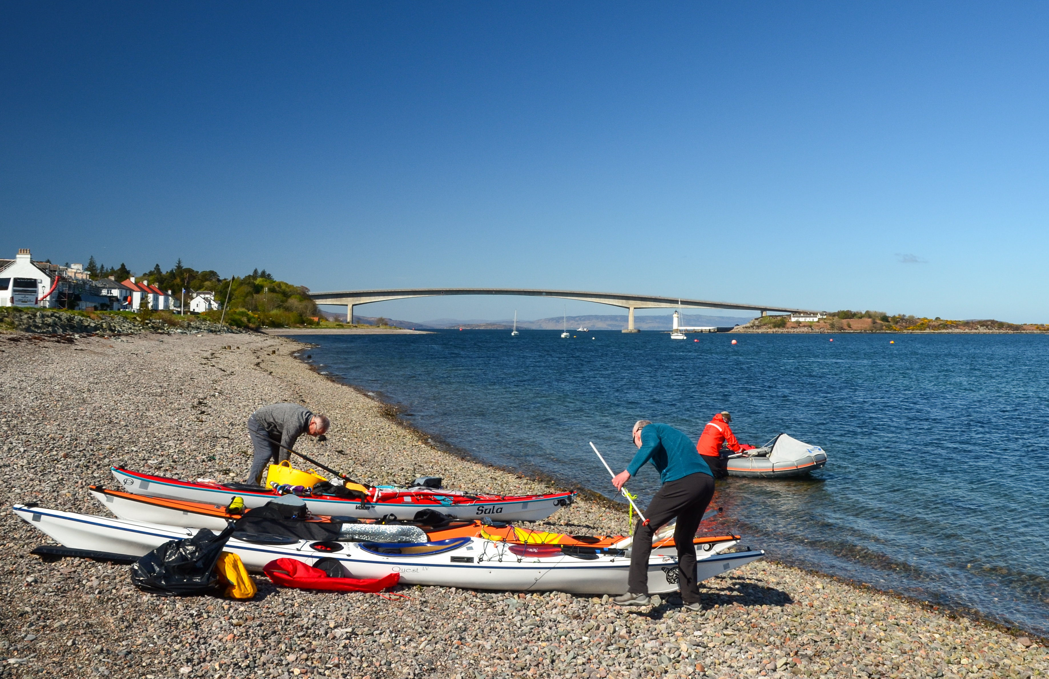
We had a leisurely breakfast and got on the water - within a few minutes we were back ashore on a tiny island with a "now you see it, now you don't" sandy beach which disappears at higher states of the tide.  We'd wanted to stop here because it's rather a fine viewpoint; the first image in this post was taken from the beach.
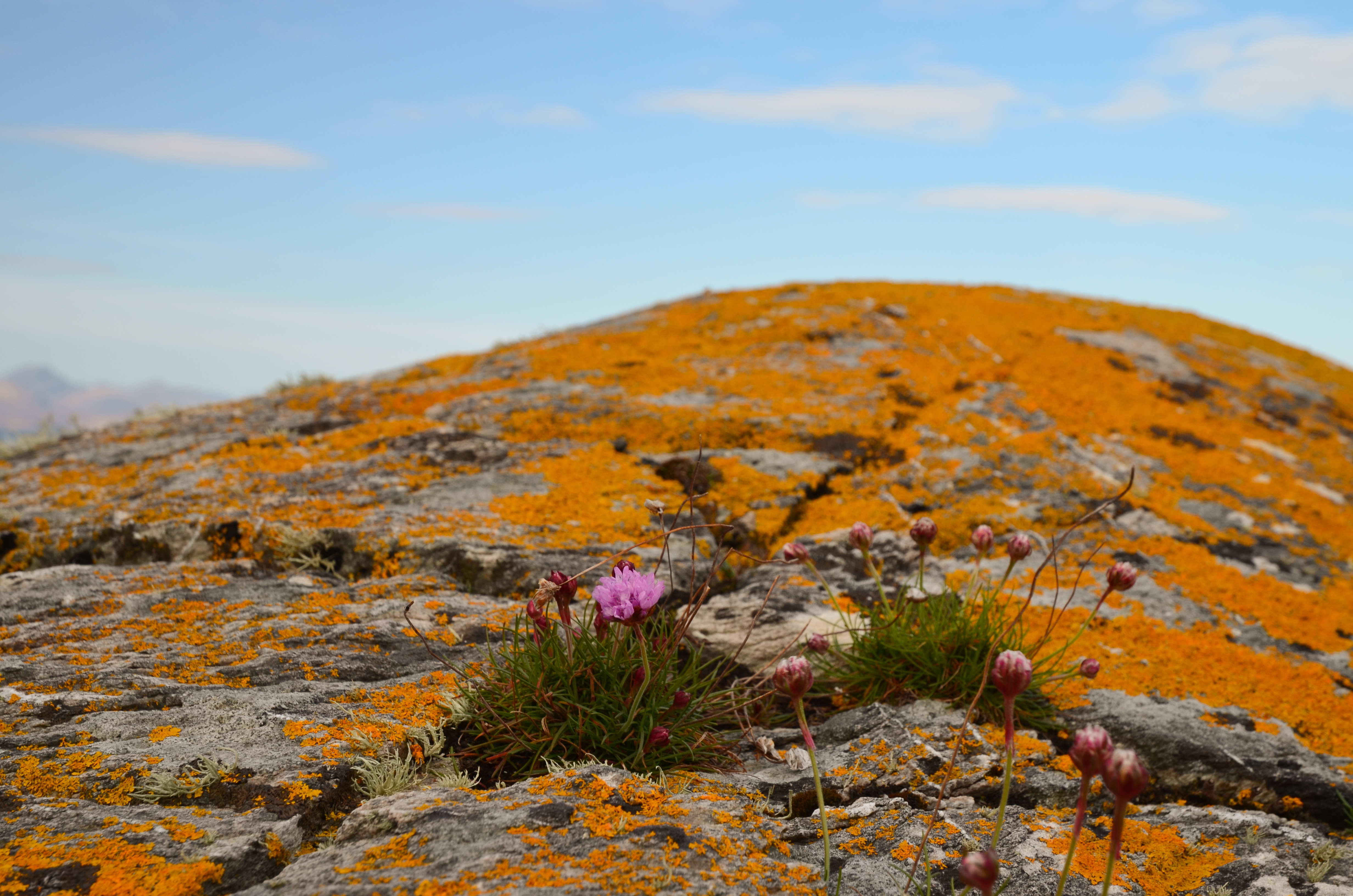


The view near to hand wasn't bad either - vivid orange lichens glowing in the morning sunshine, set off by a few Thrift flowers.


Orange seemed to be the theme of the morning; we returned briefly to Kyleakin to collect some things and whilst preparing to get back underway we noticed a bright orange vessel passing under the Skye bridge.


She's the "Mikal With", a 67 metre long palletised cargo vessel.  On most marine vessel websites she has a blue hull and a different owner than recently.  She's either owned or on charter to MOWI, a Norwegian aquaculture company.


We set out again from Kyleakin and aimed for the island of Pabay, which we intended to use as a stepping stone on our way to an intended camp on Scalpay.  The breeze had been slowly building and once clear of Kyle Akin it became quite strong from straight off the Skye coast (our port quarter).

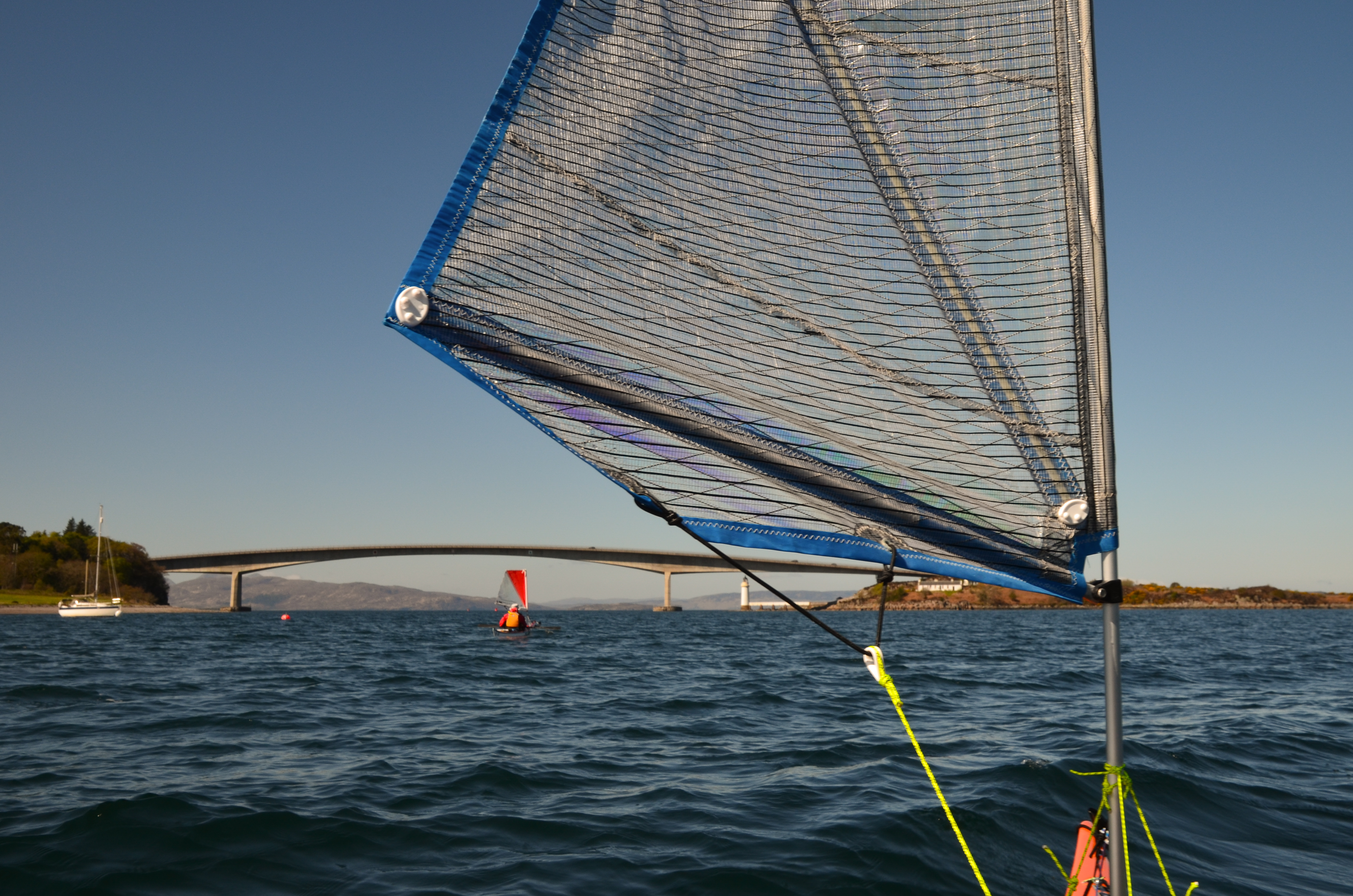
We put our sails up to take advantage of the push and were absolutely blasted across towards Pabay.  I found this a really great sailing run, but was certainly not prepared to stop paddling in order to take photos!  Our average speed on this blast was 9.4km/h, or nearly twice cruising speed.....


Although a fast passage, it had been an energetic one - it is paddle sailing rather than just sailing!  We were all ready for a lunch stop by this point.


Approaching Pabay the wind seemed to ease  a little and we dropped our sails to paddle into the tiny harbour area.  Donny had motored along to Broadford in his F-RIB and made a direct crossing from there to Pabay; he had a pretty wet ride!
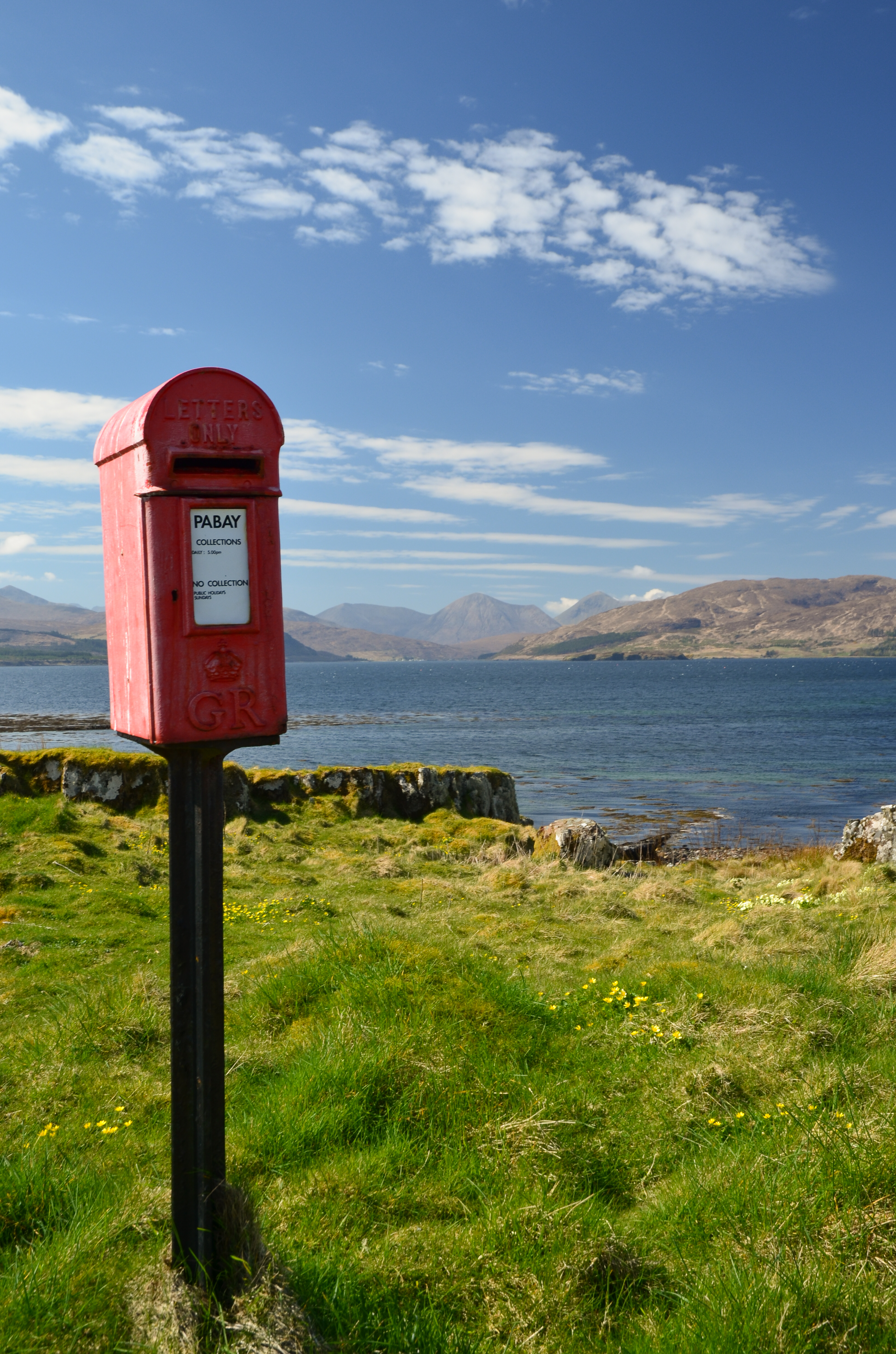


One of the iconic sights on Pabay (Norse: Priest Island) is this post box.  It seems incongruous since there are only a couple of houses on the island but is here because the island issues it's own postage stamps for mail which is transferred into the Royal Mail system in Skye (from where it needs Royal Mail stamps).


Sheltered from the breeze (which was becoming stronger) we lazed in warm sunshine, surrounded by clumps of Primroses.  The pale yellow of the flowers set against the blue of sky and sea was gorgeous.


Above where we lunched a pair of Bonxies (Great Skuas) watched us warily.  These impressive piratical predators had picked a nest site with a great view over the low lying island.


One of the features of Pabay is its geology which is shales intersected by dykes of harder rocks.  The whole island is almost flat and nearly doubles in size as the tide falls from high to low water, leaving the geometric patterns of dykes.

Another feature is that, despite being flat the island has virtually no wild camping spots accessible from the water.  The rock layers from a barrier and the softer rock gives good growing conditions for brambles and tangled low undergrowth.

This gave us a problem; we were pretty much pinned on Pabay.  The wind had continued to rise and in the Sound between Pabay and Scalpay was approaching a Force 6.  None of us was keen on trying the paddle across unless we really had to, but despite trying along the sheltered parts of Pabay by kayak we could find nowhere to camp.  We returned to the harbour to have a re-think.  Douglas and I walked up to the "big house" which is undergoing renovation by a new owner of the island.  We explained our situation and asked if we might camp near the harbour.  The Access provision in the Land Reform (Scotland) Act is wide ranging but does not cover access near to houses or infrastructure.  The owner was most kind in allowing us to camp for the night and it was really appreciated by us.


We pitched our tents in areas which wouldn't affect access to and from the harbour itself and found a spot out of the wind to cook dinner - preceded by fresh soup.  The day had been recovered but our plans would need to be altered.  The forecast was for the wind to drop almost completely by morning, so we decided on a paddle to the Applecross shore via the Crowlin Islands.


As the sun set, the wind came around a couple of points and seemed to drop by several degrees in temperature - it was pretty cold within minutes.  Dinner done, we retired to the tents (which we'd pinned very securely to Pabay) for an early night.
 

Tuesday, 31 May 2022

Over the sea from Skye


A spell of warm and sunny Spring weather is always so welcome here in Scotland - so when a run of fine days was forecast in the second half of April we made plans for a kayak trip.  Our starting point was to be Kyleakin on the Isle of Skye; and we met up on a sparkling morning.  Allan and I travelled from Aberdeenshire, Douglas from the Solway coast via Glasgow and Taynuilt, where he teamed up with Donny for the journey to Skye.  Our plan was very flexible....simply to spend some time kayaking around the southern part of the Inner Sound.

While we rigged our kayaks Donny got his F-RIB "Guppy" afloat and set off to do a little filming.  You'll be able to see the video of our trip on Donny's Youtube channel here.  


After the usual routine of boat packing and trying to make sure everything fitted in, we got underway and immediately put up our sails to catch a push from the north easterly breeze.  This stretch of water,  Kyle of Lochalsh or more properly Caol Loch Ailse (Strait of the Foaming Lake) has strong tidal streams, particularly at the narrow western entrance which is named separately as Kyle Akin (Haakon's Strait) - named for a Norse king who brought a huge force of longships through here and beached at Kyleakin on his way south where he would be engaged and beaten by a Scots army under King Alexander III on 2nd October 1263.


The building of the Skye Bridge altered the flows somewhat at Kyleakin and the strongest of the stream can be avoided by passing close under the eastern side between Eiean Ban and the mainland shore - that said it's still an energetic paddle against the tide!

We started on Skye and apart from a brief call back at Kyleakin didn't plan to paddle any of the island's coast on this trip - not so much "Over the Sea to Skye" as over the sea from Skye!


We headed north after exiting Kyleakin and stopped at Eilean a' Mhal for first luncheon. Sheltered from the breeze we sat in warm sunshine with a wonderful view across the Inner Sound to the hills of Beinn na Cailleach and Glamaig on Skye.  The colour in the water was marvellous and was the standout feature of this day.


Back underway and we continued north through the maze of the Black Islands, which today were anything but black - indeed there was a riot of colour.  This group of islands usually provides sheltered paddling in a compact area which changes from hour to hour according to the state of the tide.


Conditions were pretty good for early Spring - dry and bright with a north easterly breeze, and we observed this effect of cloud capping some, but not all, of the higher hills several times during our trip.


 As we left the Black Islands we paddled into the breeze and so dropped our sails.  After an energetic couple of kilometres of paddling we came into a lagoon with the most wonderful colour of water as the sun lit the white sand below our boats.  Really - could a day get any better than this?!

Wednesday, 26 May 2021

To hell in a hailstorm


After a chilly night, we woke to a lovely morning at our camp on the Sound of Sleat.  Handily, as it was Springs the tide would be fairly high in the mornings meaning that we'd only have a long carry with our boats at one end of each day of our trip.


The cool air was very clear and every colour was really "zinging" - Raymond's paddling attire of sea-blue top and grey trousers were in perfect colour coordination with the scenery!


A leisurely breakfast taken, tents down and final preparations complete, we had just a short carry with our heavily laden boats to the water.....


...and soon were off down the Sound in truly glorious conditions.


As we paddled south a view opened up through a gap in the hills to the Cuillin of Skye, the iconic skyline drawing both eye and memory - what days have been enjoyed on that ridge!


Our route took us south across the mouth of Loch Hourn which the previous afternoon had been whipped by a strong wind and raked by steep breaking swells.  No such issue this morning though as we paddled the 4km wide mouth in flat calm conditions.


A glance over the shoulder stopped us in our tracks as a more open view of the Black Cuillin opened up, the main ridge to the left with gars Bheinn prominent at the end of the ridge and the mighty Blaven with Clach Glas on the right.


After a coffee stop on the south shore we turned our bows inwards and headed along the south shore with the sun at our backs and a view across to Beinn Sgritheall (Scree hill) - one of the loosest mountains in Scotland to climb - it does what it says on the tin!


Conditions were very atmospheric, alternating between warm sunshine and chilling air as snow and hail showers passed.  Remarkably, we were missed by all of these through the morning.


After a lunch stop we paddled into Barrisdale Bay where Loch Hourn takes a twist and becomes very fjiord-like.  Initially it's difficult to make out the route through the Caolas Mor (big narrows) but it soon becomes clear as one approaches.  The channel is only a few metres wide and has very strong tidal flow; we'd timed our passage here carefully.  

Loch Hourn has a well-deserved reputation for fierce weather - indeed one translation of the name is Loch of Hell!  Situated on the edge of Knoydart which "enjoys" the highest rainfall  anywhere in the UK with annual totals exceeding 4.5 metres.  The loch's position sandwiched between high mountains, west facing aspect and narrow topography result in fierce winds and squalls....as we were about to rediscover!  Although the weather here can be superb for many days on end - that's not the norm.....


We arrived at the narrows just as a squall gathered at the head of the loch and swept down towards us.  Donny had already gone through in his F-RIB and pulled into the shore to sit it out.  Douglas and I were already into the throat of the channel, which is just a few metres wide, when all hell broke loose.  

The squall arrived with an instantaneous rise in wind and a frightening roar.  We simple bowed our heads into lashing hail and tried to hold position by paddling hard.  For fully ten minutes we were battered by wind, hail and spray - then just as suddenly as it had arrived, it passed.  We all gathered on the shore of the spit at Caolas Mor, a little battered and more than a little chilled.  We decieded that the best course of action would be to warm up by doing some more paddling and so got back in the boats and headed farther into the narrow upper loch.


 We made it as far as another narrows leading to the tiny Loch Beag and the road end at Kinloch Hourn.  This is one of the more remote spots in Scotland...although we were just 2km from the end of a road, that twisting, precipitous and narrow ribbon of eroded tarmac goes through totally empty country for fully 37km/23 miles before reaching a main road.  The ebbing tide was pouring out from here and the whole area dries out at low water - we could go no further.  Turning back, we headed down the ebb tide towards our intended camp site.

Monday, 25 September 2017

A two day Torridon tour - big sky morning


Sometime during the night I became aware that the rain had stopped and the wind had dropped away.  Early sunlight heating the tents prompted us to be up and about early, emerging into a bright morning.  Unfortunately, we weren't the only ones to be up and about early and we exited the tents straight into clouds of ferocious midges.  Usually they don't bite much in bright sunlight (see paragraph 2.6.2 in this paper), but the local population on this piece of Loch Torridon shoreline clearly hadn't read the paper!  We scrambled for our midge repellent and I straight away put on my suit of "midge armour" which made things much more bearable........


Though the midges were doing their level best it was still a lovely morning, and in a superb location. Packing was a little quicker than we'd have liked in order to escape the midge attack, which remarkably continued even as the day heated up. 


As soon as we were on the water and away from the shore we left the midges behind and were able to fully appreciate the morning....and what a morning!  Our position at the outermost part of Loch Torridon had sweeping views - to the west the Trotternish peninsula on Skye lay under an ever-changing cloudscape; while on the horizon we caught a glimpse of the long chain of the outer Hebrides.


It was the majestic cloudscapes (and not the midge attack!) which made the morning so memorable.  Towering cumulus would build over the land and then slowly subside in an ever-changing pattern, dissipating where it drifted over water and never really threatening rain.


We paddled eastward, into Loch Torridon and into patterns of bright sunlight and cloud-shadow.


Each time the sun emerged from the cloud pattern, the water beneath our boats was flooded with morning light, the colour and detail snapped into sharp focus by the intensity of the light.


As the morning grew warmer the cloudscape developed a heavier, more solid appearance, but still didn't really threaten rain.  The Skye shore was in shade, while here on the Torridon shore.....


...we basked in warm sun.  After an hour or so of paddling we decided on a second breakfast and landed on a beach of sandstone boulders.  Thankfully the midges seemed to have given up and we enjoyed a pleasant coffee break propped against boulders warmed by the sun.

Sunday, 26 February 2017

Just look around us.....


We landed on a white sand beach on the south side of Port Achad an Aonaich (probably port of the ridge field which describes it well).  This place has a number of names and in summer is popular for Outward Bound camping groups.  If the beach on the south side isn't to your taste, there's an equally beautiful white sand beach on the north side of the point!

We pulled our boats a little way above the high water mark and set up our tents - there's enough space to spread out here if required and the turf makes excellent ground on which to camp - except in wet conditions when the sand below the grass seems to stick to everything.


Having pitched our tents and carried sleeping bags and mattresses up from the boats we paused to take in the view - and what a view it is.  The Small Isles - Eigg, Rum and Muck (Canna isn't visible from here, being hidden behind Rum) lie to the west, while up to the north there was this glorious view of Skye beneath an arcing cloudscape.

The Cuillin ridge is prominent in the centre, lit by the late sunshine with a warm brown glow.  To the right, across Glen Sligachan are Bla Bheinn and a glimpse of Marsco in full sunshine.  To the left the west coast of Skye stretched away into the distance, rendered sharp in the cooling air.

Having made space in the boats, Douglas and I paddled back to the entrance of the North Channel and made a landing on the rocks to collect firewood.  We managed to collect a couple of bags and cut some sections of branch from a bleached dead tree washed up and wedged into the rocks.  This was the second visit I've made to this tree and what's left will require cutting with something bigger than our folding pruning saws!


The wind died completely and the sun began to set as Douglas and I made our way back. For a short while it seemed to us that the world held its breath - the only sounds were the occasional calls of shorebirds.  We slowed right down, it felt right to pause and watch rather than disturb the silence by paddling.


As the sun touched the horizon beyond Ardnamurchan Point a blaze of glorious golden light poured across the still surface of the sea.  Douglas had the vision to turn his camera away from the sunset and captured perfectly this transient and gorgeous light. Rays from the setting sun reached up and fired the base of the clouds.......


.....which began to glow in fiery shades.  We landed on the beach and joined Mike and Lorna who had climbed a little way up the point to get the full widescreen view from Ardnamurchan to Skye and beyond, all backed by the incendiary riot of sunset colour reflecting off the sea.  Lorna summed it up perfectly when she said "Just look around us......right now this is the best view in the world".

We cooked and ate dinner outside the tents, absorbing the view and certainly for my part thinking how incredibly fortunate I am to be able to enjoy experiences such as this.  After diner we gathered on the beach and lit a driftwood fire below the tideline....


...which burned bright as the embers of the sunset finally subsided some hour and a half after the sun dipped below the horizon.  The glow of the fire lit our conversation for several hours afterward as we reflected on the trip so far.  The morning would require just a short paddle, but the forecast was not good as the brief spell of settled October weather would be replaced by the strong wind and rain of an Atlantic low pressure system.

Thursday, 8 March 2012

A leisurely afternoon on Longay and Pabay


We regrouped on the east coast of Scalpay (Scallop Island); the wind had dropped and the sun was warm on our backs - this was more like it!

Most of the islands surrounding Skye have Old Norse names reflecting the Viking heritage woven into the history of the area.  We paddled eastward to the next island on our itinerary - Longay (Longship Island). To the northwest, the distinctive flattened summit of Dun Caan on Raasay came into view.


We landed on this small boulder beach on Longay's east side for first luncheon - the boulders on the lowest part of the beach were very smooth and slippy.  Longay was one of several islands utilised as  bases by pirates in the 16th century.

After a leisurely break we left Longay and made a crossing to the south, heading to Pabay (Priest Island).  By the 16th century priests had been replaced by pirates; Dean Munro in 1549 described the island as "full of woods, good for fishing and a main shelter for thieves and cutthroats"

The gently shelving reefs on the northwest of the island give rise to big waves in a northerly wind and swell, but no such excitement today.


We landed on one of the numerous boulder beaches and climbed up to some convenient slabs to take second luncheon.


Happy paddlers!


Fed and watered, we rock-hopped down the eastern side of Pabay and headed back over Caolas Pabay to the Skye "mainland".  A gentle southwesterly breeze was the strongest wind we encountered on the day.


One happy result of our leisurely pace was that the flood tide had filled the tidal inlet of Ob Breakish sufficiently to allow us to paddle direct to Gordon and Morag's back garden to finish our paddle with tea and coffeee.  Doesn't get better than that!


As we sorted out boats and kit, a very light shower produced a nice rainbow over the Ob.  We didn't need to go looking for gold; it had been a day and a weekend of memories to treasure.