Tuesday 20 September 2022

Pinned on Pabay

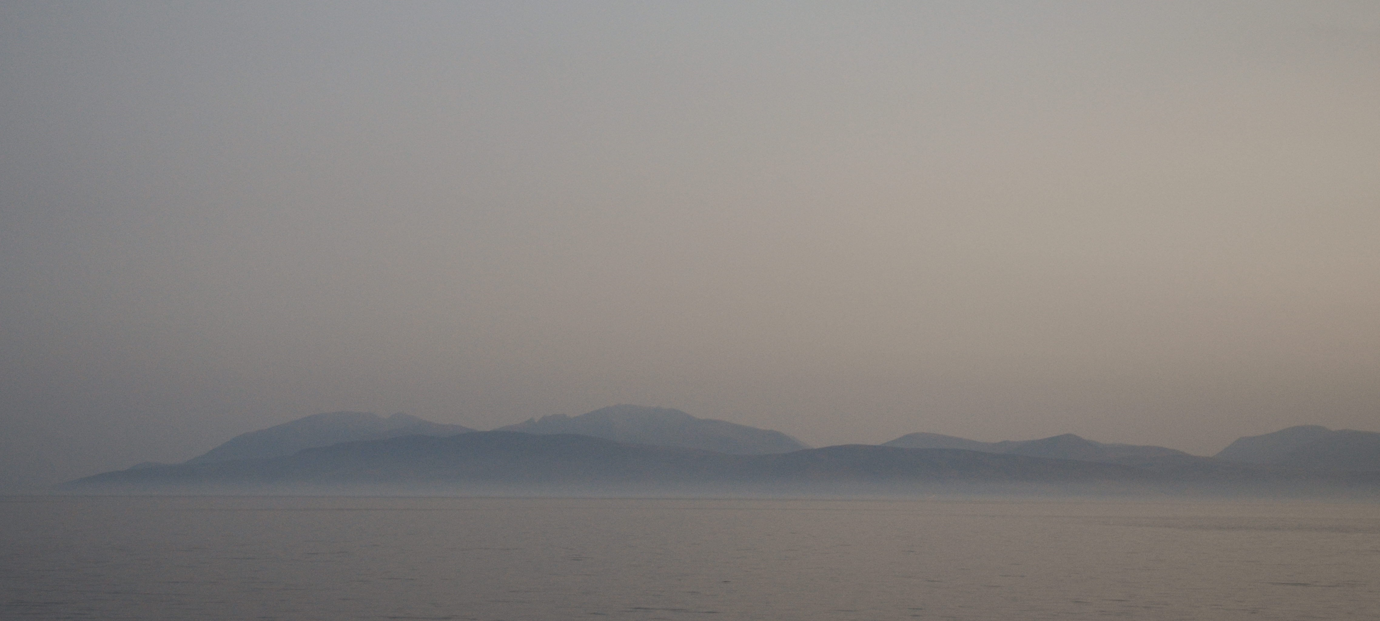
The morning weather was as lovely as the evening had been, clear and calm.  The view to the Cuillin of Skye was our constant companion on this trip and one of the highlights with changing light and angles subtly altering the colour and form.  We've all got great memories of climbs on that great arc of ridge - exhilarating and sometimes downright frightening!


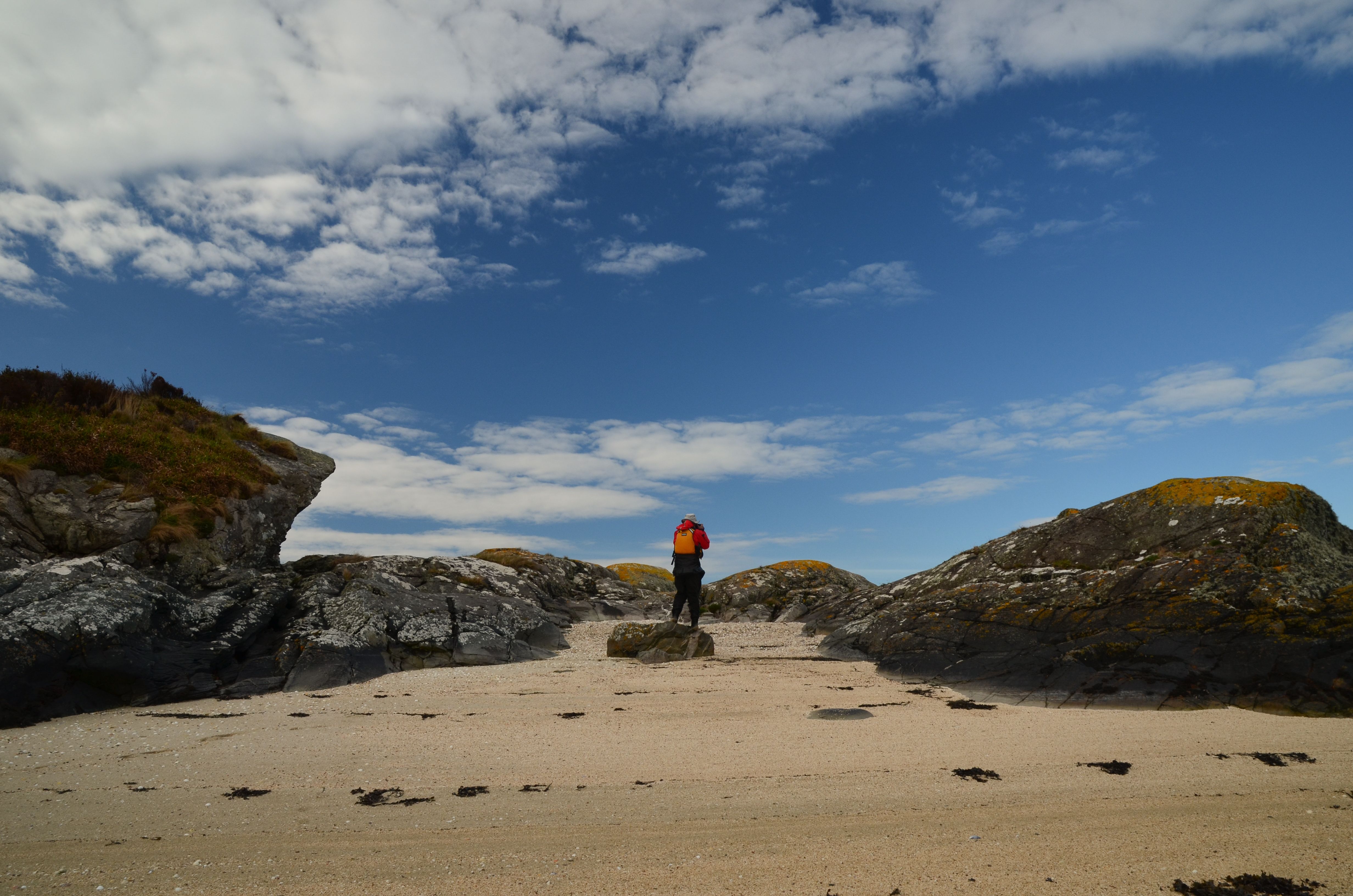
We had a leisurely breakfast and got on the water - within a few minutes we were back ashore on a tiny island with a "now you see it, now you don't" sandy beach which disappears at higher states of the tide.  We'd wanted to stop here because it's rather a fine viewpoint; the first image in this post was taken from the beach.


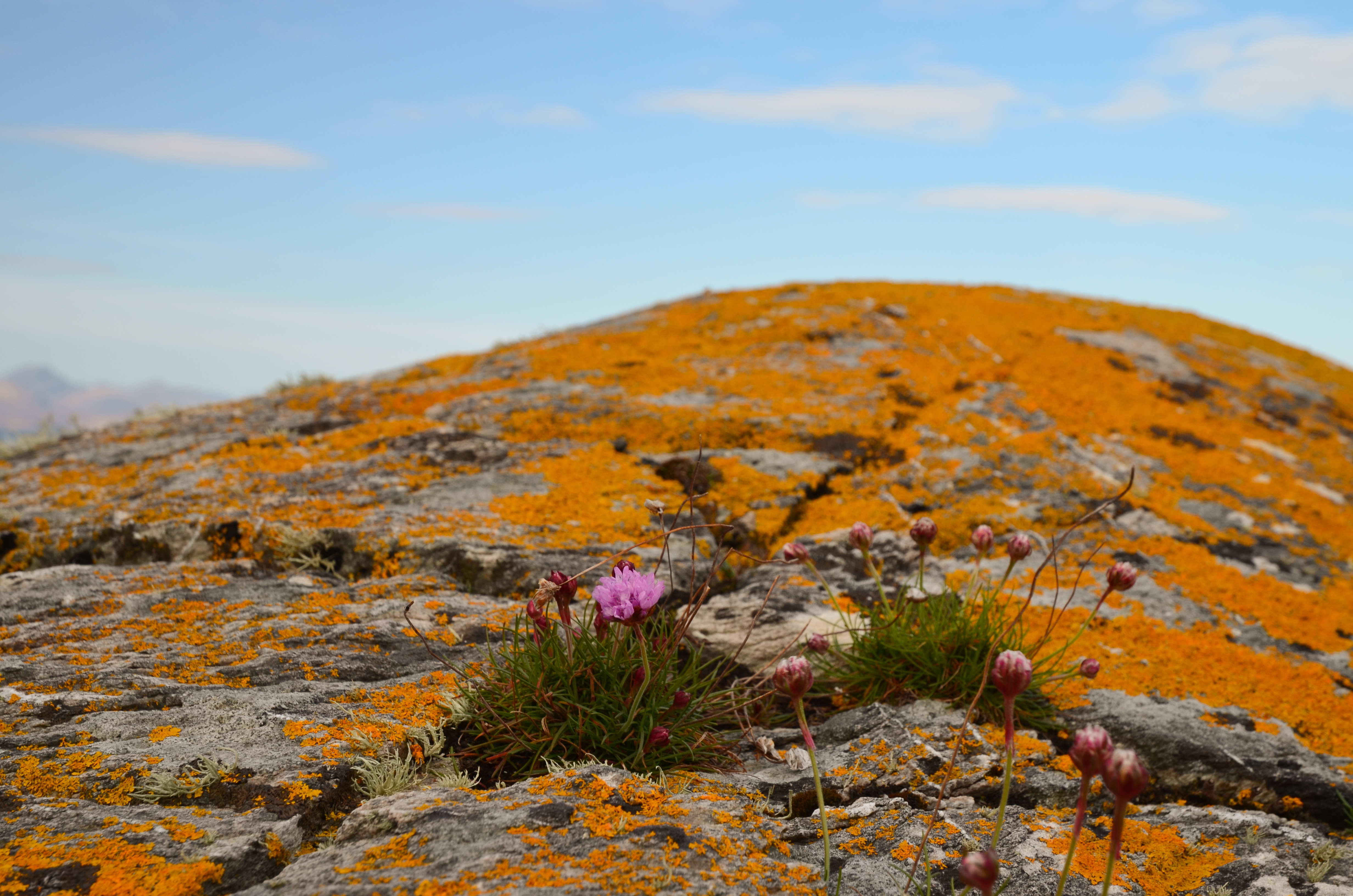
The view near to hand wasn't bad either - vivid orange lichens glowing in the morning sunshine, set off by a few Thrift flowers.


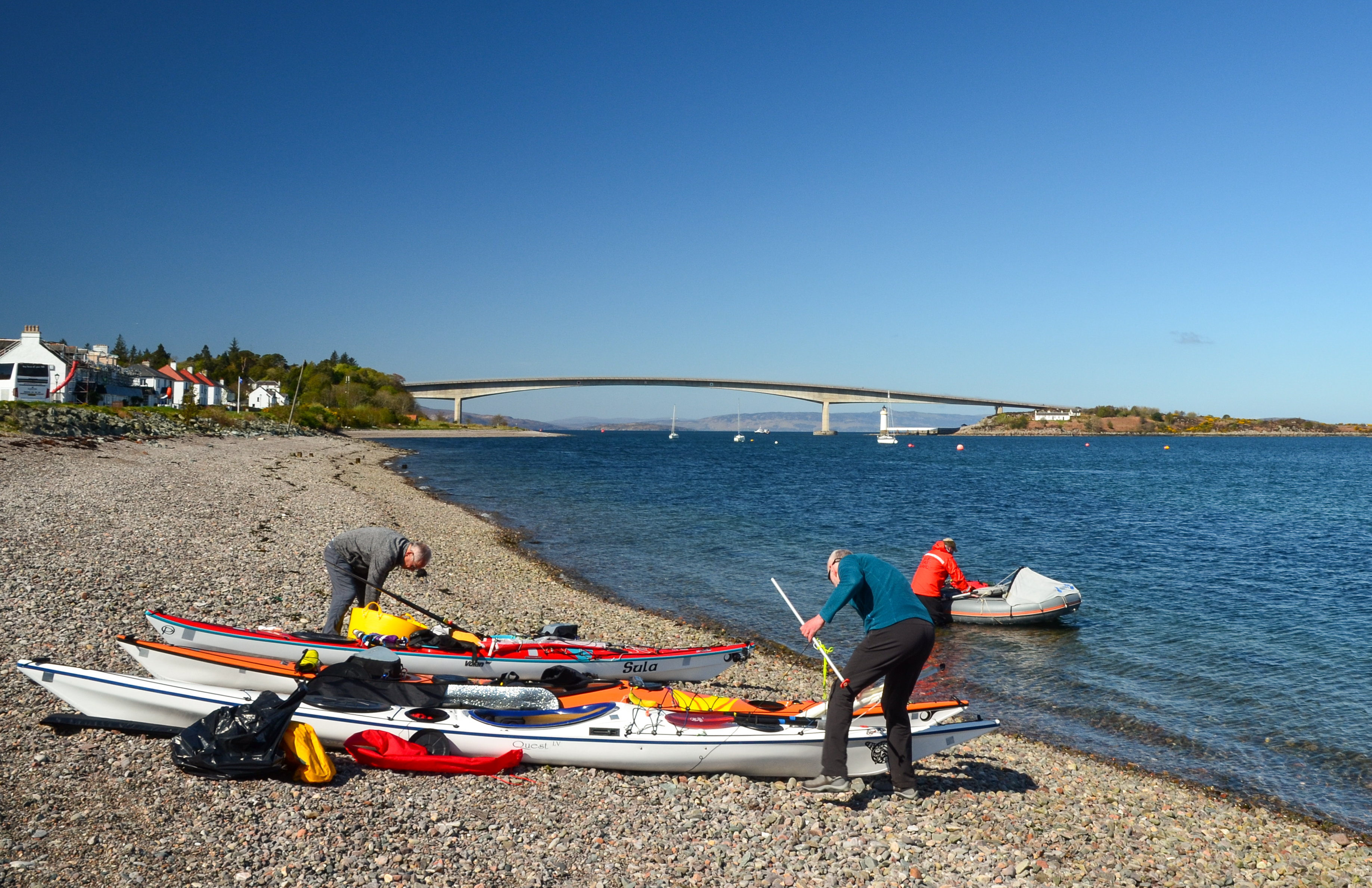
Orange seemed to be the theme of the morning; we returned briefly to Kyleakin to collect some things and whilst preparing to get back underway we noticed a bright orange vessel passing under the Skye bridge.


She's the "Mikal With", a 67 metre long palletised cargo vessel.  On most marine vessel websites she has a blue hull and a different owner than recently.  She's either owned or on charter to MOWI, a Norwegian aquaculture company.


We set out again from Kyleakin and aimed for the island of Pabay, which we intended to use as a stepping stone on our way to an intended camp on Scalpay.  The breeze had been slowly building and once clear of Kyle Akin it became quite strong from straight off the Skye coast (our port quarter).

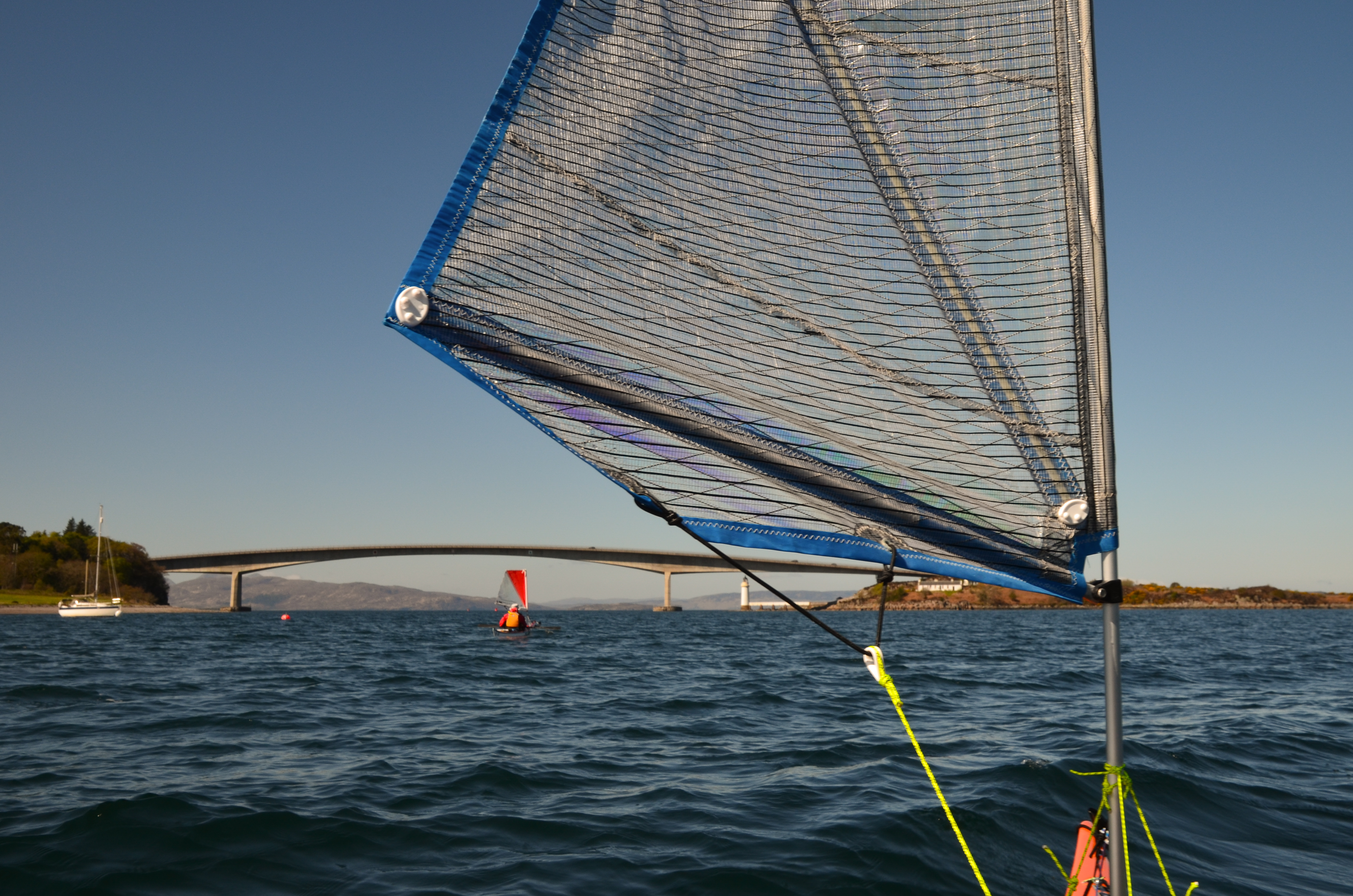
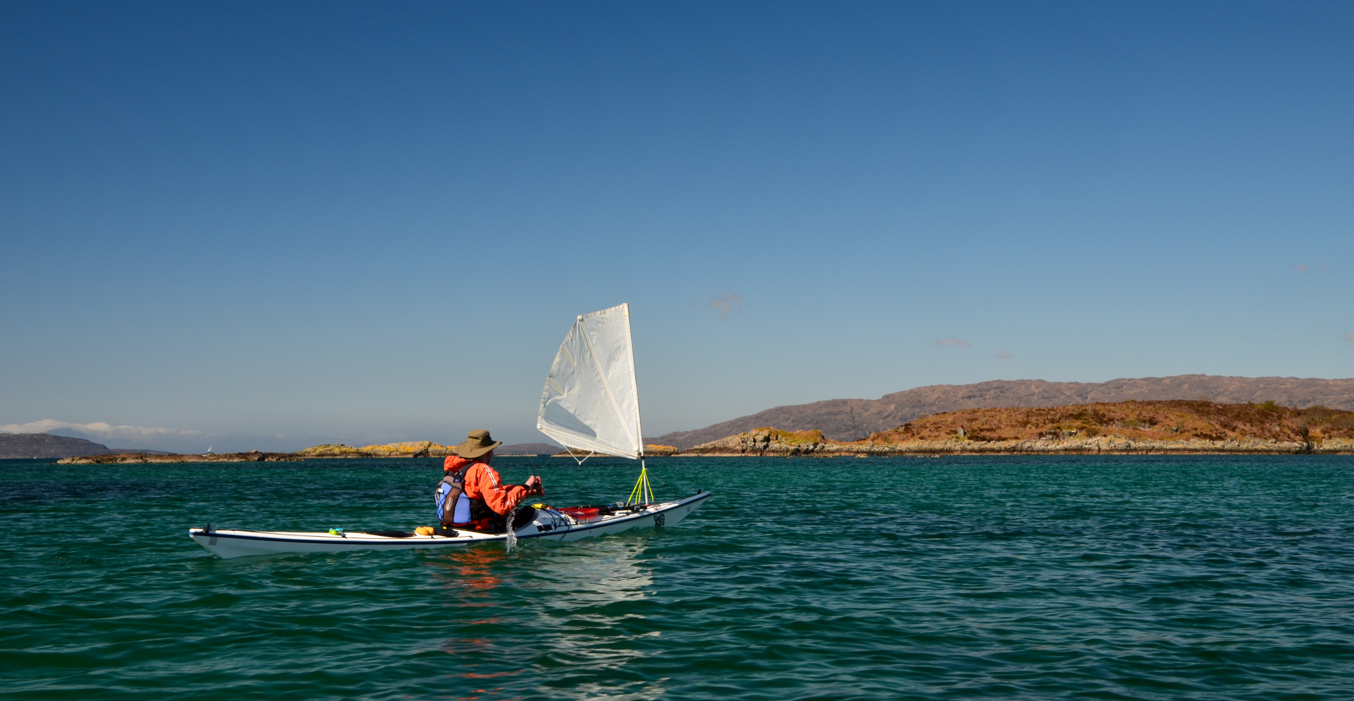
We put our sails up to take advantage of the push and were absolutely blasted across towards Pabay.  I found this a really great sailing run, but was certainly not prepared to stop paddling in order to take photos!  Our average speed on this blast was 9.4km/h, or nearly twice cruising speed.....


Although a fast passage, it had been an energetic one - it is paddle sailing rather than just sailing!  We were all ready for a lunch stop by this point.


Approaching Pabay the wind seemed to ease  a little and we dropped our sails to paddle into the tiny harbour area.  Donny had motored along to Broadford in his F-RIB and made a direct crossing from there to Pabay; he had a pretty wet ride!


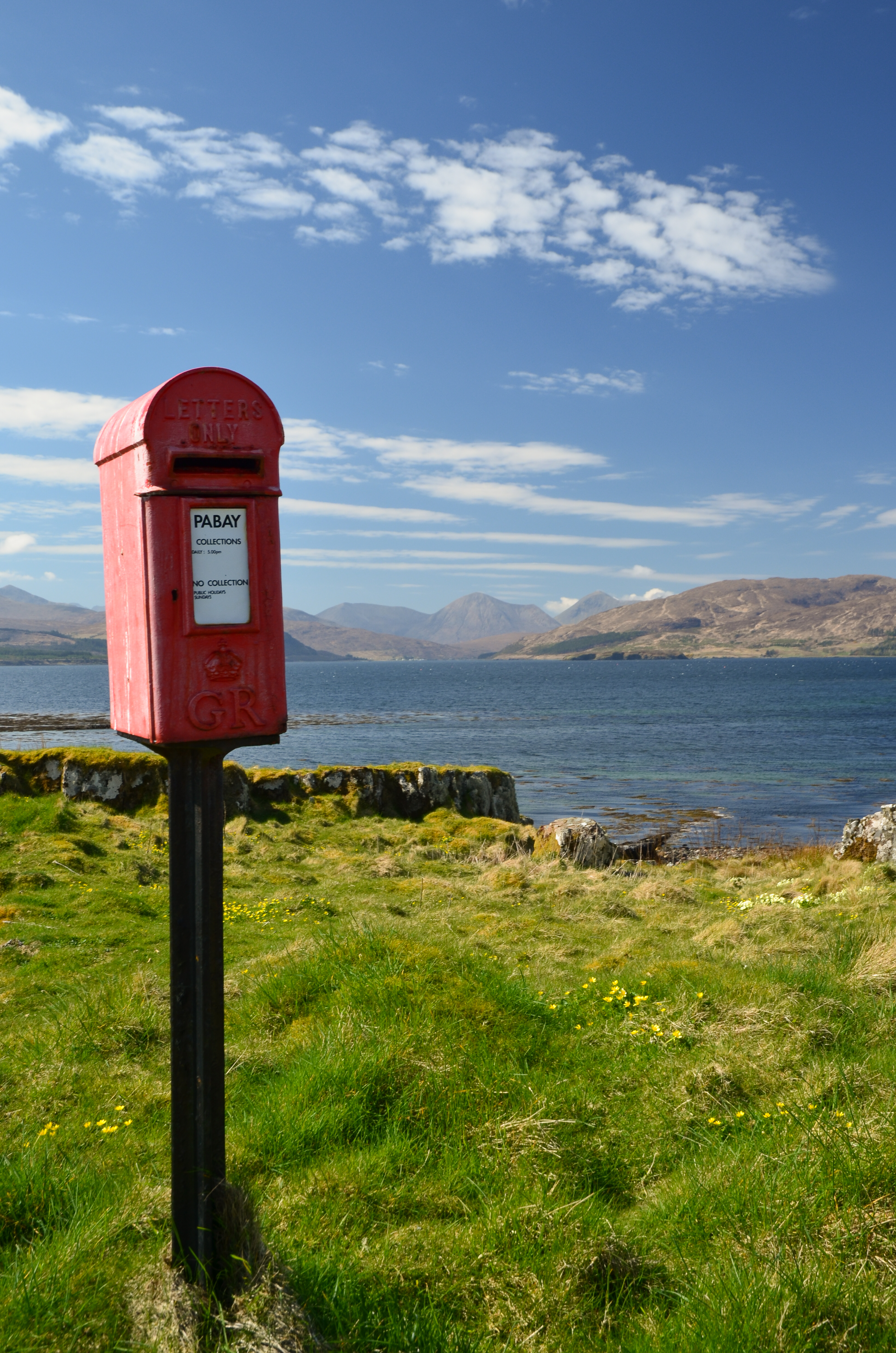
One of the iconic sights on Pabay (Norse: Priest Island) is this post box.  It seems incongruous since there are only a couple of houses on the island but is here because the island issues it's own postage stamps for mail which is transferred into the Royal Mail system in Skye (from where it needs Royal Mail stamps).


Sheltered from the breeze (which was becoming stronger) we lazed in warm sunshine, surrounded by clumps of Primroses.  The pale yellow of the flowers set against the blue of sky and sea was gorgeous.


Above where we lunched a pair of Bonxies (Great Skuas) watched us warily.  These impressive piratical predators had picked a nest site with a great view over the low lying island.


One of the features of Pabay is its geology which is shales intersected by dykes of harder rocks.  The whole island is almost flat and nearly doubles in size as the tide falls from high to low water, leaving the geometric patterns of dykes.

Another feature is that, despite being flat the island has virtually no wild camping spots accessible from the water.  The rock layers from a barrier and the softer rock gives good growing conditions for brambles and tangled low undergrowth.

This gave us a problem; we were pretty much pinned on Pabay.  The wind had continued to rise and in the Sound between Pabay and Scalpay was approaching a Force 6.  None of us was keen on trying the paddle across unless we really had to, but despite trying along the sheltered parts of Pabay by kayak we could find nowhere to camp.  We returned to the harbour to have a re-think.  Douglas and I walked up to the "big house" which is undergoing renovation by a new owner of the island.  We explained our situation and asked if we might camp near the harbour.  The Access provision in the Land Reform (Scotland) Act is wide ranging but does not cover access near to houses or infrastructure.  The owner was most kind in allowing us to camp for the night and it was really appreciated by us.


We pitched our tents in areas which wouldn't affect access to and from the harbour itself and found a spot out of the wind to cook dinner - preceded by fresh soup.  The day had been recovered but our plans would need to be altered.  The forecast was for the wind to drop almost completely by morning, so we decided on a paddle to the Applecross shore via the Crowlin Islands.


As the sun set, the wind came around a couple of points and seemed to drop by several degrees in temperature - it was pretty cold within minutes.  Dinner done, we retired to the tents (which we'd pinned very securely to Pabay) for an early night.
 

Friday 1 July 2022

A perfect pitch

It turned out that our day could and did get better!  The camping spot we'd originally planned on was a few more kilometres up the coast, and given the wind direction we realised that it would be right in the wind.  So when a flash of white sand backed by bright green woodland caught our eye at the back of a small bay, we had to take a look.


Landing near low water we found ourselves in an enclosed bay, sheltered from the wind and in full sunshine.  A few folk were enjoying the late afternoon sunshine, indicating that the bay was fairly accessible, but it did look very promising as a wild camping spot.  Our preference is for fairly remote areas which are little used, but never look a gift horse in the mouth!


As the day visitors started to leave, we pitched our tents, Donny and Douglas pitched on the level turf above the beach itself - where there was even a picnic bench......


Allan and I chose spots in a beautiful wood of birches at the back of the bay which was alive with birdsong.  At the time and in the memory, this felt a perfect pitch.


Once we'd pitched up we wandered the bay, just enjoying the sunshine and the location.  We came across this lovely piece of beach art which must have taken both patience and real creative talent to produce.  Transient and perfect, it would be washed away by the evening's high tide.


Much of the beach was covered in pieces of white "coral" - actually Maerl, a corraline algae which when living is a purplish colour.  When they die, the calcereous remains of Maerl are broken and crushed by wave action, then bleached in the sun to form dazzling white "coral" beaches such as this one.  

A rare and fragile environment, Maerl beds have comprehensive protection, but are at risk from scallop dredging - one pass by a scallop dredger's bottom gear can destroy a bed which might be hundreds of years old.   Loch Carron has some of the best examples of Maerl beds and as a result is protected by designation as a Marine Protected Area (MPA).  


In the wood, Primroses were in flower on sunny banks - perhaps my favourite of the early Spring flowers; such a cheery sight at the back of a long winter.


After dinner we wandered over to the edge of the bay and climbed a rocky outcrop to photograph the setting sun - it was a really lovely evening.


Our fire below the Spring tide mark was lit to get going while we took our photographs and brought snacks and drinks down from the tents.


 Across the sea, beyond Skye and Raasay, the setting sun slipped down to the horizon to end a truly great day on the water.  We sat with a dram by our fire and chatted into a glorious evening.

Note: Since we camped here, the bay and its beach have been featured in a national newspaper and on a well known travel website as "one of the most beautiful and accessible in Scotland".  This is undoubtedly going to increase it's popularity and perfect as it is, we will avoid camping here for the foreseeable future in order to go a small way to reducing future pressure.

Tuesday 31 May 2022

Over the sea from Skye


A spell of warm and sunny Spring weather is always so welcome here in Scotland - so when a run of fine days was forecast in the second half of April we made plans for a kayak trip.  Our starting point was to be Kyleakin on the Isle of Skye; and we met up on a sparkling morning.  Allan and I travelled from Aberdeenshire, Douglas from the Solway coast via Glasgow and Taynuilt, where he teamed up with Donny for the journey to Skye.  Our plan was very flexible....simply to spend some time kayaking around the southern part of the Inner Sound.

While we rigged our kayaks Donny got his F-RIB "Guppy" afloat and set off to do a little filming.  You'll be able to see the video of our trip on Donny's Youtube channel here.  


After the usual routine of boat packing and trying to make sure everything fitted in, we got underway and immediately put up our sails to catch a push from the north easterly breeze.  This stretch of water,  Kyle of Lochalsh or more properly Caol Loch Ailse (Strait of the Foaming Lake) has strong tidal streams, particularly at the narrow western entrance which is named separately as Kyle Akin (Haakon's Strait) - named for a Norse king who brought a huge force of longships through here and beached at Kyleakin on his way south where he would be engaged and beaten by a Scots army under King Alexander III on 2nd October 1263.


The building of the Skye Bridge altered the flows somewhat at Kyleakin and the strongest of the stream can be avoided by passing close under the eastern side between Eiean Ban and the mainland shore - that said it's still an energetic paddle against the tide!

We started on Skye and apart from a brief call back at Kyleakin didn't plan to paddle any of the island's coast on this trip - not so much "Over the Sea to Skye" as over the sea from Skye!


We headed north after exiting Kyleakin and stopped at Eilean a' Mhal for first luncheon. Sheltered from the breeze we sat in warm sunshine with a wonderful view across the Inner Sound to the hills of Beinn na Cailleach and Glamaig on Skye.  The colour in the water was marvellous and was the standout feature of this day.


Back underway and we continued north through the maze of the Black Islands, which today were anything but black - indeed there was a riot of colour.  This group of islands usually provides sheltered paddling in a compact area which changes from hour to hour according to the state of the tide.


Conditions were pretty good for early Spring - dry and bright with a north easterly breeze, and we observed this effect of cloud capping some, but not all, of the higher hills several times during our trip.


 As we left the Black Islands we paddled into the breeze and so dropped our sails.  After an energetic couple of kilometres of paddling we came into a lagoon with the most wonderful colour of water as the sun lit the white sand below our boats.  Really - could a day get any better than this?!

Wednesday 25 May 2022

Bridging the gap

This is a catch-up post from a walk in upper Donside in the second half of April.  Lorna, Allan and I have explored many of the area's tracks, especially when Covid restrictions limited the distance we could travel.

We decided on a linear walk from Corgarff at the foot of the Lecht road down to Bellabeg in Strathdon.  By the A944 road this isn't a particularly long route but we intended to use parts of altogether older roads.  We would also link a series of bridges which have historical interest - the "bridge" theme would continue in that our route would bridge a gap between walking routes we know well.


We set off on a lovely Spring morning, heading SE from Ordgarff along the track which is signed as "Old Military Road".  This simple statement has a deal of history behind it because this is a section of road built between 1748 and 1757 as part of  a massive roadbuilding and infrastructure project following the 18th century Jacobite rebellions.

That said, the first of the bridges isn't typical of the "Wade Bridge", being a graceful, slender arch over the Allt Damh - seemingly defying gravity! 


Just under 2km further along the track is Delavine Bridge.  This is much more representative of the bridge construction on the 18th century military roads.  Delavine was one of three bridges repaired and stabilised over three years from 1997 to 2000 to keep these scheduled monuments intact.  A plaque on Delavine bridge records the work, placed on the outer parapet where it is particularly difficult to read without standing in the burn itself!  It is typical of the larger bridges of the period in construction and in being 4 metres wide.

The familiar term is "Wade roads" and "Wade Bridges" in reference to General George Wade, a military Commander in North Britain from 1724 to 1740.  Wade is actually the only person named in the British National Anthem - one of the more clunky verses which isn't used today reads:

"Lord grant that Marshal Wade
may by thy aid victory bring
May he sedition hush
And like a torrent rush
Rebellious Scots to crush
God Save the King"

The "Wade" road here is part of a 100 mile (160km) route from Coupar Angus to Fort George near Inverness via Braemar, Corgarff and Grantown on Spey.  The whole route was built in nine years between 1748 and 1757, starting just two years after the final Jacobite defeat at Culloden Moor.  For context, the 26 mile/42km Aberdeen Western Peripheral route took five years to complete in the 21st century!

By the time construction of this road was started Wade had long since left the Highlands and in fact died in the same year work on this route started.  His successor, Major William Caulfeild (note the spelling, not "Caulfield") was appointed Inspector for Roads in Scotland in 1732.  While nowhere near as well known as Wade, Caulfeild oversaw far more of the network: Wade was responsible for 250 miles (400km) of road, forty bridges and two forts; Caulfeild  for 900 miles (1400km) of road and over six hundred bridges - an astonishing series of works.   

The road we now walked is part of the longest single stretch Caulfeild built at 100 miles and the line it took was clearly good because the vast majority of the route is still public road, suitably upgraded for modern traffic. This stretch wasn't absorbed into the road network and remains as a great walking route. 

The ingenuity, effort, endurance and craft of the road planners and of the regiments of soldier-navvies who constructed the military road network is a great testament to one of Britain's greatest engineering feats. 


A little over a kilometre further on the road crosses the third bridge of the section, this one spanning the Burn of Tornahaish.  Here also the bridge required restoration works and all three bridges on the section are now leased from the landowner, Candacraig Estate, by the Gordon Trust on a 99 year lease.  Smaller than Delavine and without a parapet, the span and height above what is a very small burn gives an indication of the volume the Burn of Tornahaish is capable of in spate.


The track climbs up from Burn of Tornahaish to join the A939 road, or more properly become the A939 road.  From here the Military Road goes to Gairnshiel then on over the hill to Crathie on Deeside.  We walked uphill for a short way before leaving the road on a track cutting back uphill, having bridged the gap of several kilometres between our previous walks.  Here we had a choice of routes to reach Bellabeg.  One route would take us over to link with a lower level walk we've done before while the other would climb up onto the high ground to cross the summit of Scraulac - a route done several times previously.


We chose the higher level option as the weather was good and we were in no particular rush.  The summit of Scraulac (which I think may be from the Gaelic for Scree Place) is really wide, though today a bit breezy too.  An estate worker passed us on a quad bike here and was the only other person we saw on the entire route.

We left the estate tracks to descend Scraulac's north east ridge, finding a remarkable hidden building en route.  A good track which became a metalled road soon led us down to the public road at Culfork.  This really is a "road less travelled", a loop of minor road running parallel to the A944 but on the opposite side of the river Don.  A relatively new venture along here is Cairngorms Glamping and Camp Site, which looks to be a super place to spend a holiday!


 Cutting off the road just outside Bellabeg, a track descends around a wooded hill to the last of the historic bridges of our walk.  Poldullie Bridge was constructed in 1715 by Sir John Forbes of Inverernan and crosses the River Don. A remarkably graceful single span bridge, the elegant form is best seen from above as in the images on the Canmore site.  Sir John Forbes made a fatal choice in throwing in his lot with the Jacobites at the 1715 rebellion and was captured following the battle of Sherrifmuir.  He died in Carlisle prison the day before the date of his execution.  It was this rebellion which prompted much of the roadbuilding effort in Scotland in order to "pacify" the Highlands.  Movie buffs might recognise Poldullie Bridge as it featured in the 2019 film "Mary Queen of Scots".


From Poldullie Bridge we climbed a steep bank to the main A944 road and strolled downhill to Bellabeg where we'd left a car earlier in the day.  

This had been a great walk with lots of history and great views.  The route we took is 19km/11.8 miles and it took us six hours at a fairly relaxed pace with a couple of stops.  Ordnance Survey 1:50K Landranger map 37 (Strathdon and Alford) covers the whole route.  As there is no public transport between Bellabeg and Corgarff this route does require two cars and a shuttle.  It would also make for a great mountain biking route with scope for variation.

Friday 13 May 2022

Jottnar Grim Hard Shell Jacket - Long Term Review

A hard shell waterproof jacket is one of the staple items of any outdoor kit list - especially when you operate in Scotland.  I have used a variety of waterproofs over the last 40 years, a period which has seen the development of "breathable" fabrics which have so enhanced comfort and usability of jackets.

This review is based on long-term use of the Jöttnar "Grim" hard shell jacket which was purchased in January 2021 and has been extensively and regularly used for walking, backpacking and ski touring since purchase.

Jöttnar aren't perhaps the best known outdoor brand, but have increasing visibility among mountain users, and for good reason.  The brand name sounds Nordic but Jöttnar are a small British company based in Cardiff.  The company was formed in 2013 by Steve Howarth and Tommy Kelly, two former Royal Marine Commandos who served in the Mountain Leader branch, a specialist group within the Royal Marines trained for mountain, arctic and harsh environment operations.  For more about the company's story, there's a very informative article and short video on the Jöttnar website.

The company philosophy and "house style" seems very much a reflection of the founders' background and of the Commando ethos - the kit they produce is streamlined, tough, designed-for-purpose, innovative and has fantastic attention to detail.  I heard of Jöttnar through word-of-mouth, was shown some of their kit by a friend and was veryy impressed by what I saw.

Conflict of Interest statement:  I own several items of Jöttnar clothing, all of which have been purchased at full retail price or in a limited time sale with a small reduction.  I don't have any connection with the company other than being a very satisfied customer.


Jöttnar describe the Grim as: "a fully featured hard shell technical mountain jacket. Grim protects you in the most severe conditions, without sacrificing those features which lend it versatility for all-year use".  I was looking to replace a very well-used mountain jacket which had started to delaminate and fail after several years of hard use and the Grim seemed to be a good option.

You won't find Jöttnar products in outdoor stores, the company sells directly to customers via their website.  While this does mean that you can't try on garments, the customer advice is very responsive and helpful, and there's free standard shipping on all UK orders.


The Grim, like all of  Jöttnar's full-spec hard shell jackets, is constructed using a fabric called "Skjoldr" (Shield) which is their own fabric developed in collaboration with a japanese fabric technology company.  Skjoldr is a 3-layer highly breathable 80 denier fabric with a membrane and DWR coating.  The full specification and information on this fabric are available here.  The 171gm/m2 Skjoldr used in the Grim has a fairly stiff handle and feels very robust.  I like these characteristics very much - you're left in no doubt that this is a fortress of a jacket, and the slightly stiffer fabric means that it doesn't flap madly in strong wind as lightweight fabrics tend to.

In use, the Grim has been a revelation.  Noticeably more windproof than Goretex XCR, ProShell or the eVent fabric used in kit I've recently owned, it just shrugs off weather.  The main zip has a substantial storm flap behind it (with a very well designed chin guard).  this is a feature I've always looked for in mountain jackets - 3000ft up on a Scottish hill, head down into lashing rain and half a gale is no place to be exploring the difference between "water resistant" and "waterproof"!

The pockets are positioned really well so that they don't get obstructed by rucsac hip belts or climbing harnesses.  The Grim jacket has a near-twin in the range which is the Odin which is essentially the same jacket but with chest pockets.  There's also the Hodr jacket with four pockets.  The Grim's pockets are large and the zips run faultlessly.  On one walk of several hours in truly biblical rain there was slight water ingress to the pockets, but absolutely nothing came in via the main zip.


Photo: Linda Johnston - taken in -15 Celsius weather, hence my expression!

There are pit zips under the arms to vent the jacket if required.  I've found that the breathability of the Skjoldr fabric is so good that I've very rarely got warm enough to think about using these, but they're available if needed and very easy to operate on the move. Jacket length is perfect for me, fairly short at the front but with a scoop back to protect the bum. There are hem drawcords which are snag free (i.e. not loops which could catch on gear or rocks).

A small zipped pocket is positioned on the left forearm.  This would conveniently fit a ski pass and I've used it to stow a wipe for goggles and a small laminated card with route notes.

The sleeve lengths have extra built in so that the wrist isn't exposed when reaching up (climbing/scrambling) or forward (nordic ski touring).  When I was looking at the jacket I did think that the measurements given would make the sleeves too long for me at slightly below average height, but this isn't the case at all in practice because of the design and the cuffs themselves.  these have reinforced Hypalon tabs and velcro closures at the front, and a lightly elasticated cinch underneath.  this means that the cuffs can be pulled over gloves without faffing with the velcro (which on previous jackets has had a tendency to freeze and be difficult to fasten in wet/just below zero conditions).  It's another feature of the Grim which just works.

The fit is streamlined, clean and uncluttered, but with plenty of space to layer underneath.  I'm 5ft 8ins (173cms) tall and 41in (104cm) chest and the Medium size is a perfect fit.  There's plenty of room in the shoulders to aid movement like placing axes, long reaches with walking poles or whilst ski touring.

What I can't easily show on these images is the design and cut of the jacket, which is exceptionally good and a reflection of the attention to detail and ethos of the company's founders.  Everything is there for a reason, and if it's there it adds to the jacket and is incorporated really well.  

My initial impression was that this would be a jacket I would use mainly in winter but the performance has been such that I used it right through the year on the hill in "Scottish summer" weather.  I have to really be working hard to generate even the slightest moisture inside the jacket and this soon dissipates - the Skjoldr is very, very impressive stuff and seems to this user to out-perform anything I've previously used.


Inside there's a smaller stretch chest pocket which just about takes a smartphone and a larger internat mesh "dump pocket".  This fits a pair of gloves nicely, would accommodate touring ski skins and is a great size to keep a 500ml water bottle in.  The internal taping is absolutely flawless and here too the design effort is really evident.


The hood is helmet compatible but adjustable to cinch it down.  It moves with the head faultlessly and has a very well designed stiffened and mouldable laminated peak.  This image was taken on a ski tour in very cold conditions when it really showed how protective a hood can be.

The one minor criticism I have of the Grim is that the hood can't be stowed or retained when not in use.  This means it can blow up against the back of the head if not being actually worn. A flap or retaining arrangement would be the only thing I'd change about the jacket -  it's a very small criticism though!

The Grim weighs in just over 550grams for a Medium size - not ultralight and that's a good thing as far as this user is concerned.  But neither is it heavy and the jacket rolls down neatly when not being worn.

Jöttnar jackets are all single colourways, most of which are understated (though there are some brighter options available).  I like the understated colours!  A women's version of Grim is also available.

After 15 months of very regular use in Scottish conditions hillwalking, backpacking and ski touring as well as general walking the Grim still looks like new, the DWR has remained effective and it has performed faultlessly.  Conditions of use have ranged from 20 degrees Celsius to minus 20 degrees Celsius and have included dry gales, wet gales, rain, sleet, hail, snow, ice, drizzle and freezing fog.  In all these conditions I've remained dry and comfortable when wearing the Grim.  The term "bombproof" is a little over-used, but is genuinely applicable here. Add in superb design, form and function and you get an outstanding piece of outdoor kit.  Put simply, this is the best waterproof jacket I've ever owned - in 40 years of outdoor activities.  

There's no getting away from the fact that Jöttnar products are high performance kit designed for sustained usage - and the £449 price is reflective of that.  The price was certainly a factor when I chose the Grim and it required delaying the purchase in order to save up, but I haven't regretted the outlay one little bit. 


Monday 18 April 2022

From swimming to snowmen


 After the warmth of late march, early April saw temperatures drop dramatically in north eastern Scotland as pressure systems realigned and allowed a bitterly cold northerly airstream to establish for a run of two weeks.

In our local shop I overheard a Mum remarking that on a Sunday afternoon her toddlers had been in the paddling pool in the garden, and by Thursday morning they were building a snowman in the same garden!

The hillwalking has been good though, clear northerly air gave great views like this one from near Coilochbhar Hill showing Pressendye and some of the other Donside hills.


Wednesday 13 April 2022

The end of a fine Fyne journey

I woke to birdsong and warm sunshine at our camp near Ardlamont Point.  We ate breakfast while enjoying the sights and sounds of the place.


Donny left earlier in his F-RIB than we did in our kayaks, he wanted to get back to the launch point at Kames at a relatively high tide which would considerably reduce the carrying distance with his boat, kit and outboard engine.  It had been great to do another trip with Donny; his film of the journey is here.


After a leisurely breakfast while waiting for the dew to dry off our tents we packed up too and got underway.  We erased all trace of the previous night's fire, which was lit below the Spring high water line.   There was remarkably little plastic washed up here; it's possible somebody has carried out a beach clean.  We scoured the length of the beach and removed the few bits of plastic bottles and a fish-farm feed bag to take away with us. This beach makes a fine camp site, it's one we'll return to in the future.


The paddle back to Kames was remarkable for the very warm and still conditions we experienced.  We sweated profusely even at a slow pace of travel - in March!  We returned to our launch site late morning and packed up - it was the end of a fine Fyne journey.


 Our journey to Inchmarnock and around lower loch Fyne had been comparatively short in distance - we travelled 64km over two half days and two full days, but had been packed with good things, the most important of which was getting out on a multi-day trip again with good friends and in a great location.  The weather had played a big part in the trip and had encouraged us to arrive at camping spots in the mid afternoon rather than cranking out distance; it was a routine which worked very well.

Ordnance Survey 1:50K Landranger maps 62 (North Kintyre and Tarbert) and 63 (Firth of Clyde) cover the area in which we paddled.  We launched from the concrete slipway at Blair's Ferry where there is parking for several cars across the road from the slip.  The slip itself was built during the Second World War for operating landing craft in preparation for the D-Day landings.  The car parking is on concrete slabs which were the vehicle muster and turning area and the imprint of the I Corps insignia can still be made out, pressed into the concrete ramp.

There are no significant tidal streams to be concerned about on this trip, but Ardlamont Point and Inchmarnock can be difficult places to paddle in strong wind, being exposed to most wind directions.  Ardlamont Point in particular can be a challenge.

Monday 11 April 2022

An evening to savour

The Loch Fyne Light Show started with a distinct softening and warming of the light quality.  We picked up cameras to watch as the sun sank through a cloudbank over the Kintyre shore.


Donny walked to a vantage point on a nearby rock rib to take some video - you can see Donny's film about our trip on his YouTube Channel here.


I joined Donny to get a view with no rocks in the foreground and was rewarded with this lovely path of sunlight beaming across Loch Fyne.


I spent a good twenty minutes just taking it all in; the last two years have seen few trips due to Covid restrictions and work pressures....it was so good just to "be" in the outdoors again, in the moment with a lovely sunset.


The sun dipped below the Kintyre hills and the sky put on a final flourish of gorgeous light....just superb.


As Donny and I wandered back over to join Raymond and Allan at our camp site the light show faded to a pastel finish, but there was one last and beautiful element to come.


After sunset the pale, ethereal light was as gorgeous as the sunset had been, though in a completely different way.  My photographic skills don't do the light quality any justice whatsoever, the softness and opacity of a calm evening.  It's this changing "Solas" (light) which really makes a day.


The temperature dropped after sunset and we got our fire, built well below the Spring high water line, lit and away.


Contained by a few big logs, it soon built a very satisfactory heat with remarkably little refuelling required due to the lack of wind.  We sat around and enjoyed after-dinner treats and the odd dram - life seemed particularly agreeable on this Fyne evening!