Showing posts with label Corryhabbie Hill. Show all posts

Friday, 21 December 2018

Blowing in the wind on Corryhabbie Hill


Near the summit of Corryhabbie Hill there's a series of small cairns and stone lined hollows.  I can't find much information about their origin, but it's known that Ordnance Survey teams camped on the summit in 1819 and again in 1850.  Sometimes the parties built stone shelters to live in and its possible that these are remnants of the shelters.


A fairly level walk along the ridge with splendid views soon arrives at the 781m/2562ft summit which is marked by a trig point within a shelter wall.  The trig point is topped by a conical metal "hat", something I've not seen on any other trig pillar.   I hunkered down in the lee of the shelter wall to get some respite from the biting cold of a north wind.

In the previous post I remarked on just how expansive the views are from Corryhabbie Hill, and that's why it was selected as a triangulation point for mapping by the Ordnance Survey.  The views have recently been altered completely though - to the east of Corryhabbie is Cook's Cairn, a broad ridge of heather...........


.......the north end of which hosts the turbines of the huge Dorenell Windfarm.  This has been, and continues to be, a very controversial project for a number of reasons.  The Aberdeen Press and Journal (P & J) articles make for interesting reading, as do the ones from Energy Voice.  Whatever the controversies and whatever your opinion of onshore wind energy, the simple fact is that the industrialisation of this hill has changed it forever.
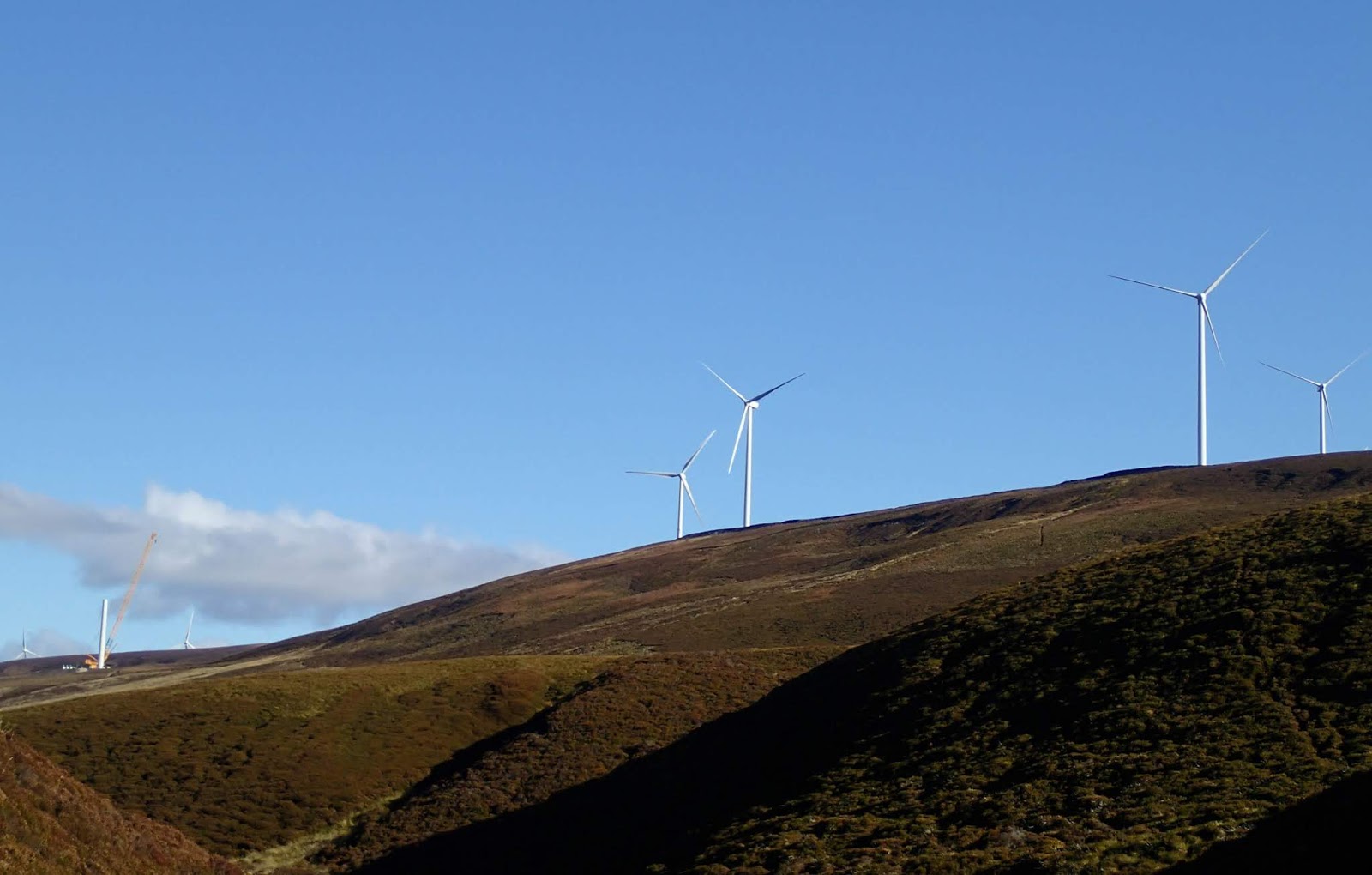


I descended from Corryhabbie Hill to a boggy bealach which drains to form the River Livet on one side and the River Fiddich on theo other, thus providing the raw material for some of Scotland's best known whiskies.  The 120m/400ft turbines dominate the ridge above, the noise of those which are operating was really obvious.


I was glad to get past the windfarm and follow the Fiddich as it curved around towards my starting point at Bridgehaugh.


The final few kilometres were a joy, some warm October sunshine on my back and glorious autumnal colour around me.  I still think that this is a better route to Corryhabbie Hill than the much shorter "up and down" from Glen Rinnes - despite the visual intrusion of Dorenell.

Friday, 14 December 2018

Old friends above the valley of the deer

This is the first of two "catch-up" posts from the end of October.  A bright and breezy day looked good for a hillwalk, and looking at the map I realised that it had been a while since I'd been over the hill to Speyside. I decided to climb Corryhabbie Hill, but not via the usual route.


My route from Donside to Speyside climbs up through high farmland and across the Cabrach, an area of moorland studded with mostly abandoned buildings.  It wasn't always so and there's a good history of the Cabrach on "Lenathehyena's" blog.  The play of light was marvellous on this October morning, rainbows appearing and disappearing as showers passed through.


I started my walk at Bridgehaugh where there's space to park a couple of cars clear of the estate road and entrance.  A steep slope covered with bracken was virtually glowing against a blue sky.


A look at the map in the link above will show that the track leading southwest from Bridgehaugh goes upstream alongside a river which is by no means large, but has a name known throughout the world.  This is the River Fiddich, and this view looks along part of Glen Fiddich.  Downstream the river runs through Speyside's "whisky capital", the village of Dufftown.  Along the banks of the river are some of the best known of Scotland's distilleries; Mortlach, Balvenie and, of course, Glenfiddich among them. Nowhere else in Scotland (or indeed the world) has a higher concentration of distilleries than this corner of Speyside.


I walked alongside the river past the now delapidated Glenfiddich Lodge, a former shooting lodge, and took a track climbing above a bend in the river up into a landscape of rounded hills covered in wind-clipped heather.  the track made for fast walking and I was soon swinging around between two hills and beginning the climb to the broad ridge which forms Corryhabbie Hill's summit.


From the higher ground the views open up to be really expansive.  To the north west, the most distinctive hill in the area, Ben Rinnes, is prominent.  It's a hill which has given some great days.  The "normal" route to climb Corryhabbie Hill from Glen Rinnes comes up the track in this image - my route would only coincide with that one on the summit ridge itself.


To the north, the slopes of the wonderfully named Thunderslap Hill fall to the Dullan water, and rising beyond is the Dufftown "double" of Meikle and Little Conval.  Looking to familiar hills - old friends-  is one of the small joys of hillwalking, and the more hills one climbs, the more joy there is to be had!


On the upper ridge of Corryhabbie Hill I was exposed to a biting north wind - to the north there's no higher ground between these hills and the north pole....and today it felt like it.  I stopped to put on another layer, gloves and a hat. 

Crouching down to sort out my kit I noticed the stunning colour on tufts of Deer Grass (Trichophorum cespitosum).  The name is misleading, it's neither a grass (actually a member of the sedge family) or particularly favoured by grazing deer.  The name derives from the wonderful shade of the plant in autumn, reminiscent of the coats of Red Deer.  There was a theme here too, because "Glenfiddich" is valley of the deer in Gaelic. 

Wrapped up against the chill of the wind, I walked on along the ridge.