Wednesday 31 May 2017

A change of plan sets the wheels in motion across Jura

Early May often brings some great weather for outdoor activities - and May 2017 didn't disappoint. Douglas and I had been carefully watching as a ridge of high pressure built over Scotland. The question was....how far would it extend and where would give the best conditions for a multi-day trip?

As usual we had several trips in mind, it was just a case of which would be best.  As the forecasts increased in confidence, we started to plan in some detail for a trip around the Small Isles (Rum, Eigg, Muck and Canna) - the best conditions were forecast for the north of Scotland's west coast.  We were delighted that Maurice, David and Sam were able to make the trip too.  We planned to set out from Mallaig on Sunday 7th May, returning on Thursday 11th May.


So what on earth were we doing loading kayaks at Carsaig Bay in Argyll on Sunday morning- some 120 km south of Mallaig ?!

Well, 24 hours prior to setting out, the forecast position of the ridge of high pressure had altered subtly.  The revised forecasts indicated strengthening winds around the top of the "high" in the northwest, with much lighter winds and sunshine now forecast further south.  After a re-evaluation we changed our plan for a trip to the islands of Jura and Colonsay.

This area is well known for remote coasts and very fast tidal streams - I was very grateful that Douglas was able to undertake the revised tidal planning as I was in the middle of a journey home from the south of England when we agreed the new plan.  Jura had made a lasting impression on me during a previous trip and I was very keen to visit Colonsay - so despite a busy evening of packing and another long drive to Carsaig on Sunday morning, I simply couldn't wait to get going!

We packed our boats for a five day trip in very warm sunshine under brilliant blue skies - there was hardly a breath of wind.  Our flexibility in changing seemed to have worked out- and this was later confirmed when we heard from one friend who experienced very windy conditions in the Small Isles and another who was on a club meet in the far northwest in cold NE'ly winds of F5 which effectively restricted their outings to the sea lochs rather than the open coast.


You'll be able to follow our journey to Jura, Oronsay and Colonsay in "Sea Kayak Stereovision" by reading Douglas' blog, starting here....   :o)


Our  trip would involve four significant crossings - the first of which was right at the outset, heading over from Carsaig to the east coast of Jura.  Our boats were well laden with supplies and kit, and each of us carried a trolley on the back deck.


A tiny breeze soon died away and we paddled out into the Sound of Jura on a mirror sea reflecting the intense blue of a Spring sky - sea kayaking heaven!

Tidal streams in this part of the Sound reach up to 3.5 knots (7km/h) so any crossing needs to take account of this.  As it happened, our crossing would neatly span the turn of the tidal stream, so we were able to aim straight for our destination and allow the tide to move us first one way then the other, pretty much cancelling out the drift.


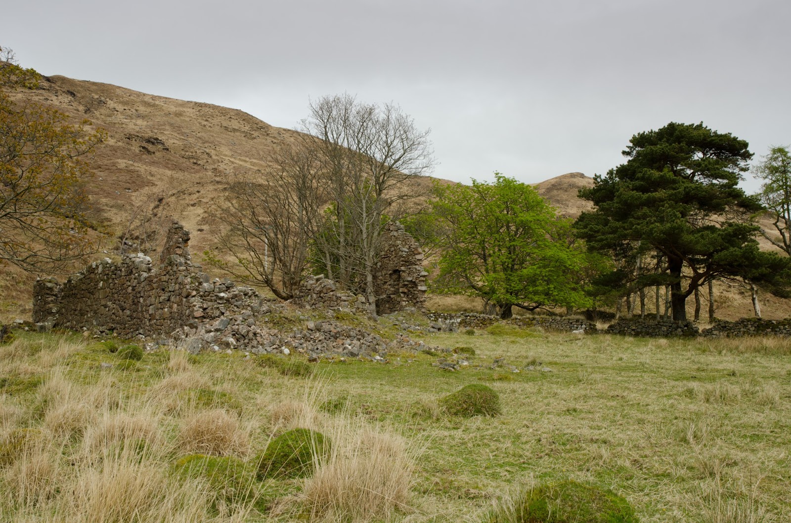
We reached Tarbert Bay on Jura's east coast at mid afternoon, just after high water.  The last time Douglas and I had been in this bay it had collected a deep barrier of rotting weed which had decayed to a stinking slime.  We approached with trepidation, but to our relief the beach was clean sand.  The place name "Tarbert" is quite common on the west coast of Scotland and indicates a narrow neck of land between tow bodies of water.  It derives from Old Norse and means "draw boat" - literally a place where longboats could be pulled overland.

In the hot afternoon sun, our portage promised to be hard work.  We helped each other lift the kayaks onto their trolleys and set out.....


...on the track which leads across the island of Jura.  Our boats were at the heaviest they'd be for the whole trip - packed with food and water (plus sports recovery drinks) so the climb up to the summit of the portage was taken at a steady pace; our ages ranged from late twenties to mid-seventies, and we were in no particular rush.  At the top - 40 metres above sea level - there was a glimpse ahead to West Loch Tarbert.


The descent was a little easier, but the track is everywhere rough and stony - it's a notorious test for sea kayak trolleys.  Happily all survived - most of us were using the KCS Expedition trolley which has been proved across this portage before.  A shoulder strap definitely helps on these longer portages, whether a bespoke item or improvised with a strap and sling/Karabiner.  Having now done this portage both ways - it seems to me that the east-west direction is slightly less strenuous as the ascent isn't as steep.  It may only be 1.6Km with 40 metres of ascent - but it's a fair pull!


We got back onto the water at 1715 with three hours until sunset.  The ebb tide was now pouring out of the inner part of West Loch Tarbert and a breeze had started up, both of which would assist us.  If our plan to circumnavigate Colonsay was to be realised, we needed to put ourselves in the best possible position to cross from Jura the following morning....we still had some distance to go before camp.

Sunday 28 May 2017

Heat and light - here comes summer...

The last week has seen some superb early summer weather across the British Isles. A southerly airflow brought warm air and temperatures soared.  The southern shore of the Moray Firth fared particularly well; in southerly winds it has a unique micro climate and for a few days it was the hottest part of Britain with temperatures approaching 30 degrees Celsius.


Lorna, Allan and I decided on a paddle from Hopeman to take advantage of the beautiful weather, setting out from the harbour heading eastwards.  Bright sunshine and a very calm sea combined in a dazzling quality of light which reached deep below the surface.


This part of the coast is composed largely of a sandstone named for Hopeman itself - the Hopeman Sandstone Formation.  A yellowish aeolian sandstone of varying hardness, some of the beds were deposited by sheet floods and are of early Triassic age.  Fossils are found in the beds, including dinosaur footprints.  One quality of the sandstone is that it's brightly coloured and breaks down to give sandy bays......


...another quality is that it's less tough than some rock types, so caves are quite common here.


We threaded in and out of cool caves and paddled through arches spanning clear green pools to emerge into arclight sunshine.


The rock formations aren't as high or as dramatic as other parts of the coast but give some superb sea kayaking in calm conditions.


One particularly large cave had a long side-chamber which led to......


....a tiny exit with outward flaring sides.  The quality of light here was absolutely jewel-like and we sat, entranced for some time.  Having watched through several minutes, we felt that the exit was just too low to attempt a passage to the outside.  It was near high water and we resolved to take another look on the return leg.


Several incut bays folowed as we headed east - I've paddled this coast several times and always find it an engaging and interesting place to explore.  In any kind of swell it's a bit of a different place though.....


The creeler "Calypso" lost power whilst lifting pots off the coast during the evening of 30th April and drifted onto the rocks.  The owner/skipper managed to get off unhurt but "Calypso" has begun to break up after just a couple of weeks exposed to the swell.


We took a quick leg stretch on one of the pebble beaches......


...before heading further along the coast and past the two-legged stack which always looks remarkably precarious!


Luncheon was taken on a beach of golden sand backed by dunes near Covesea lighthouse, relaxing in the sunshine and with a pleasant onshore breeze which had started up in the heat of the afternoon.


After lunch we headed back with the breeze on our backs, past the Sculptor's Cave which contains Pictish carvings.


We wanted to check out the entrance to the cave we'd explored previously and found that the falling tide had made the access easy but very shallow and we were just about able to paddle through into the main cave......


...and so back out into the brilliant sunlight of a hot afternoon - hopefully the start of summer!

Wednesday 24 May 2017

A Supper Club outing


What could be nicer than going out for dinner on a sunny evening?  Of course, the correct choice of venue for a Supper Club outing is important......


...the restaurant should offer a menu spiced with a little colour.


It goes without saying that the surroundings should be fresh and clean.....


...and the entrance should be welcoming and distinctive too.


Any small rooms should be intimate and cosy for those who choose to dine there.....


....but most important of all, there should be good food on offer, and tables with a view.....

Whilst British "fish n chips" might not be strictly an appellation d'origine controlee, eating it in the open air by the seaside just seems to add to the dining experience - food in it's place of orign.

An evening outing of the Supper Club, kayaking from Portknockie to Cullen, with fish and chips by Linda's of Cullen.  Sports recovery drink for the non-drivers, cups of tea for the drivers!  :o)

Monday 22 May 2017

A Cuil view


The cool northwesterly breeze dropped overnight but the sparkling sunshine of the previous day was replaced by an overcast and murky morning.  The long view up Loch Linnhe from our camp with snow capped Ben Nevis looks cold, but in fact it was a reasonably mild morning.


We decided to paddle straight across the loch before any breeze might start up and create the sort of choppy conditions we'd enjoyed the previous evening.  Landfall of the Morvern shore was made near the Glensanda superquarry, which as ever comes a a jarring intrusion into the loch scenery.


A few kilometres further on we stopped to take a walk around Arigh Shamraidh (the summer shieling).  Visible from across the loch as a green patch lined by trees, there are five ruined buildings and a field system here, the ruins probably date to the early 18th century but earlier maps how a permanent settlement of similar size.


Further along again we passed Camasnacroise (Bay of the cross) with its neatly painted white houses and church on the shore of Loch a' Coire. The church-related names include the hill which towers over the shore - Beinn na Cille (hill of the (monks) cell) In 1890 the village is recorded as having a church, school, shop and smiddy.  The village is quite remote by modern standards, and connected by tiny single track roads.


We enjoyed paddling the wild shore north of Camasnacroise, moving slowly and absorbing the atmosphere of the place.  A couple of potential camping spots came and went before we found a place on a level grassy platform above the shore.  The effort of carrying all our stuff up a steep 20 metre slope was rewarded with a view across Loch Linnhe to Cuil, from where we'd set out.

We could easily have crossed back and ended the trip without camping, but elected to spend another night out and have a short paddle the following morning.


We spent a pleasant evening enjoying the views from our camp, though the morning turned out damp with some drizzle and a thick mist.  I took some bearings and set up a route on my GPS as we packed the boats, as well as putting the VHF radios to "scan" in order to pick up any traffic from vessels moving on the loch which we'd not be able to see.


After travelling up the shore a little way we struck out across Loch Linnhe towards Cuil just as the drizzle stopped and the mist began to break into banks of low cloud.  With such damp, low-light conditions and little wind, we were thankful that the midges hadn't got going by this time in April!


All too soon we were back at Cuil in a rapidly improving morning with a fresh breeze dispersing the last of the cloud. 


 Our two night trip had been relatively short in distance at just over 50Km, but had been really relaxing as we'd deliberately kept our plans to the minimum and just gone with the flow.  It had also been a useful shake-out of our kayak camping kit, which had shown up a couple of deficiencies and necessary tweaks before a longer trip.

Friday 19 May 2017

Cuil camping

This the first of two catch-up posts from a camping trip Allan and I made on Loch Linnhe in the second half of April.  The plan was for a relaxed circuit and a couple of nights wild camping; for both of us it was the first overnight trip of the year due to work or health reasons.  A bigger trip was in the planning so this would also be a good shake-out of camping kit.


Our starting point was Cuil Bay on the eastern shore of Loch Linnhe, where a couple of cars can be parked by the side of the minor road above the shore - taking care to leave access for farm vehicles.  Cuil translates as either "wing" or "back", both of which would be good descriptions for the shape of the bay.

The weather looked good with sunshine and cloud dappling the long view down the loch towards the distant Mull hills.


We paddled south down the loch in perfect conditions, enjoying the reflections of the Morvern hills on the mirror calm water.  To our left the main A828 road follows the shore for several kilometres and there was some traffic noise, but this soon fades when the road turns inland a little.


We took luncheon on a tiny pebble beach at the north tip of Shuna (the northerly of two islands with the same name in this area, the other being in the Firth of Lorn).  The sunlight was picking out the colours of the pebbles below the water beautifully - it really was a very relaxing spot.  Looking over the loch to Morvern, I recalled one of our trips from the previous year when we'd paddled around Movern in late summer warmth.  Loch Linnhe seems to be overlooked a bit by sea kayakers, but it does have the potential for good trips.


After paddling around the outside of Shuna, our next stop was at the ferry jetty on Lismore.  There's a toilet and water from a tap at the ferry waiting room here, handy on longer trips.  We now had a decision to make....our plan was very flexible and we'd not planned in any more detail than a starting point and a basic direction down the loch.  From the jetty we could paddle down either side of the island of Lismore (Lios Mor - the big garden, so named for the fertility of the island which is on limestone).


We chose to go down the outside, west, side of the island as it has plenty of interest and a few more camping options.  Within 30 minutes of setting out, a stiff NW'ly breeze blew up and made things quite bouncy - it seemed we'd made the wrong choice!

A considerable chop built up as we passed beneath the ruin of Castle Coeffin.  Built in the 13th century by the MacDougalls of Lorn, the castle passed into ownership of Clan Stewart through marriage and eventually to Clan Campbell.


We were glad of the opportunity to tuck into the bay below the castle for a breather out of the wind.  This bay must have been a factor in the siting of the castle as the MacDougalls were a clan of sea raiders, the beach must have been a perfect base for operating the highland version of a longship - the Birlinn.


The bay also contains the well-preserved remains of a medieval fish trap.  The fish were held back as the tide dropped and could be caught easily in the confines of the trap. 

We considered making our first camp on the cropped turf below the castle, but a reasonably polite notice asks that folk don't camp here as it's close to the croft house and is grazed occasionally by horses.  We had a quick look at the map and decided to backtrack on our route a bit to a spot we'd noticed earlier.


It was a fairly stiff paddle back up against a strengthening wind to reach the spot we had in mind, but it was worthwhile as it was a good place to camp with a little shelter from what had become a cold NW'ly wind - a "Cuil" breeze in fact!


After dinner we managed to find a spot for a campfire below the high water line and enjoyed a dram or two to mark the first kayak camp of the year.

Monday 15 May 2017

A wildlife spectacular

On a cold and blustery day at the end of April we drove to Newburgh at the mouth of the River Ythan (pronounced "Eye-than") to do some wildlife watching. Although less than an hour away, we hadn't previously visited and were reminded that we really should do by an article on BBC Radio Scotland's "Out of Doors" programme.


We parked near the golf course and walked a short way along a path through the dunes which are such a feature of this part of the coast to reach the edge of the estuary close to where the Ythan enters the North Sea.  A guided wildlife watching group and some families were already enjoying the sights.


There are lots of birds on the Ythan.  Eider ducks (Somateria mollissima) are simply everywhere; this is the largest breeding colony of these striking sea ducks in the UK with some 1500 pairs nesting in the dunes of the Forvie National Nature Reserve - with non-breeding birds the summer population can be up to 5000 strong.

The heaviest, fastest flying and largest UK duck, Eiders feed primarily on molluscs, especially Mussels which they can swallow whole and crush in their gizzard - crabs are also taken and are similarly swallowed whole once the legs have been removed; a remarkable digestive feat!  The male Eiders are truly beautiful birds; predominantly black and white with pale green napes and a salmon pink blush to their breasts.  They also have a distinctive call - which leads to them being known to generations of children as "woo-woo birds"....try the video on the RSPB page to hear why!

As well as Eiders, the Ythan estuary is home to four species of terns; largely Sandwich Terns and Arctic Terns, but we were delighted to get close views of a Little Tern (Sternula albifrons) which was fishing right in front of us.  Forvie has between 15 and 35 pairs of these lovely little birds breeding each year - and this is a quarter of the entire Scottish breeding population.

Sand Martins were whizzing along the shore and we watched a pair finishing a nest burrow in a sand dune right next to the path.  The birds at Forvie make for a great wildlife experience in their own right, but it wasn't birds we'd primarily come to see....


 Now, I can get close views of seals every single time that I get in a sea kayak, so why come to a beach on a raw day to see them?  Well, just across the channel Atlantic Grey Seals (Halichoerus grypus) haul out onto the sand to rest, to moult and to pup and they can be seen at quite close quarters without disturbance.

The UK's largest land carnivore, Grey Seal bulls can reach 2.6 metres in length and weigh up to 350Kgs - they're an animal to be respected, especially when in a sea kayak!  The bulls are generally dark grey, brown or black with some lighter blotches whilst the cows are usually lighter grey with some darker blotches.


 The pebbles on the shores of the North Sea and Moray Firth coasts are actually quite similar colours to the seals.


But what makes the seals at the Ythan such a spectacle is that there are a lot of them.......


....an awful lot of them!  Over 1000 animals haul out here; the sight and noise is extraordinary - and if the wind is blowing from the north we're assured that the smell is too.   One of the presenters of the "Out of Doors" radio programme described this as one of the greatest wildlife spectacles not just in Scotland or the UK, but in Europe.

We'd agree - it's a truly world-class wildlife experience and very accessible too. The north side of the estuary is now an area of special protection and this designation means that it's a criminal offence to recklessly disturb seals which are hauled out here.

To get the best sighting, visiting near to low water allows a fairly close approach from the south side of the river, but doesn't disturb the animals.  If they raise their heads or start to move - you're too close.  From the main road through the village of Newburgh, turn onto Beach Road (near the Newburgh Inn) and drive to the car park near the golf course.  A five minute walk will bring you to the water and this remarkable wildlife watching location.