Showing posts with label Loch Ewe. Show all posts

Wednesday, 31 January 2024

Winter colours - Wester Ross

On the second paddling day of our trip in Wester Ross Allan and I launched from the jetty at Laide in Gruinard Bay.  This is a handy launch spot but there's virtually no parking at the jetty itself so we parked back up the road a way so as not to block things for any other users.  There's also an honesty box, ingeniously adapted from an old fire extinguisher, for donations towards the jetty's upkeep.

It was another very cold, clear and calm morning - "frost smoke" was rising from the sea as the sun climbed a bit higher.


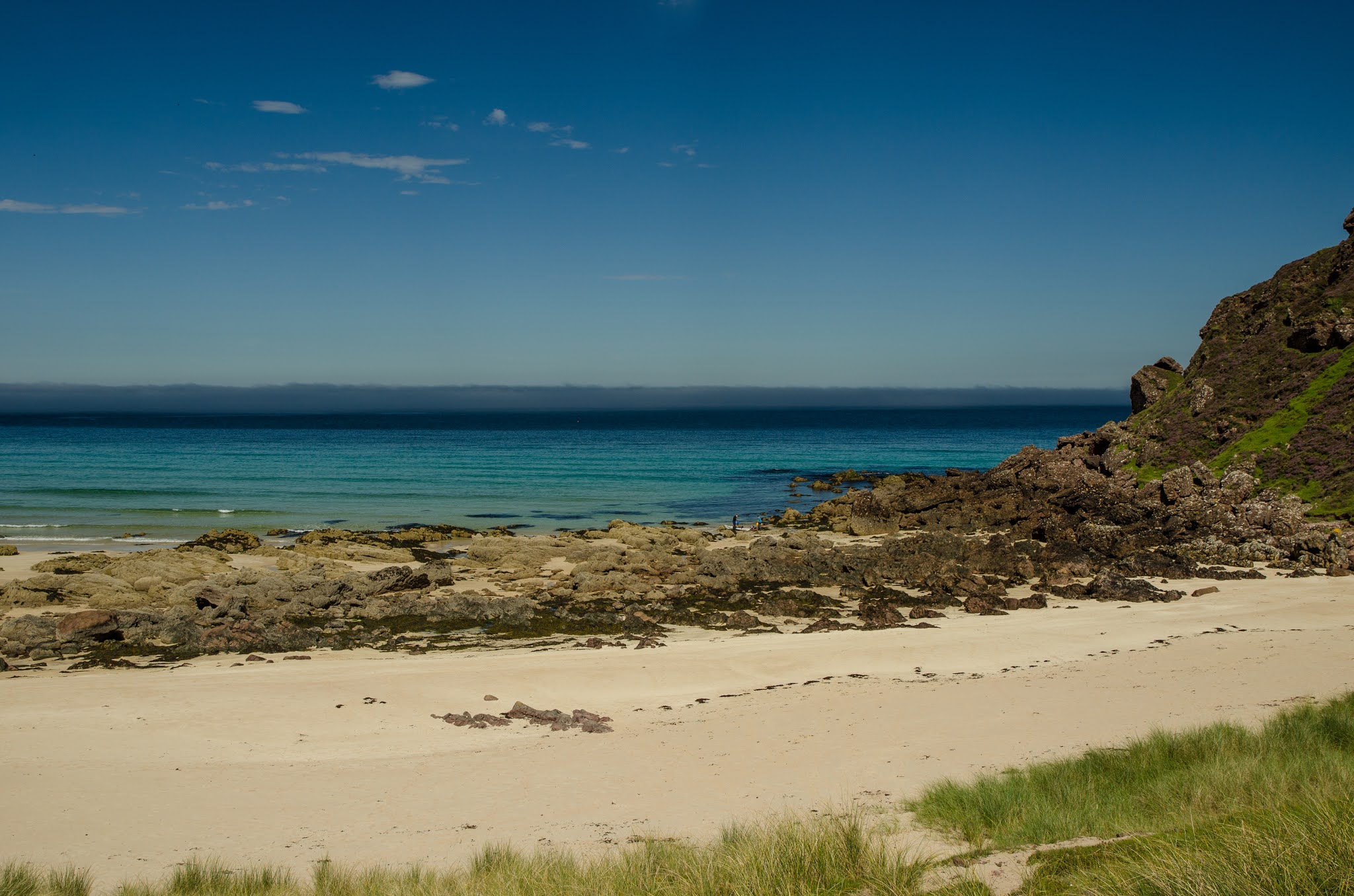
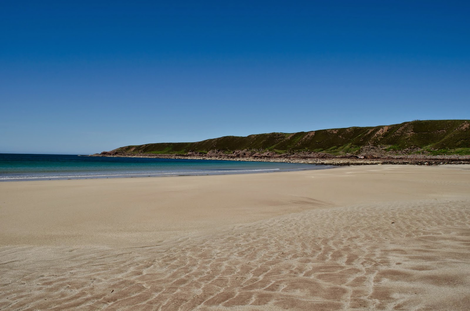
We paddled around the inner part of Gruinard Bay and landed at the northern end of the big beach which is so popular in summer.  Today we had it to ourselves for a leisurely coffee break.


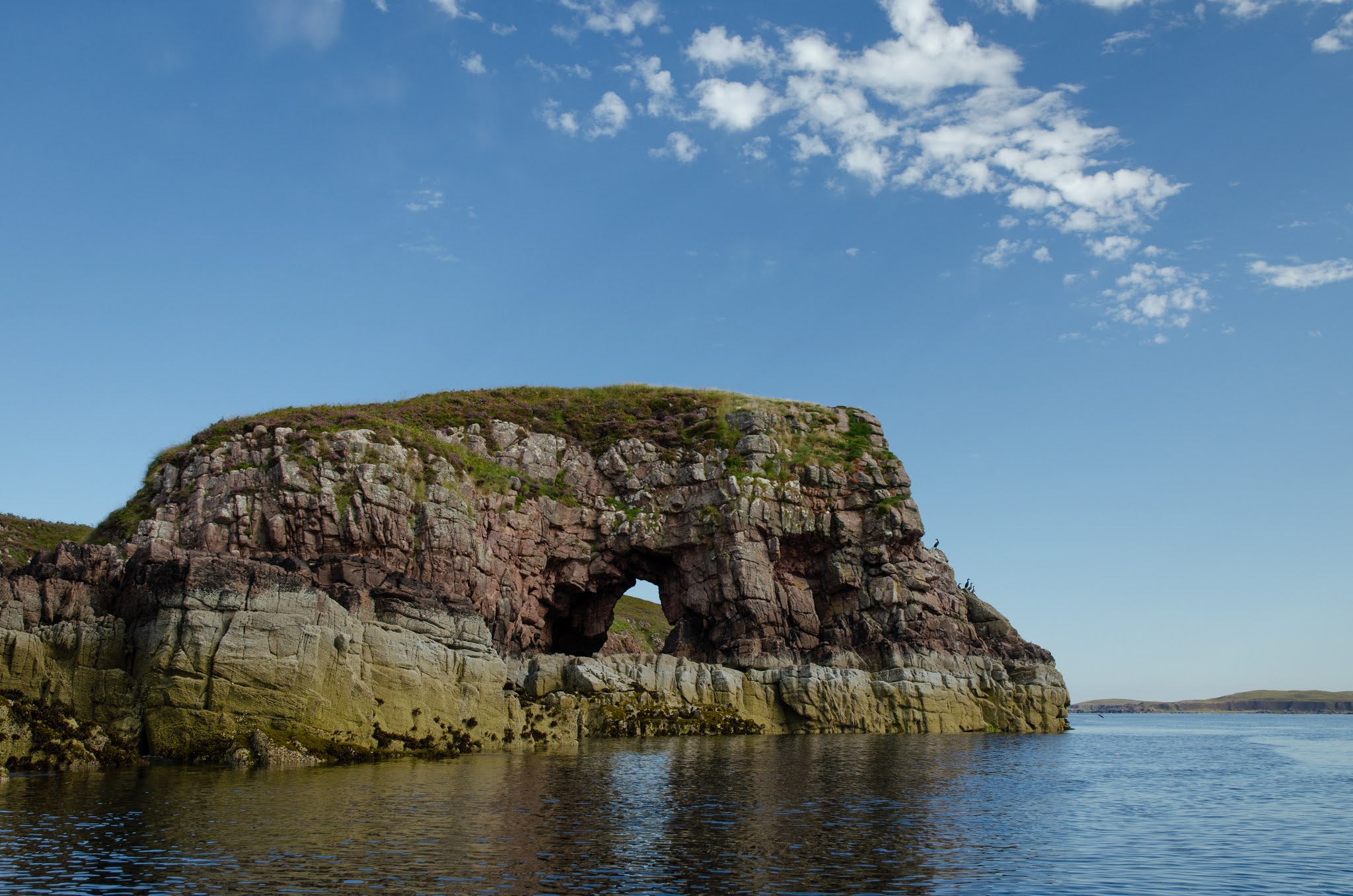
Heading north we had a view to Priest Island and the Summer Isles, we've had some great paddling ventures there!  Conditions were near perfect and we landed at Mungasdale Bay for a second stop - not sure whether that was third breakfast or first luncheon though.....


From Mungasdale we paddled over to land on the boulder spit at the south of Gruinard Island, infamous for the experiment that was carried out here to test the efficacy of a biological weapon.  The desparate measures under consideration during WW2 are understandable, but not the indifference of the UK government for decades afterward - they were eventually forced to properly (hopefully!) decontaminate the whole island in 1990.  The disconnect between a remote UK government and the north of Scotland is neatly illustrated in the staged image at the end of the BBC news article linked above with a Defence Minister pulling down the "Landing Prohibited" sign....dressed in a pinstripe city suit and immaculate dress shoes.

We stopped but briefly on the bouldery spit - it's hard on the feet in paddling footwear.  Interestingly the island has been recently and intensively planted with forestry, so clearly there is confidence that disturbing the soil won't release any dormant anthrax spores.  Behind Allan in this image, the brilliant white summits of  An Teallach rose into a blue sky .


The view across to Torridon when we arrived back in Laide was glorious - winter can sometimes throw up the most stunning conditions.


Back at our base on Loch Ewe the last of the sun lit the Fisherfield hills s we enjoyed a post-paddle cup of tea, but the best of the colour was reserved for well after the sun had set.....


 ....as the sky and sea suffused with the most intense and beautiful lilac pink light.  Some winter days are just so perfect!

Monday, 5 October 2020

Coming back to Ewe


We left Camas Mor with some reluctance.  It's a wild and beautiful spot and we'd been lucky enough to experience the place at its best in calm, sunny conditions.


We had a good distance to paddle back to our starting point in Loch Ewe and it was now hot in the afternoon sun. Our pace was steady, and why would we rush in such superb conditions?


Our friend the White Tailed Eagle was still in the same spot as we passed one of the higher points on the coast, taking off to become a huge shape just after we passed below.


At the mouth of Loch Ewe we landed on a skerry to take a break; it wouldn't be possible to land here on most days with swell running onto the angled slabs.  It was near here that the American liberty ship "William H Welch" was wrecked in a gale and snowstorm in the early hours of 26th February 1940.  Of her 74 crew only 12 survived.


We saw several other kayakers on our way back, like us taking advantage of a lovely summer afternoon.


The last leg into Loch Ewe was made much easier for us when an onshore breeze started up.  We had our sails up immediately and were soon scooting back towards our launch pint at a very satisfactory 8km/h with very little effort.


 Our route had been 27km and we'd enjoyed a simply superb day's sea kayaking in a fantastic location.  At the fourth time of trying I'd managed to paddle out to Rubha Reidh, and it had been so worth the wait!

Tuesday, 25 August 2020

Under the Eagle's gaze at Camas Mor

Continuing from Rubha nan Sasan we left Loch Ewe and began to head west towards Rubha Reidh.  A couple of low-lying skerries came into view and we just managed to squeeze between them and the mainland at quite a low tidal state.


The rock architecture began to grow again in stature as we paddled out of the loch; I remarked to Allan and Lorna that this spot was the furthest I'd previously managed in two attempts to reach Rubha Reidh from Loch Ewe (and one attempt from Gairloch when I didn't get far up the coast before it became to rough to safely continue.  So far everything was looking good.  We weren't the only ones enjoying this sunny morning either.....


I got a glimpse of a huge and unmistakable shape wheeling away above a small headland, and another huge shape atop a post.  A view of a White-Tailed Eagle (Haliaeetus albicilla) is always a thrill and this bird stayed obligingly on it's perch as we paddled below.  It was well aware of us as the head with its massive beak occasionally swivelled to stare at us as we passed by.  The bird had chosen its viewpoint well; as we rounded the headland on which it sat a great view into Camas Mor (big bay) opened up.....


It's an impressive place; a sweep of golden sand backed by steep grassy cliffs and in any kind of swell it has a reputation as a pretty difficult landing.  No road or easy path leads here either, to reach the place on foot is a long walk on a rough path, then a steep scramble down the 150m cliffs.  On this day conditions were about as perfect as you could wish, so we made our approach and landed on the sand among some reefs at the near end of the shore.  

First luncheon was most definitely in order, but before that I walked up the beach to explore a bit and to get a view right along the beach.


I deliberately kept my focus on the small sights, saving the wide view until I was in just the right place.  The only tracks here were animal tracks; whelks moving across the wet sand left their trails - these two forming a neat saltire shape.


A sandstone boulder had really interesting lichen patterns - I picked out the the outline of a heart shape and a turtle in the patterns....or is it just me?!


From the base of the cliffs I looked back to our landing place among the reefs, the view a layered one of green marram grass, golden sand, warm coloured rock, aquamarine water shading to deep indigo and a thin bank of sea mist below a blue sky.  It was lovely, but if the view over the beach was good.....


The view along it was superb!  We enjoyed a leisurely first luncheon, followed by a swim.  We can report that despite the warmth of the day, the sea temperature was on the bracing side of refreshing...though refreshing it certainly was.  It took no time at all to dry off in the sunshine and we ere soon ready to get back on the water; we were leaving as a double kayak and a RIB were arriving.  Camas Mor is a beautiful beach, and the fact that it's difficult of access by land or sea adds to its appeal.  But for all it's grandeur, we were to find out that it's not even the best beach on this stunning stretch of coast.

Saturday, 22 August 2020

Clouds and colours - a morning on Loch Ewe

The first paddling day of our trip to Loch Ewe started with a mirror flat sea reflecting an amazing cloudscape - I think these are altocumulus clouds.  The effect built quite quickly and then the cloud began to dissipate just as rapidly.


By the time we set out from Firemore the cloud had largely broken up.  We paddled out into the loch and straight away a long view opened up to the distinctive skylines of the Torridon mountains.


It was a marvellous morning to be out on the water!  Our route took us northwards along the west shore of Loch Ewe towards the open sea, which looked to be as calm as the loch - our boats simply slid along with little effort.


We enjoyed exploring some rocky channels below Meallan Na Gamha (also named Stirkhill on the map - the meaning is the same in Gaelic and Scots, "little hill of the yearling cattle") and then across the bay came upon this arch, high and dry.  As we were here near low water, we noted the place to explore on our way back when the tide would be somewhat higher.


As the morning progressed and the sun move higher the colours were simply stunning.  Most of this area is composed of Old Red Sandstone which is a warm reddish-brown - against a deep blue sky and the vivid colours of yellow lichens and green summer growth it was a very colourful.


Allan found this tiny cave, not more than half a metre across, which was half submerged but seemed to go back a fair way into the rock.  When the gentle swell from the open sea washed in, there were all kinds of gurgles and hisses before a plume of water shot out, expelled from the back of the cave - which I totally failed to capture on camera!


We soon found ourselves at Rubha nan Sasan, which has the remains of a coastal battery and searchlight battery dating from 1941 when Loch Ewe was one of the main assembly points for the Arctic convoys which headed from here up to Murmansk and Archangel in northern Russia.  Two 6-inch guns, other lighter calibre guns and two searchlight emplacements were mounted here to protect the shipping within the loch.  In 1999 a memorial stone was erected at Rubha nan Sasan to mark the sacrifice of those from allied navies and merchant seamen lost on these perilous convoys.

Friday, 21 August 2020

The view over Ewe


A period of good weather combined with some days leave isn't to be passed up!  A couple of calls later and Allan, Lorna and I had an outline plan for a sea kayaking trip in the north west.  Camping in August on the west coast brings the near inevitability of midges - but it would be worth suffering them.  Then, some terrific news - Allan and Lorna had been offered the use of a family connection's croft house above Loch Ewe - which was a huge bonus.

We left a very overcast and humid north east of Scotland, emerged into bright sunshine north of Inverness and then drove back into thick haar (sea mist) at Gairloch.  Over at Poolewe it wasn't so thick, but kept rolling in periodically through the afternoon.  We decided not to get on the water straight away and spent a leisurely afternoon sorting out kit which had been hastily packed the previous evening - we wouldn't need any camping gear after all!


Gradually the mist began to clear as late afternoon turned to evening, the outlines of the Fisherfield Munros became clearer in a pale blue sky.


Evening brought the most beautiful view over Ewe....our base faced east and the sunset light was washing the hills with warm light and showing ridges and corries in sharp relief. The forecast was for great weather the following day, and we were raring to go....

Saturday, 5 July 2014

Leaving Ewe....


Overnight the wind dropped somewhat but it was still breezy early in the morning.  While waiting for the tide to come up a bit  I explored the side of the bay I'd only briefly visited when scoping sites to camp.


In amongst the bracken are two mounds, each about three metres long which definitely look man-made.  Each has a large stone at the shoreward end.  this one isn't so easy to make out on the photograph....


...but this one is a bit more defined.  They look like burial mounds but I can find no information about them. 


As the rising tide approached high water I got the final bits into the boat and  prepared to leave Slaggan Bay.  I know that I'll come back here, saving it for a bright day to get the best from the amazing quality of light.

My morning paddle would take me back along the eastern shore of Loch Ewe to Aultbea, with plenty of interest along the way.


Geos, caves and channels cut through the sandstone cliffs....


...along with a mighty sloping slab at Leacan Donna, foreshortened in this image but quite impressive.


There was plenty of the World War 2 infrastructure in evidence too, this lookout has been converted into a fishing hut.


I'm sure I've read somewhere that the slipway and detached pier near Mellon Charles were used to service RAF Sunderland flying boats - antisubmarine patrol aircraft - but can't find the original source.  A different kind of air force is based at the pier now; a colony of Common Terns is using it as a nesting site, their noisy screeching filling the morning air as I passed.


All too soon the first houses of Mellon Charles and then Aultbea appeared and I landed at the slipway on the west (outer) side of Aird Point.  This is actually a better place to launch and land than the harbour slip at Aultbea as it has parking immediately adjacent and keeps the slipway clear for the creel boats and Scallop divers.  The stretch from aultbea to Slaggan and return via Isle of Ewe would make a great day paddle on its own - one to come back for!

Thursday, 3 July 2014

Light and texture at Slaggan Bay

Having rested, there would be plenty of time to explore Slaggan Bay. I'd already decided to stay off the water for the remainder of the afternoon and to camp above the beach. The tide was still rising so I needed to empty the boat and carry all my kit up, then return for the boat. This was a slow process as the wind would blow away anything lightweight, and the carry had to be to the very top of the beach rather than the high water mark due to the amount of blowing sand. Eventually all was done, the boat re-stowed to prevent any risk of it blowing away and it was time to get to know the place.


                                                It was clearly a busy beach, just not busy with people!


Walking around allowed a slow absorption of the place and all sorts of interest became apparent.  A feature of this beach is a strong cross-current which forms parallel curving ridges below the high water line.  It also makes it a dangerous beach from which to swim, despite the idyllic appearance.


On the sloping sand ridges the wind had carved scalloped shapes, the grains below sorted by size and colour.


Lower down the beach were the usual ripples in the sand, but after sitting and just looking for a period of time the patterns emerged not as random but as an intricate map of the receding tide.


The lateral margins of the beach are formed of sandstone boulders, part of the raw material which will in turn become a beach.  Some of the larger boulders have striking interlocked patterns which closer inspection revealed to be lichens, each small segment a pattern of life made up of a fungus and an algae in a stable symbiotic state.   The requirements of these lichens must be quite specific as only boulders of a certain size in a particular zone of the beach had such patterns, though there were other types of lichens in other places. 

I really must take a magnifying glass next time I'm on a sandstone shore to look more closely; although as it was I spent what most folk might consider an inordinate amount of time staring at a rock!

But having examined the smaller elements of the beach, to look up was to be assaulted by the light.....


The contrast of colours in the bright northern light was breathtaking.  There's a special qaulity in the combination of blue, turqoise and pale shades.  On the horizon I could see the hills of Harris - a place famed for its quality of light.

If Ewe are going to be wind-bound, it's surely no hardship to be in such a place as Slaggan Bay on a bright day.  Ewe just need to look around!  I'd spent nearly three hours exploring, and as yet hadn't left the beach itself....

Wednesday, 2 July 2014

Ewe and only Ewe....

I left the beach at Gaineamh Smo after a leisurely lunch and started out to the mouth of Loch Ewe, Rubha nan Sasan (English Point). Just as I passed the point in perfectly still conditions I noticed a dark line on the water near the horizon to the north east. As it approached, the darker line spread and soon I could see a white edge to it, clearly strong wind was coming.  Quickly putting on a jacket, I checked everything on the boat just in time for the arrival of the wind.

Apart from the dark line on the sea there had been no hint of wind; the sky remained perfectly clear and blue.  When it did arrive, the wind strength went from completely still to Force 5 within three minutes in a smooth acceleration.  I was exposed to the northeasterly direction and at the mouth of a sea loch with the ebb tide running at its strongest against the wind.  Within minutes I was in really quite challenging conditions. Wind driven chop built rapidly and was complicated by the effect of wind over tide and reflected waves from the point itself.  This was not a good place to be and I considered the options whilst the boat bucked and slammed in the confused water.

Returning to Gaineamh Smo was certainly an option, but a glance in that direction showed sizeable surf already building; if I landed there it wouldn't be easy to get back off and I'd be on a lee shore.  My original plan to paddle out around Rubha Reidh had evaporated with the arrival of the wind - the name means "smooth point " - it would be anything but smooth there!  I assessed that my best option was to cross the mouth of Loch Ewe to the shelter of the eastern shore.  The 2.5 km crossing took over an hour of unrelenting effort against the wind which was a steady F5 gusting to a strength which temporarily stopped all progress.  Sheets of water were being tnrown back across me as the boat rode and pitched across the mouth of the loch.  At least as I made ground away from Rubha nan Sasan the sea conditions moderated and the ride became more predictable.  There are no photographs from this section of the paddle!


Even close in to the east shore the wind continued to press, but at last I landed breathless and shaking from the effort.....


......on the beautiful beach of Slaggan Bay.  I took some minutes to recover before I could pull the loaded boat above the water; a combination of hard effort, stress-inducing sea conditions and a modicum of salt water intake from the flying water had resulted in temporary nausea, but it soon passed.  It all looks so peaceful in this image, but the wind hadn't slackened at all and considerable amounts of sand were blowing around.  I got up on the rocks to take in the view.


My plans had now changed, it would be "Ewe and only Ewe" for this trip, but if Ewe are going to be wind-bound onshore, there are far, far worse places to be!