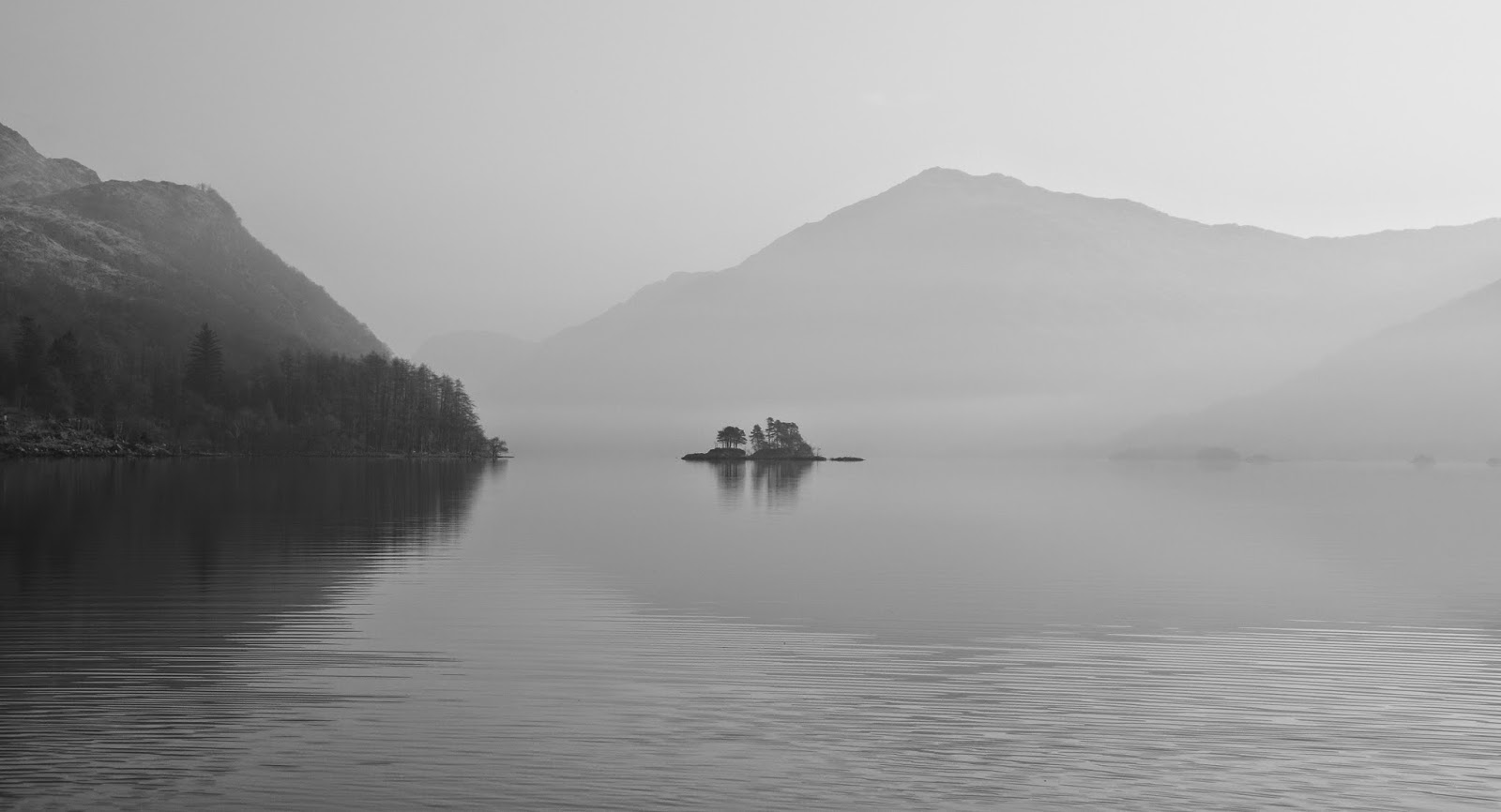
Wednesday, 15 April 2015

On foot to the sea


Having passed the bridges on the River Shiel we now had to decide where to leave the river.   We knew that there would be a considerable rapid at the point where the river empties into the sea at Loch Moidart.  The drop is caused by the raised level of the land in this part of Scotland; a rise which continues following the release of the weight of ice when the glaciers melted thousands of years ago.


During planning for this trip I'd identified a couple of possible egress points from the river and in the event we used the first of these, at a river gauging station opposite Shielfoot. 


Photo: Douglas Wilcox

 
We loaded our boats onto trollies for the portage to Loch Moidart.  This trip is one where the use of a trolley is pretty much essential to move laden kayaks from fresh water to the sea.  The first hundred metres or so were on the public road before passing through a gate.........


.....and onto an estate track.  This was the first outing for my new trolley; an Expedition trolley from Kayak Carrier Systems (KCS).  The trolley dealt with the bumpy track and a heavy kayak with ease and proved very stable.  We found that there were two further places we could have left the river to shorten the portage but we were happy to get out early because if these last opportunities are missed.........


........this is what awaits the sea kayaker!


The five metres which the fresh water pouring out of Loch Shiel needs to drop to the sea is largely taken up with two impressive and powerful falls right at the end of the river.  The first drop becomes a boiling cauldron......


....which enters the sea in a jet of white water.


We'd arrived at the Sea Pool near low water, but after two or three dry days.  We decided that portaging would almost always be our preferred route at this spot; none of us felt the slightest inclination to attempt this run in heavily laden 5 metre boats!


And so at last we came to salt water at Loch Moidart after a day and a half exploring the beautiful Loch Shiel and its river.  Back on familiar territory, we prepared to set out on the next stage of our journey.

Monday, 13 April 2015

Water under the bridge(s)


We left Eilean Fhianain knowing that we would return one day; it's a special place.  The lightest of breezes started up, the first all day so we hoisted sail to get whatever assistance it could offer.


 ......as curious locals lined the water's edge to watch us pass by


After less than ten minutes the breeze died and mirror-calm conditions were restored.  The late morning spring sunshine was pleasantly warm, hot even, on our faces.


The lower part of Loch Shiel would originally have been beyond the snout of the glacier which formed the upper loch; Eilean Fhianan was formed as a terminal moraine.  Imperceptibly the loch becomes more like a wide, shallow river and it's quite difficult to detect where Loch Shiel truly becomes River Shiel. 

We were now paddling past houses on both banks and alongside a road, on which the traffic came as a bit of  asurprise.  We'd been on our small expedition for less than 24 hours and yet we seemed to have been out much longer.


At Moss opposite Acharacle we passed the wildlife cruise vessel "Sileas" on her winter maintenance slipway.  We spent a pleasant few minutes chatting with owner Jim Michie who was tidying away the final items of preparation for her annual safety survey prior to the start of the season.

An ex-Admiralty launch built in 1940, "Sileas" has had a really interesting career and at least three names over her 75 year life.  At various times a Navy launch, mailboat, a ferry at various west coast locations, a pier construction tender and for the last 15 or so years a graceful wildlife cruise boat. After extensive refurbishment to fit her for wildlife watching, "Sileas" had to be taken to the shores of Loch Shiel by road and physically pushed off a trailer into her new freshwater home.

Built by James Silver of Rosneath, her hull is of double diagonal teak planking on oak frames - she's truly built to last and Jim has clearly engaged in a labour of love to keep her in such fine condition.  If you're not a kayaker or canoeist, a trip on the loch aboard "Sileas" would be a super way to experience Loch Shiel.


Beyond Acharacle we were definitely on the River Shiel as we approached the first of two bridges at Shiel Bridge (not to be confused with the place of the same name in Kintail on the road to Skye), this one the newer of the two is a fine stone triple arch with decorative castellated piers constructed in the 1930's.


I've driven on the road across this bridge many ties and it was nice to get a different view as we cruised underneath.


 As we passed under the bridge we became much more aware of the flow of the river, an insistent pull of water towards the sea. We now barely needed to paddle in order to keep up a steady speed downstream.


 The River Shiel is a noted fishing river and has several wooden stages from which anglers cast for salmon and sea trout.  Rounding one of these at a sharp turn in the river, the water enters a tightening gorge framed by the arch of Old Shiel Bridge.  We approached cautiously because from ahead was the umistakable sound of rapids.......


Douglas had scouted this section on a previous visit and knew that the rapid was a short one.  Nevertheless, it takes a leap of faith to point fully laden 5 metre sea kayaks towards white water hidden around a bend in a gorge!

The boats surged forward as one by one we lined up to avoid the most disturbed water and went for it.  Although fully engaging, the rapid turned out to be of moderate grade and short-lived.  Looking at the debris high up the walls of the gorge, I was very thankful once more that I hadn't attempted this trip solo after very wet and stormy weather. 

We were now past the initial obstacle and heading quickly towards the point where the River Shiel joins the sea.  It was a little after low tide and that all this fast-moving water in the river still had the best part of 5 metres to drop before reaching Loch Moidart..........

Sunday, 12 April 2015

An echo down the centuries from Eilean Fhianain


We took a last look back up Loch Shiel before we turned the corner at Camas Drollaman.  From this point the mountains which hem in the upper loch so closely and give it a fjord character begin to fall back and gradually there is a more open character to the scenery.  To have experienced the loch in such still conditions for two days was a rare treat and we wondered whether we could ever match these two days on future visits to Loch Shiel.


On the low grassy ground near the very point of Camas Drollaman we came across this Ringed Plover (Charadrius hiaticula).  A member of the Plover family and related to Lapwings, these dapper little waders are beginning to breed on more inland sites in addition to their more usual sites on sand and shingle seashore.

The UK breeding population of Ringed Plovers may be less than 6000 pairs, though numbers are boosted in the winter to about six times this figure with birds from Greenland and Canada.  I'm taking a guess that this this particular bird is a resident as it was in breeding plumage; the easiest way to tell the difference is that the bill turns from black in winter to bright yellow-orange with a black tip.

Ringed Plovers lay their beautifully marked eggs in a shallow scrape in sand or gravel.  If the nest site is approached by a predator (or a sea kayaker), the adult will try to lure away the threat by feigning a broken wing. If encountering this display, it's wise to keep a very close watch on where you put your feet as the eggs are so well camouflaged.  Seeing this display in Spring and early Summer on a beach at you intend to camp should be a cue to move on somewhere else to avoid disturbing the birds.  Mike, Douglas and I had last seen nesting Ringed Plovers on Arran in the previous summer and on that occasion had stayed well below the tideline during our second breakfast in order to avoid disturbance.


After paddling around Eilean Camas Drollaman, a wooded island which has evidence of a "bloomery" once used to smelt iron, we headed for the narrow twist of the loch containing Eilean Fhianain (Finan's Island).  We landed next to the small stone jetty, which wasn't the easiest landing due to the water deepening quite quickly immediately off the shore.

Finan was an early Celtic saint who is believed to have lived from around 520 to 600AD.  Details of his life are sketchy but he seems to have followed Columba from Ireland and became Abbot of a small monastery on the island now named after him, but which is also known as the Green Island.  He is believed to have evangelised much of Argyllshire, but considering that his name crops up all over Scotland - as well as the obvious Glenfinnan and Kilfinnan, there is a St Finzean's Fair in Perth and a Finzean as far away as Aberdeenshire, he must have travelled extensively

Known as "Finan the Leper" from the disease which afflicted him, he appears to have favoured small islands on lochs; he is also recorded as the founder of at Inisfallen on Lough Leane in Ireland's County Kerry.  Finan died, it is thought, at Clonmore in his native Ireland.


I've often thought that the early Celtic churchmen knew a good spot when they saw one, and the island which Finan chose as his base is certainly that.  A grassy green hump formed of glacial sand and till, it sits away from the shadow of the high hills and has great a view up Loch Shiel and down to the sea at Moidart.  Crucially for the purposes of the early church it sat in a prominent position on the sea and land routes through Argyll, Sunart and Moidart.

The first of the daffodils were opening on the sunny slopes as we climbed up to explore Finan's island, a splash of bright yellow against the late winter colours elsewhere.


The top of the island is largely given over to a burial ground; some of the graveslabs here are very old, probably early mediaeval, but though some of this group of crosses appear very old they date from the 18th century.  The island was a traditional burial place for the chiefs of Moidart, indeed it may have already been in use as a burial place when Finan arrived in the 6th century.  The island is still used as a place to commemorate the dead, we saw several recent stones marking the interment of ashes - a continuity of use which would surely please Finan the Leper.


A very fine Celtic cross monument stands in a prominent spot overlooking lower Loch Shiel, commemorating  a Reverend Charles MacDonald, priest of the diocese of Argyll and the Isles who also wrote a history of Moidart and of Clanranald.


The stonework on the monument is very fine indeed with celtic motifs, designs and a range of tail-casing animals.

The ruins of a stone chapel sit in a small hollow high on the island, dating from about the 16th century.  It was the centre of worship for those of the Catholic faith but fell into disuse in the 1700's, possibly in the bloody aftermath of the 1745 rebellion.  The visible ruins themselves replaced a wooden chapel which was probably built by Allan MacRuari, a chieftain of Clanranald who had a distinctly violent reputation.

But predating even this is a remarkable artifact - and one which you might reasonably expect to find in a glass case in a musem rather than exposed to the elements in this place.


On the roughly formed altar slab, sitting next to a weathered stone cross is a bronze bell which dates from the 10th century.  It takes a moment for the significance of the thing to sink in - a seamless bronze hand-bell which is in excess of 1000 years old on a small island in Loch Shiel.....

It has survived the ravages of time, of the vikings and all the tumult of the years since to remain intact on the altar here, secured with a small chain.  There are of course stories telling of the curse which will befall any person removing the bell which must have been persuasive enough for the authorities to leave it in place.

We can vouch for the fact that the bell is fully functional, an experimental ring brought a clear tone which echoed back in the still morning air and caused deer over a kilometre away on the mainland to raise their heads - it's an echo which has been heard here down ten centuries.


Eilean Fhianain is a real gem of a place and very well worth a visit.  We spent an hour or so exploring the island and its history before returning to the jetty to make coffee prior to setting out again on our route to the sea.   To have simply paddled past, intent on racking up distance would have been a great shame, one of the advantages of paddling with like-minded friends is that small explorations such as this are a real highlight of the journey as a whole.

From Eilean Fhianain we would paddle the shallow lower part of Loch Shiel and we now started to think ahead to our transition from fresh to salt water.

Thursday, 9 April 2015

A Golden Hour

Photographers talk of the "golden hour", a period in the early morning when the light quality is at its best. Certainly the light quality had changed from the previous afternoon; in place of overcast skies and subdued colour there was brilliant morning sunshine and a wash of warm tones despite the early season.


Something which hadn't changed was the lack of wind and the great reflections on the surface of the loch.  We made our way steadily along the shore just enjoying being out on such a lovely morning.  However, as we cleared a small outcrop at Gaskan Wood.........


.....the view went from simply lovely to absolutely jaw dropping.  Ahead were the small collection of glaciated rock islands called Eilanan Comhlach (possibly Islands of the meeting).  Set against the russet and blonde tones of the hillside and under a sky of intense blue, the islands seem to float on the loch.  The shred of mist clinging to the hillside just completed a scene which might have come from a "Visit Scotland" brochure.  The whole was simply gorgeous.

I had paddled out a little way into the loch to get the image above while Mike had drifted slowly towards the largest of the islands.  Douglas had landed briefly to demist his camera as this scenery was too good to miss photographing  - I think he did a pretty good job!


   We paddled slowly around the larger island, admiring the reflections of the Scots Pine and Holly on the still water......


.....and then headed for the collection of rocks forming the smaller island.  I did wonder how the group of Scots Pines here had managed to get any kind of foothold on the island which is a bare rock with the thinnest skin of peaty soil and heather.


Douglas was back on the water and his approaching kayak added a sense of perspective to the view back up the loch. Surrounded by bigger hills, that part of the loch was yet to receive the morning sun and was still shrouded in a cold but atmospheric mist.


                                              The glorious views just kept on coming..........


                                                                   both ahead............


                                                                       .....and astern.


Just beyond Eilanan Comhlach we passed the cottage at Gaskan where the naturalist and author Mike Tomkies lived for many years.  He wrote nine books about Scottish wildlife at he cottage which he called "Wildernesse" including the bestselling "A Last Wild Place" and "Golden Eagle Years".  His has been a fascinating and varied life, and there seems little doubt that the years at Gaskan shaped the astute and insightful observations of this consummate naturalist.


We were startled to find that we'd been on the water less than an hour when we reached this small beach backed by a ruined croft.  I was immensely glad that I'd stuck to the principle of waiting for the right conditions and hadn't attempted this trip solo and in poor weather.

There's no doubt in my mind that this first part of the morning was among the best hours I've ever spent in the outdoors. For sheer beauty, impact and in terms of my emotional response perhaps only one other comes close, a crossing of the Kilbrannan Sound which I was also fortunate to share with Douglas and Mike.

We still had a long way to go, but a short stop to reflect on the "golden hour" we'd just enjoyed seemed very natural.  I approached the beach slightly ahead of the others and had a very strange experience; the water was so still and crystal clear and the reflection so sharp that I couldn't determine where the edge of the water was - the momentary disorientation caused me to lose balance and required a quick corrective stroke...... what a day it was turning into!

Wednesday, 8 April 2015

Cold start


I slept well, and despite a marked drop in temperature when the skies cleared in the early hours (the thermometer on my watch registering minus 5 Celsius) I woke warm and well rested.  One of the nice things about paddling with Mike and Douglas is that all three of us have similar routines and are naturally early starters; we were up and about at 6am in the pre-dawn making breakfast and packing away our camping kit.

The frigid air wasn't conducive to a leisurely breakfast; breakfast and hot drinks done we erased all signs of the previous evening's fire and completed packing our boats.  This was the first time I'd camped out of the Cetus MV and the space available came as a very pleasant surprise.

Unexpectedly, we found our boats a little higher from the water than we had left them the previous evening.  We'd jokingly remarked that there was no tide to worry about, but here was indisputable evidence that the water level  in a 28 kilometre  loch had receded by at least 15 cm overnight.  That's an awful lot of water and we knew that our route would follow that outflow later in the day.


Just as we were getting on the water the sun was rising above the hills to the east.  While it brought the first welcome hint of warmth, the sunrise changed the relative humidity very quickly, misting camera lenses and sensors.  It was some time before things equalised and the DSLR cameras were fully functional.


We paddled out onto the still water of Loch Shiel in anticipation of a great morning's paddling.......


                             ......but we had no idea just how good it would turn out to be..........

Tuesday, 7 April 2015

Alternative realities on Loch Shiel


Loch Shiel is a 28 kilometre long freshwater loch which meets the sea via the outflow of the River Shiel.  The loch and its surrounding mountains are heavily glaciated, the water of the loch contained in a trench which reaches a depth of 128 metres before becoming shallow near the outflow - the classic glacial valley loch.

Due to the effects of isostatic rebound, this part of Scotland is continuing to rise following the release of the weight of glacial ice and the original sea level outflow of the loch is some 4.5 metres above current sea level.  It takes only a short pause for thought to deduce that somewhere ahead that 4.5 metre difference was going to make itself very apparent!  That however, lay well ahead of us. 

 We'd subconsciously moved into the very middle of the loch, aligning ourselves with the symmetry ahead.  This was the first of some very unusual effects we experienced during the afternoon and following day.  Realising that the greater interest lay as ever on the edge of the land, we moved close in to the west shore.


The reflection of the steep banks of the loch were incredibly clear on water undisturbed by the slightest breath of wind.


Symmetry and reflection were to be found everywhere one looked - we paddled on, each of us lost in our own thoughts and appreciation of these rare and very special conditions.  For my part, I kept returning to thinking how incredibly fortunate we were in being able to experience this place at this time.


The overcast sky lent a stark quality to some of the trees lining the shore.  The woodland here is in a semi-natural condition and due to difficulty of access has been relatively lightly grazed or cleared.  On the eastern side of the loch there are some areas of dense forestry plantation but we paddled along past woods of birch, oak, rowan, holly and (as here) alder, that most water-loving of trees.

Later in the Spring these trees would be in the full glory of early leaf and the woods alive with birdsong.  This early in the year the buds were yet to open, the shapes of the trees strong silhouettes and, very fittingly, the few birds singing could be heard individually and clearly across the still water.


In places we found that the reflections on the surface of the water had more clarity than the objects themselves; an alternative and inverted reality that confused the eye.


....and at times the coincidence of shape, colour and reflection was simply breathtaking.  This snatched image with Mike framed by a halo of colour and shape looked like something from a child's kaleidoscope.......


.......it was definitely time to stop and put the reality of a small beach beneath our feet!  It was now early evening and we assessed our progress to determine which of several potential campsites we could reach in good time to get set up during daylight.  We don't push on unnecessarily, and besides - with all this scenery around us why rush?  We felt that a small application of Golden Steadying Liquid would assist in the process and accordingly took a small dram of Linkwood (cask strength), watered to the correct specification using the rather abundant supply of crystal clear loch water.


About thirty minutes further paddling  brought us to two potential campsites a couple of hundred metres apart.  The first had better ground but the second was more sheltered.  Almost as our keels touched the coarse sand of the beach a chilly "sundowner" breeze started up..... our decision was made.


It took no time at all for us to set up camp, change into "shoregoing" clothes and put our paddling kit out to air in the breeze.  Stoves on, hot drinks and a hot meal were soon produced.  This was the reality we'd been waiting for through a stormy winter; camping on a beach surrounded by wild mountains and entirely self-contained.  We might be on fresh water, but this was most definitely sea kayaking reality!

Before it got dark we gathered driftwood piled up at the side of the shore by the recent stormy weather and made a fire in an area of sand behind the beach where it would cause no damage and we could erase all trace in the morning.  Using a "Wilcox Ignition Aid" (TM) we soon had a good fire which provided hot embers to bake our potatoes, served with butter and salt and which by unanimous vote were declared the best yet.

We retired to our tents warm and very content.  An owl called a few times and then there was complete silence.  The wind had died and the absence of sound was palpable and very relaxing. 


Sunday, 5 April 2015

A fresh start

Glenfinnan to Lochailort by sea kayak is a trip which both Douglas and I have long wanted to do. Looked at on a large scale map it doesn't seem to be much of a trip; after all the two points are little over 15 kilometres apart by road. However, if done by the long and scenic route this would be a 65 kilometre paddle with some potentially committing sections.

Our method for planning and executing multi-day trips is quite simple; plan the outline of the journey, work out the basis of the tidal requirements, potential stopping points, contingency planning etc and then wait for the conditions to be favourable. For some trips the waiting can take quite some time; our journey among the Small Isles for example was planned in outline for almost two years and in detail some eight months before we actually set off as either the conditions or our availability didn't coincide.

A winter dominated by frequent wet and windy spells didn't seem to offer much hope for multi-day trips, particularly one which could be directly affected by very wet weather (the reason this trip is best done in dry weather will become clear in a later blog post!).  Added to this, Douglas had been unwell for the best part of a month and was still recovering.  I considered a solo attempt when a brief weather window looked to be on the horizon, but the forecast gradually deteriorated; besides which this would be a much better trip if shared with friends.

And then on 15th March the forecast for the following week indicated a spell of light winds as a result of a nearby high pressure system.  The proximity of  high pressure to the run of Atlantic low pressure systems can provide fine weather but even slight movement of either influence can change conditions quickly.  It wouldn't be wall-to-wall sunshine but the wind would be light and there was no significant rainfall in the forecast.

As the basic planning of the trip was already done, it required just two text messages and a couple of phone calls to make the final arrangements - on 17th March, Mike, Douglas and I convened at Glenfinnan a little after lunchtime.  Douglas had phoned ahead to see whether we could park a car at the Glenfiinnan House Hotel; we offered to either pay to park or to have a meal at the hotel prior to setting out. The hotel wasn't yet open for visitors, however the manager kindly allowed us not only to park a car but to launch from the hotel grounds.  This was a kind gesture and very much appreciated - in summer with both hotel and loch busy with visitors we probably wouldn't have approached the hotel but parked at the car-park just off the A830 used by people visiting the Glenfinnan viaduct (overnight parking at the NTS car park is not permitted).

This trip can be be viewed in "Sea Kayak Stereovision" by also following it on Douglas' blog starting here......


While Mike and I ran the shuttle to get a car to our planned destination for two days ahead, Douglas moved the boats on their trolleys to the waters edge.  By 1440 we were on the water to start another trip - a fresh start because we set out onto the freshwater Loch Shiel.  We couldn't head down the loch without first paddling the short distance to see the Glenfinnan Monument. 


On 19th August 1745 Charles Edward Stuart was rowed to the head of Loch Shiel where arrangements had been made for a gathering of clans sympathetic to the Stuart (Jacobite) cause.  He was eventually joined by about 1500 men, mainly from the clans MacDonald, Cameron and MacDonnel who formed the basis of an army with which the Stuart Prince hoped to win back the crowns of both Scotland and England from the Hanoverian King George for his father James, who was in exile in France.

The story of the 1745 rebellion is one of impulse, drama, mismanagement and ultimately disaster.  A very useful resource can be found here. Initially the campaign was successful, reaching Derby after a couple of victories over Government forces en route.  With the Hanoverian court already packing to flee and Government forces in disarray, factional issues and lack of clear leadership within the Jacobite army caused the rebellion to falter and withdraw.  There followed a period of retreat ending in a final calamity on Culloden Moor near Inverness in April of 1746.  Charles Edward Stuart passed Glenfinnan again in 146, this time as a fugitive hunted by Redcoat troops.  The loyalty of his followers eventually ensured that he was taken off from Loch Nan Uamh in a French warship on 20th September 1746, the same loch from which he'd disembarked a little over a year earlier.  The price paid by the Jacobites and by the highland people in general in the wake of the rebellion was devastating.  A period of brutal repression and the sweeping away of the clan system paved the way for the empty highlands of today.

In 1815 with Britain on a high after the defeat of Napolean, tensions had receded sufficiently to enable the erection of a monument to commemorate the 1745 rebellion.  Paid for by Alexander MacDonald of Glenaladale, descendant of a wealthy Jacobite family, the figure atop the slender stone tower is not of Charles Edward Stuart but of a kilted highlander in fine dress.  The simplicity of the monument set among  mountain and loch scenery is quite striking.


    From the historical, we turned our boats to head to the immediate future - a very calm Loch Shiel........


                  ...so glassy calm that it seemed a shame to disturb the surface with our paddling!


       The overcast conditions and late winter colouring of the mountains gave some wonderful effects.....


                       ....mountains were reflected in perfect symmetry onto the surface of the loch.....


     ....while ahead of us the ranks of hills framed the loch to the far distance, drawing us on to a fresh adventure