Monday, 25 March 2013

Return to a Rum retreat

I took no photographs at all on our crossing of the Sound of Canna from the west end of Sanday, around the south of Sandy and across the open water to the north tip of Rum.  Douglas took one image just as we left Sanday and it shows the swells beginning to build up - and this was some 3.5km from the main tidal race.

As soon as we left the shelter of the bay we'd camped in we were exposed to an Atlantic swell and a good deal of clapotis generated by the swell crashing onto the south coast of Sanday.  We moved out into more open water and kept close together, if we got separated it would have been easy for us to lose sight of each other.

Initially the wind blown chop was the dominant sea condition, but fairly soon we moved into the main tidal race which was pushing  eastward.  Though in its final third this was still quite strong, and was maginfying the big swells coming in from the open ocean.  these swells were being further compressed as they were funnelled into the Sound and we were very aware of their increasing size.

Several times we backed off the crests of these swells as they threatened to become rollers - but they rarely actually broke.  After about an hour of these conditions, which could fairly described as "having our full attention" we passed out of the narrower part of the Sound of Canna and the swell and tidal movement gradually subsided, allowing us to use the now much more manageable swells to push us towards the tip of Rum.

Exposure to the weather is a feature of the Small Isles, any trip here is at the mercy of the conditions.  We'd hoped to have paddled right around Canna and to have journeyed down the west coast of Rum; neither of those would have been prudent (or enjoyable) in the heavy swell and gusty wind.  Here, the flexibility of our plans served us well.


Turning the cornerat the north tip of Rum was to enter another world......


Entirely sheltered from both wind and swell, the east coast of Rum was glassy calm.  The mist and low cloud hid the view of Skye completely.


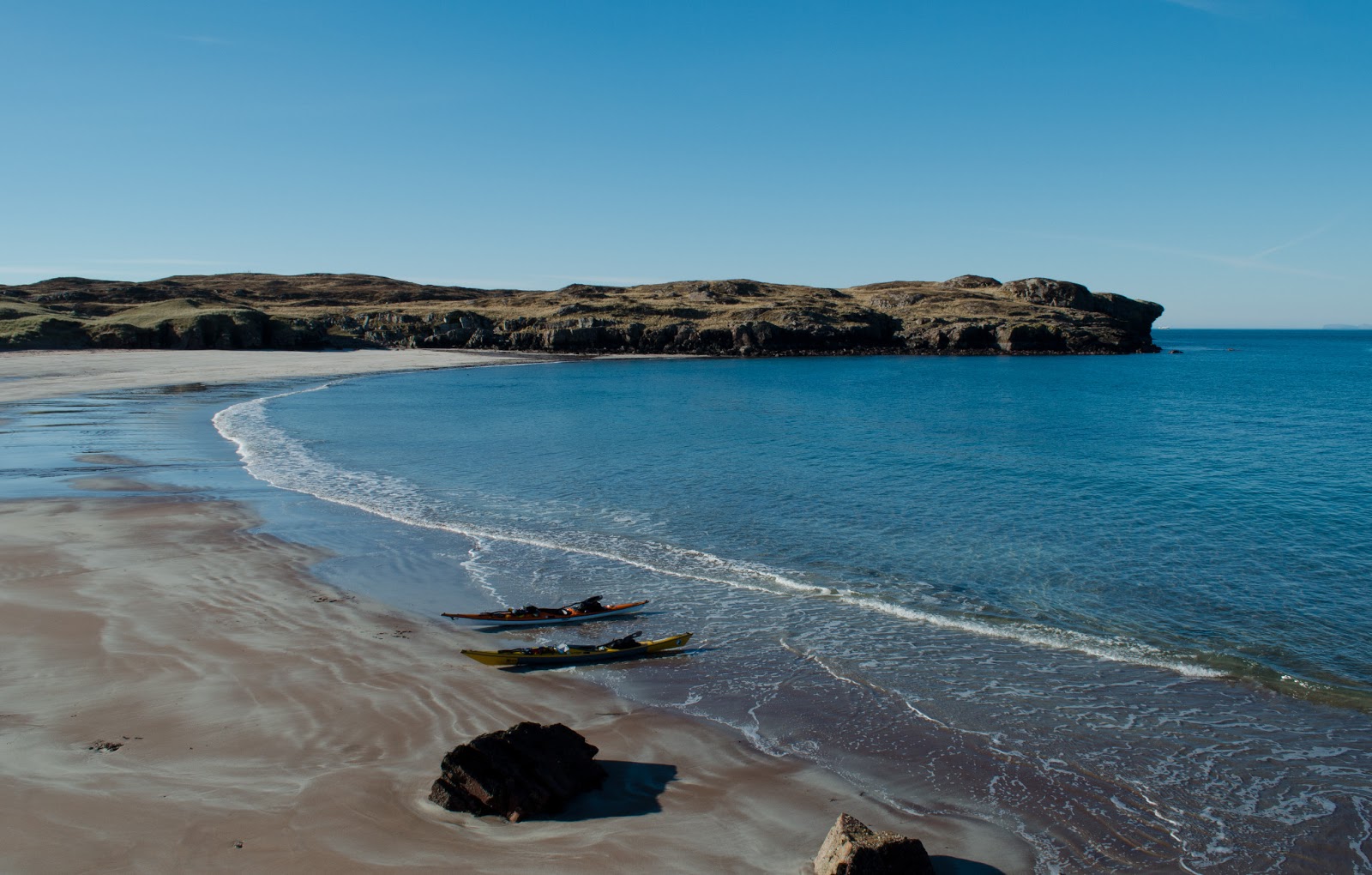
We landed back at the beautiful bay of Samhan Insir for first luncheon and a small measure of Golden Steadying Liquid.  Although today wasn't a sunny day like the previous day when the breathtaking colours of this beach were fairly zinging.....


There was still plenty to admire....


In the intricate patterns of water on the sand.


Suitably fed and watered, we mad our way down the coast to Loch Scresort.  Here too it was glassy calm; we could clearly hear voices over a couple of kilometres of water.  We shuddered to think what the midges would have been like on a still, overcast evening like this had it been summer!


Our accommodation for the night would be somewhat different from the tents of the previous night!

Saturday, 23 March 2013

Contrasting technologies on Canna


we continued on our walk to explore a little of the island of Canna and arrived at the telecommunications and postal hub.  A traditional phone box with functioning payphone, Post Office  and post box contrasted with the satellite technology used to carry calls from the payphone and transactions from the Post Office.  We used the payphone to check in with families (no mobile phone signal here!) and to arrange a call ahead to let the hostel manager on Rum know that we hoped to arrive later that evening.

Canna has recently been connected via satellite link to a fast wireless broadband network known as "Hebnet".  Developed initially for Eigg, the network is gradually being rolled out acorss the Small Isles (Rum, Eigg, Muck and Canna) and has brought dramatic increases in bandwidth/operating speed.  The network has been designed and implemented by the community with assistance from Highlands & Islands Enterprise and has had to take account of some local constraints such as lack of a centralised electricity supply on the islands. 

Hebnet is capable of 50Mbps transfer rates - and is now only limited by the BT backhaul arrangements on the mainland which limits speeds to 8Mbps - an interesting situation!  The roll-out of a fast wireless network is, rightly, perceived as crucial by the islanders.  Without access to the internet at realistic rates businesses are constrained and folk simply won't be able to diversify in a way which can develop and enhance the island economies.


 We wondered what the users of these earlier technologies would have made of it all!

One traditional technology which is in obvious use on Canna is the use of  snares to kill rabbits and traps to ensure that the Rat problem doesn't re-emerge.

Canna suffered a large increase in the population of Brown Rats, and a consequent large decrease in the number of nesting seabirds.  Clearly some form of control was required (Rats are not native to Canna) and so a programme of eradication began, primarily using poison.  One creature which needed special protection was the Canna Woodmouse, a distinct form of woodmouse found nowhere else.  As the mice would also be depleted by the poison, the Trust in partnership with the Royal Zoological Society for Scotland trapped over 150 mice and moved them to sites in Edinburgh and Kincraig in order to preserve a viable population pool for susequent re-introduction.

The programme has been a big success; the Rats are pretty much gone and the reintroduction programme for the mice can begin.

But as ever in nature, removing one animal from a niche gives an opportunity to another......


 Rabbits.  With no Rats, the rabbit population has vastly increased to an unsustainable level.  We saw big areas undermined by burrows, causing damage to farmland and the rabbits will potentially eat both crops and wild flowers to the ground, as well as competing with burrow nesting birds such as Manx Shearwaters.

An active control programme is in full swing using snares and the gun to reduce the rabbit population down to a manageable level.  It's a battle against large numbers, and this rabbit was among several piles of carcasses near the NTS buildings awaiting disposal.

It's not pretty, but it is very necessary.  Wherever possible the meat is sold on to butchers on the mainland- and the island restaurant and tearoom (currently up for lease) featured a lot of rabbit dishes on its menu!


Next on our route was the rather fine Canna House, home of the then owners of the island John Lorne Campbell and his wife Margaret Fay Shaw.  Open for visiting in the summer months, the house houses the Canna Archive, an imprtant collection of items relating to Hebridean culture and folklore.


Next we passed the Presbyterian church and burial ground - one of three churches on this small island.  Built in 1914, it was constructed partly in memory of Robert Thom and was also designed in part to act as a landmark for the fishermen who would worship there - an interesting mutifunctional technology in itself.


 The furthest point of our short exploration was the new slipway built to accomodate the newer classes of ferry as well as a Ro-Ro facility for freight and vehicles.  The waiting room has toilets and a tap for water (useful for kayakers) and also contains a small exhibition of pictures and information about Canna.  Nearby is the tiny community shop whic in summer sells (amongst other things)  island handcrafts to visitors.


 On our way back along the shore road to our tents, it was obvious that although Canna is a relatively sheltered and fertile island, it gets its share of strong winds!  Near here we had a superb close view of a Sea Eagle, perhaps eyeing up some of the rabbit carcasses we'd seen earlier.


Arriving back at our camp site, we took down the tents and packed the boats.  The wind had only dropped slightly, but our timings now fitted in with the last part of the east-going tidal stream.  this would help us whilst not being so strong as to kick up rough conditions in the wind - we hoped!

Setting out, we felt that this section of our journey would be potentially the roughest water we'd encounter.  We were correct.....


Friday, 22 March 2013

A short walk on Canna


We woke to a grey and blustery morning, grateful that we didn't have to attempt a launch off the boulder beach at Guirdil, which would be exposed to the southwesterly swell. 

Our original plan had been to have paddled from Guirdil, circumnavigated Canna and camped in this spot on the second night.  The plan had already altered to camping here the first night, and it was clear that we'd have to alter our plans further. 


A glance towards Rum showed low cloud moving quickly, a glance from the tent door showed large breakers beyoond the bay we were camped in.  Paddling around Canna was quickly discounted, as was bringing forward the intention to paddle the west coast of Rum by a day.  Both these are long paddles with no landing places on a shore fully exposed to the Atlantic swell.

Our flexible approach to planning was put into place and we decided to paddle back to the sheltered east coast of Rum, and to return to Kinloch and spend the night in the hostel there.

This wasn't altogether a simple plan - there were a couple of complications.  Firstly, there was a big spring tide running and if we launched straight away we'd be paddling against a tidal stream of up to four knots, with wind against tide to further enliven conditions.  We decided to wait until an hour and a half before slack water before setting off, which would mean less tidal movement and wind effect.  This led to a further slight complication - the channel we'd paddled in through would have long dried out, so we'd need to go around the west and south coasts of Sanday to reach  the open water of the Sound of Canna.

We felt that this would work, and if conditions were too bad, we would have the option to return to Canna via either end of Sanday, giving a "bail out" option or two.  An advantage to the revised plan ws that we had plenty of time to explore a bit of Canna on foot.


We set out across the bridge linking Sanday with Canna, and found these pieces of whale vertebra near to the bridge.  The south coast of Canna beyond was dashed with surf - we were now sure we we were making a good decision!


We passed the single storey vehicle park.......


To reach the National Trust for Scotland building, housed in a farm.  The island has been held by the Trust since it was gifted in 1981 by the then owners, John and Fay Lorne Campell.  The terms of the gift ensure that a viable community should remain on the island and that it shouldn't just become an empty, if beautiful place.  The poulation varies, but is generally between 12 and 20 people.

A small museum is housed in the former dairy building at the farm and has interesting displays about life on Canna in times past


Featuring implements and tools used in fishing....


And also farming; Canna has rich soil and good grazing; butter and milk were prime produce.  There are still cattle grazing on both Canna and Sanday, we saw Galloway Belties, Highland cattle and a fine Aberdeen Angus bull on our short walk.

If visiting by kayak, it's useful to know that there is also a toilet and a shower (£2 coin required for the shower) in an outbuilding of the farm, and a tap for water.

Thursday, 21 March 2013

Canna beat an evening like this....

During the crossing from the west coast of Rum we used the lighthouse on the eastern tip of Sanday as our target.  Constructed in 1907, the light flashes white once every six seconds.  We had to aim off a considerable way to the left in order to arrive underneath the light as the tidal stream would push us to the right - at a rate of over 4 knots near to Sanday itself.


It was nearly sunset when we turned into Canna Harbour, and what a glorious evening it was!  We paddled past the St Edwards Centre on Sanday, a deconsecrated Catholic church converted to a study centre.....


And past the former schoolhouse, both silhouetted in a golden sunset glow.


As we moved along Canna harbour the view back across Sanday past the St Edwards centre to the hills of Rum was pin-sharp in the cool evening air.


 We slowed right down to savour the atmosphere and the quality of light, agreeing that "you just Canna beat an evening like this!".


At this state of the tide we'd easily be able to paddle under the bridge which connects Sanday to Canna in order to reach our intended camp site.  For now, this was simply too good an evening to rush - this couple of kilometres into Canna harbour stands out as one of the real highlights of our trip.


The sun had set by the time we landed on a small beach and put up our tents.  As the glow faded the first stars emerged and we were treated to a great display of the night sky, followed later by an enormous full moon rising over Rum.

We cooked by the light of our head-torches and sat chatting until the temperature dropped away.  It was a chilly night, and sometime in the small hours the wind rose.  As I turned over in my sleeping bag, I reflected that had we managed to land at Guirdil on Rum the previous evening we would have had great difficulty in getting off again in the rising weather.


Tuesday, 19 March 2013

Rum, on the rocks


 Once we'd left Kilmory, the coastline was a line of cliffs.  The gentle swell would occasionally burst against the base of the cliffs with a roar; it's a place to be careful in.

Squinting into the sun, we made out an unusual shape at the base of a rock buttress.  As we approached, the shape became obvious as a shipwreck.


This is (or rather was) the French registered fishing vessel "Jack Abry II".  She grounded near this spot late at night on 31 January 2011 in poor weather conditions whilst on passage from Lochinver to fishing grounds south of Ireland.  Fortunately, there was no loss of life amongst her 14 crew. The Marine Accident Investigation Branch (MAIB) report is, as usual, both thorough and searchingly frank.  As with so many shipping accidents, there was no single cause, rather a chain of events which led to the loss of the Jack Abry II.


Outwardly the wreck seems in good condition, but closer inspection showed the damage wrought by winter storms.  Although nearly all the fuel oil has been removed from the vessel there was still a faint smell of diesel. As a seafarer, it's always quite shocking to see a ship in this condition.


As we continued down the coast the view became increasingly dominated by Bloodstone Hill.  We knew that the bothy we intended to use for the night was near the base of this hill, but we were under no illusions that we'd have a simple landing.  The swell was still low, but a haze of suspended spray told its own story.....


A short way offshore and we saw Guirdil bothy.  A fine "reek" of  woodsmoke from the lum indicated that we'd have company for the evening - if we could land.  In this image the sea appears very calm.  It wasn't!  A swell was surging up the left hand side of the bay onto a pebble beach, while the right hand side was guarded by sharp fangs of rock.

We felt that it would be possible to land our loaded boats, but what then?  If, as forecast, the wind and swell got up overnight we'd be stuck here.  We'd already pretty much made our decision when one of the folks staying in the bothy came out to wave.  The fact that he and his companion were dressed head to toe in camouflage gear was no incentive to try the landing!

If you plan to use Guirdil on a journey by kayak in the Small Isles, the exposure of this bay to the prevailing swell should be a factor in your planning.  


We moved back offshore into the sunshine to raft up and check our bearings and tidal stream timings.  Our plan was now to make the crossing we'd intended for the following morning, to Canna.  We could expect a tidal stream of up to 5 knots across our track on the 7 kilometre crossing so we worked out vectors before setting out.  A last look at Guirdil and we commenced the crossing.


Our change of plan was to be possibly the best decision we made all week - and for several reasons.  The first became apparent straight away as we basked in the evening sunshine just offshore while Guirdil was in deep and frosty shade....

Monday, 18 March 2013

Rum, on the beach


We continued our journey towards the north end of the Isle of Rum and soon approached this rock feature - dubbed "the old man of Rum".  The face appears to stare out over the water to Skye - and who could dispute that he has a good view?! 

We continued around the base of the rocks to reach.....


....another small piece of paradise.

This beach at Samhnan Insir is, quite simply, stunning.  There was no question of passing by - we paddled in to land and explore a little.  A ruined house lies at the back of the beach and near to the house the faint marks of at least four former buildings.  In 1964 a schoolboy unearthed artefacts here including a bloodstone arrowhead and a scraper, both dating to the Bronze Age.  Clearly, we weren't the only people to appreciate a good beach.


The patterns formed by the red and cream sands were really beautiful.  It's a captivating spot and one marked in our minds for a return visit.


We moved on somewhat reluctantly and paddled around the headland at the north end of the beach.  This is the northern tip of Rum and from here we'd be exposed to both northerly and westerly weather.  All was calm apart from a slight swell - things were looking good.


This perched rock lay just around the corner.  We speculated on how it had come to be so precariously balanced - then noticed that it formed a neat "T" shape.  Time for a cup of tea!


Handily, we were approaching Kilmory, another fine beach but this one would be the last landing place before our intended overnight  halt.  Scottish Natural Heritage (SNH) have a Red Deer research facility at Kilmory - their subjects are both numerous and conveniently located on-site....


We landed for a cup of tea and a leg-stretch before starting down the west coast of Rum.  We intended to paddle about 8 kilometres further to Guirdil and to spend the night there.  As things turned out, it was as well we did stretch our legs at Kilmory; it would be somewhat further than 8 kilometres before we were next able to land.


Our footprints joined those of the deer on the sands; beyond the beach is a fine view to Askival and Hallival.

Saturday, 16 March 2013

Almost deserted beaches on the east coast of Rum


We left Loch Scresort and turned north to head up the east coast of the Isle of Rum.  Our boats were heavy with kit and food for the anticipated five day journey and we'd also packed some nice "extras".  Each of us had a boat trolley strapped in a bag on the back deck to assist in moving the boats.  The backdrop as we paddled along was the mountains of Skye - which isn't too bad a view!


It was a little after the aftenoon low water and a day or so prior to spring tides; a small bonus was that the flood had started and we'd have a gentle push at our backs for the first couple of hours.  The first part of this coast is rocky outcrops and scattered woods.


The first beach we passed was this one at Camas Pliasgaig, consisting mostly of pebbles.  The action of the winter storms had created a series of terraces which must constantly shift through the year.  At the edge of the beach some Red Deer were feeding on the exposed seaweed.


Some way further along we simply couldn't resist landing at a glorious sandy beach.  It looked deserted....


But closer inspection revealed we weren't the first visitors of the afternoon.

Thursday, 14 March 2013

"It's too early in the year!" - an island journey

The next series of posts will cover a winter journey around the Small Isles of the Inner Hebrides undertaken with my good friend Douglas during the last few days of February and into early March - very much winter in Scotland. We'd had this trip planned since the previous summer, but due to either unsuitable weather or our various commitments it hadn't been possible until a weather window of sustained high pressure was forecast for late in February.  We'd not long returned from a couple of days in Arisaig, so "Brownie Points" had to be earned prior to being allowed out to play....

We hoped to visit four islands in our five day journey; to paddle as much of the coastline of each as we could and also to explore a little more of each island on foot where possible.

Douglas will also be  telling the story of this trip on his blog with some wonderful images.  The story starts here - well worth checking out!


I left home at 4am to meet up with Douglas at Mallaig - the timing was necessary as we had a ferry to catch.  It was well below freezing when I left home in Aberdeenshire to cross the spine of Scotland to the west coast.  Dawn washed across the sky in my rear-view mirror as I passed Loch Laggan; I hoped that the clear sky was a good omen.


We packed our boats with food and gear for five days and left our cars in the car park.  Kayaks go free on Caledonian MacBrayne's (Calmac) ferry services, which is a real bonus for travelling to and between islands.

This is probably the right point in the story to note some of the approach Douglas and I used in planning this journey.  We would use the ferry for the initial crossing to Rum.  This is a long-ish crossing and although well achievable by paddling, would take a full day - we preferred to paddle the islands instead!

We were fully prepared to camp or use bothies on each night of our journey, though we would use other accommodation options if available.  The overriding planning principle was flexibility - in timings, route and where we ended up.  The trip was carefully timed with the Calmac winter timetable - by leaving on a Tuesday, we could paddle our hoped for journey from the northernmost island to the southernmost (which was with the predicted wind direction), with the option, if weather-bound on any one island, to wait just one day to use the ferry to reach the next island.  This flexible approach meant that we didn't pre-book any accommodation.  As it turned out, this added tremendously to the experience.

We were fully self-sufficient for food but hoped to spend some money on meals in the communities we visited if possible.  The end of winter is a marginal time for many small businesses in these communities, and besides, what better way to experience the best of the islands?

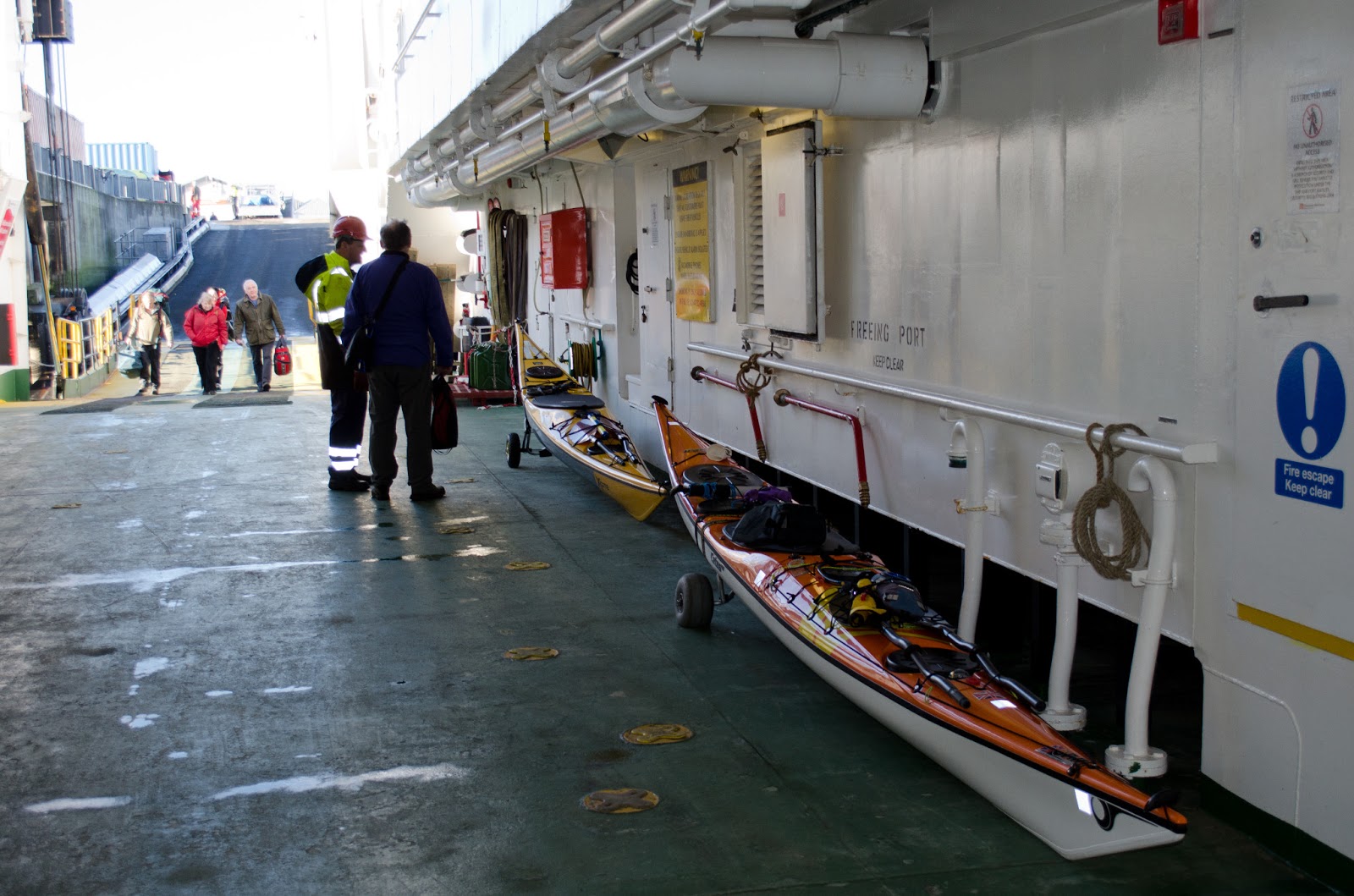
We pulled our boats onboard the MV Loch Nevis on trollies - if you do this trip or similar; a trolley is a must to move a heavily loaded boat on and off the link-spans.  On the vehicle deck, the crew were  welcoming and genuinely interested in our plans.  Kayakers are not uncommon in the summer, but no-one could recall kayaks attempting an inter-island trip in the winter.  The title of this post is a reference to the ground-breaking journey undertaken by Seamas Adam and Alastair Dinnet ("The Canoe Boys") in the autumn of 1934.  On their epic journey from Bowling in Glasgow to Kyle of Lochalsh they were continually told that it was "too late in the year".  If you haven't read this classic, Douglas and I would heartily recommend it!  One really nice aspect of our short journey was that, from the outset on the Loch Nevis, our plans were known, and our journey remarked upon in the islands we visited.  Not in any way comparable to the fame of the Canoe Boys, but it was fun!


As the Loch Nevis left Mallaig we passed the statue of a fisherman and his daughter pointing the way to the sea.  This statue by Mark Rogers of Knoydart has been cast with concrete legs to keep it in place in gales!


We took second breakfast on the Loch Nevis then went out on deck to watch the approach of our stepping-off point of the Isle of Rum.  The hills of Rum would be our constant skyline companion over the next five days - a reassuring sight.


As we sailed into Loch Scresort, the grand Norse-named hills of Askival (Ash tree hill) and Hallival (? sloping hill) dominated the skyline.  the name "Rum" itself seems to be pre-Gaelic and possibly a Norse-derived "broad" island.


To the south and in the eye of a glittering sun lay the island of Eigg.  If all went well we hoped to visit Eigg two days later, but for now our eyes were on Rum....


We disembarked from the MV Loch Nevis at the ferry slip in Kinloch and waited for her to depart on her onward journey.  Our own journey was about to start in earnest!  But before we set out we had the first of a series of coincidental meetings which did much to shape our journey.  A lady came down to the slip and asked jokingly if we were, by chance, the Doctor she was expecting on his rounds?  Well,  Douglas is indeed a Doctor - but not the expected one...   It turned out that Rachel was the manager of the Rum hostel.  She asked about our journey and let us know that although the hostel didn't really open until April it was open to accommodate seasonal workers, and that there were beds available should we need them.

We've always believed that you can do much to create the conditions in which good luck might happen - this was one such occasion.  We now had an option for future nights, although our plan was to spend the night on the far side of the Isle of Rum - time to get on the water!