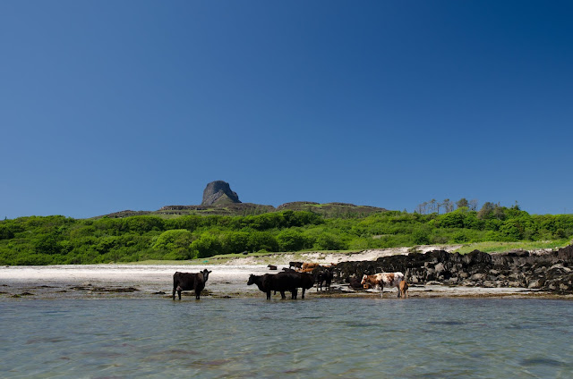
I knew from a previous visit that the ground behind the bay is also used for grazing sheep and cattle - and sure enough some of the cattle were cooling themselves in the water when we arrived on the beach.While we felt that they'd have seen it all before and would be unlikely to bother us, we felt t wise to leave everything in our boats rather than pitching the tents straight away in case one of the younger beasts got curious....
Having used a trolley to half pull and half carry each boat up the soft sand, we got changed into shorts and light shirts for a bit of a walk. We each had an ultralight rucsac in our boats and packed these with water, some snacks, a long sleeved top and sun cream....good to go.
Heading up the track back towards Galmisdale, we found where the sheep normally on the machair had gone......everything on Eigg is dual purpose where possible! These ewes had the right idea, at just gone 1pm the heat was pretty full-on, and they still had thick fleeces.
At Galmisdale there's a sign board detailing waymarked walks, with each walk having a colour code. The coloured waymarks are a bit sketchy to find - if, like us, you want the quickest route to climb An Sgurr, take a track up through some pretty woodland, then follow a rough track across open pasture to reach a gate near this house. The route then goes left beyond the house and then immediately right - not that obvious but once on the hill path, very straightforward.
This must be one of the most photographed views of An Sgurr, it has a nice composition with the house giving some foreground - and is also a good place to pause on the first of the steep slopes!
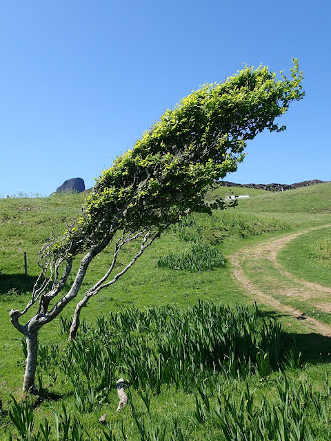
There really isn't much doubt which way the wind blows here. This tree, unexpectedly it's a Beech, was older than its size suggests, cropped and sculpted by the wind.
The climb towards An Sgurr is steady and uncomplicated, just a couple of rocky steps on the crossing of a moor which laps the base of the prow - which gets steadily more impressive as you approach.
The Sgurr is the southern termination of a pitchstone ridge which runs along the spine of Eigg. Formed during the birth of a huge volcano complex which included creation of the island of Rum, it is effectively a mirror image of the landscape of 58 million years ago.
Pitchstone is formed from viscous lava flows and is tougher than the usual basaltic lavas. The story of the Sgurr ridge is this:
As the Rum volcano complex erupted, a layered basalt lava flow landscape emerged, covering the ground to the level of the present day ridge. Over time (about 6 million years), a valley was eroded out of the basalt lavas, and when the pitchstone lava was erupted it filled this valley to the brim. Because pitchstone is so much harder than basalt it resisted erosion as the basalt around it was worn away, so what you see today is an inverted valley, like a jelly-mould image. There's a good explanation of the process in this paper by the JNCC.
As we crested the slope at the base of the great prow, the view opened to Rum, the source of all the lava. From an elevated viewpoint the vague shape of the Rum Main Ring Fault can be seen in the hills. Our route contoured along the north flank of An Sgurr to climb though a fault line and emerge onto a shallow col.....
....where the view to the south is suddenly revealed. The long finger of Ardnamurchan is in the foreground with the west coasts of Islay beyond, fading into a heat haze.
The route now switches to the south side of the An Sgurr ridge and follows a narrow path with a little bit of exposure and stunning views. Below our feet was the coast we'd paddled that morning, out to sea lies Muck, our original target for the day. Beyond Muck, faintly discernable in the haze we could see the outline of land - and puzzled for a few minutes about where this might be until Mike correctly identified Coll and Tiree - islands I've yet to visit.
It was clear that the wind had dropped considerably, and that we'd probably have been able to get to and from Muck safely - but what we'd missed in visiting Muck was being amply compensated by this brilliant hillwalk.
Cresting the ridge, we got a view down to Galmisdale and the route we'd walked to get up. We could clearly see the narrow finger of turf where we would camp, just below the dark coloured skerry in this image.
To the north, the previous night's camp at Bay of Laig was visible at the same time, and the view leapt across the Sound of Rum, now an intense blue.
The final few metres to the summit track across the surface of the pitchstone, showing some of the columnar shapes formed as it cooled. Right now, it felt like the lava was still warm from the volcano - the heat was terrific and was being reflected up from the rock in pulsing waves of dry, hot air.
On reaching the summit, we flopped down and spent a good half an hour just taking in the views and the situation. At 393 metres/1289 feet An Sgurr is quite a small hill, but it has a view matched by few other hills in Scotland. The combination of islands, mountains and lochs forming a true 360 degree panorama are simply stunning.
We left the summit reluctantly - it would have been easy to while away hours up here but we were being absolutely scorched by the sun and had limited water with us. Truly, we were being fried on Eigg, and would be "sunny side up" for days afterward.
We went fast and direct on the descent - for we had a powerful incentive.....


Very interesting geological story and excellent storytelling too! You got me hooked anyway!
ReplyDeleteThanks Leif, more to come soon.....
ReplyDelete:o)
Truly "mountain and sea", Ian! Wonderful!
ReplyDeleteThanks Duncan - there's something quite satisfying about paddling to the base of a hill, then climbing it :o)
Delete