Monday, 18 November 2013

Winter Backpacking on the White Mounth


Dave and I continued to climb steadily until we reached the cloudbase at about 800 metres.  Visibility in the clouds was about 200 metres with a chilling NW'ly wind at about 30mph - in other words perfectly acceptable and normal Scottish winter conditions!


Our route took us uphill on a line of old iron fence posts marking an estate boundary.  Placed on one strainer post was a piece of aircraft engine.  It is very likely that this is part of the wreckage of an RAF Canberra WJ615, a bomber/reconnaisance aircraft which crashed into the mountain in level flight on the evening of 22 November 1956, killing its crew of two, Flying Officer Redman (pilot) and Flying Officer Mansell (navigator).  The subsequent enquiry was unable to determine the cause of the crash.  The wreckage is scattered across a wide area of the mountain; I've seen odd pieces including a wing section around this location. 


Our climb soon levelled out and we navigated across to the summit cairn; or one of them, there are two which seem to be of equal height and about 200 metres apart.  Carn an t-Sagairt Mor (rocky hill of the big priest) is 1047m/3435ft, and up here the scene is Arctic even this early in the season.  We'd seen Hares and Ptarmigan on our ascent, both in full winter garb of white streaked with grey and perfectly camouflaged and adapted for life here.  Unlike us.  Although our Buffalo Mountain Shirts are great for these conditions, the exertion of carrying fairly heavy rucsacs meant that we'd begin to chill down if we lingered.  A brief five minute stop for a snack and a drink, then we took a compass bearing for our next destination and set out across the broad summit area of the hill.


We visited the second cairn on our way across the broad dome of Carn an t-Sagairt Mor, where the rime icing was quite impressive for November.  The "feathers" of ice are depoisted on the upwind side of rocks (and in this case old fenceposts) in a cold, moist airstream and can grow out to a foot or more.  They are one of the real features of Scottish hills in winter and I've always thought them beautiful, even if it takes hostile weather to form them.


As we descended below the cloudbase, our next destination showed itself in a window through the clouds - we were right on track.

Thursday, 14 November 2013

Winter backpacking on the White Mounth - Loch Callater

At the beginning of November, my friend Dave and I were looking to do a short backpacking trip. Given the cold and blustery MWIS forecast for following days, using bothies for accommodation seemed to make sense over camping.

 We set out from Auchallater on the main A93 Braemar - Perth road late on an afternoon as a full gale and heavy showers were befinning to subside.  Our route took us along an estate track along Glen Callater to the loch at the head of the glen.  Here there's a shooting lodge and in one of the outbuildings an MBA bothy.


We arrived at dusk, started to sort out our kit and got a cup of tea.  Shortly after we had a visit from one of the custodians of the adjacent Lodge inviting us to spend an hour by the fire in the main building.  We spent a pleasant evening with Bill and Keith and a Belgian lady who is making some really long walking routes around the country.  We found that we knew some of the same folk and the conversation ranged far and wide, accompanied by a couple of drams.  We retired to our sleeping bags in the bothy warm and slept well.


Early in the morning we had another visitor at the door - one of the estate ponies was keen to say hello and investigate what might be on offer for breakfast!  The ponies at Auchallater are used by Invercauld estate to bring down the carcasses of shot deer from the hill.  They're sturdy and adaptale animals and can go where vehicles either can't or would cause damage.


The view along Loch Callater was fairly encouraging.  Although it was cold with the air temperature around freezing, the wind had dropped and there were breaks in the cloud.  It looked like a fair day for the route we had planned.


We went across to the Lodge to thank Bill (and the ponies) for the warm hospitality before departing - noticing the rather fine curling stones on the doorstep.  It had been a most pleasant stay at Callater bothy and a tentative plan to get sea kayaks onto Loch Callater in the future had emerged......


Our route now took us above the loch and into the hills of the White Mounth.  The term "mounth" is an indication that through routes exist and here is no exception; long routes cross the high passes to link with the south.  We used the start of one of these routes but cut off it quite quickly.  As we gained height, rucsacs feeling heavy with winter kit this early in the day, we were glad of an excellent stalker's path slanting in an effortless line across the face of the steep hill ground.


We were soon level with the head of the loch, the glacial origin and hummocky moraines clear to see.  It looked a bit wintry above too, a defined snowline had appeared on the hills as winter made its first appearance.


Tuning south east off a shallow bealach we started a steeper climb which not only went uphill but also into winter proper.  The snow was hard and wind scoured, affording a good bite for the boots as we plodded steadily upwards.  To the north, the Dee valley and Ballochbuie Forest were lit by warm sunshine.

Monday, 11 November 2013

Remembrance

                                                                                                                  Image:  Inner Sound, Skye 11 Nov 2010

In remembrance of all those men and women who have lost their lives in the service of their countries, those who still suffer the physical and mental scars of the conflicts in which they served; and those who are left with loss and grief.

               "At the going down of the sun, and in the morning, we will remember them"      

Sunday, 10 November 2013

Autumn's glory at Rogie Falls

My hopes of a day hillwalking were washed away overnight as the Assynt area was hammered by strong winds and truly torrential rain. The morning was very wet with cloudbases down to less than 300 metres - not ideal for any hill, but when much of the joy of Assynt hillwalking is in the extraordinary views I wasn't encouraged to get out.

Driving back on the A835 road towards Inverness and descending off the higher ground, there's a Forest Enterprise car park between Garve and Contin which gives access to some short walks based around Rogie Falls.  I was keen to get at least a short walk and parked up to wander down to the falls.  It proved to be a good decision.......


The falls themselves are just ten minutes walk from the busy route into the Highlands - but a world away. The traffic noise is soon left behind and different senses are assaulted; the autum colours were simply gorgeous.


The warm orange of the beeches was set against the glowing yellow of the birches and backed by the green of spruces, alders and pines.


Down in the cleft near the falls the light itself seemed to be changed by the intensity of this pyrotechnic autumnal display


.


A suspension bridge crosses the Black Water below the falls and gives a super view.  In spate, the falls are fearsome and the spray easily reaches the bridge.  There were several folk enjoying just watching and photographing the colourful scene, but it seems that most visitors just walk to the falls and return by the same route.  I wanted a little more exercise and so crossed the bridge and explored the woods a bit urther.


The colours beneath the trees were just as vibrant as the leaves which were still to fall.  These Sycamore leaves were every shade from faded green through yellow and red to a deep nut-brown.  The distinctive smell of a damp autumn wood was everywhere.


Re-crossing the bridge, I walked up the bank of the river to get above the falls.  The water was deeply peat stained to a degree where even the "white" water rushing down faults in the rock was a pale coffee colour.


Just as I was preparing to head off back to the car park, a sudden break in the clouds allowed sun to stream through and illuminate a beech tree at the edge of the falls to an incredibly bright shade.  An American couple standing near me on the bridge were the only other folk to share this transitory slice of autumn glory.

Just ten minutes from the road, the Rogie Falls has to be one of the better "service stations" !

Friday, 8 November 2013

An Old Man's warning


Pushing south against the ebb tide from the Point of Stoer wasn't too difficult and I soon reached the Old Man of Stoer.  A 60 metre sea stack formed of Torridonian Sandstone, it's an instantly recognisable landmark.  Climbed in 1966 by the Aberdonian climber Dr Tom Patey, it remains a popular though committing climb.  There are several stacks prefixed with "Old Man" in Scotland - the similarly named Old Man of Storr in Skye and the Old Man of Hoy in Orkney are the best known.  In each case the term "old man" refers to the priapic appearance of the stack - though another well known and priapic stack (on which Tom Patey was killed whilst abseiling) is known as A' Mhaighdean (the maiden) !


I'd looked across to the stack from the cliffs opposite, but not been this close up before.  From seaward the whole edifice seems to be leaning out gently to the west.  It is possible at certain states of the tide to paddle behind the stack, but not today.

A look to the south showed that the sky was dark grey and lowering, a sign of the approaching weather front which would bring strong wind and rain.  Suddenly, I didn't feel comfortable - a powerful and urgent feeling of unease gripped me.

Perhaps it was a combination of the strangely distorted verticals in the stack and the cliffs, coupled with the unusual motion of the swell which lifted the boat but slid it northwards with each surge.  Whatever, the uneasy feeling and the clear warning in the sky to the south decided the issue; I'd not continue south to Stoer Head lighthouse, but get back around the Point of Stoer as quickly as I could.

This inner, instinctive alarm system has served me well in the past on both mountains and on the sea; I've learned to listen.  I took no photographs on the way back around the point and found the paddling more difficult.  A tense half hour got me around, out of the strong tidal stream in the vicinity of the headland itself and into the relative shelter of the eastern side.


To the south east, Quinag lay under a threatening grey sky, the weather clearly beginning to make felt its presence.

In the boat, I was beginning to feel a sense of euphoria and an easing of tension, but this is no place to relax, there was still several kilometres of paddling along a cliff-girt shore and a tricky headland to pass before I could rest.


I did have time to appreciate the cliff scenery more fully on the way back though.  Contorted and weathered sandstone beds have been tilted and exposed to form some grand formations


It's an exceptional piece of coastline to paddle.


A bay of translucent green water backed by a purple-red boulder beach was a tempting place to try to land but the still powerful swell was a bit too big for comfort - one to save for another day.


Around the point of Rubh an Dunain (which was still as tricky as on the way out) and I could finally land next to the small jetty in Bay of Culkein.  Now the euphoria could be indulged - the rush of endorphins drained the strength from my legs and I felt a little shaky as I walked up to find a seat on the rocks and make a cup of tea.

I'd managed to round Point of Stoer twice in a day, achieved more than I'd thought possible in the day and extended myself to deal with something which intimidates me.  I had no sense of "conquering" the headland, I'd merely stepped out of my comfort zone, into the "elastic zone" and had a fantastic experience.  Had I backed off the point I'd have still had a great day - retreat would be no defeat at all and my decision would have been right for the day and the situation.  Solo sea kayaking puts these choices to a paddler in a very fundamental and direct way; it's part of the solo experience.

But I still had a couple of hours paddling to do, daylight was short and it was time to go.....


The rainstorms were sweeping northwards in grand curtains as I crossed towards Eilean Chrona (the dark, low island in this image).  I've often heard the otherwordly singing of Atlantic grey Seals here and today as I approached the song reached out across the water.

Grey Seals pup in November and it's possible that this is a breeding site because there were large numbers of rather portly seals hauled out.  I didn't want to disturb the animals and decided to give the island a good wide berth - but not wide enough.  A truly huge bull seal launched from the rock and swam purposely towards me, his body language and huffing an unmistakeable warning to stay away.  Somewhat less subtle than my inner system, this "old man's" warning was very effective and I put on a spurt to get clear of his patch!


Soon I was threading the Oldany Island channel and picking through the low tide skerries to arrive back at Culkein Drumbeg as the weather closed in and the wind picked up.  I'd been right to heed the signs at the Old Man.  During the night the wind and torrential rain battered Assynt and washed away hopes of a climb of either Suilven or Stac Pollaidh the following day.  No matter.


Wednesday, 6 November 2013

Psychology and commitment - the Point of Stoer

The thing is, I have a bit of an issue with big headlands - they intimidate me.

They're exposed, energetic places where wind, sea and tide are amplified and concentrated; they are nearly always challenging and for the solo sea kayaker they can be lonely and committing places.

My plan was to paddle around Point of Stoer, one of the six big mainland Scottish headlands (and one of the more exposed) not once but twice. I hoped to round the point and head south to Stoer Head lighthouse before returning back around the point.  The Imray Yachtsman's Pilot for this area notes that

 "Two of the headlands, Rubha Reidh and Point of Stoer, are notorious for heavy seas, caused mainly by their exposure and the strength of the tidal streams around them.  Seas around these headlands are particularly dangerous with wind against tide and they should be given a berth of several miles if it is necessary to pass them under such conditions"  

 Clearly this paddle isn't something to attempt on a whim!  I'd had the trip in mind for some time but the three factors I needed in my favour (wind, sea and tidal state) hadn't coincided neatly enough.

This time I had a chance. The wind was southerly at about F2 but was forecast to increase rapidly to F4-5 by late afternoon which gave me a window in which to work.  The swell was reasonably low at a metre from the north, which I felt I could manage.  The one nagging doubt was the state of the tidal stream.  In this area the ebb runs north and whichever way I planned it I'd be arriving at the point three hours after high water at Ullapool which would mean that it would be at the end of the strongest part of the stream.  At a day or so after Springs, the Admiralty Tidal Stream Atlas showed that the stream offshore would be 0.6kts.  Close in at the point this would be about 2kts.  Waiting for the tidal stream to slacken risked being caught by the strengthening wind and also the shorter day length.

As a precaution against my being able to get around the point but not back I had walking kit in the boat which would enable me to walk and hitch the miles back to either Lochinver or to my starting point of Culkein Drumbeg from where I could sort out recovery of my boat.  I'd done what I could; it was now a matter of whether the conditions would be suitable.


Imediately north from Bay of Culkein there's an arch set in the point of Rubh an Dunain (headland of the fort).  The point itself would give a hint as to conditions at the Point of Stoer, and it wasn't encouraging.  Clapotic water near the arch and a heavy swell running up the angled sandstone reefs below the point had me feeling very twitchy and uneasy.  In hindsight this was undoubtedly in part due to the tension in my head transmitting itself to my body and then through the boat; although the conditions here were pretty tricky.


Beyond Rubh an Dunain the sandstone cliffs get markedly higher.  There are no realistic landing places between Bay of Culkein and (probably) getting back to Bay of Culkein so I was as prepared as possible for a few hours without landing.


Passing along under these 80 metre cliffs I was in shelter from any wind but aware of the swell.  Normally I'd have been enjoying the proximity of the cliff scenery but today I was focused entirely on the potential difficulties ahead.  At Geodha na Leth-Roinn (Geo of the half-seal; perhaps Selkie?) I was just 600 metres from the point itself.  A good stretch out of muscles, then I put on the paddle leash (one less thing to think about if things went wrong), a check to make sure my VHF was on Channel 16 and set to high power (purely psychological), a drink of water and a biscuit.  Good to go.

400 metres, then 200 metres to the point and all looked well.  My inner "contract" stipulated that if conditions looked rough at the point, any breaking water in the tidal stream, it could wait for another day.  So far, so good and I began to feel that this might be OK.


The weather chose this moment to add some "interest" and a truly torrential downpour began as the Cloud Lever (TM) set itself to "fully closed".  For the 15 or so minutes it rained the dominant noise was a static hiss of rain on sea and the rather louder roar of rain on my hood.  At least I couldn't hear the breakers now! Once the rain passed, leaving the surface strangely calm and a complete absence of wind, I pressed forward.  50 metres, then.....


........I was level with the Point of Stoer.  The swell was large and powerful, but nothing was breaking outside the surf zone.  A clear line on the surface ahead showed where the tidal fun would begin.  Decision time - commit or back off.

This is where all the psychology of solo paddling is tested - at least it is for me.  Risk needs to be assessed against reward, a brutally honest assessment of one's abilities and weaknesses needs to be undertaken, reserves both mental and physical need to be brought forward and a big breath needs to be inhaled!  Using all this and some self-talk (thanks Gordon - it rarely fails!) gave a positive result.  I dug the paddle in and powered forward.  Approaching the line of tidal activity a strange cushion of water seemed to slightly lift the boat and suddenly twist it -  I was now both engaged and committed.

In truth, it wasn't as bad as I'd feared.  I could make ground easily through the turbulence around the point and although the swell was larger on the seaward side it was manageable.  And then suddenly, I was around......


...and to the south, beyond a line of bursting surf, one of the most distinctive of landmarks on the Scottish coast came into view.

Saturday, 2 November 2013

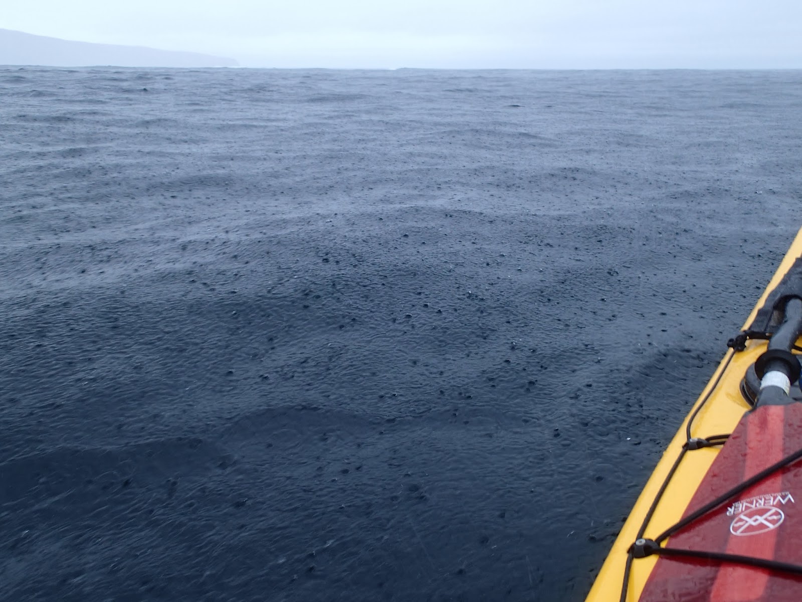
Grey sky and pouring rain - a great day on the water!


The morning after I'd experienced a glorious display of changing light and colour dawned grey and wet.  A partial clearance at breakfast time was encouraging, but the forecast was for a fairly narrow window during the first half of the day followed by deteriorating conditions later.  The twenty-odd miles from Lochinver to Culkein Drumbeg are on very narrow and twisty roads through a spectacular landscape - expect it to take over an hour.

At the tiny jetty of Culkein Drumbeg there's space to park a couple of cars considerately; noting that this is a working jetty.  For the passing sea-kayaker it's worth knowing that there is a water tap at the jetty too, it's on the Assynt Crofters game larder (the left hand, green building in this image).  It was only a few weeks since I'd paddled in this area, though the changed weather and different state of the tide made it all seem completely new.


 It was just after high water one day past Springs, and after exploring around some of the islands and inlets I headed for the channel which separates Oldany Island from the mainland.  This time there was lots of water in the channel and it made a pleasant passge with plenty of birdlife for company.

At this early stage of the morning there was almost no wind and I was in very sheltered water.  If my plan for the day was to come to fruition I'd be paddling in much more open conditions later.


Heading over the open mouth of Clashnessie Bay I once again crossed the geological unconformity which places Lewisian Gneiss adjacent to much younger Torridonian sedimentary rock.  The sedimentary layers of low cliffs and outcrops on the west side of the bay were  clearly visible with their shallow dipping strata well defined.


 As I headed into the Bay of Culkein (similar name but quite a distance from my starting point) the outcrops got a little bigger, the low northerly swell creating a constant low roar and leaving a haze of suspended spray in the calm air.


It's been claimed that Douglas and I have some sort of "Cloud Lever" (TM), or, scandalously, that we only venture out in good weather!  Whilst we are of the opinion that you can sometimes make your own meteorological luck, often it's a case of taking what's on offer.  This day was punctuated with spells of very heavy rain and had a forecast of rapidly rising wind towards the late afternoon.  Nonetheless, it was a great day to be out on the water and I found myself really enjoying the conditions :o)

My onward plans relied on the coincidence of three conditions - relatively low sea states/swell, light winds and favourable tidal conditions.  So far I had two of these, but waiting for the optimum tidal state would risk being in a very exposed place when the wind and sea increased.

I pulled into the shore at bay of Culkein for second breakfast and to consider the options.  It was a wet stop in pouring rain, but over a rapidly diluting cup of tea I worked out a plan I thought would work and formed a "contract" inside my head which would give me the parameters in which to attempt the rounding of one of the best of west coast headlands.

Friday, 1 November 2013

Sea Kayaking with Gordon Brown Volume 3


My copy of this new DVD arrived in the post a couple of weeks ago, but until now I've not had time to sit and watch much of it.

This is the third DVD in the series made by Gordon Brown of Skyak and film-maker and producer Simon Willis of Sunart Media.  The premiere was at the Paddle 13 event in Perth on the last weekend of October.

Rather than attempt to write a review, I'm going to link to the in-depth review by Dr Douglas Wilcox.  I wholeheartedly agree with all that Douglas has put in his review; and I'd only add the following points:

1.    There is something for every sea kayaker in this DVD, most obviously in the Emergency Situations section, but really throughout the DVD.  There are real gems of information about emergency kit, navigation and dealing with what happens when the sh*t hits the fan.  The rolling section is innovative and an approach I'm going to try to use to nail my own roll.

2.   The fact that Simon and Gordon have released a free version of the Emergency Situations section speaks volumes about both of them and will be an important (freely available) resource for years to come - even for those who don't buy the DVD


If you've not got a copy of the DVD, you can purchase it from seakayakingwithgordonbrown.com

Personal interest statement:

 Like Douglas, I'm a friend of both Simon and Gordon and took part in the journey to St Kilda which formed part of Volume 2 of the series.  However, if  I thought that this DVD was below par in any way I'd still have commented honestly to that effect - and it isn't, it's a really professional and informative product !