Friday, 30 October 2015

October's colours

October - it's perhaps the most colourful of months in Scotland and one of the best times to be out and about.


The predominant colour is golden yellow as on these Aspens beside the River Don at Montgarrie near to home, the colour reflecting beautifully onto a deeper stretch of the river.  We saw a Kingfisher here recently, a new arrival on this part of the river - a blue jewel flashing across the gold.


On our regular evening walk in the woods nearby the advance of autumn is really apparent as the sun dips lower, the light gold tinged with soft greens.....


...backed with the warm brown of heather on the hills.  This view is across the River Don towards Bennachie.


The golden colour reached its height on a dull day when the birches and larches along the River Dee at Invercauld were so vibrant that they actually altered the whole quality of light alongside the river.


Not just gold; reds too.  The Rowans (Sorbus accuparia) are aflame with vibrant dark red shades.


Not quite as red as the knitted decorations adorning the bridge over the Clunie Water at Braemar though!  These colourful "wild knitting" creations were a temporary art installation knitted by local people as part of a "wild knitting trail" , and after being on display for a week were sold at a craft event in the village.


The carpets of Beech leaves on the woodland floor are a quintessential part of autumn, kicking through them isn't just for small kids!


The gold theme returns when the Beech leaves are joined by those of Sycamores.  Wet weather intensifies the colours of the leaves which have already fallen.......


......whilst sunshine illuminates those still to fall with beautiful light as the green chlorophyll of summer recedes and allows the hidden shades to emerge.


There's another element to the October palette too - brilliant white.  On the day when clocks in the UK reverted to UTC signalling the end of British Summer Time, the first snow fell on the high ground of Ben Avon, at 1171 metres/3842 feet one of Scotland's highest hills.

During the second half of the month we've seen skeins of geese high overhead, trailing their wild music behind them as they head south from breeding grounds in Svalbard, Greenland and the high Arctic to winter in the comparatively mild climate of the UK.  And this morning, the unmistakable chatter of the first flocks of Fieldfares arriving from Scandinavia.

October is such a great month!

Sunday, 25 October 2015

Looking back to Gigha and Cara


With the dramatic Mull of Cara behind us, Douglas and I paddled up the east coast of Cara past Aird Fhada (Long Point) with a view up the ahead to Cara House.  The conditions were very still, flat calm water and without a breath of wind.  We knew however that this would be the last day of calm; the afternoon and evening were set to bring strengthening winds and rain as an Atlantic low pressure system approached to displace the high pressure which had given us such great paddling conditions.

We bid the Brownie a good day as we passed Cara House and headed north to pass Gigalum Island and enjoy another exploration.....


..of the skerries and channels near to Port an Sgiathain (Port of the Wing).


The water here is crystal clear - the sensation of gliding over the sea bed is one which never fails to  delight.


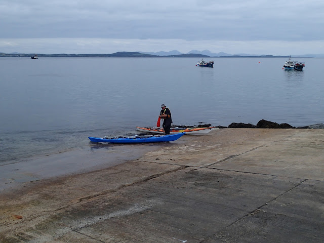
We turned in to land at the small white sand beach of Port an Sgiathain to take second breakfast, and also to check the ferry timetable between Gigha and Tayinloan. 

We didn't intend to take the ferry, but to coordinate our arrival at Tayinloan with the departure of the ferry on one of her crossings to Gigha - that way we'd have plenty of time to use the ferry slip in order to land and clear our boats away from the slipway.


As it happened, the best way to achieve this was to slow down our crossing of the Sound of Gigha - which suited the mood of the day perfectly.  We paddled slowly, just chatting and savouring the relaxed rhythm.  Over our right shoulder, the island of Cara gradually grew smaller, but this small island has a big place in our memory-bank of sea kayaking adventures.  It was my first time visiting Gigha and Cara - it won't be my last.


Meanwhile, over our left shoulder MV Loch Ranza was rapidly overhauling us on her way to Tayinloan.  We were crossing well to the south of her track in the shallowest part of the Sound of Gigha, so we were sure we'd not inconvenience her in any way.  Beyond again, a hint of brightness was speckling the Jura hills - a destination discussed for future trips!


We arrived off the ferry slipway as MV Loch Ranza completed loading for her return journey to Gigha.  We'd met with her several times during our journey, and once again there was a cheery wave from the wheelhouse as she departed.  Ferries are such a big part of the fabric of the marginal places around Scotland's west coast, Western and Northern Isles - the service they provide crucial to sustaining communities and supporting both business and tourism; they and their crews are a genuine national treasure.


With a full hour to move our boats off the slipway we could afford to relax and stroll up to the car park to retrieve our trollies.  It was nearly the end of another small adventure, but not quite.

We both had a long drive ahead of us and so decided to refuel and refresh at Big Jessie's Tearoom.  We can both heartily recommend the Wild Boar & Chorizo Burgers; a tasty and locally sourced treat!  Douglas was driving almost to Scotland's south westerly point (but not in a direct line due to the hugely indented nature of the coast) while my journey home would take me to the north east of the country.  We arrived at our respective destinations some hours later, but within ten minutes of each other.

Now, where next?!

Saturday, 24 October 2015

Capra and the Mull of Cara


The final day of our trip around Gigha and Cara dawned overcast but dry.  In contrast to the previous morning, the overnight breeze had kept the tents dry so we were able to strike camp as soon as we'd had breakfast.  We intended to circumnavigate Cara before crossing back to Gigha, then making the crossing back to Tayinloan to complete our trip.

Turning the north tip of Cara, we started down the west coast of the island.  This place has a reputation for very rough water but the calm conditions continued and we had a quiet paddle through the reefs......


...under the watchful, impassive and unblinking gaze of one of the resident herds of goats.  The poet Norman MacCaig seemed to capture the essence of these characterful animals in his poem simply entitled "Goat" :

The goat with amber dumb-bells in his eyes,
The blase lecher, inquisitive as sin,
White sarcasm walking, proof against surprise,

The nothing like him goat, goat-in-itself,
Idea of goatishness made flesh, pure essence
In idle masquerade on a rocky shelf - 

Hangs upside down from the lushest grass to twitch
A shrivelled blade from the cliff's barren chest,
And holds the grass well lost; the narrowest niche

Is frame for the devil's face; the steepest thatch
Of barn or byre is pavement to his foot;
The last, loved rose a prisoner to his snatch;

And the man in his man-ness, passing feels suddenly
Hypocrite found out, hearing behind him that
Vulgar vibrato, thin derisive me-eh.


Past the reefs at the north of Cara the west coast becomes increasingly steep and there are no landings.  The cliffs remain relatively low, but as the south west corner is turned there's a great sight ahead......


...as the sliced-off face of the Mull of Cara comes into view.  Given that the remainder of Cara is quite low-lying, the sudden appearance of the Mull makes it appear much higher than it's 50 metres.


In 1756 the whole face of the Mull of Cara collapsed and a tidal wave swept around the island destroying houses on Cara, Gigha, Kintyre and West Loch Tarbert.  Given the size of the rockfall, it's probable that the collapse was an effect of a much larger event rather than the cause of all the destruction.  Theories include a sub-sea earthquake and a meteor strike, but we'll really never know.


The Mull of Cara is not often a quiet place. being exposed to wind and swell from most directions and is subject to strong tidal movement.  We were delighted to find absolutely calm conditions and made the most of the opportunity to get close in to the base of the cliff.


As we paddled around, the extent of the headland and the scale of the place became apparent.....


There's another herd of goats at the southern tip of the island -  here Douglas is assessing the options for Goat Bhuna on a future trip :o)


A last look back at this striking place before we turned the corner to head up the east coast of Cara - it's a really impressive place to sea kayak.


From farther up the east coast, only the hill of the Brownie's Chair is a clue to the dramatic rock architecture.


Friday, 23 October 2015

"Flickering embers go higher and higher....."

Once we'd landed and changed from our paddling clothes we decided to take a stroll inland to look at Cara House.


Built in about 1733, Cara House was the residence of the tacksman who held the island who held the island from its proprietors, the MacDonalds of Largie. A "tacksman" was essentially a leaseholder who could sub-let land which he leased from the land owner and this was a common form of land holding at the time.  The house has been renovated and is used as a holiday home by the family who now own Cara.

A large, imposing though not necessarily attractive building, Cara House is two stories with an attic.....


...where the Brownie's room is situated.  It's said that there is often twinkling light seen from this attic and noises heard from within the house.


A little to the east of Cara House lies a ruined chapel.  Hamish Haswell-Smith in his indispensable "The Scottish Islands" states that the chapel is the ruin behind the house (to the west) "which could easily be be mistaken at first for a sheep pen", but from what we could see and from the evidence on the Ordnance Survey map, it seems that the chapel is the ruin to the east.

Dedicated to St Fionnlugh, the chapel probably dates from the late Middle Ages but had ceased to be used for ecclesiastical purposes by the 1770's.


The inshot splayed windows are quite well preserved and dressed with sandstone - similar to the dressing on sites such as Skipness Chapel, though much simpler here.


A grey stone slab propped against the ruin looks to have been shaped for insertion into the ground and may well have been a grave-marker.

On the east side of Cara is a bay called Port na Cille (Port of the (monks) cell) - it's a good landing place and would probably have been the means of access to and from Cara for the monks.


Returning to our camp, we cooked and ate our meal and then lit our fire.  We had plenty of dry driftwood and a quantity of seasoned logs, and used the base of a broken creel washed up on the shore as a windbreak from the breeze.

Sitting back in our camp chairs, we admired a dome of stars washed with a swathe of the Milky Way, spotting several satellites moving across the sky.  Frothing Sports Recovery drinks in hand, we reflected on how fortunate we are to be able to experience all that we had on this and so many other days.


As the fire developed, so did the heat -  "flickering embers going higher and higher" as Paul McCartney wrote nearby.  In fact, of all the fires we've enjoyed, this one was one of the smaller examples, but gave a heat out of all proportion to it's size.  More thermonuclear device than campfire, it was so hot that it changed the properties of the bottom part of Douglas' trouser legs!

We had to wait quite a while for the fire to burn down enough to cook our Sweet Potato and Potato The recipe is simple enough - wrap in strong foil, bake in the embers at "Log Mark 6" for about 40 minutes and serve with a little butter and salt on one of the remaining split logs - more holz cuisine than haute cuisine!


Thursday, 22 October 2015

Great expectations dashed on Gigha

In comparison to the wonderful west coast of Gigha, I found the north-east coast a bit lacking, though Douglas captured some nice images. Open bays and fish farms charaterise the paddling until Ardminish Point is reach, where interest really picks up again.

In order to reach the focus of our immediate interest we needed to adhere to the Calmac timetable, so that we didn't cross ahead of the soon-to-depart ferry MV Loch Ranza.


We got a cheery wave from the bridge as the Loch Ranza headed off on her crossing to Tayinloan....


...and once she was clear we crossed astern of her and headed across Ardminish Bay, stomachs fairly rumbling.......


..towards The Boathouse cafe bar.  Douglas had been regaling me with tales of how good the seafood was, and in particular the lobsters for which Gigha is renowned.  As we approached, we could see that the lights were on and the door open...we were virtually salivating at the thought of a freshly cooked lobster, perhaps accompanied by  a chilled sports recovery drink.  We were able to paddle right up to the door of the place and land on a small beach of white sand - this was perfect!


Oh no!

We'd missed the season by just one single day; the owners had closed up and gone on holiday, leaving the maintenance crew sprucing up the decking and patio area. Somehow our wraps, humous and cheese weren't quite compensation, so we also consoled ourselves with a small Jura to deaden the disappointment......


...and after eating paddled on south, thankful that we had an evening meal to cook at our camp.  The group of tiny skerries at Port an Sgiathan (Port of the Shield, or Wing) gave some beautiful paddling in clear, shallow water.


Our passage was watched by a couple of curious locals; we tried hard to put thoughts of Gigha steak firmly from our minds!.....


...concentrating instead on the seabed beneath our kayaks (hoping not to spot a lobster scuttling away!)


Soon enough the light breeze pushed us across the channel and back to our camp on Cara, where we of course repeated the correct form of address to the Brownie.


The previous evening a stunning moonrise had marked what we took as the Brownie's blessing; this evening no sooner had we landed than a shaft of brilliant sunlight broke through the clouds and lit up the beach and our boats.


It was the only sunlight we'd seen all day and shone in a direct line across the beach, our boats and over to the Kintyre shore - surely the Brownie's approval?!

Wednesday, 21 October 2015

A miller's tale on the west coast of Gigha


We continued northwards along Gigha's wild west coast, paddling along low cliffs for several kilometres - and seeing yet more Otters on the way.  Our stomachs were reminding us that it was some time since breakfast, so we were pleased to reach the tiny bay of Port an Duin (Port of the Fort) which is sheltered behind an equally tiny island.


We landed on the slippery, weed covered rocks and walked carefully up to the dry flat boulder on the left of this image to take first luncheon of wraps, houmous, cheese and grapes with a welcome mug of coffee.

The bay contains a former mill and millers house close to the shore. There are few burns (streams) on Gigha and even where they occur they're insubstantial things which probably dry up in dry spells.  This mill appears to have been supplied by a lade which must have been dug from the nearby Mill Loch as there loch has no natural outlet to the west.

When the mill was operating Port an Duin and nearby Ardailly must have been one of the centres of Gigha society - much of the barley and oats produced on this fertile island would have been milled here.

The mill itself was a two storey building with an attic and had a smaller building joined to it at right angles, the miller's house was separate.


The final run of the lade, made of cast iron, is still in place and feeds the top of a 16 foot (4.9 metre) diameter wheel, also made of cast iron.  The wheel was originally black in colour and is of an overshot design.  "Overshot" means that the water enters the wheel at the top, rather than "undershot" where the base of the wheel is placed in the mill-race or lade to provide the power.

Overshot wheels were a later innovation in milling technology and were more than twice as efficient as undershot wheels.  There was a problem however if a miller wished to convert from one to the other - the overshot design reverses the rotation of the wheel compared to the undershot version, so all the machinery would also need to be reversed.  Careful siting of the mill was required too, with an overshot design the mill couldn't simply be placed next to the mill-race with the wheel dipping in; the water had to be led to the top of the wheel.  Given all this, it seems that Ardailly Mill was designed from the outset as an overshot mill.


Having "mulled all this over" we set out again to paddle to the north west corner of Gigha, where the map promised a treat in store - a tombolo beach connecting Eilean Garbh (Rough Island) with the north of Gigha.


Landing at the southern beach in Bagh Rubha Ruaidh (Red Point Bay) on white sand, we set out for a short exploration.  The southern beach is beautiful......


....but if anything the beach facing north is even more so - a sweep of white sand backed by marram grass.


Looking eastwards towards the very north tip of Gigha, there's another couple of small white sand beaches.  The only thing our trip had lacked was bright sunshine (under which most of Scotland was basking!) which would have transformed the scene to a dazzling array of colour, but we weren't complaining.....

These beaches are justifiably popular and get plenty of visitors through the summer, so we weren't surprised at the lack of driftwood on the tideline.  We felt that there might be some where the south beach meets Eilean Garbh though, as it was open to the prevailing wind and quite rough and rocky.

So it proved, we filled two Indispensable Kayak Expedition Accessory bags with driftwood to supplement the logs we'd left at our camp on Cara, easily fitting these in the hatches of our boats.


The north coast of Eilean Garbh a wild place with granite outcrops falling straight into the sea.  Given its exposure to Atlantic swell it must be a most impressive place in heavy weather.  We'd taken advantage of the unusually calm conditions created by several days of light winds both locally and farther out in the Atlantic to enjoy Gigha's west coast in calm conditions.  Douglas has paddled here in less settled weather and rates it as one of the roughest places he's enjoyed.


We passed by the northern tombolo beach......


...and paused before heading down the east coast to look at the Paps of Jura which were just becoming visible through the cloud.  A rumble of diesel engines in the calm air announced the appearance of MV Finlaggan on her route from Islay to Kennacraig in Kintyre.

Our stomachs were also rumbling (again) - but we had a plan.....